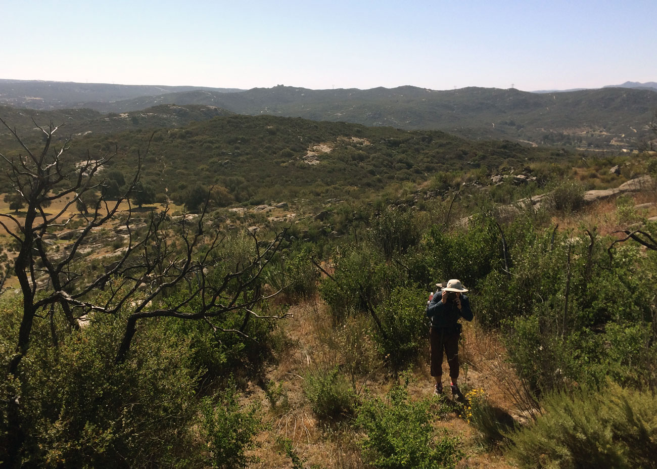
The captains strap on their crampons and learn to ice climb at Colorado’s Ouray Ice Festival.
Read MoreOuray Ice Fest
in Colorado
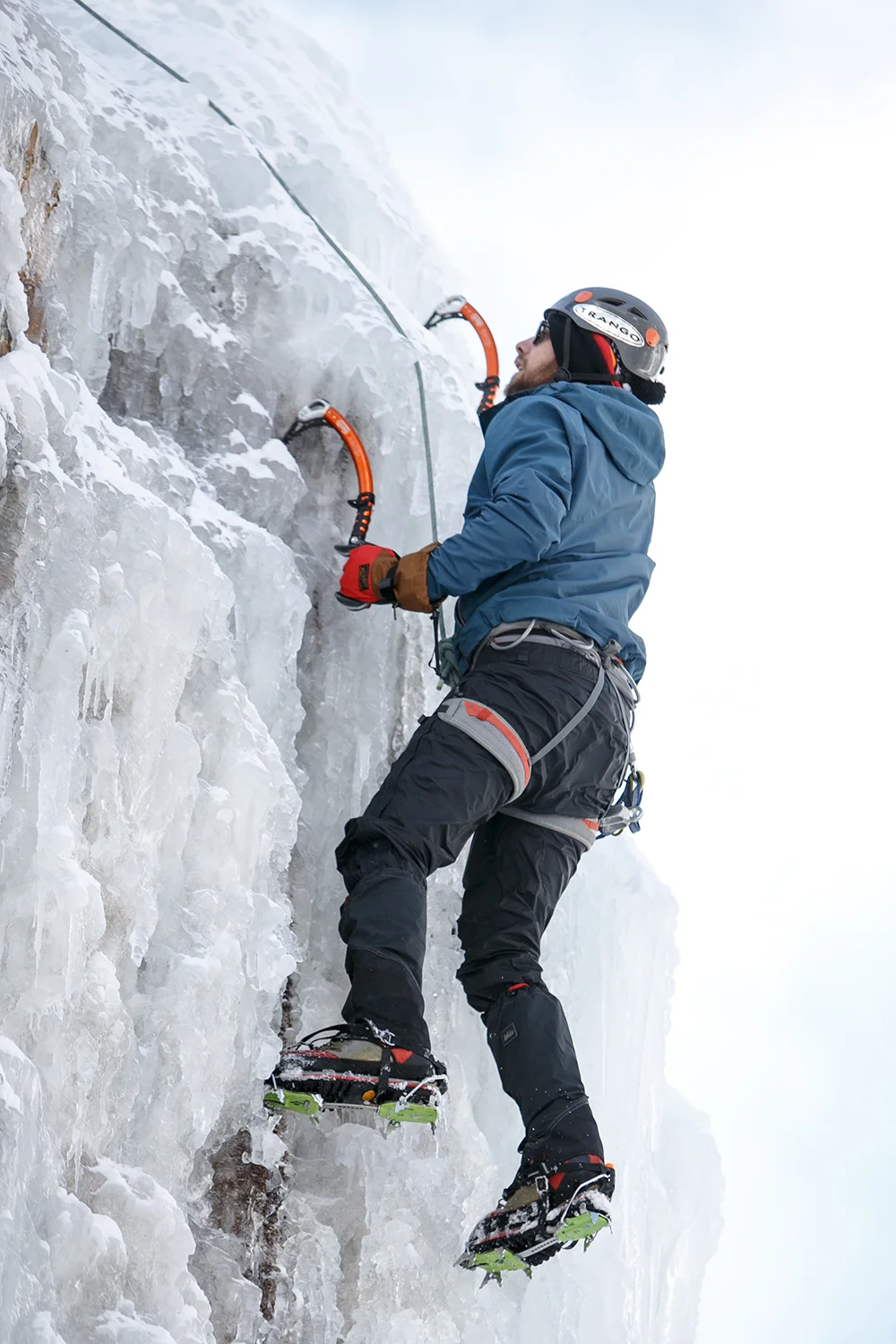
The captains strap on their crampons and learn to ice climb at Colorado’s Ouray Ice Festival.
Read MoreThe Captains of Us are back in action! This August, Jonathan and Molly will undertake another crazy adventure: attempting to fastpack the 485-mile long Colorado Trail (CT) in just 14 days.
Read MoreMolly gifts Jonathan an extra-special adventure for his 28th birthday: a 3-day backcountry skiing hut trip.
Read MorePOSTER'S NOTE:
If you have been following Dan and Jonathan's blog since its inception, you may remember a certain red-haired tagalong who started popping up about halfway along the PCT when she and Jonathan hiked a double marathon together (the *real* one). 900 miles later, there she was again, photobombing their monument pictures. When the boys realized that they hadn't booked a ride back to STL, it was Ms. Frizzle and my Magic School Bus on loan, who came to the rescue. (Or at least, that's sort of how it happened...).
After leaving these fine fellows in St. Louis, I drove back to Vermont to live off the fruit of my parents' table for a few months while splitboarding the East's finest backcountry. You might say that a life of free rent and powder refills sounds pretty good. And it was. But I just couldn't leave these guys alone.
Somewhere along that 900 miles, I fell in love with Jonathan and to my delight, he agreed to go on another crazy adventure in which we moved from our respective homes here to Boulder, CO to play in some really big mountains. Daniel even moved out to Golden, CO, just down the road, putting the third wheel back on our PCTricycle (Or is that me?).
I've shared a lot of great stories with the Captains of Us, and I may pop up once in a while to tell a story or two when these clowns are taking themselves too seriously. I think its realistic to say I outrank them.
-- Major Frizzle, reporting.
THE REAL STORY:
The natives call these mountains the "14ers": the 54 peaks in Colorado above 14,000ft in elevation. There are websites, even an app, dedicated to the pursuit of summiting the whole set. Since arriving in Colorado in April, Dan, Jonathan and I have collectively summited 10 of them, but this past week, Jonathan and I got a little ambitious and decided to do a few more. Ok, a lot more.
Taking 4 days off, we decided to attempt a route through the Sawatch Range developed for a challenge known as "Nolan's 14". This challenge, that some insane athletes complete in under 60 hours, goes up and over fourteen 14ers by the most expedient possible route, which can vary slightly depending on who you ask. On average, to complete the challenge, you have to cover between 90 and 110 miles and do 44,500ft of climbing, or, about 3.5 times the amount needed to summit Everest from Base Camp. Much of this is off-trail route-finding and, as we soon discovered, much of that is scambling over sketchy, loose scree at 13,000ft. Check out the details of the route here.
No problem. We have 4 days and we're in good shape, right? Right?
On Day 1, we wake up to a frosty car window and put the alarm on snooze for a few more moments in the relative warmth. It is cold already at 9,500ft, but we start up the trail and we both feel strong as the sun comes up. Mt. Massive is the second highest peak in Colorado, the largest contiguous area above 14,000' in the U.S. and our first challenge of the day. Instead of taking the Class 1 trail up this rockpile, the route takes us up the shorter North Ridge, a steep Class 2 scramble. Huffing and puffing up the last few hundred feet we see someone heading down toward us.
"Wow, he's moving fast!" Jonathan exclaimed. The guy was wearing a running vest and was jogging off-road down the slippery rocks. When we came up to one another, he asked where we were headed and we explained our plan to hike the Nolan's 14 route. The guy grinned. He said, "I'm just finishing up!"
What?!
"Actually," he continued, "I think I'm about to set the speed record!" His GPS was at 51 hours. We asked him his name. Sure enough, when we got home there it was "Andrew Hamilton breaks speed record on Nolan's 14". Check out Andrew's website here for some inspiration.
Back to us, we had just barely made it to peak #1. It felt great. And look at that view behind us!
Made it to the top of Mt. Massive
Mt. Elbert looms in the distance as we hiked through a lovely valley.
On to the next! Peak #2 is Mt. Elbert, the highest peak in the Rockies, at 14,433'. Usually known for being one of the easiest 14ers, it turns out that Elbert has a dark side. (Its the west one). Instead of cruising up Class 1 trail on the East Ridge, which would add lots of mileage, we ran down the back side of Massive, hiked up a 4WD road to the West Ridge and proceeded to climb 3,000 vertical feet over 1 mile of extremely loose, football sized rock-missiles. Do people really do this during a speed attempt?
Jonathan in front of Mt Elbert. Our route went up the ridge on the left.
Nearing the top and closing in on 8,000ft of climbing for the day, we were working for that summit. (read: I felt like I wanted to die). It even started snowing on us: Happy Autumn! Suddenly, we heard someone cheering us on. I heard Jonathan say: "They're so close! There's someone on the summit and they're so close!" Motivated, we pushed onwards to the summit.
This is how I felt on the summit of Mt. Elbert
At the top of the Rockies, we enjoyed a new view as our cheering squad erected his "BEER HERE" flag and cracked a tall boy. His friend was wearing a "DRINK WATER" sweatshirt and did not take photos with the flag, although it sounded like he had probably carried it for most of the hike. Mr. Keystone Ice told us it was his first 14er. (Yea... we know).
Man and Beer met on the summit of Mt. Elbert
Jonathan and I were pretty wrecked after that climb and as we ate our summit snacks, we both realized that we were burning through food way faster than we had anticipated. We wouldn't have enough for even two more full days of snacks, and looking at the maps, we also realized that the best, and maybe only, opportunity to hitchhike back to the car for a resupply would come on Hwy 82, right on the other side of Elbert. So, we changed our plans.
It got dark as we finished our descent to the highway and we cowboy camped near the road, talking about our changing expectations. Before we left, we'd been impressed by the athletes who completed Nolan's 14 in just 60 hours. After just two peaks and just under a quarter of the elevation gain required to complete the route, we were astounded. After about 13 hours, covering 22 miles and over 8,000' of elevation, it wasn't that we were behind schedule. We were just ready to sleep. Soundly. Not do another 40+ hours of hiking.
Instead, we had a great night's sleep, and woke up to a beautiful morning. Did I mention that it's autumn in the high country? The aspens glowed that morning, amber against the sunrise as we walked down the highway, waiting for a hitch.
Jonathan captured this majestic shot of the aspens in the morning light.
Not a whole lot of traffic, but what a lovely morning for a walk!
Highway 82 is a direct route to Aspen, so after a stream of dapperly dressed folks in Priuses drove past without flinching, a pickup truck was a welcome sight. An older gentleman pulled the truck to the side of the road and motioned for us to hop in the back. Hooray for pickup hitches!
The view from the back of the truck.
After two easy hitches, we made it back to the car, drove into Leadville and concocted a new plan over delicious coffee at City on a Hill Coffee & Espresso. New plan: Hit La Plata Peak (#3) that afternoon, then drive south to hit the two southernmost peaks the following day.
La Plata was a steep hike, but the trail was relatively easy-going and the weather was gorgeous. We were sore from the previous day's hike, but we made it up to see another mind-blowing view.
Summit of La Plata Peak
Crazy-looking ridge seen looking north from La Plata Peak
It was an uneventful evening, but we had fresh food waiting at the car, so we were in great spirits as we drove south to the Angel of Shavano Trailhead, close to the southern terminus of Nolan's 14.
I wasn't feeling great the next morning, but the sun was up and off we went. The trail up Mt. Shavano follows the Colorado Trail for a few miles of stunning aspen glades and well-manicured path, then juts upwards through a forest of krummholz trees to a high saddle. Mt Shavano and Tabeguache Peak (say: "Tabawatch") are close together, connected by a gorgeous rocky ridgeline, and after snack breaks on both (of course), we felt like we had done enough for one weekend.
Things got a little silly on the Summit of Shavano
Jonathan doesn't want to go back to work after the Summit of Tabeguache.
Molly enjoys watching over Tabeguache Peak as the Gargoyle of Shavano.
Finally on our last descent, we decided to take Friday to rest and recuperate our bodies before returning to work on Saturday. For good measure, we ran down Shavano, jogging the last few miles under a golden roof in the late afternoon sun.
The ambiance of an aspen grove in late afternoon as the leaves turn golden is an almost unparalleled experience. So unbelievably serene.
That evening, a little sore and pretty tired, we drove up to Breckenridge to meet up with Washpot, who Jonathan had met on the PCT, and his girlfriend, Charlotte. Back at their place, we scarfed down a whole pizza and talked about tiny homes with a stunning view of Mt. Quandary (a 14er in the Tenmile-Mosquito Range). Washpot enlightened us with an answer to a questions we've been pondering since arriving in Colorado: Does high altitude give everyone gas? The answer? Not everyone (Charlotte was quick to explain), but almost. Coloradans have a name for this syndrome: HAFE, or, High Altitude Flatulent Expulsions. Well, now we know.
On our three day mini-adventure, and within 60 hours, we had hiked about 50 miles, climbed approximately 18,000ft (about 1.5 Everests) and bagged 5 peaks. Plus, we had two good nights' sleep! Even without going for speed, the rocky terrain and consistent high elevation were hard on our bodies and we would have been very hard pressed to hike for more hours than we did. We learned that, more than anything, Nolan's 14 is about brutal endurance: the willingness to push for hours, and when it gets hard, to push harder. In terms of the challenge, we completed only 35% of the peaks (5 of 14), but over 40% of the total elevation gain as well as about half the mileage (with some different routes, of course). We also slept for approximately 18 hours and drove for 3.5 to 4 hours. The rest was mostly eating, with some hiking interspersed in there. Let's just say we came back with a healthy respect for the athletes who complete the whole thing in that same time frame.
Maybe one day, we'll come back and bag the rest of the peaks. Perhaps someday, we'll even have a fighting chance at completing the challenge. For now, I'm pretty pleased with the fantastic days we spent hiking in these beautiful mountains. Altogether, not bad for a weekend.
Cheers,
Words: Molly (AKA Ms. Frizzle)
Visuals: Jonathan
Hey folks. We're still alive and kicking. Short update first: Pedi and I have relocated to Colorado and are living in Boulder and Golden, respectively. The PCT had/has a profound effect on both of us. More on that later.
Currently, Soapbox has submitted photo prints to Cranky Yellow in St. Louis for the Strange Folk Festival at Union Station. The Strange Folk Fest is located in Union Station mall in St. Louis. It's a festival of makers - some 200 next-wave small businesses and vendors: crafters, artists, designers and vintage curators. If you are able, stop by Cranky Yellow and see some cool art.

We are still alive. Jonathan and I are both in St. Louis, MO. Here's a little photo series/update! Hope all the 2015 PCT hikers out there are enjoying their prep work, I definitely feel like I could hit the trail again. Ozark Trail, the CDT, the AT, the American Discovery Trail. So many opportunities for adventure. So much of the world to see. I digress... on to the meat and potatoes:
Jonathan is a photojournalist by training. His eye is searching, he is framing, he is that weird guy with a big camera that you manage to lose track of when suddenly he's by a tree on the hill snapping shots of you while you walk by. He completed a photo series, the shots of all the hiker trash, as we walked the PCT which he posted on the blog a while ago.
This is my somewhat meta project of Jonathan shooting while we hiked. Carrying a 3 lb camera mounted on a hip holster while you hike 20+ miles a day can be tough, I heard about it more than once. While I carried a Fuji X100 during the early stages of the trek, by Northern California I had shipped the x100 and was taking pictures with my iPhone exclusively. I have a lot of respect for his work ethic while we traveled - tuning out the noise, writing, shooting, editing, posting. Many hikers start blogs, few keep them alive. I was lucky to hike with someone so talented in that respect.
The first day out. We both took a ton of pictures. The trail was new and we were finding out what worked.
Third day on the trail, close to the Sunrise Highway in southern California. The trail overlooks a large stretch of desert, I think the Anza-Borrego Desert State Park.
Jonathan sets up a group photo on what very well might have been a cornice on Forester Pass. Heart attack.
Taking a picture and a break lake-side. We were on our Mt. Whitney evening approach.
I think Quinoa made it across dry this time.
Jonathan shooting some climbers just after they reached the top of Halfdome. The most stunningly beautiful place I've ever been.
We all took a ton of pictures on Halfdome. Here is Jonathan taking a break to shooting on the way down.
This was the day we reached the halfway point on the PCT. This is the last time I saw Pedi for a little while, I reached the halfway point with Midway.
I caught Jonathan shooting for his Hiker Trash project. Usually I was holding the Tyvek in the background, luckily I shirked my responsibility to get a pic.
Fast forward. Jonathan captures another of the more beautiful scenes on the PCT - Mt. Rainier to the south, sun setting to the west. This was the day after my sickness in Washington.
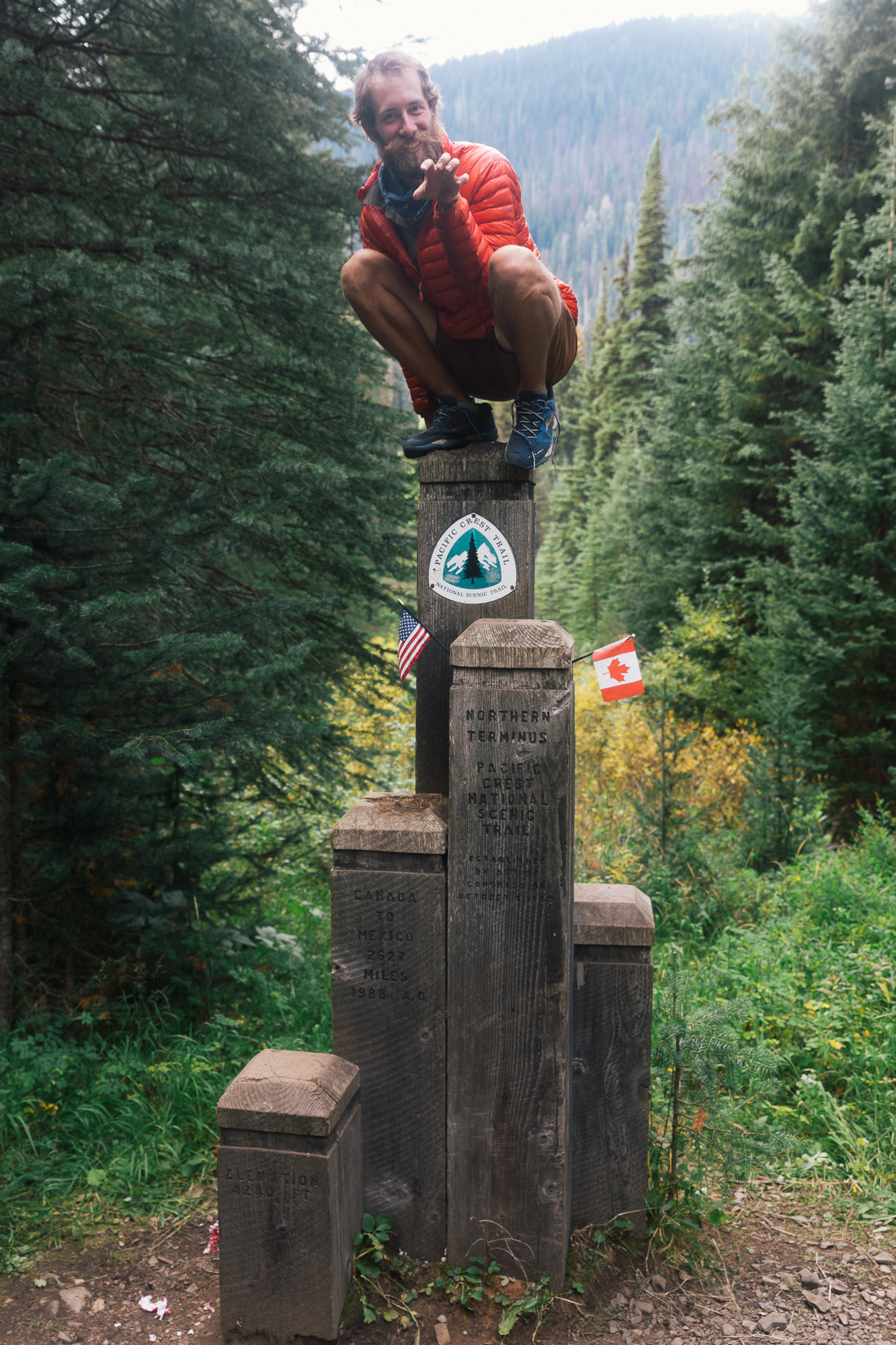
An appropriate end to a trip. Frizzle getting some classy shots at the PCT northern terminus. Note the clear-cut US/Canadian border. Neat.
Cheers folks, thanks for checking out the blog
Dan
Jonathan and I have both been rigorously submitting attempts to win the #LifeIsWILD contest. The contest is built as part of a marketing campaign for the new movie, WILD, about Cheryl Strayed's adventure on the PCT (adapted from her book). The contest is looking for transformative experiences.
“Cheryl Strayed was changed forever by her adventure in the WILD, and we want to learn about YOUR transformative experiences in the great outdoors!”
Everyday was an adventure. Every day we were in nature. Every day was wild. The moments captured by pictures, these blog posts with our stories are more our attempt to make sense of the experiences we had. Nothing we create comes close to the time spent on the PCT. But take note and I try to remember that the PCT is just a dusty path. Dusty paths are everywhere. Pick one and follow it. You don't have to try to be John Muir, Cheryll or us. You can get lost anywhere.
Anyway, here's some of my favorite entries. The contest ends today so cross your fingers for us.
Dan's shots:
This day I learned natural beauty is unmeasurable, GI bugs are miserable. dichotomy on the PCT #LifeisWILD #contest pic.twitter.com/DKVpg92Xur
— Daniel Beerman (@toBDaniel) December 7, 2014Her first backpacking trip she hiked 18 miles a day - swarming mosquitoes, ice fields, mountains #lifeiswild #contest pic.twitter.com/nxk3KwsF9l
— Daniel Beerman (@toBDaniel) November 26, 2014Overwhelmed, we stopped to take the world in. Instead the world took us in. #lifeiswild #contest @radstam #pct pic.twitter.com/bVgU62nPaQ
— Daniel Beerman (@toBDaniel) November 19, 2014climbin' up the side of Pinchot Pass. 1 down, 1 to go - Mather Pass was next. #lifeiswild #contest pic.twitter.com/oTYq69icCH
— Daniel Beerman (@toBDaniel) November 17, 2014As the rain came in sheets we continued north, we were motivated to find shelter. #lifeiswild #contest @radstam pic.twitter.com/xWOj8iVJdn
— Daniel Beerman (@toBDaniel) November 14, 2014"It's all down hill from here," he said as they descended from highest point on the PCT #contest #LifeIsWild pic.twitter.com/6GR3DIQjUJ
— Daniel Beerman (@toBDaniel) November 11, 2014We reached the top of San Jacinto and made it through the snowy night. To Canada! #LifeisWild #contest pic.twitter.com/6Zm2SUCtSa
— Daniel Beerman (@toBDaniel) November 4, 2014There we were... end of an epic saga. 2600+ transformational miles. New adventures await. #PCT #LifeisWILD #contest pic.twitter.com/jjA5jQx7qx
— Daniel Beerman (@toBDaniel) December 12, 2014Some people like to watch the world burn... but we just wanted to hike away from the fire. #lifeiswild #Contest pic.twitter.com/oaFU3SM0IT
— Daniel Beerman (@toBDaniel) November 28, 2014Jonathans shots:
The last ridge to Canada helped put the hike in perspective. #LifeIsWILD #contest #pct pic.twitter.com/kIBOBY46Kv
— Jonathan Hinderliter (@radstam) November 29, 2014The sprawling Mohave desert at sunset on the #PCT. #LifeIsWild #contest pic.twitter.com/KIcU9im22a
— Jonathan Hinderliter (@radstam) November 21, 2014A rainstorm at sunset in southern Oregon on the #PCT. #LifeIsWILD #contest pic.twitter.com/s2QyWxHDoX
— Jonathan Hinderliter (@radstam) November 19, 2014Sometimes you have to sit by a river and meditate on the #PCT. #LifeIsWILD #contest pic.twitter.com/x8Qt8xyqnt
— Jonathan Hinderliter (@radstam) November 17, 2014The #pct goes past gorgeous lakes like this one in NorCal. #LifeIsWild #contest pic.twitter.com/walbdpBeNc
— Jonathan Hinderliter (@radstam) November 15, 2014Golden hour in the forest is my favorite. #LifeIsWild #PCT #contest pic.twitter.com/1r1sf0MZWs
— Jonathan Hinderliter (@radstam) November 14, 2014Sometimes exploring the wilderness involves epic creek crossings. #PCT #LifeIsWILD pic.twitter.com/9q3Ue1CECL
— Jonathan Hinderliter (@radstam) November 7, 2014There’s nothing like the first time hitching in the bed of a pickup to get back to trail. #LifeIsWILD pic.twitter.com/QQ1NhzvIrv
— Jonathan Hinderliter (@radstam) November 4, 2014As always, thanks for reading.
Dan
It's been a couple months since we've gotten off the trail. We have had time to reflect a bit on the experience as a whole. To try and summarize the Pacific Crest trail is a difficult thing to do, but what we can do with much greater ease is show you some numbers and answer some questions that help put our hike in perspective.
Favorite section
Pedi: Depends on how I look at it. In terms of beauty, the Sierra Nevada is the clear winner. The things I saw up there were beyond the realm of things I knew existed. When it comes to all around good times and adventure, though, it's hard to beat Oregon. It was such a fortuitous time on the PCT. Everything fell into place and new avenues opened up that blew our minds.
Soapbox: Hiking in the Sierra Nevada was also my favorite. I dreamed of that section, seeing Half Dome, experiencing the challenges, and no part of it was disappointing. Many other PCT hikers will echo Pedi and myself. If I had to offer each section an award:
Least favorite section
Pedi: I can't say I really have a least favorite section. Even through the hard times I was thankful to be on trail. If I had to pick something though, it would be split based on how the sections affected me. Southern California was the most physically challenging. I was in near constant pain from blistered feet. Not only did this make hiking difficult, it also meant that I was practically immobile once we were done hiking for the day. This was incredibly inconvenient. Mentally, I think NorCal was the most challenging. It's long, hot and I found myself getting more grouchy during this section.
Soapbox: Not really applicable for me. Even my sick days didn't keep me from enjoying Washington.
Favorite town stop
Pedi: Portland was a magical place. It was one of only two times I went to a town that was far off trail. It was my first time, and I got a grand tour that packed as much delicious food and culture into two days as possible. We were given a car to drive and town clothes to wear. We were practically normal people! Boy did that make life convenient. All of that being said, most town stops were a delight in their own way.
Soapbox: We had a chance to experience so many places for such brief moments and in such unique ways. With that in mind, I loved our first town stop and zero day(s) spent in Idyllwild. We learned who our hiker family was (kind of). We succumbed to a hiker vortex for the first time there. Two days! As we hiked out we got a hitch from two really interesting dudes.
Least favorite town stop
Pedi: Sierra City. Many, if not most town stops are very circumstantial. It totally depends on who you meet, when you're there and, especially, how long you are there. Sierra City was a tiny thing that would have been fine for a quick afternoon, but the two and a half days I spent there was way more than I would have preferred.
Soapbox: Chester, California. The day I reached the PCT halfway marker I hiked 22 miles with Midway. He and I were both experiencing some kind of stomach bug And we could not get a ride into Chester - the only time that hitching completely failed me. The next day I spent in Chester I mostly slept under a flight of stairs at a hotel.
Number of shoes used
Pedi: 6 (This is an unusually high number. I used three pair in the SoCal alone because of rapid feet swelling and size problems. The second pair I traded for)
SoapBox: 3 pairs... trained in my first pair + 700 miles. 1300 miles in the second. Still wear my third pair sometimes.
If I did the PCT again, what would I do differently?
Pedi: Two things specifically. First, I would start with bigger shoes. Avoiding the blisters and foot pain of the desert would dramatically change my experience during that section. The shoes I started with were only one size larger than normal and were not wide enough. The sweat, heat and friction caused them to become "meat grinder feat" as Soapbox so aptly call them. Once I got shoes that were a full one and a half sizes larger than normal I was good to go. Second, I would add more variety to the food in the resupply boxes we mailed ourselves. I thought they were diverse when I made them. Little did I know how wrong I would be by the end of the trail. I could barely look at a bag of that same trail mix, Pop Tarts and peanut butter crackers.
Soapbox: There are sections where I wish I had hitched off-trail to experience side adventures, days I could have hiked more miles, and to trust that "the trail provides" earlier would be useful at the beginning. More explicitly, I would learn more about the areas we hiked beforehand. We did so much research to prep for the trip itself that I wish I would have obsessed over gear a little less and researched some history, flora and fauna. I found myself often wanting to know more about the places we passed through. That said, I gained so much info about the PCT and logistics, I'm not upset.
DATA SETS
| PEDI | DESERT | SIERRAS | NORCAL | OR | WA | TOTAL |
|---|---|---|---|---|---|---|
| DAYS | 40 | 29 | 34 | 20 | 24 | 147 |
| MILES | 702 | 400 | 595 | 457 | 508 | 2662 |
| RESUPPLY STOPS | 9 | 4 | 7 | 6 | 5 | 33 |
| ZERO DAYS | 7 | 3 | 5 | 4 | 1 | 20 |
| NEAR-O DAYS | 3 | 5 | 5 | 1 | 3 | 17 |
| MILES/DAY | 20.4 | 17.3 | 21.4 | 26.9 | 23.3 | 21.3 |
| MILES/DAY (+ ZERO DAYS) | 16.8 | 15.5 | 18.3 | 21.5 | 22.3 | 18.4 |
| LONGEST DAY | 35 | 30 | 54 | 52 | 32 | 54 |
| SOAPBOX | DESERT | SIERRAS | NORCAL | OR | WA | TOTAL |
|---|---|---|---|---|---|---|
| DAYS | 40 | 29 | 34 | 20 | 24 | 147 |
| MILES | 702 | 400 | 595 | 457 | 508 | 2662 |
| RESUPPLY STOPS | 9 | 4 | 8 | 6 | 5 | 33 |
| ZERO DAYS | 6 | 3 | 3 | 4 | 1 | 17 |
| NEAR-O DAYS | 3 | 6 | 6 | 1 | 3 | 19 |
| MILES/DAY | 19.8 | 18.2 | 19.7 | 27.3 | 23.1 | 21.3 |
| MILES/DAY (+ ZERO DAYS) | 16.8 | 15.5 | 18.3 | 21.5 | 22.3 | 18.4 |
| LONGEST DAY | 27 | 31 | 40 | 36 | 32 | 40 |
We hiked the same PCT, but some days Soapbox hung back, Pedi sped up or one of us wasn't feeling well so we would do our own thing. Let us know if you have questions!
Cheers,
Dan and Jonathan
There is a trend among backpackers toward using less and lighter gear which has grown over the past decade and is popularly known as the ultralight or “UL” movement. This shift is part cultural, part technological.
The packs carried in the past were significantly heavier than those we carry today because we have materials that simply did not exist five or ten years ago. Packs in the '70s had external aluminum frames that weighed 3.5 lb minimum. My pack (just the backpack) is 2 lb 2 oz. Apply this same shift to nearly every piece of gear available and it totally changes how people outfit themselves for long distance hikes. This is especially true on long-distance trails like the Pacific Crest Trail. When you hike 20+ miles day in and day out for five months, every ounce matters.
I truly applaud the women and men of older generations who went mountaineering and hiked long-distance. They faced far more challenges than I did, and they did it with base weights far greater than mine. For reference, your base weight is how much your pack weighs with all your gear in it, but without food or water. To really start getting into the realm of lightweight and ultralight backpacking, your base weight will should be around 20 lb and 10 lb respectively. Carrying much below 10 lb is both impressive and crazy. It should be noted that achieving a base weight of 10 lb or less probably involves foregoing any medical kit or creature comforts. It definitely means you aren’t carrying a stove.
While "going UL" is becoming more popular on long distance trails, you should heed a few warnings before buying a bunch of fancy, lightweight gear. A better or more expensive set-up (read: more UL) isn’t going to make you a good hiker. For that matter, what does it even mean to be a good hiker? There's nothing competitive about it, and generally speaking, there is no exact right way to do this hiking thing. All I can do is share my perspective, and in my opinion going UL is a good way to go.
For many, UL gear is simply not an option. You can pretty much count on the lightest gear being the most expensive gear (with some exceptions, mostly in the homemade category). Many hikers may decide they want to join the UL ranks, the big challenge is balancing cost and weight. Sometime you have to sacrifice dollars for fewer ounces. As you learn about gear you may find it can become an obsession.
If you do decide to join in the UL movement, here are a couple pieces of advice. First, don't be a dick about it. Just because you might be UL and don't have any single piece of gear weighing more than 2.5 lb doesn't make you better than any other hiker. Second, there are other things to talk about on the trail than your gear. A little bit of gear talk is great. Most hikers, myself included, love learning about new gear and seeing how it works for different people.I hiked with a couple of UL bros who pretty much never shut up about their base weight. It got really old, really fast.
For those long-distance hikers who are not UL, having a higher base weight does not mean they’re doing it wrong. Some people are perfectly happy carrying extra weight or like the luxury of a few key items. Sometimes these items are about preparedness. This could include a SPOT device, compass, maps, jackets, warm clothing, etc. If you get caught in the wrong weather at the wrong time with the wrong gear, things can get very scary, very quickly. It can be dangerous and potentially lethal. While I don’t like carrying more than I need to, I’m never advocating neglecting gear that very well may save your life if it starts raining and gets cold or windy. A good friend of mine from the trail, Smokes, carried an extra of damn near everything and often that was really handy (not just for him!). Smokes is well-versed in wilderness survival. He was ready for anything both in terms of gear available and mental preparedness. On the luxury side of gear, certain people enjoy their creature comforts. Maybe you want your book, harmonica, wind shirt or town shirt. Dan carried a harmonica for the whole trail. Hike your own hike. (HYOH. It’s a phrase/acronym you hear often around trail. It means do your own thing, and let other people do their own thing.) Those people probably value those comforts over big miles anyway. There is nothing wrong with that.
There are, however, other hikers who are not UL and who may not even have the heaviest of gear but just have way too much gear. These people's gear choices seem to be guided by fear. You should never go into a situation unprepared, but do not underestimate how much you can do with very little. Do a shakedown of your pack sometime and consider how much you truly need each item. There are likely quite a few that will never be used nor missed once you have ditched them. (A shakedown is when you dump everything, and I mean EVERYTHING, out of your pack to re-evaluate exactly what you do and do not use/need.) Do you really need that Tiger Balm? Why on earth do you have a knife that big? How come you always walk into town with at least two days worth of extra food?
Once I lightened my pack I quickly realized a few things. My legs hurt less, especially going down hills. I could go faster and I was more nimble. Heavy, bulky packs can be unruly and make it harder to maintain a brisk pace. It makes climbing over obstacles more cumbersome too. I could go farther each day. Because you burn fewer calories with less weight, you are usually less exhausted. Even if you don't want to do big miles or hike hard, the fact that it reduced leg pain and strain would have been enough to convince me.
Because of the UL trend, at least in part, the outdoor gear industry has been shaken up over the last few years. Smaller cottage companies are springing up all over the place because they came up with new ideas on ways to approach gear. Sure, it’s a cliche word nowadays, but I love seeing this innovation. The proliferation of cuben fiber in the backpacking world is perhaps the best example. Do a search for cuben fiber gear and look in awe at what you can make out of it and how little it weighs. (i.e.: Z-packs and Hyperlite Mountain Gear.
I don’t think the trend will completely take over the backpacking/hiking world. There are still more than enough people who aren’t worried about weight and want to take their time. This trend will, however, continue to grow, just as thru-hiking does.
Take it from me, a guy with absolutely no credentials who has only done one big hike and then made a blog about it, dropping your base weight can make life way easier on trail.
Cheers,
Jonathan
This posts takes us back to the High Sierra when we carried solar panels, extra clothes, and bear cans. Refer back to the previous two posts about both Forester and Glen passes - climbing them took time and required some logistical coordination. Surely climbing two in a day wouldn't be a great idea...
We had put ourselves in a tough spot, we hiked out from Kearsarge with 6 days of food hoping we would be okay hiking through the Sierra, we had a deadline. To get to the next food resupply we needed to hike both Pinchot and Mather in the same day and we thought we could do it.
The two passes were only 5 miles apart, both were over 12000 feet. Pinchot was straightforward, we camped in its shadow so the approach would be easy: hike a short distance and climb 2000 feet as soon as we woke up. I woke up late - around 7:30 or so, and was hiking alone. The climb was steady, but snow fields covered the trail most of the way. It was easy to get lost with the pass not yet in view.
I lost the trail several times, but once I could see where the pass was I just hiked straight for the it. Closing in on the final climb I stopped in the snow field. When I looked around and saw Quinoa and Pedi making their way in the snow behind me. Somehow I had gotten ahead of them by climbing over a rise in the snow pack while they followed the trail around the rise. I laughed because I was ahead now and because I was having the time of my life in the most beautiful, rugged landscape I'd ever been in. The pass was in sight and Half and half was ahead. It was time to get to the top. Looking forward, I saw the trail in the distance and plenty of foot prints in the snow to guide me.
I was third to gain the pass and the view was incredible. All four of us had made it and we ate a late breakfast together. Next we set our sights on Mather. The descent from Pinchot was easy - the trail was mostly uncovered and the north side of the pass was fantastic to look at.
Mather was a more gradual climb over 6 miles, but took longer than two hours. On the way up we encountered a ranger! She was headed the opposite direction and just asked for our names, but it was an incredible encounter to me. She was clean and carrying a huge pack and a shovel. She wished us luck and took down our names and let us go. I couldn't help but admire how clean she looked next to us, with our worn out shirts, shorts and tiny backpacks. She was hiking out to her summer appointment, most likely.
We made it to the final climb quickly - a couple stream crossings and walking on some snow, we crunched across hoping to avoid postholing as we went. It had looked easy from distance, but was not. The first part of the climb was fun compared to the other passes. The switchbacks were steep. I was able to look around and really observe the scenery. Mather had a gradual approach with a big lake at its base and the trail snaked around to the east. As we began the climb up switchbacks we entered the shade of the afternoon sun and we were totally exposed. After just a short way up I looked back to see what where we had come from. I took in that moment in the mountains.
The High Sierras are really like no place I've ever been. Snow covered and treacherous, they command respect. From the high places we could see vast expanses of white and grey teeth jutting upwards. We got to sample some the forces that helped shape the landscape as the cold wind whipped. I felt my own smallness and was struck by my insignificance relative to the giants I crawled upon. In that moment, on the side of a mountain pass, I was humbled by the enormity and majesty of the raw expanses which I was granted passage over. My moment of romance passed quickly, though - I had more altitude to gain and then we had to get down safely.
Loose talus (gravelly rock) and snow covered, the trail on the last few switchbacks was a littler nerve racking, and the mountainside was a deceiving 60 - 70 degree incline so no one fancied slipping. At one point I was clambering on softened snow and ice and slipped, feeling a shock from my feet, up my spine and in my neck - the image of me with my heavy pack (bear can included) sliding and falling down a mountain flashed in my mind. Immediately, I punched my fist into the snow on my left side and stabbed my trek pole hard on the right. No harm. Just sweating like crazy and that image not fading quickly enough. The snow had been in the sun all morning, after all, we couldn't rely on it to carry our weight as we gained altitude in the hundreds of feet.
The rest of the climb I finished carefully and was really happy to see the final switchback was mostly cleared of snow. The down climb was going to be rough - it was late in the day and the snow was soft and the first part of the descent was completely covered with thick snowpack and a few jutting rock points.
Pedi and Half and Half chose a different route than Quinoa and I. All of us postholed over and over again. I was soaked from falling in the soft snow, sweaty and exhausted by the slow, slipping down climb - fearing with each step I would sink into the snow, into some unseen pointed rock. Oh, and I was concerned the other two wouldn't find a safe way down and that I'd hear a yell from higher up on the pass as the sun began to set. The north side of Mather Pass was steep and had some shear cliffs and the trail probably navigated them well, but we had no idea where the trail was underneath the layer of thick snow.
Finally I made it to a boulder field and could hop from rock to rock downwards. Quickly I descended and found the trail - until that point I was just searching for a route in soft snow that led safely downward. Even though the trail was acting as a channel for ice-melt, I walked the cold water, completely soaked, but happy to take a full step again with confidence. To make progress. After what seemed like hours, I was anxious to find the others and to find a spot to camp.
After a few minutes of trudging in the water I saw Pedi and Half and Half! And they were ahead of me! Quinoa had postholed a lot and fell once or twice, but scrambled down quickly as well - I had a sense he was not far behind me the entire time as I could hear him cursing when he postholed (I'm sure he could here me, too. I'm not Soapbox because I'm the quiet one). Finally we could hike down and find a spot to sleep without slipping. We were exhausted.
With the four of us reunited and the trail immediately in front of us we hiked as fast as we could to find a place to camp for the night. As a reward for our double pass day we hiked to Palisade Lakes just as the sun set. Beautiful end to a day, but the Sierras had taken quite a toll on us.
Cheers and thanks for reading,
Dan (aka Soapbox)
View all the snow fields we crossed that morning from the top of Pinchot
Quinoa encountering a ranger.
Nature.
the snowy, icy slopes of the south side of Mather Pass. Almost fell here...
Jonathan standing at the top of Mather.
View of Palisades Lake and the north face of Mather Pass.
Sunset at the outlet of Palisades Lake, we were still searching for a camping spot.
I took all these pictures of myself while I hiked and I needed to do something with them so I made a video. The trail takes its toll on a body and you can definitely see a change in through hikers as they travel north.
Watch the beard grow!
Use sites like Steep and Cheap, I suggest knowing what you want and watching for deals if you have the time. Also, this is a great gear reference: 10 lb Backpack.
The other stuff:
Navigation
I read the book to help prep. I made little notes in it and used it as a reference point and to help me feel less insane since everyone I knew thought I was crazy for deciding to walk across the country. At least this Yogi person and the people that answered the questionnaire understood my mania.
The book comes with “beta” pages or tear-out pages about sections of the trail. They included phone numbers, diagrams, notes from other hikers. Jonathan and I shared a copy. I saw these pages only a couple of times, but the info was quite useful.
I love this app. It’s free. It’s accurate. It was reliable. I wish Halfmile made an app for my everyday life. “You are 2.2 miles off trail for your life. Get it together. The shortest distance to achieving your goals is ...” I could use support like that. I miss looking at this and knowing where I was, where I needed to go and the fastest way to get there.
If you are hiking with a smart device, this is the way to go.
While using Guthook and Halfmile I could answer most questions about the trail. Guthook costs money, each section was $6. You can buy the whole suite of apps for $30, I think. Go for it, although if you are on super strict budget, you could get by without.
Water storage
Smart Water bottles and a wide mouthed Gatorade bottle. Don’t carry Nalgenes for they are heavy.
Maybe use a platypus or camelbak container for the ease of packing. In the desert I carried up to a 6 liter capacity using plastic bottles from gas stations. They're light, durable and cheap!
Water purification
AquaMira - Mix part A with part B. Wait. Add to bottles. Wait. Drink. Tedious but effective as long as you use it correctly. Chlorine Dioxide (active Aquamira) /= bleach.
Sawyer / Squeeze (3oz) - This is a great purification solution. Compared to the pumps and thing I used growing up, you can't ask for a better innovation. That said, using it every day gets old fast. Its not as quick as using drops because you have to fill the bag and squeeze it, which can get more difficult with dirtier water. Also, the bags can break or leak and contaminate your clean water. The filters do fit on several water bottles, which helps with the bag issue. For me - this is for short trips or back up/emergency water purification method.
Bleach (household bleach is typically Sodium Hypochlorite, although you should always check the container for potency and composition if you are planning on using a chemical to treat your drinking water)
Treating water with bleach is definitely effective, but there are certain risks and may not be able to destroy cryptosporidium pathogen with 2 drops in a liter. I used bleach to treat water from Northern California to the border and have used bleach in the past very frequently. There are plenty of studies out there discussing the use of bleach as water treatment. I would consider reading up on water treatment. Start with the CDC or something.
Misc
I carried a myriad of other items in my backpack. These included a harmonica, an iPhone, iPhone charger, sketchbook, pen and pencil, permanent marker, some paper, my hiking permit, and some money and credit cards. These extra things can add up fast. Your friends may put rocks in your pack. You might put a beer in your bag to have on the first night then forget about it (great surprise when you do end up finding it later, though). It's a fun trip, enjoy it. Try not to flip out about gear too much. I'm sure while you are planning your trip you will freak out a few times... once you are on the trail, stop doing that.
Cheers,
Dan (aka Soapbox)
Use sites like Steep and Cheap if you can tell they post brands or gear you like. Also, this is a great gear reference: 10 lb Backpack. Feel free to ask questions. Try things on before you buy them. Go to a store and look before you make an online purchase!
Wearables (clothing):
In general you're going to probably be able to figure out what clothes to wear without consulting blogs, but here's my data for the sake of completion. I hope someone finds it useful.
Shirt - Columbia Silver Ridge
It’s a shirt. Whatever. Oh - it cleaned up well in the wash. You’ll want to wear something. Or maybe you are a nudist? Me? I prefer a “Tradewinds Grey” color to protect from the sun and harsh elements on the PCT.
Bottoms - "I can't begin to care.” - Pedi.
I wore these stupid heavy canvas pants I bought for $2 at a thrift shop until I stopped worrying about getting sunburned behind my knees then I tied the pants to the bottom of my pack and forgot about them. Seriously… I left these things tied to my pack for 200 miles or so until I threw them away in Bishop, CA when I was doing a shakedown. I wore some elastic Prana shorts I found on Steep and Cheap the rest of the way. Sometimes I wore compression shorts or running tights.
Compression shorts - Nike something.
Personal decisions are hard.
Underwear - Ex Officio / Give-n-go boxer brief
"BEST. UNDERWEAR. EVER.” - Pedi
I really can’t improve upon Jonathan’s review. I hope to own these boxers for a long time and I intend on taking them all over the world. And damnit, for $20 they better last forever.
Extra shirt - Stoic / Breathe Composite (pretty light?)
Warm long sleeve. Especially nice to have in the Sierra otherwise useful as a pillow or sleep shirt (protect your sleeping bag/quilt from getting dirty). Personally? I don’t use sleep clothes and I ended up getting rid of this after the halfway point. Probably could have gotten by without it the whole way.
Sleep pants - I had running tights but definitely did not sleep in them more than a few times. I am a warm sleeper.
Socks - Stoic Synth / Trail Crew Sock
I used Injinjis and Stoics almost exclusively. Stoics were the best; I went through six pairs or so the entire trail and still have a few of them. Injinjis were nice early on to help prevent blisters, but they wore out within 100 miles and were a pain in the ass to get my weird toes into. I only picked these because I found them on Steep and Cheap for a great price.
Interesting side note - Injinjis make great sun gloves if you cut holes in the toes once you wear them out as socks. I started the trend and Pedi picked up on it pretty fast. You’re going to want to wash them before you put them on your hands…
Shoes - Solomon / Sense Mantra (16 oz) AND Brooks / Cascadia (13 oz)
I had very few foot problems the entire trail. I went through 3 pairs of shoes, but only two different models. In general, I think shoe choice is very personal and you'll know what is right when you try them on.
Brooks Cascadia: Join the Brooks Club! If the PCT had a fork in it, we'd search for Cascadia shoe prints. It was usually the right way. A very popular shoe for a good reason. I hiked 1300+ miles with one pair. 10mm heel-to-toe drop
Solomon Sense Mantra: Really loved this trail runner while I was in the desert. I was able to get 800+ miles out of them. I trained in them then wore them to Kennedy Meadows, CA. Solomon has a great manufacturer guaranty as well. I think if you are hiking with under 25 lb, this is plenty of shoe and it's light, dries very fast, and is pretty durable. Note: the synch shoestring never broke, someone told me it definitely would. It did not. Also, I think this is a 6mm drop shoe.
Gaiters - I’d wear 'em if the whole trail was in the snow, but otherwise they make taking my shoes off too much work.
Jacket - Mountain Hardwear / Ghost Whisperer (7oz)
Expensive, but worthwhile, I think. This lasted the entire trek and I washed it with Nikwax and it’s like-new (minus the hole and lack of branding/logos). The material is very delicate. Wear something over it if you are being active, I climbed a tree and the bark caught and ripped a hole instantly. No bueno. That said, all down is an investment. It lasts if you treat it well.
Rain Jacket - Outdoor Research / Proverb (13oz)
Another Steep and Cheap find. Great value when found on sale. Certainly not the best jacket on the market, but it served its purpose.
For "next time": Jonathan said in his review, consider: Outdoor Research / Helium 2. I'm also researching some Marmot-made options like the Mica and the Essence. Check out Snarky Nomad's reviews.
Rain pants - Mountain Hardwear / Alkane Pant (9oz)
Great pants. They saw heavy use in WA when we were in the rain for days on end. Also great for in the Sierra. Not sure if they are essential, but it was nice to have them, particularly in the multiple day long downpours.
Warm hat - Some outdoorsy hat, you need a hat. It's just a hat. There are many like it.
Gloves - Nope.
I thought about buying gloves every time I went into an REI or outfitter… But I never bought them. I would have worn them in WA if I had them. In the desert and in the Sierra I would cover my hands with a bandana, cut up injinjis, cut up sleeves from a cotton shirt. Whatever. HYOH.
Sunglasses - Solar Shields
Solar shields. Solar shields. solar shields. They may get worn out, scratched, or lost, but never stolen. Don’t get attached to your shades because you’re going to lose them at some point. Or break them. Probably both.
Happy hiking,
Dan
I’m a gear head, and I can obsess about gear, but by the third day of the Pacific Crest Trail I was exhausted with all the gear talk. It’s one of the most popular topics on the trail. It’s great to learn the ins and outs of the materials, the weight, the costs. Learn to compromise size, durability, and comfort for weight, speed, and simplicity. Many PCT hikers spend tons time researching every single thing they choose to carry (certainly not all of them). Naturally, people tend to have opinions about what to bring. These discussions were not always constructive and after awhile I kind of toned gear talk out.
Either way, I hiked the PCT and lived out of a backpack for five months and these are the things I took and what I thought of them.
Jonathan, three days from the Canadian border, was still giving me grief about carrying a harmonica I hardly played. I was not a UL master. No one is perfect.
The Big Three and essentials:
Pack - The Osprey Exos 58 (2 lb 6 oz for a medium pack with brain. 2 lb 2 oz without the brain)
Loved my pack. I loved the suspension system and that aluminum frame. I loved how easily my kit fit into it. I loved that I could put things I wanted in the hip belt pockets, shoulder strap pockets, back pouch or in the brain. Many ultralight backpackers tend to go for more minimalist packs, but I liked having the extra support for the long stretches and first few days out of town when my pack would be loaded to 40 lb or more. The Exos fit a Bear Vault bear canister with ease, and I often had extra room in the pack.
To shave weight you can elect to cut extra straps, remove the brain (which is adjustable, detachable and works as a fanny pack or something like that), or get a smaller size. I saw people using an Exos 48 and even the 38, the compromise is a dedication to minimalism. Also, Osprey is an extremely hiker-friendly company and will honor a lifetime warranty on their gear.
For "Next time": Saw a ton of ULA / Circuit (2lb 6oz), the most popular pack on trail. Our friend, Mongo had a completely stripped down Z-packs pack (this was literally a bag with straps).
Sleeping bag < QUILT!!! - Enlightened Equipment Revelation 20ºF (26 oz)
The specs: Revelation 750 fill goose down, 20ºF rating
Prior to the PCT I only used mummy bags, but now I am in love with Enlightened Equipment quilts. Great idea, functional, lightweight, great company. Within the first week of hiking the trail I knew I had made the right choice. The general idea is that you save on material because you don’t need down underneath you when you sleep - that just wastes down because down needs to loft in order to provide warmth. The quilt has fasteners or straps that keeps it tight around you on cold nights and you can sleep with it loosely covering you on warmer nights.
For "next time": Would have sprung for the 850 fill goose down to get an even lighter quilt, but 26oz for a 20ºF sleep system is a great deal. Plus you cant beat the manufacturer's prices considering the great quality of the product.
Sleeping pad - Thermarest / Prolite 4 (1lb 8oz)
Lighter options are out there. Smaller options are out there. This was one of the first things we each bought and we found it on Steep and Cheap so it was quite affordable. Bottom line: it’s durable, it’s warm, and it’s comfortable.
For "next time": Thermarest / Neo Air XLite, Were I to do the trail again, I'd get this in a Small and use some z-lite or my pack for my legs and feet. I thought about using my Thermarest Z-lite, but when I used it I noticed I had to be strategic about where I slept. If the ground was wet or soft or muddy or snowy my body heat would get sucked out of me. I pay attention to the "R value", which describes the thermal resistance of the pad (higher is better, but weight and size are directly related). A great table comparing sleeping pads makes picking easy.
Groundsheet - 2' x 7' sheet of Tyvek (4oz?)
I bought a single sheet for 9$ in Wrightwood. Split it with Jonathan, cut it in the hardware store. Bing, bang, boom. Done. Protect your tent and your sleeping pad.
Tent - REI Quarter Dome (2 lb 10oz)
This is another piece of gear where you can find lighter and cheaper options. The trade off: this tent is spacious and bomb-proof (not literally, but it's stable). The people I hiked with got tired of hearing me talk about how much I liked it. Easy to put up. Plenty of room for activities. Big vestibule for those gross nights where everything has to be stored under it. Complaints are mostly that, like with all ultralight gear, the material is delicate. If I were to hike again I would consider lighter shelters if I could find them at low enough prices. I bought my Quarter Dome on sale at REI so it was a great buy.
For "next time": For the right price I'd try out the Notch or go waaaay UL maybe with something like the Hexamid and buy a big piece of Tyvek to protect my pad.
Headlamp - Some old Black Diamond thing (?oz)
Bring a light. Make sure it's bright if you plan on night hiking.
Knife/multitool - Multitool (?oz)
I went most of the trail without a knife and I lost my spork in my backpack every day. I made it from border to border. Without a gun. Without a sword. I bought a comically tiny multitool in Bend because it had a bottle cap opener on it.
Power - Goal Zero / Nomad 7 and Guide 10 (13oz) and (6.4oz) respectively
The Nomad 7 is a solar panel. I used it for charging my phone and camera. It worked, but it may not be the best power solution.
For "next time": I'll buy a little auxiliary battery pack for my iPhone and make sure to charge that in towns. Solar panels work and work well sometimes. But not all of the time. And they aren't the most convenient thing to strap to your pack while you glisade (slide down snowy mountains) and stuff.
Trekking Poles - Black Diamond / Distance Z-Poles (13 oz)
I still don't know if I like hiking with trekking poles that much. I bet that as I get older I'll use them more. I've been camping and backpacking for a long time and I'm still not sure how I feel about some gear.
Bottom line: I'd say grab a set on sale and if you don't like them return them.
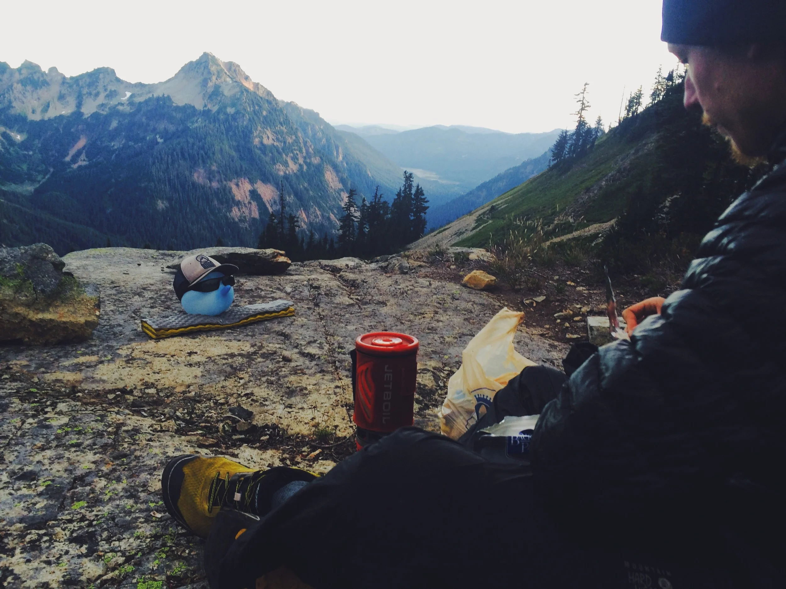
Stove - JetBoil / Flash (15 oz)
An incredibly fuel efficient water boiling device is what this thing is. You can kind of simmer, but you have to be careful. If you are going to cook full meals you may want to look at larger pots and a different stove. I like cooking on the trail quite a bit. Bottom line: I'd use this again, but if I found a cheaper/lighter stove + pot system I'd go for it.
For "next time": If I stick with canister stoves I would consider the gnat (1.6 oz) and a 4 - 5 oz pot or find a stove similarly minimal. Save money upfront and save weight. You wont beat the Jetboil for fuel economy.
Stuff sacks
There are tons of options. I mostly used gallon/quart zip-locks. My food bag? Grocery bags or a trash bag. Lots of other hikers went for the roll top sacks. HYOH. End of the day - everything you carry should be in some kind of bag in a bag (in a bag… BAG-CEPTION).
More to come on gear because it's Gear Week 2! Don't worry, we have more cool pictures and stories, but these are questions a lot of people had about the trail and we wanted to share it.
Love,
Dan
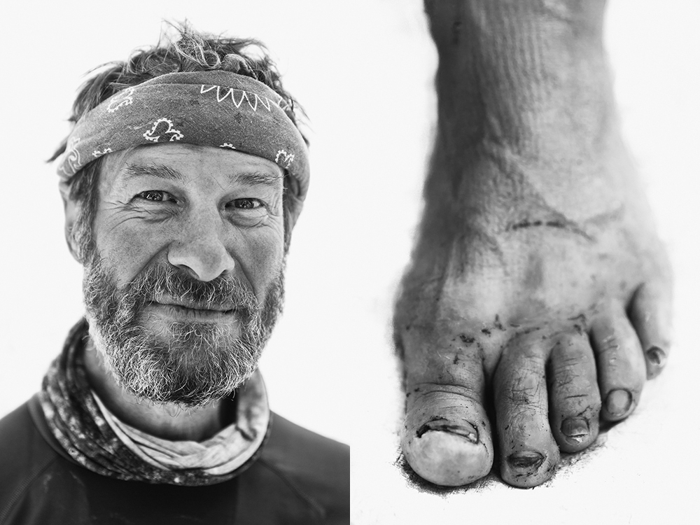
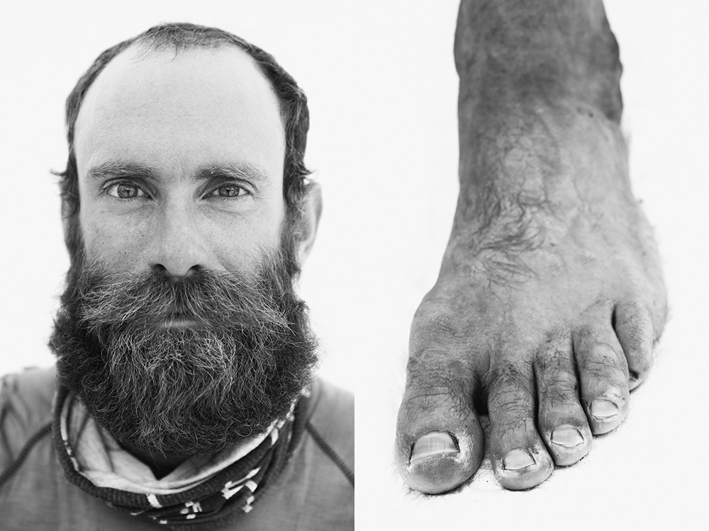
Throughout the second half of my time on the PCT, I conducted a personal project to explore a novel way to document the trail. I took two portraits of each thru-hiker I passed. One tight facial portrait and one foot portrait. This I managed to do with 49 different hikers, and all with the minimal amount of lightweight gear in my pack.
Below you will find some highlights of the series. The full project can be viewed on my personal website. Special thanks to Soapbox and Ms. Frizzle, without whom this project would not exist.
Hiker Trash: noun: a term used to describe thru-hikers and all of their hairy, dirty, grunginess. They are typically characterized by their far-beyond disheveled appearance and god-awful smell. These are people that set out to complete a 2,663 mile hike along the Pacific Crest Trail, a long distance trail spanning California, Oregon and Washington. I consider them my friends and comrades. They put aside their daily lives in ‘the real world’ to spend about five months walking in the woods and experiencing life and nature. They attack a pile of food like no human you have ever seen, and they do it without remorse or shame. The nomadic community created by Hiker Trash is one of the most beautiful and ephemeral tribes a person can experience. For the five months I spent on the PCT, everyone I met treated me as one of their own. They were my tribe. I was their kin.
They embrace the constant and daily challenges presented by the grueling terrain, merciless pace, and mercurial weather. All in the name of making it from Mexico to Canada armed with nothing but sheer force of will and their own feet. It is with perseverance and grit that every thru-hiker is able to put one foot in front of the other. The pounding on a thru-hiker’s foot is constant and brutal. The cost of their dream is shown in their battered and bruised feet. Their indomitable spirit and fortitude is shown in their faces. These are their faces. These are their feet.
Iceman
Joaquin
Pot Luck
Trail Dancer
Mr. President
Snail Trainer
Polar Bear
Quickdraw
Cheers,
Jonathan
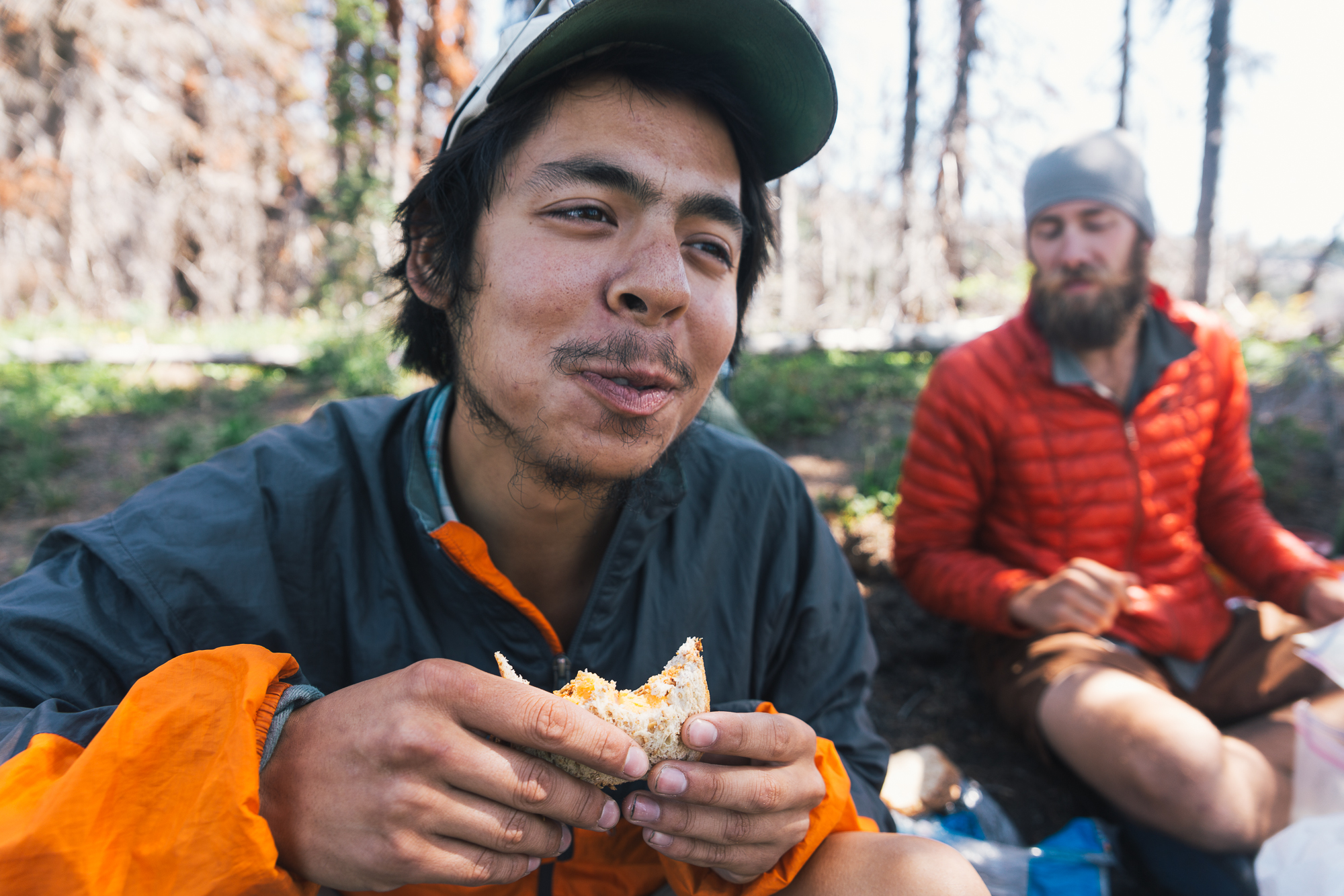
Washington was a pretty crazy place. While our saga of being sick wasn't exactly the greatest, we had some phenomenal times walking through the final state of the PCT. As always, the people we hiked with were some of our favorite highlights. We had such great times on trail.
You eat that lunch Butters. You eat it good.
Smitty traversing a snowfield in Goat Rocks.
Dan decided to hang up his tent to let it dry while he ate breakfast. Who does that?
Butters at the hotel in Snoqualmie.
Dan (with Winston) Hiking out of Snoqualmie Pass.
Butters at the Dinsmore's Hiker Haven in Skykomish.
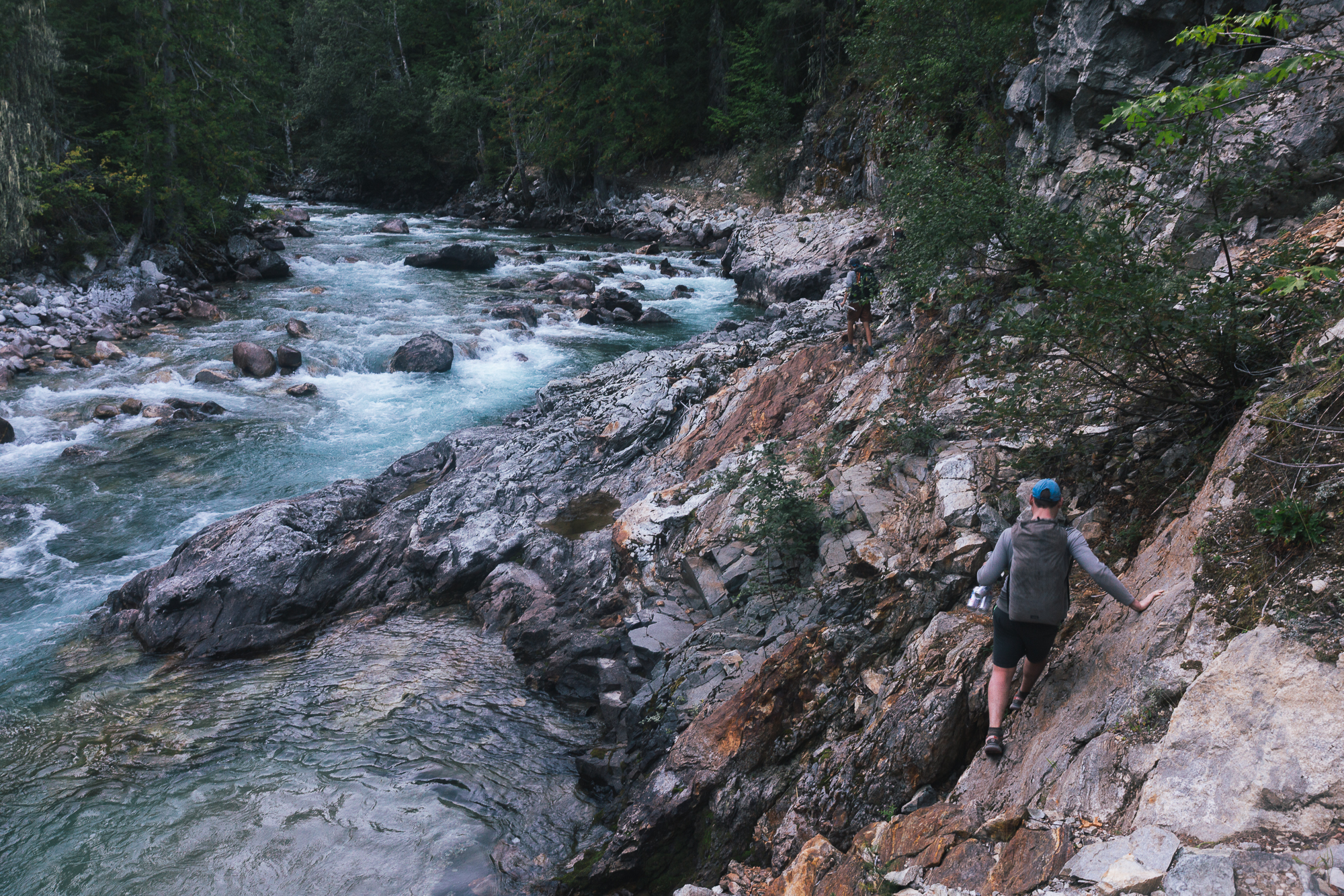
traversing the "impassable" trail with Trip, Mongo and co.
Impassable? Ya, we don't think so. Trip, Dan, Mongo and Frizzle.
Loved the way the light hit this bridge.
DANG, this bridge is hella messed up.
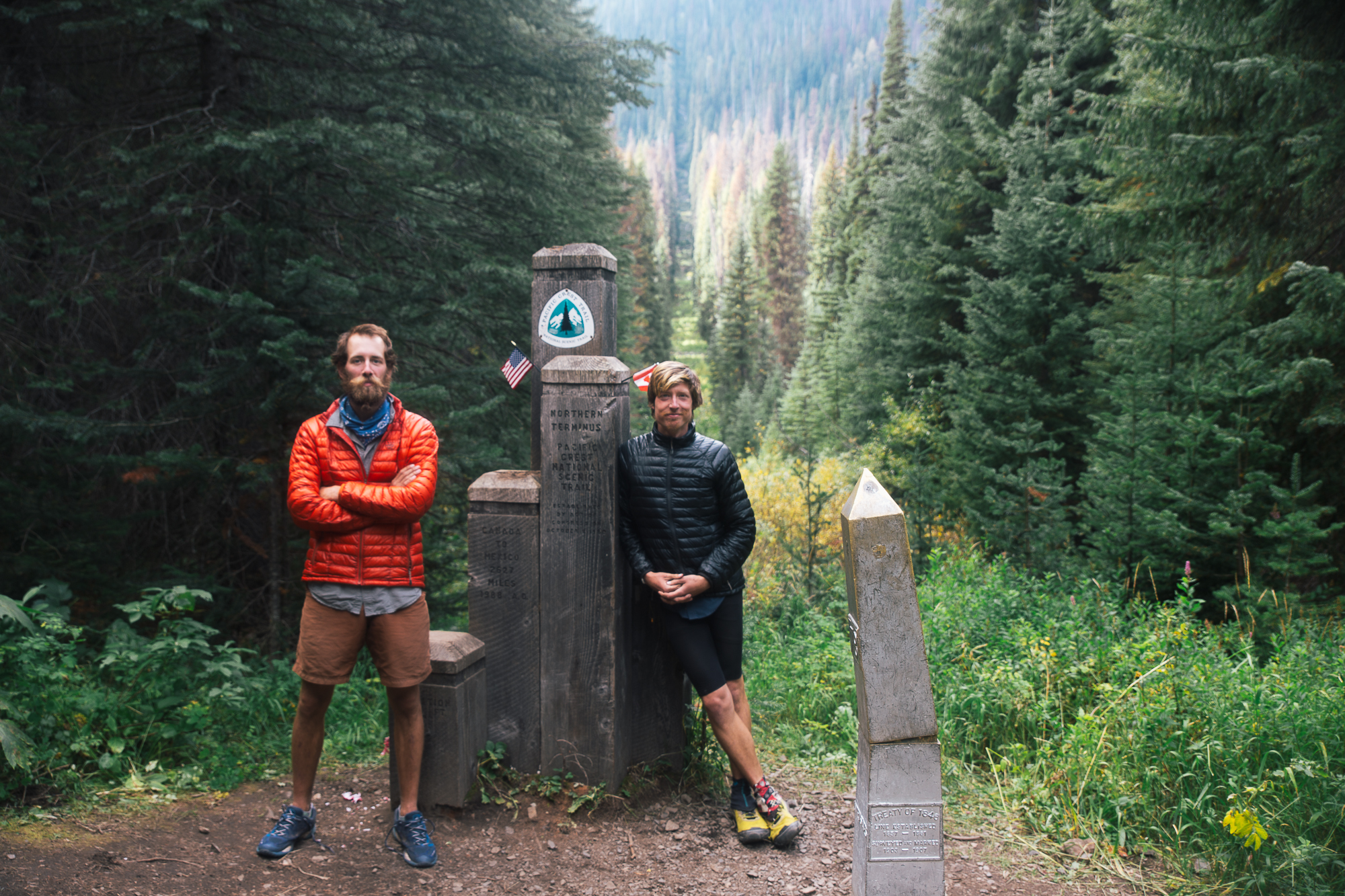
Dan was a cat on the monument at the Canadian border.
Border to border, baby.
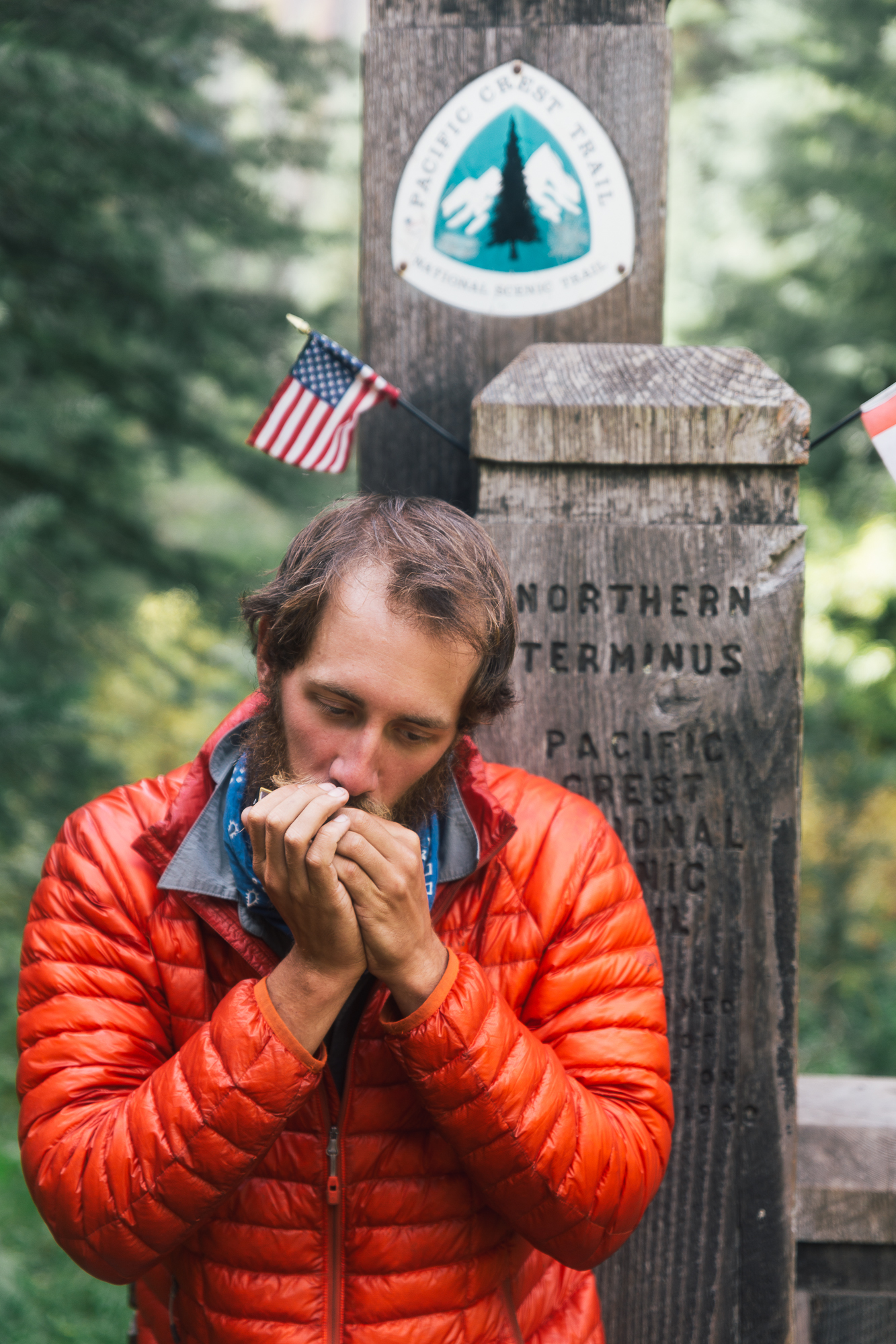
Dan had to pull the harmonica out and play a quick song for Canada.
Cheers,
Jonathan
When I was struck down by sickness in Washington I made it to a clinic in North Bend. Just as in Castaway when Tom Hanks creates a companion, Wilson, made of a Wilson volleyball with a hand-print face, I created Winston from an inflated nitrile glove (courtesy of the clinic in North Bend) with sunglasses and a hat. He was my anchor. He was my inspiration. He was with Jonathan and I through the good and bad, the ups and the downs, and most importantly he weighed very little. His downfall was a tragedy, but he survived long enough to see me through my ailment. In case you're wondering, he lasted a little more than an entire afternoon and he popped on a bush.
Sometimes living in the woods makes you a little crazy (sometimes living around people makes you crazy, too). I'm not admitting to talking to this little inflated glove with a face drawn on it. What I'm saying is that while we hiked the PCT the journey wore at us in strange ways we had not expected. We looked for ways to blow off the steam and relax. This was one of them. Maybe we'll tell the story about giving our packs to a stranger so our hiking group could run a section of trail sometime.
Cheers,
Dan
I caught Jonathan sharing dinner with Winston on the last night he was with us. What a view.
I handed off Winston before I ran off-trail to answer nature's call on the second and last day Winston hiked with us. He wasn't with us nearly long enough.
Note he is resting on an evergreen bush. Likely this was his downfall. Ever the risk-taker.
The last portrait of Winston. What a fun little dude.
Knowing I might undergo some radical physical changes while on the PCT, I sought to document this transformation. You see, in the “real world," I love fashion and like being "that weird looking guy." To find me in colored skinny jeans, with makeup and oddly colored hair is not uncommon. On the trail, however, I put all my pampering and primping aside. I wanted to do this without the costume and style of my regular life. And so I left my eyeliner and hair dye at home. For the first time in my entire life I even let my facial hair grow, which turned out to be the saddest of sights. It should be noted that I didn't trim my facial hair at all, I simply don't grow any. Definitely not going to be winning a moustache growing contest anytime soon.
At one point I met some section hikers completely in awe of the thru-hikers they passed, who told me that we all looked either homeless or sporty. I kind of hoped I was some mix of the two, to be honest. While most men on trail looked more and more like Paul-freakin’-Bunyan each day, my hiking companion among them, I maintained this odd sort of boy band / homeless look.
The guy who left as Jonathan was not the same person who returned as Pedi. The transformation goes far beyond the visual, but even still, the visual changes are staggering. I photographed these changes with a selfie-a-day project, which I present to you now. From newbie to seasoned hiker, from scrub to full-on hiker-trash, here is my transformation as I hiked that 2,663 mile trail.
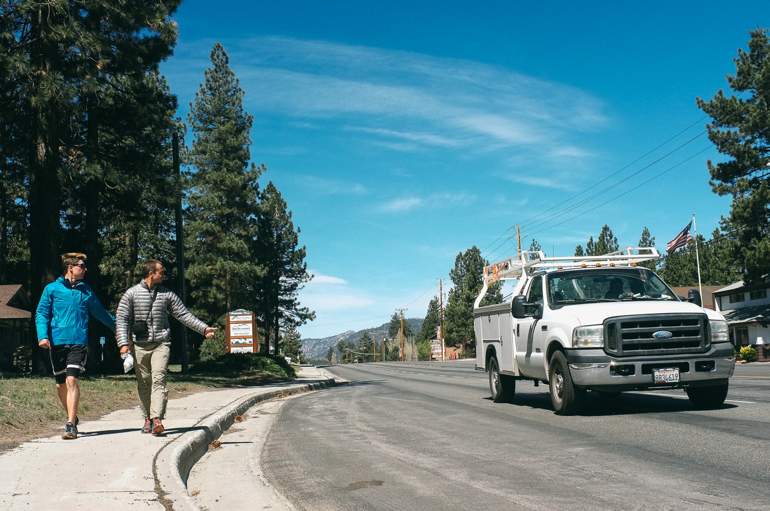
Hitchhiking is one of those aspects of trail life that non-hikers tend to find shocking. The first question people ask when they hear about the trail ("You walked how far?!") is often followed by "How did you get food and supplies?" My explanation to is that we hitch into the small towns near the trail to buy food. This invariably elicits interestings reactions.
"What do you mean hitching? Like hitchhiking?" they say, wide eyed.
The logistics of getting a hitch are pretty much the same as they've always been. Stand on the side of a road with your thumb out and hope that some kind soul will stop to pick you up. This is the most common form of soliciting a hitch, at least. Getting a hitch can be about much more than simply sticking your thumb out. When I talk about hitchhiking I am referring to the general act of getting a ride from a stranger. This can happen in so many more ways than my pre-trail self could have imagined: sometimes you find yourself in a parking lot, and you just have to approach a stranger or two and ask for a ride. Other times you have to divide and conquer; there are too many hikers to fit in one normal-sized vehicle. There are even times where you have to do, well, nothing. On these rare occasions rides were solicited to us, which is an incredible experience.
From the day we landed in Southern California until we returned to our hometown of St. Louis, I hitched 43 rides. They varied greatly in quality and novelty, but every one of them was a blessing. Of those 43 times, only once did I ever feel remotely unsafe, and it was due to the driver's carelessness, not because I ever felt I would be harmed.
Before the PCT I had never hitched a ride. I had never ridden in the back of a pickup truck. I had never done a lot of things that I have now done. Sure, I was a little nervous. Mostly, I think the nerves were caused by fear of continual rejection by passing cars. I never really worried about my personal safety or uncomfortable situations. Or at least I accepted it as an inherent risk. Then again, I'm a 6' tall white male who tends to be a bit callous with things like safety, so that might have something to do with it. As for my nerves, they were immediately put to rest after our very first hitch came completely without solicitation. A nice couple saw us walking through San Diego and stopped to see if we needed a ride. HOW CRAZY IS THAT? I would soon find out that this was only the tip of the iceberg.
In case you are still worried, let's see if perspective and clarity don’t put you more at ease. When you go through towns on or near the trail, most people know about the Pacific Crest Trail. When those people see us with our dirty clothes and backpacks, they usually know we're hikers. There really is a community around this trail that looks out for hikers. We are all strangers, but we are strangers within a hiking community.
Beyond that, you have to be willing to let the unexpected happen. You have to let go of absolute control, go with the flow and leave some things up to chance. You are always going to hear stories on the news that someone was found dead in a ditch because some evil monster picked them up. But what about all the times where humans rise to the occasion and help each other out in little ways? These aren't news stories, they are random acts of human kindness. I bet if you look around you will find lots more of those acts than you do big scary stuff. I saw it happen day in and day out on trail; it was a beautiful thing.
Here are a few examples of what hitching on the PCT was like.
Best hitch: We got a hitch out of Bishop, CA from a 70 year old woman in her RV. She came into the cafe where we were sitting and offered my crew a ride. She even offered us some cold Bud Light Limes for the ride back to trail. This woman embodied the spirit of adventure.
We sometimes joked about the most epic hitches imaginable. Firetruck hitch was always at the top of our list. We never got one, but a few hiker trash friends of ours did get a hitch in the bucket of a front loading tractor. We were jealous, to say the least.
Worst hitch: Being shoved three-deep in the back of a car with all our gear and a dog on our laps, winding down mountain roads with a driver who was less than concerned about staying on the right side of the road. The guys that gave us a ride were quite kind, but their driving was less than stellar. As noted earlier, this was the one and only time I ever felt the least bit uncomfortable in a stranger's car.
Weirdest character who gave us a hitch: This super right-wing guy who told us the national economy was on the brink of collapse explained that precious metals were the only thing that were going to be worth a damn. He then preceded to show us a minted silver coin that he happened to carry around in his pocket.
A word of politeness to those who choose solicit their own hitches: if possible, it's best to offer a few dollars in gas money to those that give you a hitch. Ya know, because paying it forward, being a good person and all that jazz. Screw karma, it's just the right thing to do.
One last detail that eluded me before the trail: Oftentimes when someone gives you a hitch, they load you up, drive off, start chatting and roll up the windows. Make sure they don't do this last part! This kind, unassuming person obviously doesn't realize you smell TERRIBLE and should be warned before enclosing themselves in a small, mostly airtight capsule with filthy hiker trash. I didn’t even want to be enclosed in a vehicle with my own smell. I can't imagine how bad it must be for 'normal folk' to have to smell us.
Cheers,
Jonathan
Dan (Soapbox) trying to hitch out of Chester, CA.
Myself and Half'n'Half trying to walk and hitch a ride in Big Bear City, CA
Dan hitching in the back of a pickup to Kennedy Meadows Resort in central California. We had to ride with the gate down because the bed was so full.
Frizzle riding in the bed of a pickup on our way back to trail from Trout Lake, WA
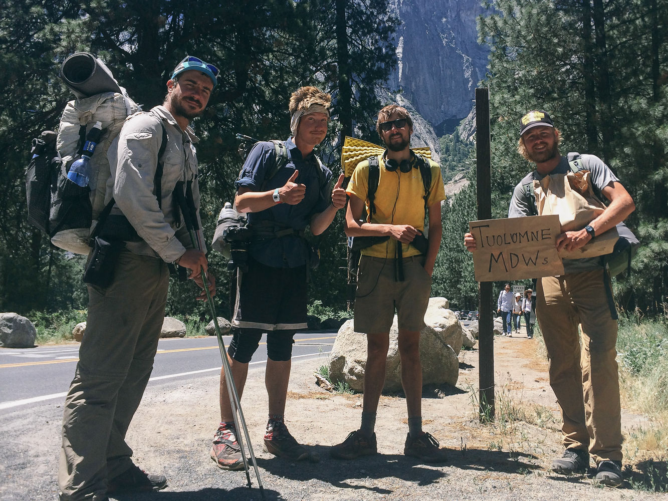
Half'n'Half, myself, Quinoa and Choop hitching back up to Tuolomne Meadows from Yosemite Valley.
Dan took you through the brunt of his own illness and the toll it took on him as we continued making our way through Washington. Now I'm going to pick up the baton and finish out the saga. Oh how I wished it had ended with some annoying mice that kept us up in the night.
As I awoke on this, the 137th day on trail, I felt my stomach lurch. I ran off into the woods expecting the worst, and that's exactly what I got. Making my way back to my tent, I couldn't bring myself to start eating breakfast or packing up. I tried to go back to sleep. As I turned onto my back I felt immediate discomfort. Dan had described that exact discomfort not two days prior. After a few more trips back into the thicket I knew I had fallen prey to the same condition from which Dan had been ailing. Now I had Giardia too. Horror of horrors. This was not going to be easy.
And it wasn't. Luckily, Dan was incredibly patient and empathetic. After all, he was only now recovering from mostly the same symptoms. Like I had done for Dan, he showed great patience as our situations reversed. We stopped when I needed to stop and kept going as soon as I was able. The nausea came in waves, and I had to make the most of the times of stability before again having to urgently rush off trail.
Oh yeah, and it was raining all day. Did I mention the rain? For the next 36 hours we would experience almost constant rain and cloud cover. This was supposed to be one of the most beautiful sections of the trail. Not only could we not see anything through the thick fog and cloud cover, but instead of sharing vistas we both had nausea and diarrhea. In case you've never experienced it before, diarrhea in the cold rain sucks. A lot.
It was at this point that I realized this was only the second time on trail that Dan and I had been hiking completely by ourselves. No crew, no loose group of friends with whom we would leapfrog. Just two friends out in the woods shitting our brains out in the cold rain. What else can you really ask for? Honestly, it's an amazing bonding experience.
After two days of trudging along and trying to keep our spirits up, we made it to Steven's Pass, a skiing/mountain biking resort. We found ourselves a ride to the Dinsmore's Hiker Haven, a trail angel house in Skykomish, WA, where we were reunited with Butters and Frizzle. I may have felt like crap, but the comfort of friends meant the world to me. It was also at this point that Dan noticed a voicemail he had received from the clinic in North Bend. HE DIDN'T HAVE GIARDIA! Huzzah. Which also means that I didn't have Giardia. Again, HUZZAH. We simply had a common stomach bug. Food poisoning, or something like that. Unfortunately this news did nothing to alleviate the nausea I continued to feel. There wasn't much we could do at this point except ride it out.
Butters too had been experiencing the pangs of sickness, only his manifested in an inability to keep food down. Consistent vomiting does not make for easy hiking. Less because it's had to walk while vomiting and more because it's hard to take in adequate sustenance required to do 25+ miles/day.
One day out of Skykomish and Butters was officially worried. There was no indication that his vomiting would cease. He was going to hike back to Skykomish, get a ride to Seattle and see a doctor. We didn't want to see our friend go, but only he could know what was best for him. We woefully gave him goodbye hugs before seeing him head off the same way we had come. This would be the last time we saw Butters. We missed him dearly in the week it took us to finish out the trail. Thankfully, it did not mean his hike was over. More on that later.
As Butters left us we gained a new crew member in Mongo, a fellow St. Louisan, jokester and all around good guy. So our crew would stay until the very end: Dan, Frizzle, Mongo and I.
Unfortunately, Mongo was not the only thing to see us to the trail's end. The nausea, diarrhea and general feelings of discomfort persisted off and on throughout the rest of the trail too. I guess you could say I learned to manage it well enough, but it put a damper on my mood to be sure. For 95% of the trail I felt up-beat and excited for what was to come. During dark moments in that stretch I could only hope that the trail would simply come to an end. We had walked 2500 miles since the Mexican border. I wasn't about to give up on the last 163 miles without a fight.
I never actively wanted to quit before the finish, but I did occasionally wonder how much grit I had left in me. On one hand, we had already accomplished a great feat. We walked really far, we learned things about ourselves and we had a great time. Technically, we could have stopped there and still gotten a great deal out of the adventure. I wasn't willing to stop until we reached the end, though. I wanted to follow through on the commitment we made to this journey. I wanted the closure of making it to the monument at the Canadian border. Willpower and camaraderie were what kept me going.
Dan was mostly better in that last week, though he too had bouts of diarrhea from time to time. Even Ms. Frizzle was unable to fully avoid our misfortune. It was less severe than what Dan and I went through but far from optimal. Huge props to that girl for being a driving positive force. It was with this unwillingness to let our ailments and Washington's elements bring us down that we finished the trail.
On September 8, our 146th day hiking this Pacific Crest Trail, we made it. We arrived at the Canadian border with adrenaline surging through our bodies. Nothing could have brought us down in that moment of triumph, although it didn't hurt that we all felt some respite from illness. The weather, too, had cooperated with us. We hadn't seen rain in at least three days.
Now we could rest. Glorious rest. After getting back to our respective homes and a week or so of recuperation I'm happy to report that all are once again well. Even Butters managed to make it back to trail and finished it out.
You tested us, PCT. You threw us some curveballs, and still we stuck it out to the end. What a wild ride.
Cheers,
Jonathan


