
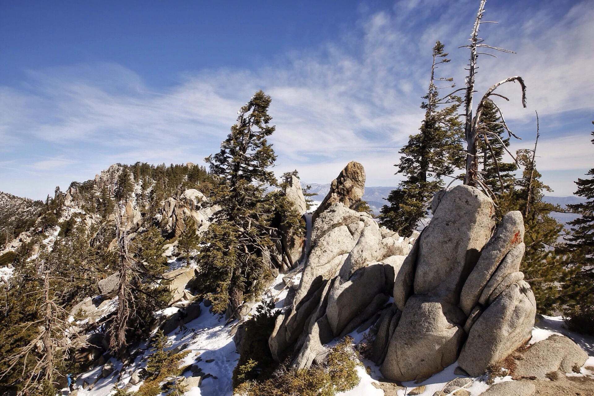
Looking back: wind farms to Kennedy Meadows

The last stretch of desert before the central California section of the PCT is a doozy. We loved hiking through some exotic and interesting wilderness so far - remote desert, burned forest, high mountains - each treated us well except the wind farms.
The farms were smattered across our path from day 30 - day 36, almost the end of the Southern California section. We had nearly reached the Sierra Nevada mountains, but the desert wasn't done with us quite yet.
We arrived at a strange pit stop called Hikertown on day 30. The owners had a large garage they had converted into a hiker hang out, but they had also constructed what seemed to be an old west town. I mean a line of small shops, post office, a little city hall, and even a little jail. All these constructions were around 3/4 scale - large enough to enter, but not full size buildings. Oh, and the owners use the jail as a chicken coup. An interesting place, but they had ice cream, water and a place to get out of the sun because after Hikertown we had to cross the Mojave.

Pedi captures Hikertown's sheriff building and a few other parts of the miniature old west town.
In the evening of day 30 we left Hikertown. We walked along an aqueduct overnight to cross the Mojave Desert - it was a long flat stretch that would have been unbearable during the day due to intense heat and sun. After that it was the wind farms. Our night hike placed us right at the beginning of a cluster of turbines. Innocent, clean, white and a symbol of renewable energy, at first I thought they were elegant.

I caught Pedi walking on the aqueduct at sunset.
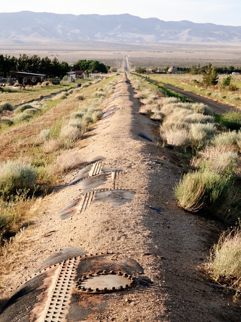
The aqueduct. Photo credit: Jonathan
That first night I realized what could be obvious about hiking and sleeping by wind turbines: extremely high winds, we rarely found great shelter, and water sources were many miles apart. Great way to ring in our first month on the trail.
On day 32 we hiked through some of the largest wind power installations in the country. Luckily we made it to a highway so the four of us could hitch into Tehachapi to get more food. Also, the nonstop 40 mph gusts might have driven me insane. A couple trail angels helped us get to and from town, they took us to the restaurant they owned, called the Apple Shed, and told us stories about Tehachapi (incredibly kind, interesting people). Then it was back to the wind.

Side of the Apple Shed.
On day 33, Quinoa was nearly blown off the first mountain we ascended as we left Tehachapi. I was getting tossed side to side with each step. I thought I was going to break a trekking pole as I used them to cling to the rocky trail. We slept in a ditch using our packs as windbreaks. The gale force winds stole Pedi's hat. As we crossed the Tehachapi valley we were beginning to leave the desert, but it felt like the desert wasn't finished with us.
Areas of high wind just after the Mojave section.
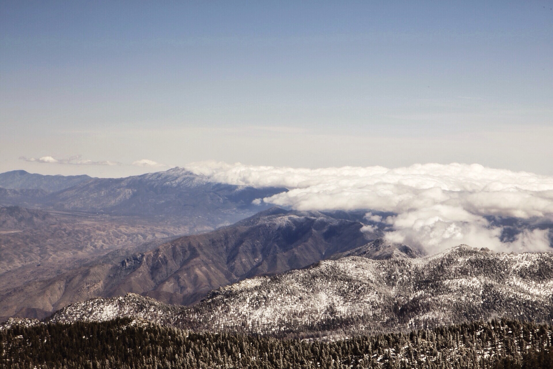
The trail angels from Tehachapi informed us we had reached the transference region - where two mountain ranges met, separated by Tehachapi Valley. This signified a kind of boundary between the desert (San Gabriel Mountains) and the Sierra. The ending of Act 1, of sorts.
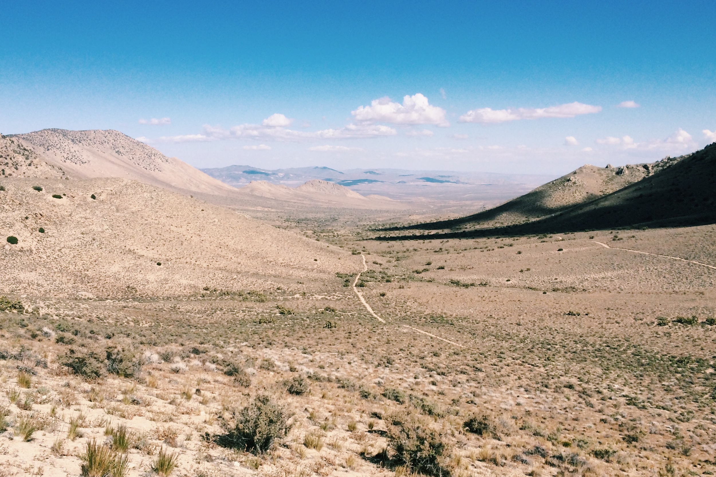
On day 34 we climbed in altitude and saw the high Sierra in the distance. We were getting out of the constant wind and dryness. Our group of four was excited for what was coming.
Day 35 was hot; we had to gain elevation while hiking in wind and loose sand. Still the turbines seemed to haunt us. Finally as the morning wore on we had reached Walker Pass, and even though it rained we were only two days away from Kennedy Meadows, our last resupply before the high Sierra. Also of note, we met (The) Yogi, kind of a PCT celeb as she was getting ready to cook pancakes for thru-hikers at Walker Pass.
Day 36 we climbed Bird Spring Pass and had two more days to the end of the Southern California section of the PCT. Our destination was Kennedy Meadows. We hiked 25 then 27 miles days with ever-lighter packs, inspired by what was coming. As we arrived in Kennedy Meadows the Central California section started, we had completed over a quarter of the trek.

Dan hiking towards Hikertown. Photo credit: Jonathan
Happy hiking!
Dan
Ascending Mt. Whitney
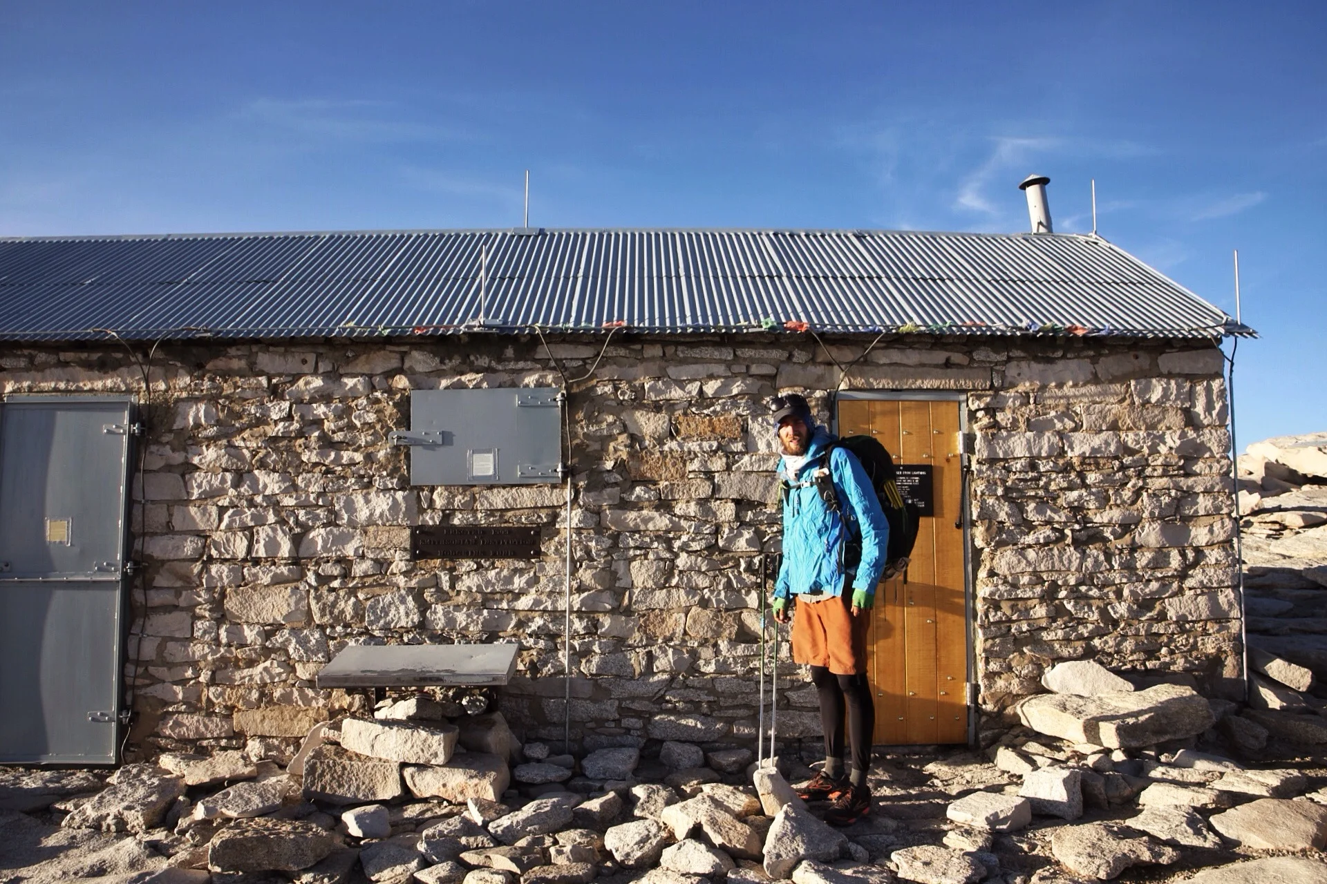
The desert has come to an end. As we hiked our way up into the Sierra Nevada our jaws dropped at the beauty we saw around us. We haven't managed to pick our jaws back up yet. 60 miles later we found ourselves at the trail juncture that would lead us up to the top of the tallest peak in the lower 48 states, Mt. Whitney. At 14,505 feet, it's a doozy. There are an endless number of ways to "do Whitney," and we thought it would be cool to ascend in the afternoon to see the sunset, sleep in the Smithsonian shelter at the summit overnight, watch the sunrise and then descend that morning.
Sleep didn't come too easily, but what do you expect at 14,000 feet sleeping head to toe in a small hut? No worries though, we kind of expected that. It was worth it.
The morning was bitter cold and windy, but nothing could dampen our spirits as the sun began to rise over the eastern Sierra.
Then our friends started showing up. One by one, Bomber, Siesta, Butters, Cheese, Midway, Barbie, Freedom, Friendrik, Washpot and Baggins reached the summit, each of them having started in the wee hours of the morning. We all crammed ourselves back into the hut to celebrate the reunion. Soon enough, however, it was time for us to head back down the mountain.
The views were awe inspiring, completely breathtaking. Or was that the lack of oxygen that was breathtaking? Who knows. It was astounding. But enough of my jibber jabber. Why don't I show you.

The valley below.
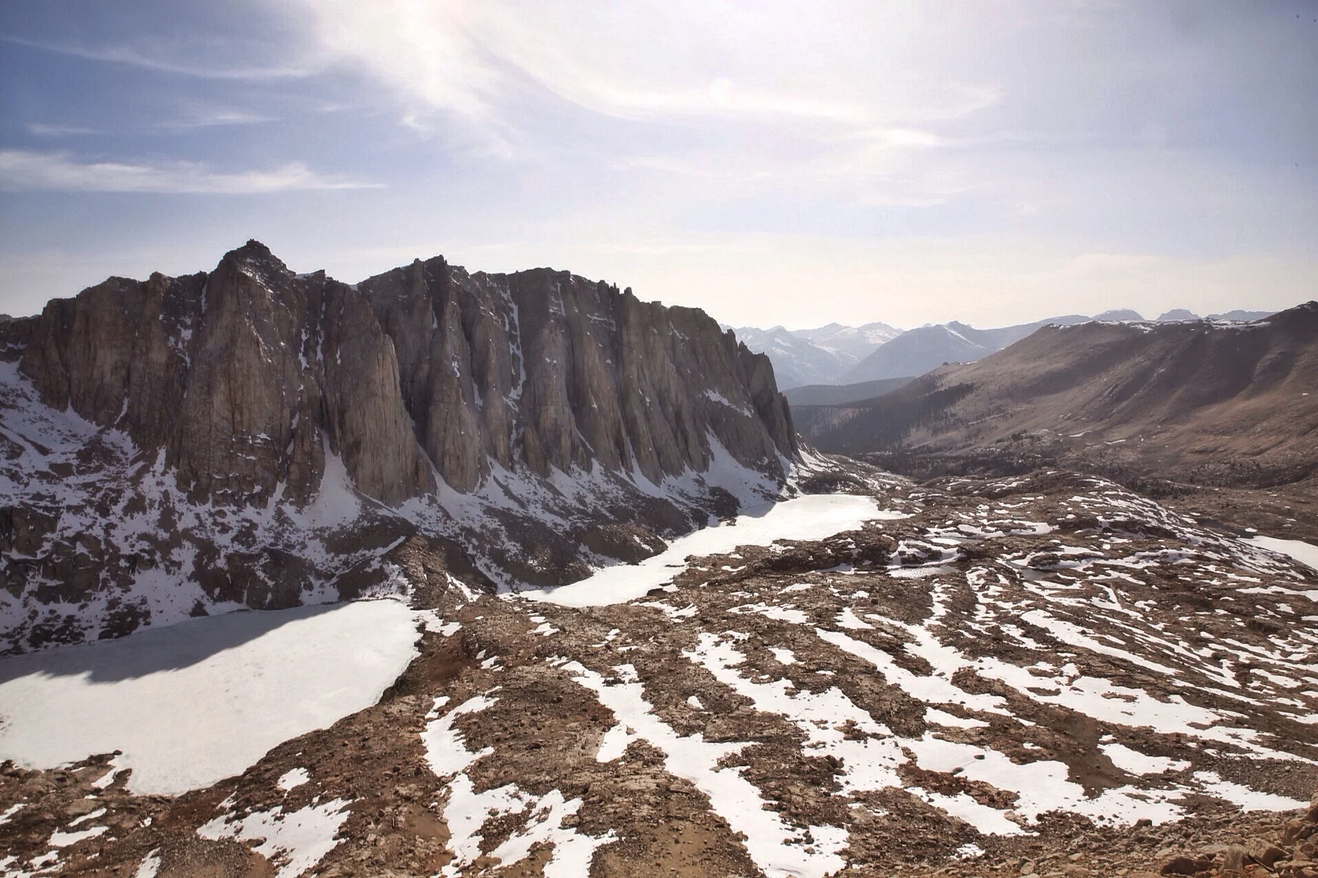
West of Whitney.

Half'n'Half pushes through the struggle of breathing at high altitude.

Soap Box being epic most of the way up.

The teeth near the summit.
WE MADE IT.

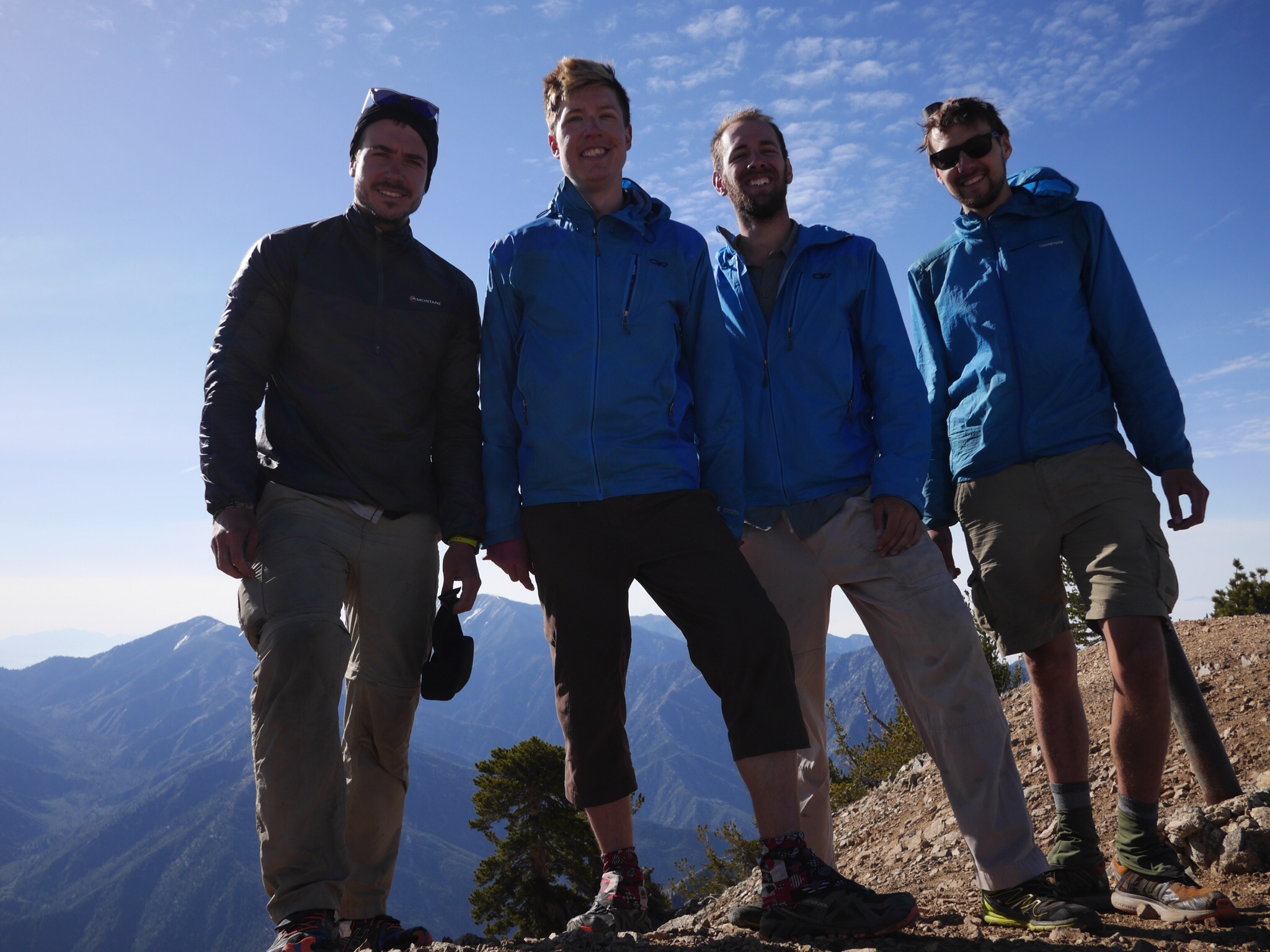
Obligatory group photo on the summit.

Sunset did not disappoint.

What strange things are amok outside the shelter? I think it best to stay warm in the hut.

Soap Box, Half'n'Half and Pedi (me) bundled in our bags at dawn.
Photo/Quinoa

Cheese feeling victorious.
Cheers,
Jonathan
On shoes and conformity
Almost immediately and instinctively you start noticing other hikers' footprints on the trail. You figure out the shape of each comrade's footprint and can easily ascertain who is in front of you. Having a unique shoe-print helps, but you pick it up either way.
When we all (my group of four) started this trail, we each had a different pair of shoes. Two kinds of Solomons, a pair of La Sportivas and some Asics. It made discerning one another's footprints a breeze.
With more than 700 miles between us and the Mexican border we have all moved on to at least our second pair of shoes. And now are all wearing the same model of shoe: Brooks Cascadias. By far the most popular shoe on the trail, each of us fell prey to the allure. Nearly every person I saw with them would receive the question "How are you liking your Cascadias?" as if I'd receive some sort of new answer. Unanimously, people swore by them.
Boy do I love these shoes. People were right and I couldn't be happier, mostly.
While the shoe itself feels wonderful, my whole crew now bears the same footprint, along with a ton of other hikers on the trail. At this point, I cannot tell who is in front or who is behind, only that I am on the PCT and that people are indeed in front of me.
We're part of the crowd now.


Cheers,
Jonathan
How we remember the trail

There are lots of ways we catalog memories from life in a physical sense. That's how we get memorabilia. I've loved seeing how PCT hikers create their own memorabilia to look back on later in life. Obviously, for me it's a photo narrative. For Butters though, it's autographed baseballs. He has each thru-hiker he sees sign the baseball. When the ball is full, he sends it home and gets a new ball. What a cool way to capture a piece of each thru hiker to reminisce about down the line.
Cheers,
Jonathan
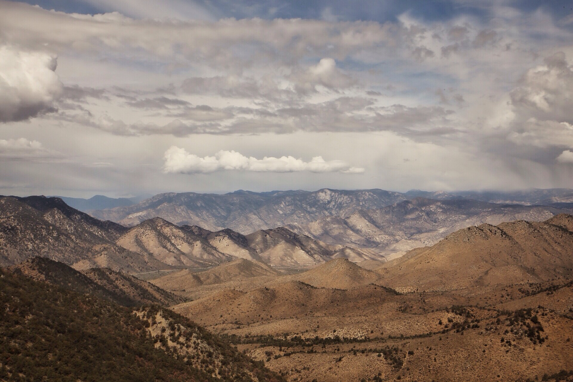
Scenes of the desert
The desert is so many things and has so many varieties. There's low desert, high desert, hilly desert, sandy desert and on and on. It's not as glamorous as snow covered mountains, but we have given much of our lives to it of late.

mile 220

mile 224

Mile 226

Mile 285
Mile 312

Mile 337

mile 315

Mile 345

Mile 344

mile 387

Mile 343

Mile 540

Mile 522

Mile 515

mile 524
Mile 656ish
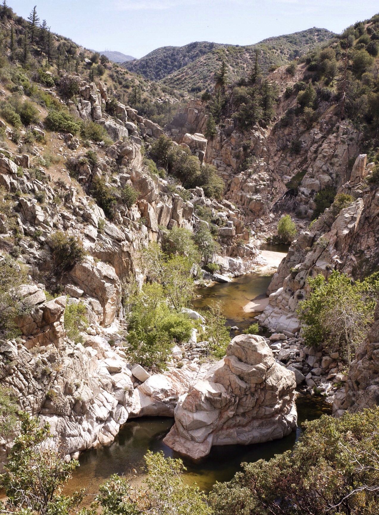
Now the desert comes to a close as we ascend up into the Sierra Nevada. The mountains look grand and beautiful.
Cheers,
Jonathan
Learning moderation

While I have loved my time on the PCT thus far, it has not been without its trials and obstacles. Mostly they have come in the form of pain from either blisters or leg strain. Some of this was unavoidable, but perhaps others might have been of my own doing. It seemed like I had two modes: injured or I WANNA GO FAST. I was either trailing behind my group with a nasty limp or I was full speed ahead leaving them to play catchup. The past few days have been good lessons in being steady. I can feel the Sierra looming. Gotta stay healthy.
Cheers,
Jonathan
Poodle-dog bush

This is poodle-dog bush.
Also known as common turricula, this plant has altered our trek from Mexico to Canada. It thrives in areas affected by wildfires - where tree cover has been removed (burned). We're hiking in SoCal. Thus, drought and lots of burned areas. Ergo, tons of PDB.
Easy to identify and reeking like pot (or certain thru-hikers), you know when it's near. It's like the poison oak of the San Gabriel mountains, except more dangerous. PDB has grown so thick along the PCT that there are detours to avoid sections overrun by the plant.
It's kind of pretty, but I'll be happy to never see it again.
Mt. Baden Powell
A few days ago we ascended the 9400 foot Mt. Baden Powell after leaving Wrightwood, Ca. We made a fantastic camp at 7500 feet elevation (above the clouds and in the high 30s overnight).

View from Baden Powell looking towards Mt. Baldy.
The next morning we gained the summit after climbing through an old growth pine forest - and old means a tree 1500 years old (trees that were young in the Dark Ages). On the summit we found a memorial built by Boy Scouts in the 1950s - they hiked the mountain with concrete to build it. From the summit we could see Mt. Baldy, another giant of the San Gabriels Range.
For those not in the know: Lord Baden Powell was the founder of the World Scouting Movement and this little bit of rock was renamed for him in 1931 (originally it was called Little Baldy). As an Eagle Scout I owe ol Mr. Powell. Also, I can't imagine hiking to the summit with backpacks filled with concrete (definitly not Ultralight).

1500 year old tree.
Julius Bude, Julius-pct2014.blogspot.com
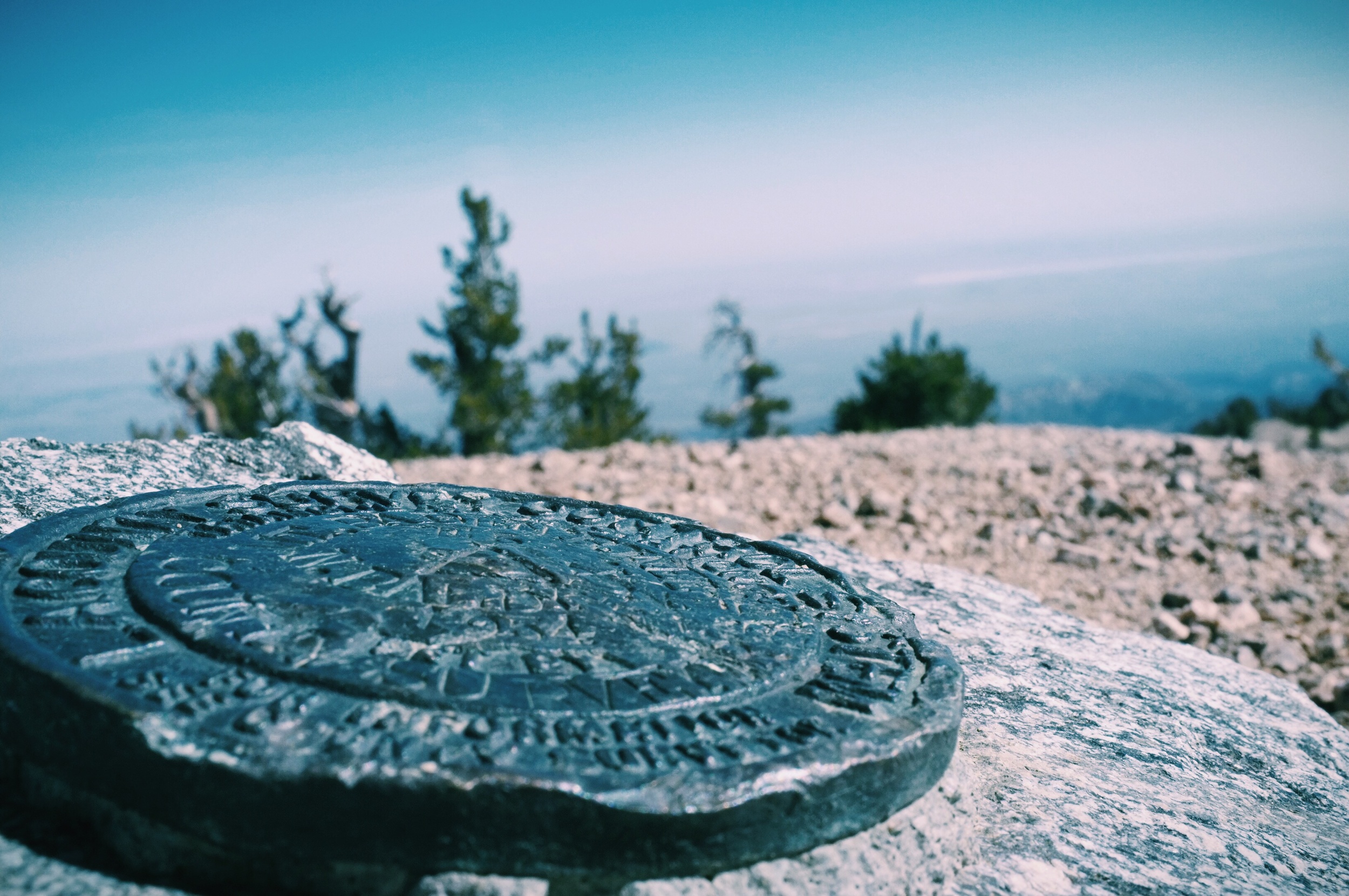
USGS seal at the top of the mountain.
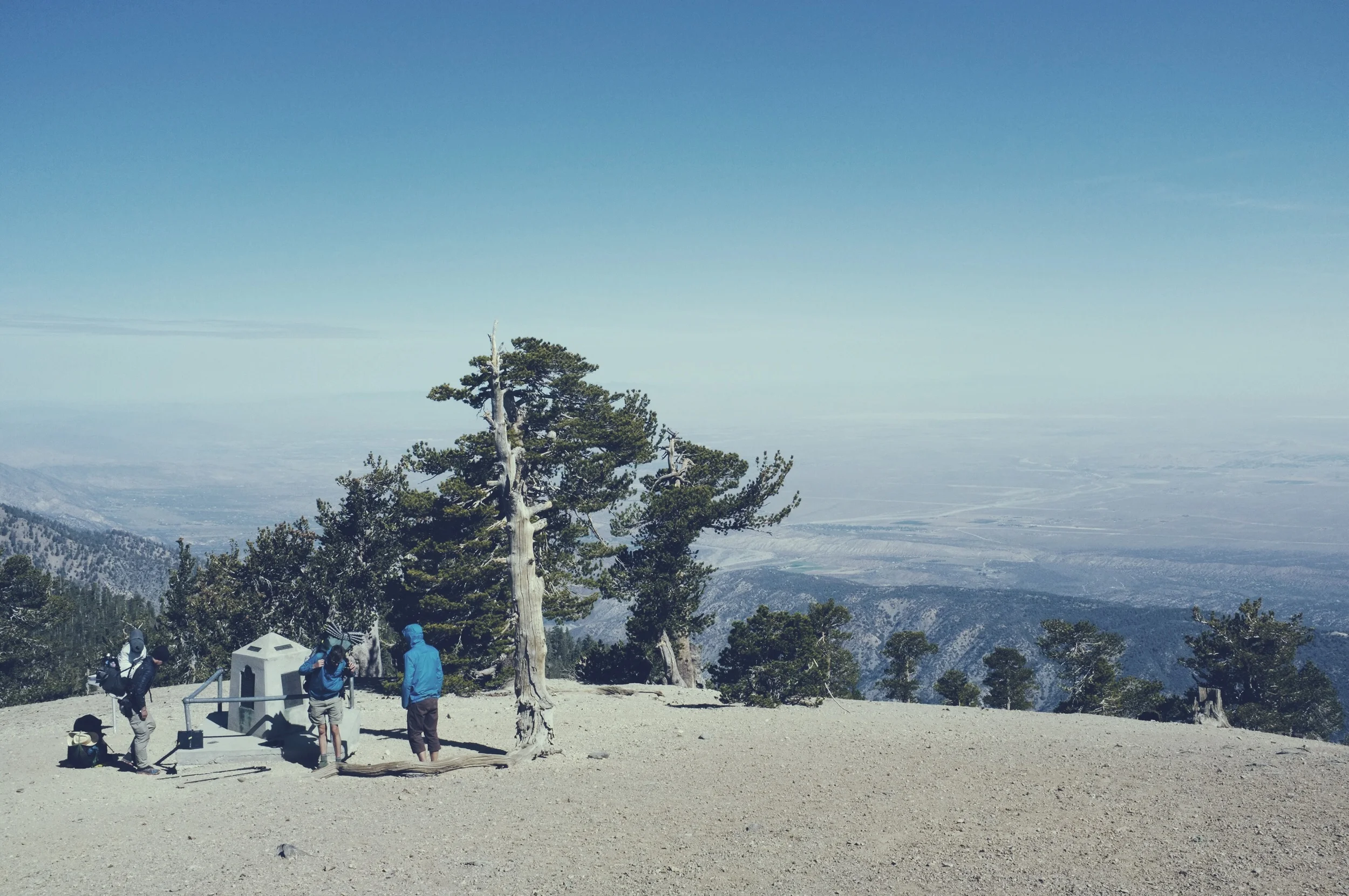
Pedi, Half'n'half, Quinoa hanging out at the monument.
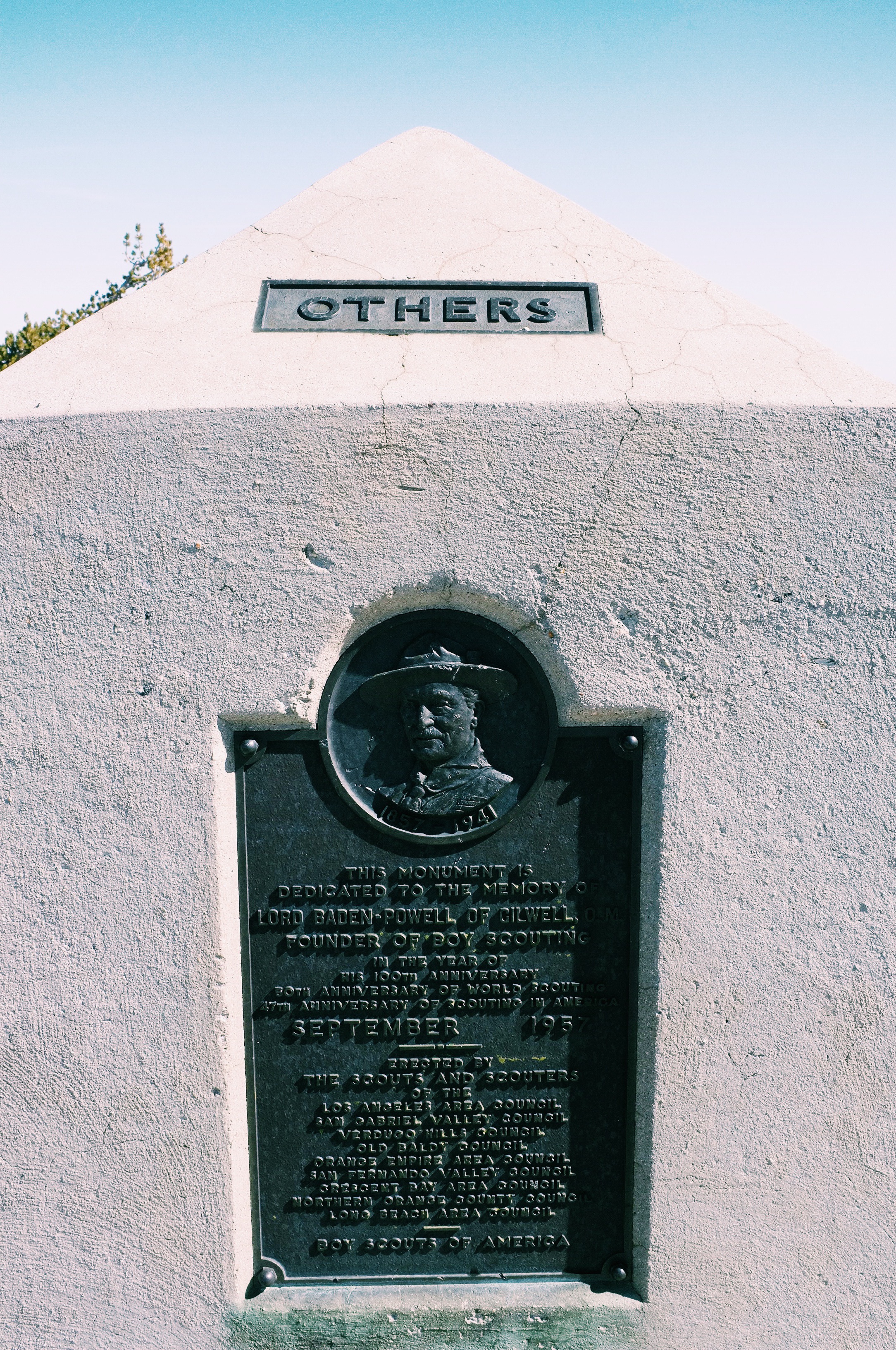
The monument built in the 1950s.


This sign says says something about the tree being 1500 years old.
Visual update
This is what we look like after 500 miles and almost a month on the trail.

Soap Box

Pedi
Half'n'Half

Quinoa
Thanks, Black Diamond
I have had a few unfortunate happenstances on the trail so far. Luckily, the trail provides. By mile 300 one of my trekking poles snapped. I let the manufacturer know and they immediately sent me a fresh one. Solid customer service, Black Diamond.

Happy Mother's Day
Hiking the PCT is a really great experience, but it's something that likely wouldn't be possible without the support of my mother. Monday she will mail three boxes full of food and gear to our next resupply point on the trail. Without the help of my mom Dan and I would literally starve in the Sierra Nevada.
I'm sad I can't be with her on this Mother's Day, but I'll never forget how much her love and support has meant to me. Thanks for being OK with me wandering in the wilderness for five months Mom.
Cheers,
Jonathan
P.S.:Vicki, thank you a million times over for all of your support and kindness throughout this whole trip!

My mom and I the day I graduated from college
The McDash
Mile 342 of the Pacific Crest Trail has a McDonalds 0.4 miles away from the trail. Hikers choose to gorge themselves at this haven of free wifi, food and clean water. Even hikers outwardly against McDonalds plan to camp within easy hiking range to gain the Golden Arches the next day.
We were overcome by hunger, you see. Not starvation, but knowledge that $10 could get you 3000 calories of already prepared food and maybe a milkshake, this fact drove us all.

The day before we had hiked over 20 miles and managed to find a lake to swim in. After finding a place to camp 13 miles away from McDonalds, the Dash was on. Pedi and Quinoa flew down the trail while Half'n'Half and myself held a steady pace. Beautiful country with great gashes in the landscape from seismic activity - we were hiking over the San Andreas fault. Finally I saw highway 10 and was within sight of my goal. Upon arrival Pedi welcomed me with the most divine 10pc chicken nuggets, and after that the afternoon was a blur of burgers, fries and fountain soda.
At one point the PCT hikers outnumbered the regular guests. A pair had fallen asleep in a booth, cell phones and camera batteries hung from the ceiling like stalactites, and the trays of empty fries and burger wrappers filled the tables.
After gorging ourselves we had to rally to hike up and away from sanctuary and back into the mountains. After eating all that food it felt good to put some miles behind the place where we shamed ourselves.
People on mountains

"DUDE, this place is beautiful."

Moonshine's beard.

Most of the way up San Jacinto.
photo/probably Half and Half

Soap Box, Pedi, Half and Half, and Quinoa at 10,800 ft atop Mt. San Jacinto.
photo/random nice couple

We climbed over many a fallen tree at higher altitudes.

Jonathan hiking through the fresh snow.

Jonathan descending, seeking warmer climbs.

Half and Half snapping photos at the summit of San Jacinto.
We say our goodbyes to the snow covered mountain (Not unhappily).
Greater than a marathon
I ran my first marathon in 3h40m and it was one of the most proud moments I'd ever experienced. Yesterday I completed my second marathon length endeavor, except this time I did it in 11 hours with 30 lbs on my back while climbing 4000 ft in elevation.
It felt like a mere drop in the ocean.
But I didn't stop once I had done 26.2 miles. Throughout the day I'd been leapfrogging with Zippy Morroco, a fellow thru-hiker, and by mile 22 we had banded together for the day's endeavor.
"Wanna try for a 30 day?" Zippy asked me once I passed my marathon mark.
Sure, why the hell not.
I'd split up from my group a few days prior. It was my first time hiking alone and I had it stuck in my brain that I could push myself to complete this seemingly ludicrous feat.
At the completion of 30 miles we knew there were only five more left until Big Bear, my hiking family and a soft bed. We donned our headlamps, scarfed a few granola bars pounded out the last miles. Darkness, tired legs and sore feet be damned, 14 hours after I started walking I had made it.

Zippy Morroco, my hiking partner for the day. It was a joy getting to know him and experience the day together. I could never have done it all without him.

My feet at the end of the day.

A Joshua tree as night fell.
Cheers,
Jonathan
2nd zero day
Wait, wait, no mileage for two days? Why? Snow, 5 inches or more, and 70+ mph winds on a mountain ridge would be an acceptable answer. After reading our local weather our merry little band - joker, whisk, moonshine, sideways, Half'n'half, quinoa, pedi and myself (soap box) all decided to stay in Iyllwild a second day. What did we wake up to on the morning we were supposed to depart? More snow. What precipitation we see at 6000ft, in town, will be much worse at 9000ft (and much colder). What an adventure...

Highlighting the difference a day can make for mountain weather.
We meant to avoid what turned into a wintery morning. Instead we hiked out in the snow. On the plus side we enjoyed a wonderful small mountain town, we had two days off, and my legs knew it was time to get back to work. The US is a big country and we have a lot more to do if we're making it to Canada.

J and J brothers gave us a lift to the trailhead.

Back on the PCT, hiked the Devil's Slide trail out of Idyllwild.
Cheers
Dan (Soap Box)
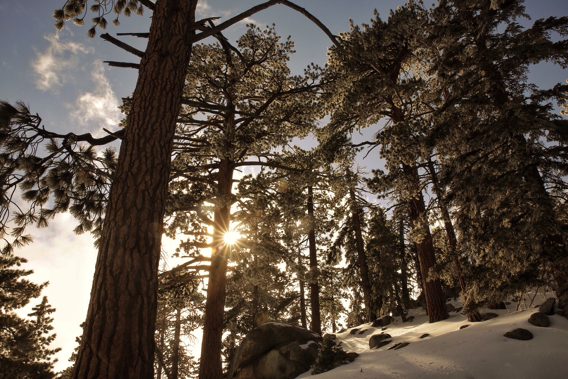
Scenes of snow
Walking through the snow for a day and a half has been one of the most challenging and exhilarating experiences of the hike so far. As I panted for breath in the cold wind and trudged my feet sloppily through snow it was all I could do to stop myself and shoot a few frames every five yards. The scenes were spectacular beyond any words that I can write. With my camera at least I could put forth a worthwhile effort.


Cheers,
Jonathan
Zero day
Hiking is great. I love seeing all of the sights, pushing over a mountain ridge and learning how to live in the back country.
That being said, zero days are absolutely necessary. My feet are trashed and in bad need of repair. We found a loose group of fellow hikers with whom we've bonded nicely. Now we sit back and relax for a day or two before getting back out on the trail. I couldn't be more thankful for this period of rehabbing my feet and spending time with fellow hikers. I even slept in a bed last night!
To top it all off, Idyllwild is the most adorably quaint town. I'm not usually the biggest fan of tiny towns, but this one has treated us well (read: BOGO ice cream cones).

Soap Box, Moonshine, Joker, Half and Half,
Pedi, Sideways D, Whisk, Quinoa
Cheers,
Jonathan
Day 6 - Resupply!
iking with a jar of peanut butter, some angel hair pasta and a single liter of water, Jonathan and I made it to Warner Spring early day 6. We broke camp quickly and started out knowing every person we passed meant a shower that much sooner (maybe even warm water?).
Warner Springs isn't a huge settlement, the part we saw consisted of a fire station, complete with bunkhouse and a backcountry fire fighting rig, and a community center which had been transformed into a hiker center - showers, laundry, wi-fi access, and cooked meals. All of which came at a price but was worth any amount and all proceeds went back to the community.
Aside from bathing, which we all needed, the real pay dirt was our first resupply box. We had done ourselves quite well - snickers, nuts, mashed potatoes. Every meal we've cooked has been delicious, but we didn't buy enough for Jonathan and I so we'd been splitting meals. Oops. A problem no longer! Protein powder, Mass Gainer Complex, and packaged tuna solved our crisis.

Opening supply boxes at Warner Springs like it's Christmas morning.
It's difficult to describe PCT culture, but this resupply day was a short hike - 8 miles in the morning (passed the beatiful Eagle Rock). After we got in line for showers the rest of "The Pack" first trickled then poured into the community center. So many that the staff had to stop accepting laundry by noon so they could catch up on what had been dropped off.
One of the center's staff said they had served 100 breakfast the previous day and that our cohort was setting the new record for number of burgers cooked in the afternoon. Yet another sign of the popularity of the PCT this season.
It felt good to hike on after a day of refueling.

Heading back out, northward!
A few trail photos

Dan being glamorous in the desert


ramen for lunch on a hot day

Quinoa jamming out with Dan at a trail angel spot on day 7
Quinoa napping at a trail angel's house.

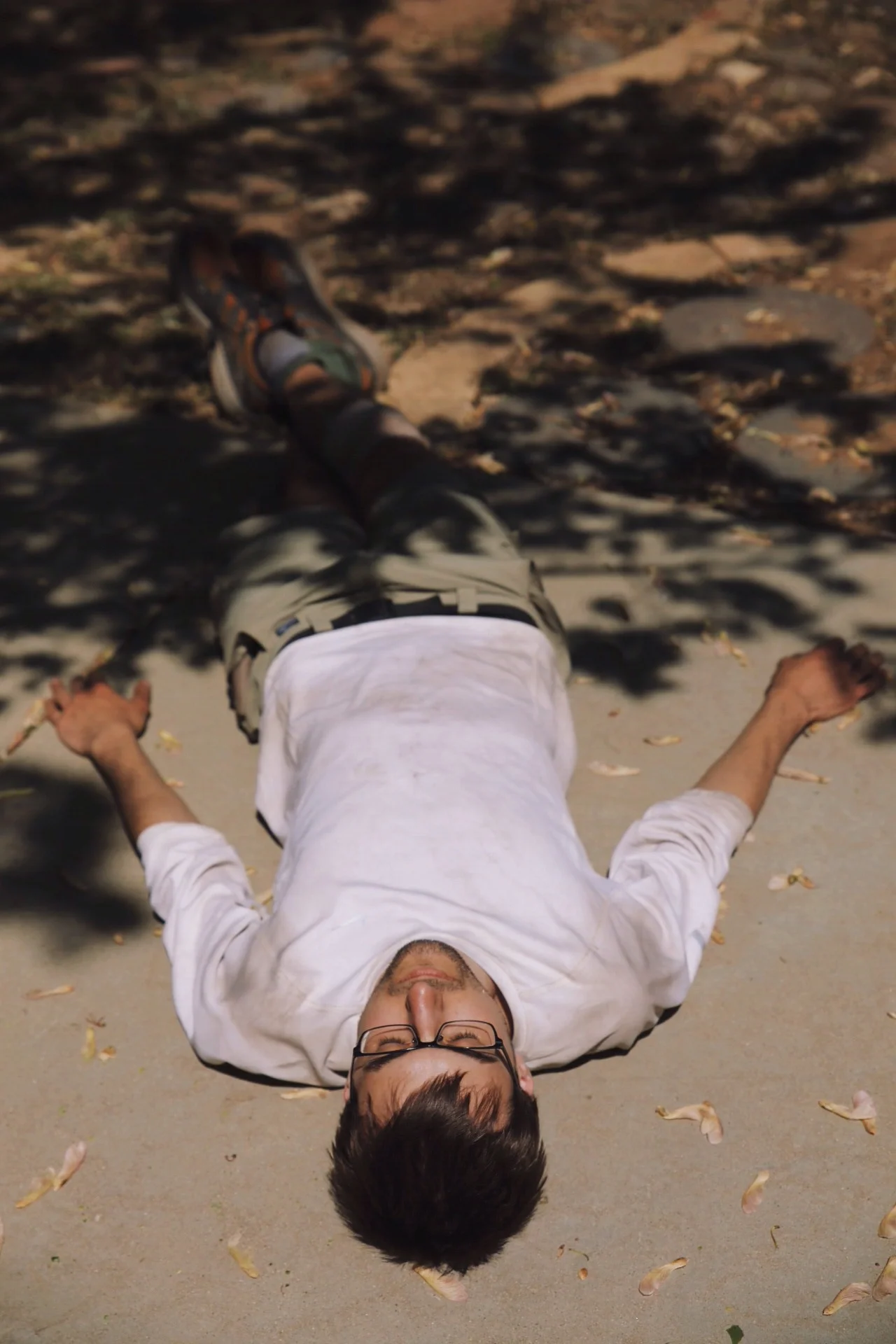
break is over, back to hiking

need more water!

biggest squirrels ever up in Idyllwild

the beauty I witness each day is breathtaking
Cheers,
Jonathan
I am a runner
By my nature and experience I am a runner, not a hiker. Maybe I'm a hiker now, but only since six days ago.
Blisters have been my biggest struggle on the trail so far. When, on day three, my feet screamed in agony with every step from the pain of 10 different blisters I decided it was time to run. Three miles later I could finally walk again, and my inner-runner smiled with pride. I don't know how it worked out that running with 25 lbs. on my back was anything less than awful, but in that moment it helped get me through the day
http://youtu.be/EVxoBhIEJbs
Pardon the vertical video. Plz.