
I walked really far with a bunch of stuff and this is what I think about that stuff: Clothing
PCT gear review part 2: CLOTHING
There are always more things you could bring on trail, but this should help you find best options to limit the number of items in your pack.
Note: UL means ultralight. There is a trend among backpackers to carry gear as light as possible.
Note II: Always look for gear at a discount. Steep and Cheap is my favorite, but you get almost any piece of gear for a discount. Just because someone has a pack full of nice new gear doesn't mean they shelled out for it.
Note III: There is almost never an end all, be all for any single piece of gear. See what fits for your style and budget. These are simply my observations and opinions.
Shirt - REI / SaharaTechShirt
This shirt made the hike as awesome as it was. I bought it the day before we left and it's the best purchase possible. Breast pockets, a collar to look less trashy in town, durable fabric and sleeves that roll and button up make this shirt the ideal hiking top. The brand and model don't matter. You can find those features in a shirt from any brand, but dammit get a hiking shirt.
Bottoms
I can't begin to care. If you must know, I did the desert in 3/4 capris, the Sierra through Oregon in running shorts and eventually ditched those to only wear compression shorts on bottom.
Compression shorts - Under Armour
Yup.
Underwear - Ex Officio / Give-n-go boxer brief
BEST. UNDERWEAR. EVER. I wore them the whole trail and they still look brand new. Hell, I even shit my pants once on trail and I'd wear the same pair for another thru-hike.
Sleep shirt - Under Armour / Cold Gear compression shirt
Nice and warm. Long sleeve sleep clothes are also good for keeping your disgusting skin from touching your sleeping bag. This helps keep your bag cleaner for longer. Mine might have been a bit heavy.
Also consider: Icebreaker long underwear. Like SmartWool's merino wool products, they are not cheap, but they are incredibly light and super comfy.
Sleep pants - SmartWool / Microweight long underwear
Merino wool is kind of expensive, but it's great quality. Lightweight, warm and very comfortable. Most any tights will do I guess.
Socks
Injinjis, Darn Toughs, Wigwams, Stoics and Balegas all worked well for me. Darn Toughs and Stoics were the best. I like the lighter weight running socks as opposed to the thicker, taller hiking socks.
Smartwool can suck it. Instant holes.
Shoes
They can't make your hike, but they can break it. My feet swelled a size and a half almost instantly. I like my shoes light and with a wide toe box. Don't wear boots. Trail runners are the way to go.
Way too narrow for my feet and those of most hikers.
The most popular shoe on trails. Solid shoe. Decently wide and wears well. A great go-to. Highly recommended.
Wide toe box and great fit for my foot. Another bonus: they have Velcro for gaiters built in, in case gaiters are your thing. They are for me. Note: these shoes are zero drop and can require a little getting used to. Perhaps not as well suited for the Sierra Nevada or Washington sections. They wore out way faster over rough mountain terrain.
Gaiters - Dirty Girl
I really loved having gaiters. What kind you have doesn't matter, but the variety of designs Dirty Girl offers is cool. Not everyone likes them, but I found them great for keeping large amounts of sand and rocks out of my shoe. Yes, you're feet will still get filthy, and sand will still get in your shoes, though it won't be as bad as it would be otherwise.
Outdoor Research Gaiters
Pretty much the same as dirty girls, but plain looking.
Jacket - Mountain Hardwear / Ghost Whisperer (7oz)
This is hands down my favorite piece of gear. It's so light, so comfy and so warm. Not cheap, but I love it. As always, respect down and keep it dry.
Rain Jacket - Outdor Research / Proverb (13oz)
A solid rain jacket that was neither too expensive nor heavy. Not exactly the most breathable, but what good rain jacket is? There are lighter option out there, but I can't speak for how water resistant they are.
Also consider: Outdoor Research / Helium 2. It's lighter than mine.
Rain pants - Mountain Hardwear / Alkane Pant (9oz)
Great pants. Only really needed them for the Sierra and Washington, but boy were they great in Washington. The zipper up the side makes them easy to get on and off even with shoes on, they're very water resistant and surprisingly breathable for rain pants.
Warm hat - Outdoor Research / WinterTrek Fleece Hat
It was a nice, warm hat. Plus it had a wind-stopper in it.
Gloves - Seirus / Soundtouch hyperlite
Only really used them in the Sierra, but they work just fine. For the rest of the trail I used a pair of Injinji socks that I cut up into hobo gloves. Very hiker trashy, but they worked. I thought the ability to use my phone was going to be nice, which is why I got these gloves. Were I to do it again, I'd get some lightweight liner gloves that are easier to get on/off.
Sunglasses
Yup. Preferably polarized. You WILL lose or break at least one pair on the trail.
Cheers,
Jonathan
I walked really far with a bunch of stuff and this is what I think about that stuff: Pt. 1
I guess you could also call this post "PCT gear review."
Note: UL means ultralight. There is a trend among backpackers to carry gear as light as possible.
Note II: Always look for gear at a discount. Steep and Cheap is my favorite, but you get almost any piece of gear for a discount. Just because someone has a pack full of nice new gear doesn't mean they shelled out for it.
Note III: There is almost never an end all, be all for any single piece of gear. See what fits for your style and budget. These are simply my observations and opinions.
Pack - Granite Gear / VC Crown 60 (2lb 2oz)
Your pack needs to do two things. It should hold your stuff and ride comfortably. That's about it. That's exactly what the Crown 60 does, and it does it well. It does not have tons of bells and whistles, but it doesn't need to. It's comfy, light and reliable. One of my favorite pieces of gear. If it has a shortcoming, it's the lack of hip-belt pockets, but you can buy them and add them if you like. A very popular pack this year.
Also consider: ULA / Circuit (2lb 6oz), the most popular pack on trail. If you're really UL try out a Gossamer Gear or Z-packs pack.
Sleeping bag - North Face / Blue Kazoo (2lb 6oz)
My sleeping bag is slightly heavier than average, but not by too much. It kept me warm almost every night but the most bitter cold and did so at a cost that was impossible to pass up. Not the fanciest piece of gear I own, but certainly one of the best values.
Also consider: Mountain Hardwear / Phantom (2lb)or Western Mountaineering. Expensive, but incredible bags.
Sleeping pad - Thermarest / Prolite 4 (1lb 8oz)
My pad is an inflatable one, so you have to blow it up. Not a big deal, since it is one of the more comfortable options out there. It doesn't pack down as small as other pads, nor is it as light as most others, but it performs well and was cheap.
Also consider: Thermarest / Neo Air , the Cadillac of sleeping pads. Expensive, but the most comfortable and definitely UL. Requires lots of blowing up. Were I to do the trail again, I'd get this in a 3/4 length and use my pack for under my feet. (8oz for the shorty)
Also: Thermarest / Z-lite. Very popular, UL, durable and inexpensive. Doubles as a sit pad. Not exactly the cushiest pad though. (10oz for the shorty)
Groundsheet - 2' x 7' sheet of Tyvek (4oz?)
Totally necessary. I bought mine for $5, it weighs next to nothing, adds mild insulation and protects both your tent and sleeping pad from punctures and abrasions.
Tent - Easton / Kilo 1p (1lb 14oz)
I loved my tent. It's light, reliable, kept me warm and dry, has a decent size vestibule, and doesn't take too long to set up. Add the great price at which I purchased it, and it is a great buy. The big downside was that it is a monopole tent and, therefore, not freestanding, which means you have to be careful how you set it up in the wind, but that was never really a problem for me. Unfortunately nobody seems to have it in stock anymore.
Also consider: Big Agnes / Flycreek UL 2, a very popular tent on trail and with good reason. (1lb 15oz)
Don't consider: Tarptent / Contrail. Everyone I knew who had one if these hated it.
Headlamp - Petzl / Tikka XP 2 (3oz)
While the headlamp can be a pretty inconsequential piece of gear, I loved mine. Bright/dim, beam/diffused, white/red lights. It's got all the features and doesn't weigh much.
Also consider: I can't be bothered to care.
Knife/multitool - Leatherman / Style CS Multitool (1.4oz)
Great little tool. Not too heavy and just the right tools, which include a knife, scissors, clip/bottle opener and a file.
Backup power
Goal Zero / Nomad 7 and Guide 10 (13oz) and (6.4oz) respectively
These worked well for the desert and Sierra, but their effectiveness dropped off rapidly by time we hit dense forest in NorCal and Oregon. Useless in Washington. Plus, they aren't exactly UL, especially not with the Guide 10 attached.
EasyAcc / 5000mAh Ultra Slim Power Bank (5oz)
At only $20 and and 5 ounces, I think this is a much better option for recharging your phone. It'll give my iPhone two charges, which should be enough for pretty much any section of the trail. It's also much smaller and less cumbersome than dealing with a solar panel.
Trekking Poles - Black Diamond / Ultra Distance Z-poles (10oz)
These are among the lightest poles available on the market and worked well for me. One broke, but Black Diamond had great customer service and immediately replaced it. Poles are actually one of the few pieces of gear where weight doesn't seem to matter so much. Even having poles is up for argument. The lighter your pack, the less necessary they are. Sometimes I wouldn't use them for most of a section and find them irritating, especially over rocky terrain. Other times I found them invaluable. Mostly, I recommend looking for a pair that are affordable.
Stove - JetBoil / Flash (15oz)
The JetBoil is faster than anything else out there, but it's really only effective for boiling water. If you try to cook pasta and stuff in it you're going to burn stuff to the bottom, which is a major pain in the butt to clean. It's also slightly heavier than other options. If you cook a lot of Mountain House, Ramen or instant potatoes, though, it's awesome.
Also consider: MSR / Pocket Rocket with an Evernew / Titanium pot
Nothing is going to be perfect, but this setup allows for actual cooking if you have things like Knorr sides or Mac'n'cheese. Not as fast as a JetBoil, but it's a little more versatile and lighter. Remember, variety is key when it comes to eating on the PCT.
Stuff sacks
A small one for odds and ends like toothbrush, permits and Ibuprofen. Also for sleep clothes. You could honestly just use a gallon ziplock bag though. Why didn't I think of that while I was still on trail
Cheers,
Jonathan
Whataya nuts?

Well, we'd finally lost it. Gone crazy. We had eaten so much of the same thing over and over again that sanity was starting to seem like an elusive idea. Luckily, when we arrived at Snoqualmie Pass we were greeted by a box of goodies from back home. In the box were four bags of nut mixes from St. Louis-based Whataya Nuts.
Frankly they're pretty solid trail snacks. And no, we aren't biased being from St. Louis or anything like that. Though it was nice to have some hometown support since we hiked with so many people from Portland, Seattle and all over California who received support and luxuries from home. We've eaten every kind of hiker food out there, from all the granolas, bars, oatmeal, and protein powder to peanut butter mixed with jelly in the jar. None of them offer such unique flavors. Whataya Nuts, on the other hand, provided nice variety. My personal favorite was the Maple Cinnamon Madness, followed by Stark Raving Chocolate. While we do need a ridiculous number of sheer calories, nutrition is still important. It's nice to know that those calories are healthy and not simply processed junk food. That's where Whataya Nuts excels. It's got the good fats that give hikers energy to put away big miles, but, ya know, without just being plain old nuts.
Being from St. Louis, it's nice to be reminded of home once in awhile without having to read national news. Not that jalapeño nuts bring St. Louis to mind, but you get the idea.

Cheers,
Dan and Jonathan
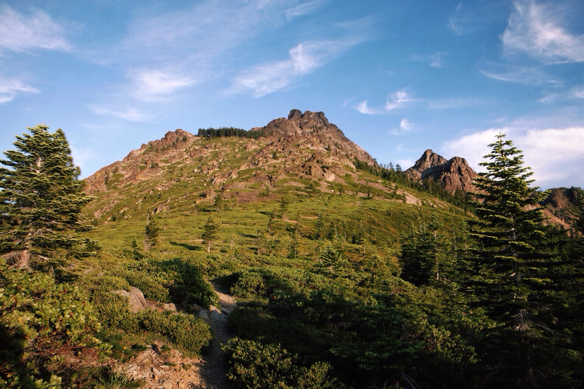
Scenes of Washington
Washington, the final state on the PCT, was a doozy. After the easy cruising we did through Oregon, Washington was not about to let us reach the finish without working for it. And work for it we did. Despite the struggles, Washington presented us with truly mind-boggling scenery. Goat Rocks was probably the most magnificent section followed very closely by the north Cascades. Really though, most of the state was quite impressive.
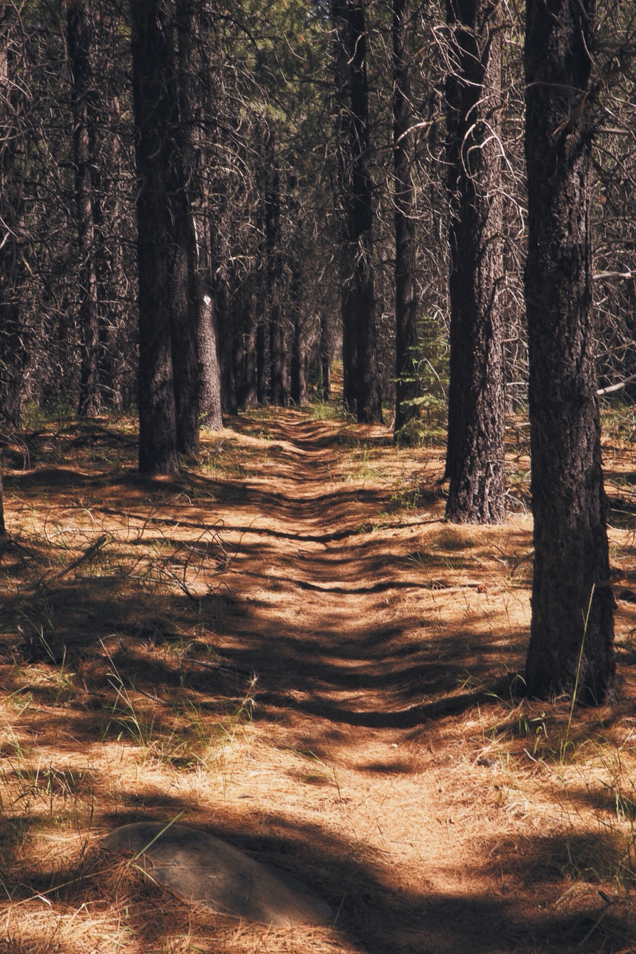
Unfortunately, this post will give you a slightly smaller glimpse of the state than I would have liked. About a week's worth of time spent in the Evergreen State was spent in thick clouds and rain. By Washington my camera proved less than capable of performing in the rain and was relegated to staying dry(ish) in my pack for large chunks of the trail. Also, at least 1/3 of the trail through Washington was forested. Rather than give you a gallery of tree photos, I figured I would spare you the monotony, give you one solid forest photo and then move on to the grand scenes.

Mile 2173

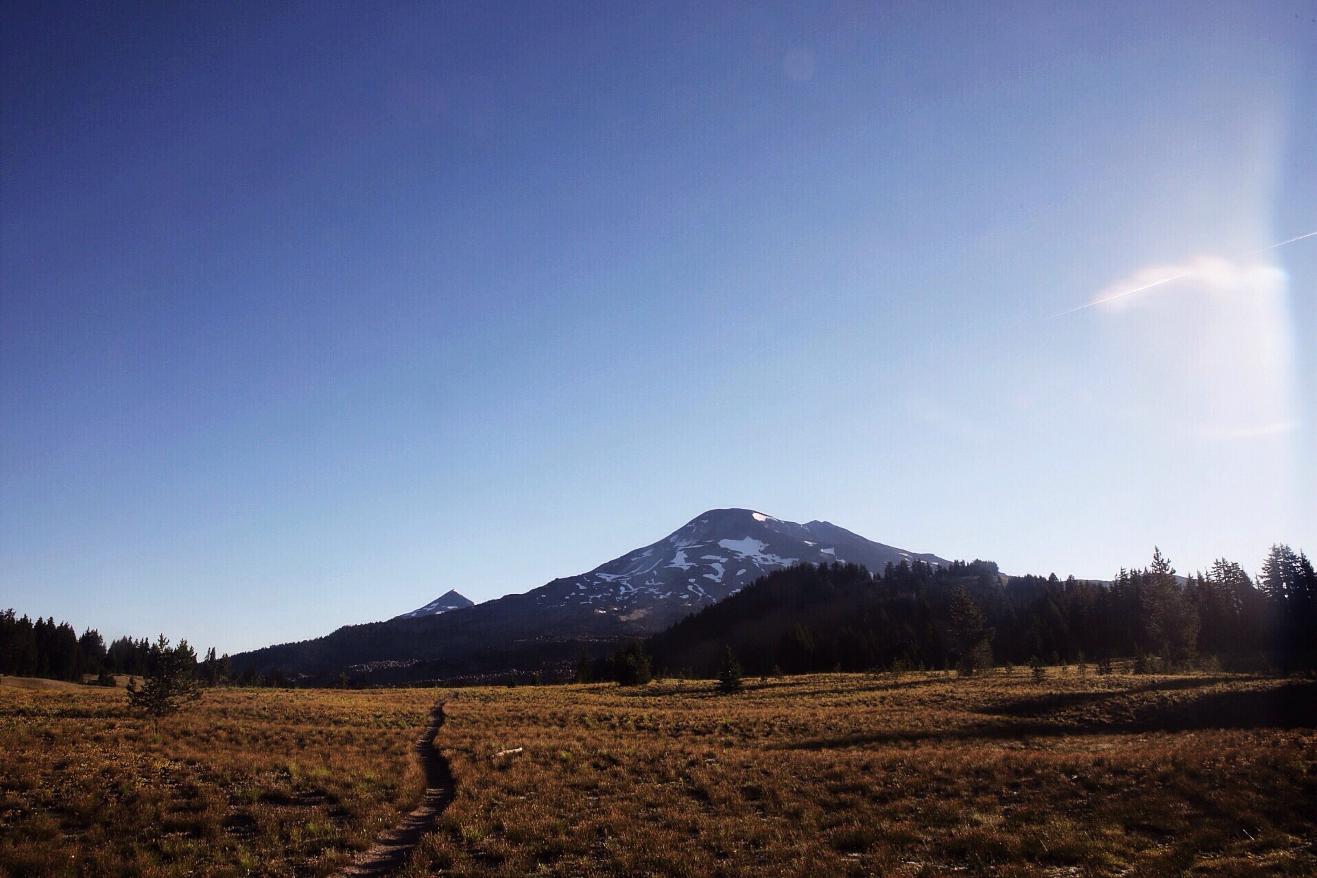
Mile 2272. Mt. Adams

Mile 2279. The beginning of Goat Rocks.
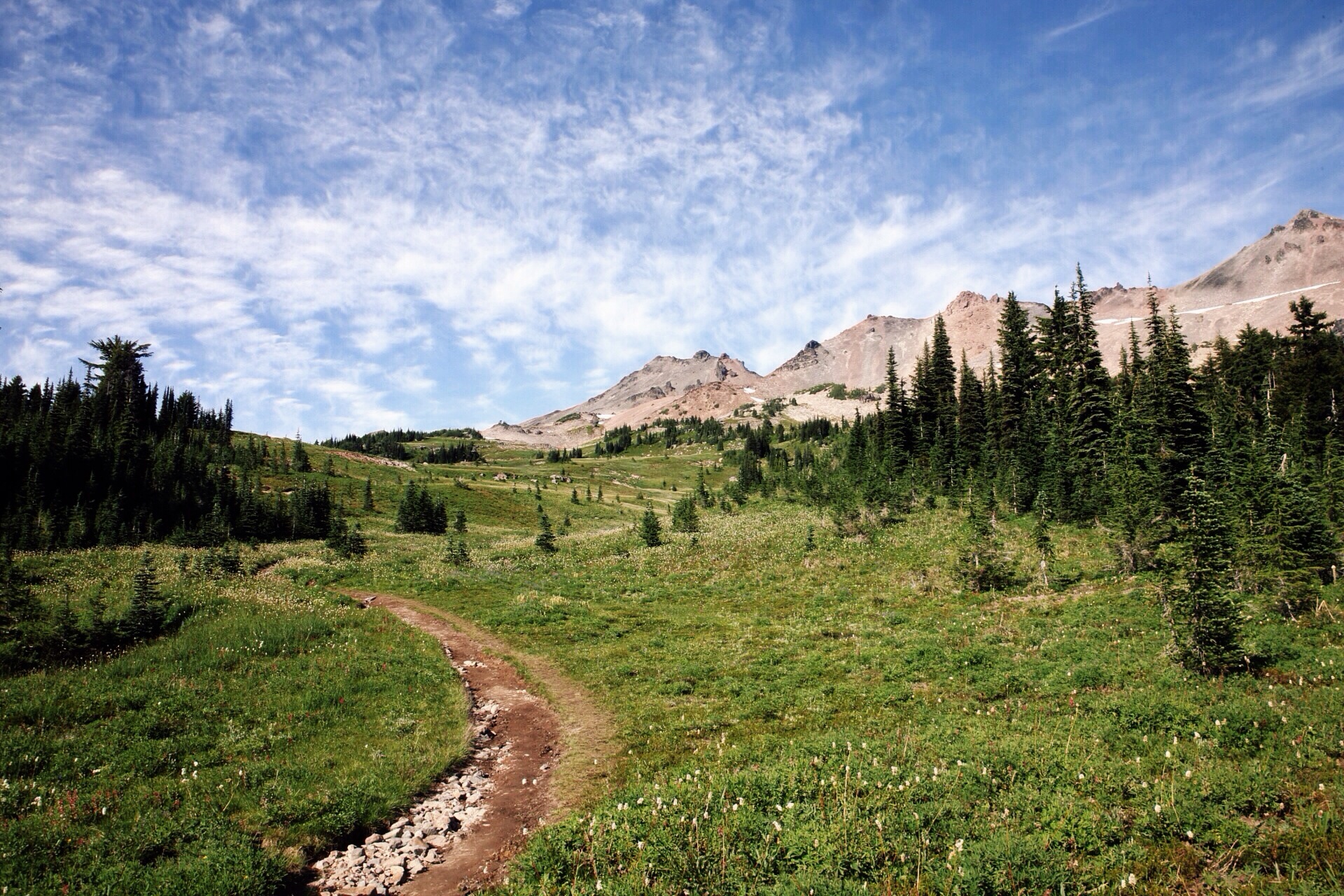
Mile 2281. Goat Rocks

Mile 2285. Knife's Edge with Mt. Rainier in the background.
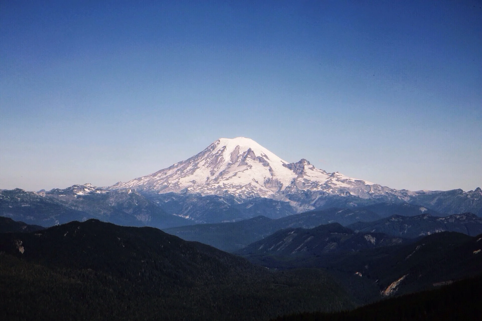
Mile 2297. Mt. Rainier
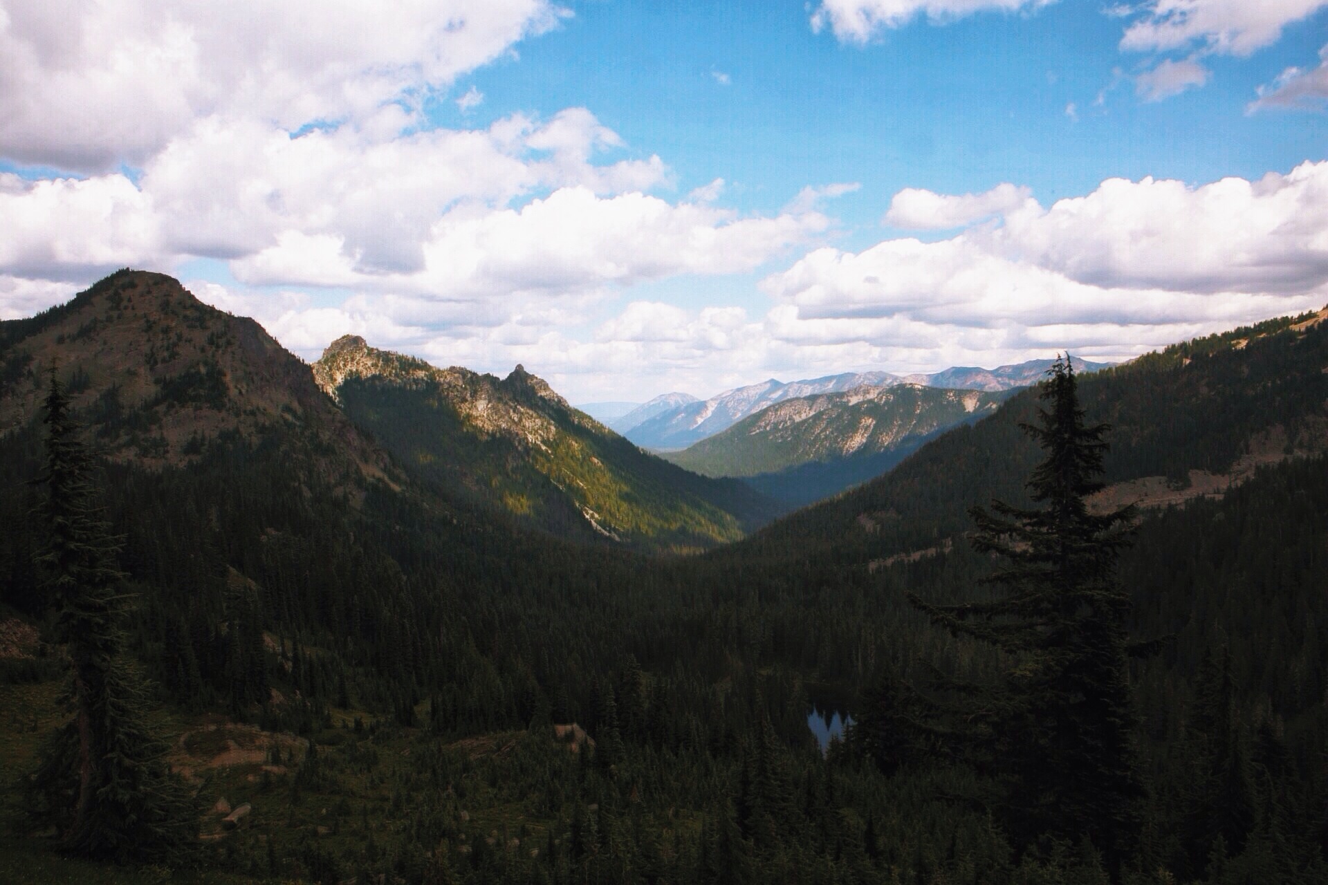
Mile 2326

Mile 2606

Mile 2393

Mile 2409. Kendall Katwalk
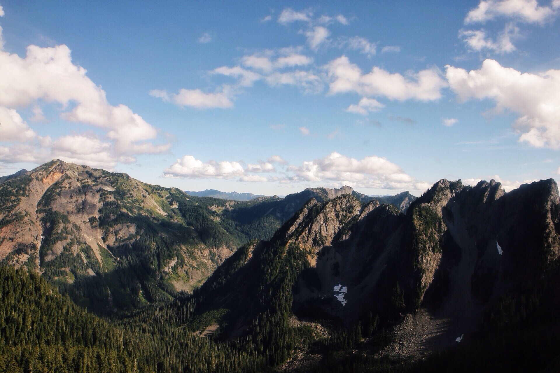
Mile 2410

Mile 2413

Mile 2582. We took a slightly alternate route.

Mile 2636

Mile 2605

Mile 2580. Lake Chelan

Mile 2650. Technically this is a scene of Washington and Canada.
Cheers,
Jonathan
CANADA!!!

It's official. It's real. We made it to Canada! We reached the Canadian border in the afternoon of September 8th with Mongo, a fellow St. Louisan thru-hiker, and Ms. Frizzle.
We are thru-hikers. We met friends, had incredible experiences, and walked to and from many places... This trip may have started in Mexico, but I don't think Canada is the end.
We still have so much amazing material to share, so keep checking back for more. Right now we are just trying to make our way to a place where there are beds (back to St. Louis for Pedi and Soapbox).
A quote written in the trail register stored in the obelisk that hit home:
"Now I see the secret of making the best person: it is to grow in the open air and to eat and sleep with the earth."
-Walt Whitman
Cheers,
Dan and Jonathan
The Octopus

The sign read, "The Octopus," with no clear indication as to what the octopus was.
There we were walking along in the Northern California wilderness when suddenly a placard appeared in a tree (ok, maybe the signage didn't 'appear' out of nowhere). But it had a mysterious message. A Forest Service sign had piqued my attention. It just said "The Octopus."
What was the octopus? A mysterious octopedal forest creature? Side show freak? A machine left in the woods? Probably none of these is correct.
I think the Octopus is a tree, but not just any tree. The Octopus would be the tree of trees (assuming that's what the signage was for). As we hiked past we noted it would take all four to wrap around its base. We turned a corner and hiked into a clearing. Looking back we could see the towering behemoth stand high above the other pines surrounding it. My best guess, a gigantic tree, became a legend, the Octopus lording over the forest.
Then that was that. I turned and hiked on, leaving the Octopus where it stood. We hiked into Mt. Shasta City and there was beer to be drunk.
---
Note: Ok, if you're reading, I need help. I haven't been able to confirm that The Octopus is, in fact, a giant tree in Northern California. Any information would be helpful. I scoured what tiny corner of the web I could on the limited internet access I have, but I found nothing about this sign. I'll get back to you with more info on the location of the sign later.
Cheers,
Dan
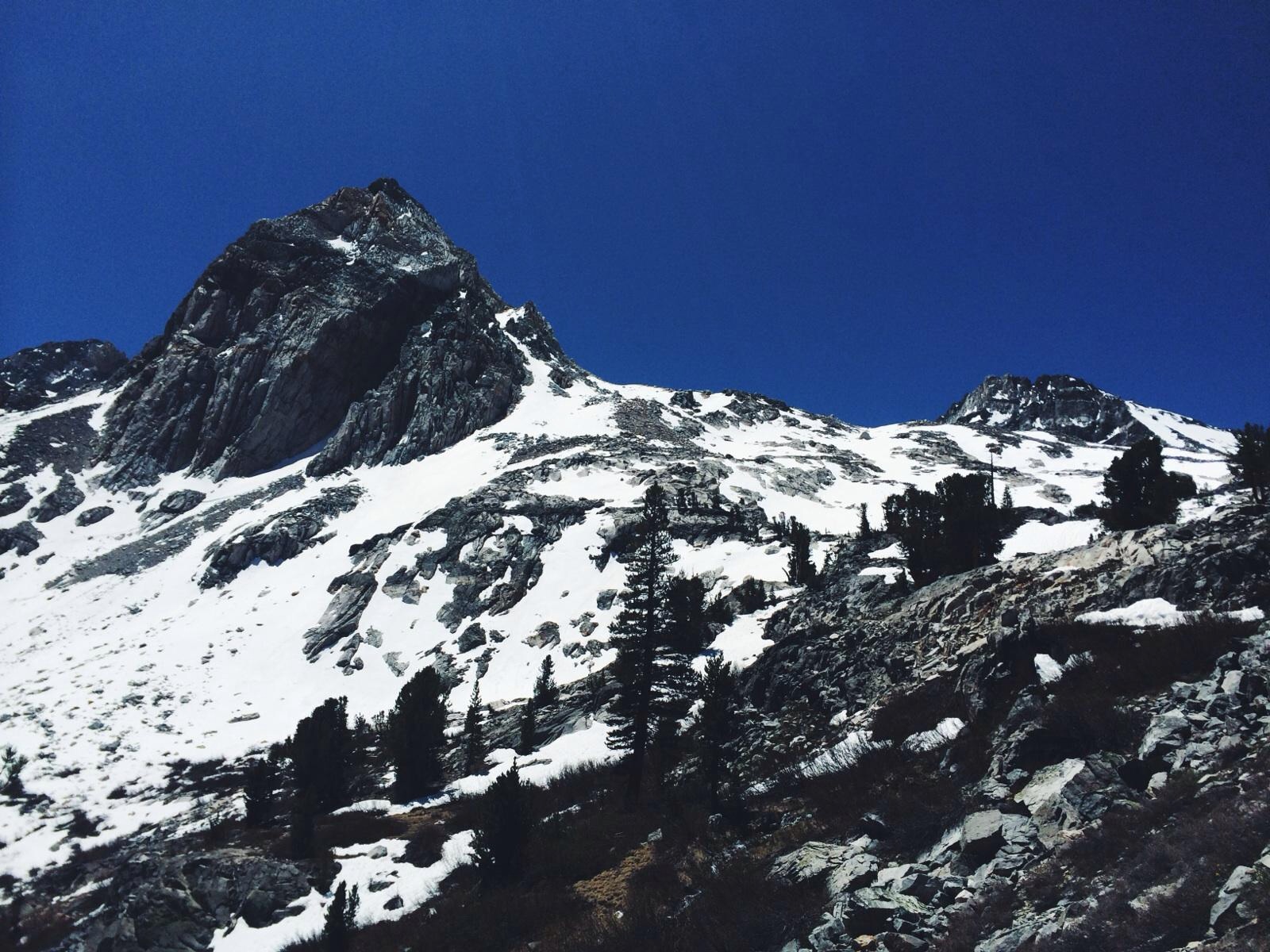
The passes - Glen
Just a quick reminder - the passes were from the High Sierras, which we finished hiking in mid - summer.
We had just resupplied and camped on the trail past Kearsarge Pass, as our path began to climb to the next pass. We woke, ate and got a move on before 7 am. The ascent to Glen Pass was a moderate hike by High Sierra standards - steady climb, we had kept elevation by camping at higher altitude couple thousand feet and some icy steps and we'd be at the top.
We made the pass by late morning and ate second breakfast - oatmeal and granola (mmm). Happy Pants - whose pants were a bright, colorful print from Senegal - joined us. We watched as he descended ahead of us - he selected a route with a long glissade. It looked fun so we followed.
Happy Pants made the glisade look easy. It was not. I slid down a long stretch and Pedi followed, landing hard and bruising his rump. Quinoas pack spewed water bottles as he descended, not gracefully (we recovered them). Half and Half made it look easy and have us his typical shrug followed by, "No problem." It felt like he was smiling at our difficulty.
The rest of the descent was harder - I split from the group by taking a different route through the melting snow pack. We had all lost the trail as we searched for a simple route down. I had walked on what looked like great snow pack only to fall through into running water (yippee!) - what would become known as the double posthole.
Finally I found the trail and everyone else caught up. It was nearly lunch time and we were at the edge of a majestic mountain lake. Soaked and tired, we ate. These passes were proving to be more difficult than we thought and we learned timing really was crucial to getting down quickly and safely.
The conflict was going to be balancing time with covering miles so we didn't run out of food in the future. Such was the reality of hiking in the High Sierras.


Cheers,
Dan
Visual update pt. 3
2500 miles down, 163 left to go. SO CLOSE.
With less than 200 miles left until we reach the Canadian border, I can almost taste the finish. We have wandered so far in this journey, but never wavered. It's crazy to think that in two weeks I'll be back in the Midwest. The trail has become normal life at this point. The finish doesn't simply mean the end of this trail, though. It also means parting ways with some incredible friends and a way of life I have enjoyed to the fullest. I don't think I ever could have guessed how much of an impression this experience would have on me.
I could ramble forever about what 2500 miles means. Instead, I'll leave you with a few photos of some beautiful hiker trash and the knowledge that we'll be done within a week.

Butters
Ms. Frizzle

Soap Box

Pedi
Cheers,
Jonathan
New states, new crews
Dan (Soap Box) and I have not only made it to the final state of our journey, we now find ourselves in a new crew. Smokes, Schmitty and Quinoa have all ebbed and flowed in and out, but Ms. Frizzle and Butters seem to be permanent members at this point. They're fantastic people and I couldn't be happier to have them around.
Our first crew lasted for a solid 900 miles, and it wasn't until afterward that I even realized what an anomaly that was. Most hikers start the trail solo and, while they often hike with others, most don't crew up for such long stretches. Usually people's schedules or hiking speeds are too different. Or somebody gets sick or injured. Regardless, I'm thankful to have made such great friends as I have on this adventure.
Now then, let's get back to finishing up Washington.

Soap Box, Butters and Ms. Frizzle. Oh yeah, and Mt. Adams.

Soap Box and Frizzle deftly speed down a hill as we head for town.

Ms. Frizzle and the most giant cairn ever.
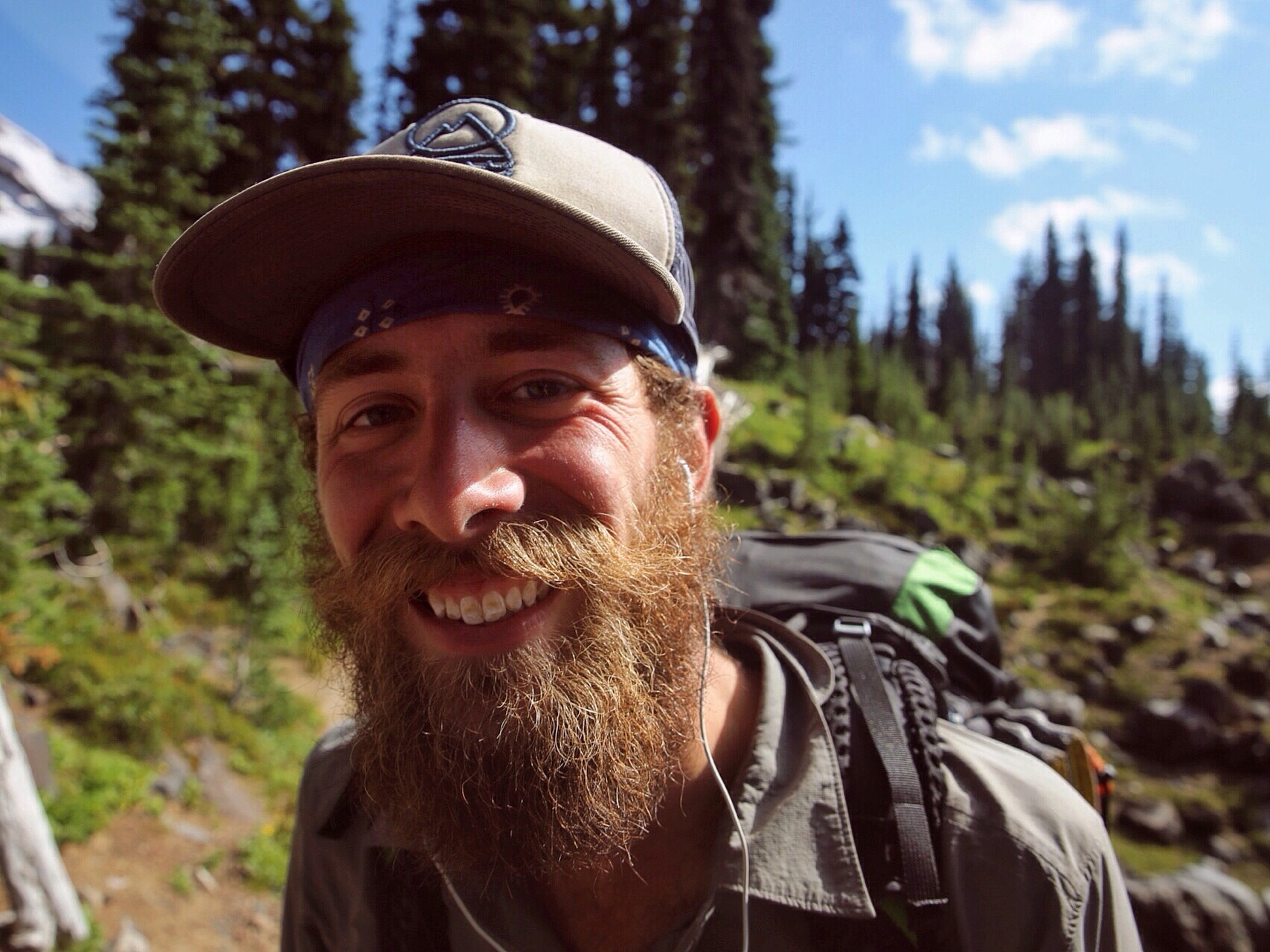
Beautiful hiker trash.
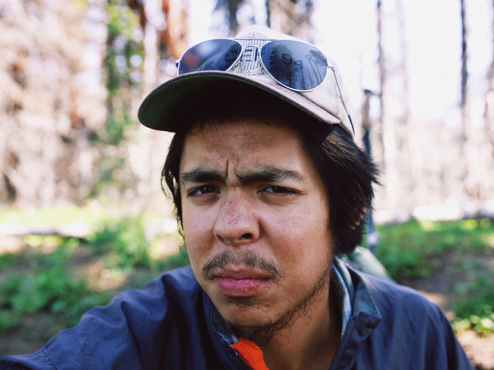
Slightly less beardy, but equally as beautiful hiker trash.

NINJA RUNNING!

True hiker trash. Butters brushing his teeth while hiking.

Haha, hiker crossing. Somebody added the poles and pack with tape. Oh, and the sign has hella bullet holes in it.

Butters and Frizzle stomping and clomping through a Washington meadow in the morning.

Sexy butters in morning light.

A troll, er, Frizzle under a bridge.
Cheers,
Jonathan
This thing we're doing
On this particular day, Dan and I happened to be hiking alone, finding ourselves - however briefly - without a crew. We came upon a saddle with one helluva view. As will sometimes happen on the PCT, we felt morally compelled to stop and observe the scene in front of us. It was too magnificent to pass up.
As Dan and I sat on that saddle observing the wondrous nature that lay before us, I felt a great sense of calm and contentment come over me.
"I'm not exactly sure what this thing is that we're doing, and I'm definitely not sure what will come next in life," I said, turning to Dan. "What I am sure of, though, is that this, this thing we're doing is the right thing to be doing."
He smiled, knowing exactly what I meant.
"Yeah man, yeah," Dan responded, giving a bit of a chuckle.
Nowadays, I feel that same sense of calm and happiness pretty often. Whenever I do I turn to Dan with a big stupid grin on my face and say, "Man, this thing we're doing."
Hiking the PCT has been and will continue to be one of the greatest adventures of which I could possibly conceive. I am constantly in awe of how fun it has been to incorporate so many things I love into my everyday life for the last four months.
-Jonathan
When Bambi attacks, true danger on the PCT

Dan's accurate representation of the following story.
Over halfway, hiking in Oregon has been great, but it hasn't been without challenges. Sometimes the trail greets you with magic, other times hardships. I have heard from a friend that "hardship builds character," so there's that.
A day into Oregon my reflexes and bravery were put to the test. I was walking with a German hiker known as Free Refill. We were covering all the usual topics as we walked - politics, history, science, culture, you know, the light conversations. At a point not far after a road crossing we found a note warning of a hornet nest, but we didn't see anything so we kept walking. Within a half mile of that spot a tree had fallen across the trail. Free Refill and I each started clambering around it. The moment my foot made it to the trail again as I stepped off the fallen tree, before I even raised my head from looking at my landing place some brown shape had buried its head in my chest.
I remember dropping my elbows down hard and stepping back to keep from falling. Next thing I know Free Refill and I both are pointing our trek poles at the beast, like spears, unsure of whether to attack or run. We should have run. Ilene were faced with a beast not unlike the fanged rabbit from Monty Python. It was a four foot tall female deer. Thank god it wasn't an antlered adult male. But the encounter wasn't over.
In an instant the deer was up on its hind legs and falling towards Free Refill. BAM! The deer smacks him in the face with its front hooves as it knocks him over and leaps over the logs we had hiked around moments ago.
I jump over Free Refill. "Stay down," I say, thinking he's hurt. I face off between the monster and my German compatriot as the deer lowers its head like a mad dog. Before we engage each other I feel fire on my legs. Turns out the log Free Refill fell next to, the one I was standing on, was a hornets' nest. Oops.
The fire I felt was the hornets stinging. "Stand up, Refill. Hornet nest." We both shuffled away, keeping an eye on the mad deer.
It seemed we were safe as we backed down the trail. The deer held its ground, head still lowered, eyes locked on us as we started walking briskly away.
"I wanna punch that deer," I said.
"I would do more than that," Refill replied jokingly. Neither of us could believe what had just happened. And that we came out far worse than the little deer. And we were thankful she wasn't a huge buck with antlers.
Just another day on the PCT.
Scenes of and thoughts on Oregon
Wow, just wow. Oregon blew me away. Getting through California was such a feat that I felt really fresh as we got going in Oregon. I have heard it referred to as Boregon in reference to a hiker's experience as one travels the PCT. Sure, we all have our own experiences, but for me Oregon was superb, maybe even my favorite section to date.
There were certainly a considerable number of dense forests, but I never minded these. They helped shade you from the sun. The weather was impeccable anyways, save for one day of storms, and that was actually pretty fun. Sometimes when I would think about this blog post I would laugh because there are no scenes of Oregon. Only forests. I jest, but we really did spend a lot of time walking in the woods. The times we weren't in the woods we found ourselves in quite diverse landscapes. From Crater Lake to lava rock fields to the Sisters Wilderness, Oregon truly has much to offer.
Even beyond the actual wilderness, the Beaver State's culture sets it apart. While the whole west coast is seen as liberal, Oregon and California do not seem to be the same type of liberal. For starters, there are tons more hippies here. More than any of that though, California seems to talk a good talk, but Oregon really lives it. California likes to seem environmentally friendly, but Oregon truly is. There's no front to it. I have seen solar panels everywhere, and I mean everywhere. Environmental consciousness in Oregon feels natural and engrained into everyday life more than any other place I've experienced in the States. I understand that I have limited experiences in both states and I am no expert. Equally, I'm not trying to trash California nor make Oregon out to be the Holy Land, but Oregon was magical.
But I digress; on to the landscape photos.

Thunderstorm at sunset.


Crater Lake

More Crater Lake


South Sister


Jeff Creek

Mt. Hood

Mt. Jefferson from the North

Oregon fog

Tunnel Falls
Burn section over a ridge.

Mt. Jefferson
Cheers,
Jonathan
The first one didn't count
I guess one double-marathon simply was not enough.
Fence and I had been waiting around for two days. We mostly slept and ate. That is, until we realized how much food we were plowing through.

Fence lounging while we wait for Dan.
Then, finally, Dan showed up with Cheese, Baggins and Choop in tow. I had only hiked 37 miles in three days, which made me itch to do something stupid, something big. Now that I knew Dan was safe and caught up, I somehow had the desire to go and just keep going. We were at mile 1453.

Sunset with the bros before heading off into the night.
I left camp at 7 p.m. and walked all through the night, which can be a tricky thing when there is no moon and you are in dense forest. Still, I found a rhythm and was able to get by without kicking too many rocks and roots. By 4 A.M. I had reached McCloud River, mile 1476. After putting my pack down I cleaned my feet off, ate a snack and got a bit of rest. By rest I mean I leaned against my pack in the dirt at the end of the bridge for an hour.
Having rested a single hour, I got back up and kept hiking, but this time in a state of delirium. I met a new hiker, Free Refill, shortly after getting back on my feet. What a cool guy. He's a middle aged German engineer with one helluva sense of humor. This fact, however, I would not learn until a bit later. Free Refill was just warming up for the morning, and I needed to get my blood flowing so I didn't pass out on the trail. I pressed on at an unusually quick pace for that time of the morning.

Completely random note I saw that afternoon.
At certain points I could feel the proverbial wheels start to come off, but I hung in there. With enough caffeine, food, Ibuprofen and water you can do just about anything. Willpower doesn't hurt either. The miles kept rolling by. I saw a few other hiker friends, but mostly I kept my pace steady and powered on. The goal was Interstate-5 where I could hitch into town. By 2 P.M. or so I had reached mile 1500. WOOHOO! I still like the feeling of passing each hundred mile mark written in stones in the dirt.

By 4 P.M. I had finally reached my mark, mile 1507. After 21 hours my 54 miles were complete. 54 miles! That included 12,000 feet of climbing and and 18,000 feet of down. I felt accomplished. Also, I felt wrecked. My body had nothing left. Trail magic always makes everything better though. A couple and their daughter showed up with fresh watermelon, giant muffins and freshly baked cookies that were still warm. It felt like a pretty good reward for my day's trek.
About an hour and a half later Free Refill showed up. I had not yet moved from the spot where I stopped walking. He asked about my day and so I told him of my my distance record.
"Yeah, but you didn't do it in one day," he said.
"Maybe not in one calendar day, but I did it in 24 hours," I retorted.
"So, it still wasn't in one day."
God dammit.
This day was not Free Refill-approved.
----
Two weeks later, having passed Ashland, OR (and all of its magic), I was hiking with Ms. Frizzle, a bad-ass with an equally insatiable desire for doing stupid stuff as I do. Now that we were in the flattest section of the trail, we felt like we could do anything. Having told the tale of my first 50+ day, Ms. Frizzle wanted get on the bandwagon. Let's be real here, it's not like I was ever going to turn down another opportunity to do a crazy big day with another cool hiker.
And so on the 107th day of our journey on this Pacific Crest Trail, Frizzle and I awoke at 4:30 to embark on a double marathon. Mostly, the day went off without much incident. Frizzle likes to hike hard, which means that if you manage to hike in step with her the miles start to fly by. By mid-afternoon we hit some pretty crazy lava fields, but the actual trail through said lava rock was like a magic carpet, smooth as can be.

Frizzle and lava rock fields.
Sometime between 4 and 5 P.M. we heard cars. A road! We were 32 miles deep and while I didn't feel bad, it had already been a sizable day.
"Pray for magic, pray for magic, pray for magic," I muttered to Frizzle.
Awaiting us at the other side of the road were a couple of tail angels doling out tons of food to a group of hiker trash. There were grilled cheese sandwiches, beers, orange juice, coffee, ibuprofen, fruit snacks and more. I can scarcely think of anything that would have made that moment better than the grilled cheese sandwich brought to me upon reaching the other side of that highway. Oh, did I mention chairs? It turns out that chairs are, in fact, a pretty sweet invention.

Glorious trail magic
We spent 45 minutes hanging with our fellow hiker trash and the generous angels who were passing out magic galore before Frizzle and I nodded to one another that we needed to get back out on the trail. We still had 20 miles to go, after all.
Things really started getting rough as the sun went down. The batteries in my headlamp had worn down to the point of making the light barely useful. My body was already fairly depleted of all resources and the almost-constant tripping did not help the situation. I doubled-up on lights, adding my iPhone's LED as a secondary. We pushed on into the night. And pushed. And pushed.
The last few of those 52.4 miles felt eerily similar to the last few of the first time I ran 26.2 miles. Everything hurt. The voice in my head kept saying "Please, just let this be over with." I conjured what willpower I had and forced myself to keep putting one foot in front of the other until, at 11:10 P.M. Frizzle and I had reached our double-marathon mark.
A few days later Frizzle and I met back up with Free Refill and told him our tale.
"This time I did it in one day," I exclaimed.
"OK, now you can tell people it was approved by a German engineer."

Frizzle waking up the next morning to an early sun.
Cheers,
Jonathan
What fuels a hiker
We eat a lot. Like a lot, a lot. Like 5000 calories per day, a lot. This means as much of as many different kinds of food as possible.
For dinner, though, we usually eat hiker slop. It was great in the beginning. Now I can hardly stand the stuff.

Hiker slop
1 package Idahoans (doesn't matter what flavor)
1 or 2 packages ramen (doesn't matter what flavor)
Big handful of cheese (generally shredded)
A few tablespoons of olive oil
Packet of tuna
Mix it all in a gallon ziplock bag, add three cups boiling and chow down.
Hooray for calories!
Cheers,
Jonathan
The Magic of Ashland
This is the kind of post that might start with something cliché like "Sometimes you find the adventure and sometimes the adventure finds you." Or maybe even "This is why you don't make plans."
The last day of California Jonathan gently convinced Dan to hike a 52 mile challenge into Ashland. While it might have been best to get up and going by 3:30am we got out of "camp" about two hours later than that. We were not exactly fresh - we literally slept on the trail, and we only slept there for about six hours after a night hike which included a 5000ft climb out of Seiad Valley.
Once we got going we put big miles behind us. We still weren't making outstanding time, but it could be done. After a quick lunch at the Oregon border we trudged back out into what had become a sweltering hot day. By 8:30 p.m. we had hit the 40 mile mark. Jonathan wandered up a ridge to see the sunset. It looked as glorious as ever with {blah blah flowery language about pretty colors}. As Dan followed we heard some voices and saw a fire. "Do you guys want a beer?" they said to us. Of course we do! They were amazing people. There were six of them, a little boy and a dog. They gave us beer and smoked salmon. Dat smoked salmon doe. On top of being generous, they were extraordinarily cool people to hang out with for an evening. At first we felt bad, since it was sort of a going away gathering for one of the guys, but they insisted that they had all secretly been wanting to magic stuff to PCT hikers but hadn't gotten a chance. Now they had one. At 10pm we were talking about hiking out and sleeping by the highway. A few hours past, and by midnight we knew we weren't hiking any farther. These gregarious people from Ashland truly gave us the best welcome into Oregon that we could have asked for.

Good company and a campfire are a great start to an evening. Especially when they're unexpected.
Things were off to a good start. We finished out the last 12 miles early the next morning to make it into Callahan's Lodge.
While crossing an outer road to I-5 a big white van pulled over to the side of the road. After honking and rolling down the window the driver yelled over to us "Beerman!" Dan turned, his eyes lit up and he shouted "I'm getting in the car with those strangers!" as he raced off to the van. Jonathan could do nothing but sit and stare confused as his hiking partner rushed off to a car of strange people. These "strangers" turned out to be a mentor of Dan's from college and Alpha Phi Omega (community service org) and his wife. The amount of chance involved for this meeting is astounding - we're talking alignment of the planets. They had planned on meeting Dan, but had to return to Ashland, Missouri. They left a note at the trailhead and were on the on-ramp to drive when our paths crossed. The couple (Paul and Charlotte) drove us into Ashland and bought us beers. After Paul and Dan spent some time catching up and marveling at the serendipity of our encounter the couple bid us farewell. They headed back toward Missouri while Dan and Jonathan ventured out into the metropolis of Ashland (pop. 20,000).
One delicious Indian buffet later, we knew that finding lodging needed to be at the top of our priority list. We were in a gear shop checking out a trail register when we came across names and numbers of some trail angels. Dan made a call, while Jonathan looked on with puzzled eyes. It seemed like the call went well, but all Dan said was that the guy was going to call us back. A few minutes later Dan received a call. It drags on a while. Somewhere along the way he looked up, smiled and gave a thumbs up. Now we had a place to stay for the night.
For the record, this formula is not a foreign experience for us. In college we moved after two years in a piece of shit house to an apartment. That apartment would have never happened without Dan's research and effort. Jonathan put forth enough effort to say thanks that Dan found us a place to live and to sign the lease.
It turns out that this trail angel is a former thru-hiker and angels for current hikers. He said we could stay at his place. Awesome! But wait, he's not even in town. His son may be around he said. The front door is unlocked, though, because of course it is. He asks that we keep things LNT (leave no trace) and clean up after ourselves, maybe grab some laundry detergent. Not a problem. We wouldn't dream of being anything but the most respectful guests - laundry, air conditioning, a safe place to leave the packs while we walk around town, a base camp. Seriously, when people show you the sort of kindness we have been shown you do everything you can to pay it forward and not take it for granted.
A good nights sleep, laundry and a shower later we felt like this adventure could not get any better.

A little friend that came to hang out on the porch as we sipped on morning coffee.
Not only are beds pretty cool every once in a while, but being in an actual home felt comforting, even if we didn't really know this home's owner. By day three of this story Jonathan found himself lounging on the couch and writing a blog much like this very one. All of a sudden, in walks this late 20 something man that is super fit. Jonathan looks up as the young man says "Um, hi. You must be a hiker from the trail." It's said more like a question than anything.
"And you must be the son of (trailname of dude whose house we're in)," Jonathan said, equally as unsure of his own statement.
"Yeah," says the young man. "I run a fitness apparel company and I'm just here to grab this bag. You guys have a great hike and enjoy Ashland."
As fast as he was in the house he was once again out of it. Not only did he seem a nice fellow, but he seemed totally unphased by walking into his father's house to find hikers and all their gear sprawled across the living room.
At this point it is unclear if the levels of awesome and strange will continue to escalate at consistent intervals, but it seems possible. As it stands they are at an all time high. We are loving Oregon.
Needless to say, all you trail angels out there, everything you do for hikers and to maintain the ethos of trail culture is inspiring. Your actions demonstrate a humanity and consideration I want to carry into my own life.
Keep adventuring,
Dan and Jonathan
Scenes of Northern California pt. 2
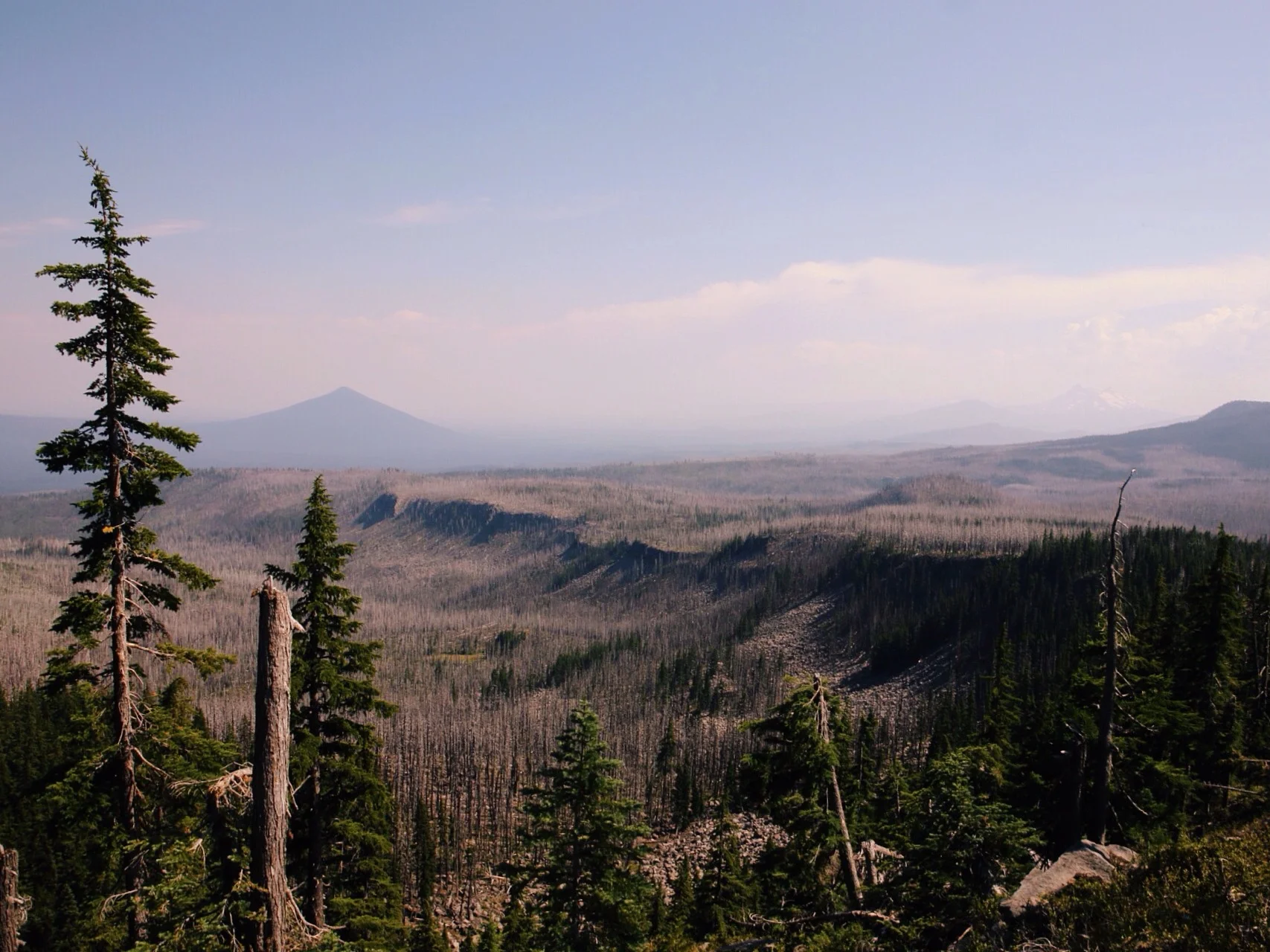
If a PCT hiker were to say that NorCal is boring, I don't think they would be entirely wrong. Conversely, if they were to say there is nothing cool about NorCal, I would say they are grossly mistaken. This section of the trail introduces far more forests than any heretofore, and they are more dense. On one hand, it means shade from the harsh summer sun. On the other hand it means fewer grand, scenic views. Despite this, the past 600 miles have afforded us some sweet views. Chief among them might be Mt. Shasta, which, even at the Oregon border, is still visible and has been since somewhere around mile 1300. It sits so tall off in the distance, dwarfing absolutey everything around it for hundreds of miles.
This has certainly been the most odd section so far. There was never really a routine, and things were always getting shaken up. Our crew was in constant flux and even Dan and I ended up separated for chunks of the section. This post, however, is about the visuals through the State of Jefferson. The personal stories are yet to come.

Mile 1425 - Burney Falls

Mile 1361

Mile 1371 - night hiking on Hat Creek Rim

Mile 1496 - Mt. Shasta

Mile 1580

Mile 1541 - Mt. Shasta from the north

Mile 1635 - Paradise Lake

Mile 1547

Mile 1574

Mile 1523 - Castle Crags
Cheers,
Jonathan
The Bet, concluded

How?! How is this possible? How do you make one roll of toilet paper last for a little over 900 miles? I don't think of myself as a gambling man, and thus I found the prospect of Dan accomplishing this feat preposterous, absolutely ludicrous. I had this in the bag. Then the miles past, but the size of the toilet paper roll barely seemed to shrink. Eventually, I realized that Oregon was fast approaching, and Dan hadn't run out of TP yet. It is now to my dismay that I must announce my concession in the bet over the Roll of Toilet Paper that Could. This is truly an impressive achievement. Many a hiker has listened wide-eyed as Soap Box explains the meaning of this roll. In the end, he only had three measles squares left. Now let's all continue walking through the woods as the number of miles left until Canada wain to under 1000.
-Jonathan
---
Perseverance. Perseverance, a steady hand and restraint are the skills required to make a roll of toilet paper last over 900 miles. Long days and many calories, stretches of no towns or pit stops, even a nasty bout of GI and still the roll turns. I'm not saying the PCT isn't impressive, but limiting toilet paper doesn't make the hiking easier. The bet has come to a close and I will gracefully accept my prize.
I'm not sure I'm even happy I won this bet... Or at least I won't be until I taste a few beers. Also, if anyone won any sizable side bets feel free to share the wealth.
-Dan
GUEST POST - Ms. Hoge
At a certain point, the thought of turning back becomes impossible, unsavory. As you amble along on feet that don’t exactly feel as if they can hold you, across shallow streams, through deep pine forests, and fields of unknown flowers, the choice that you make each moment becomes as simple as breathing: walk on.
A newcomer to the world of long-distance hiking, I didn’t truly understand the meaning of sore feet until I chose to join Dan (Soap Box) for a stretch of the PCT, from South Lake Tahoe to Donner Pass. Four days translated into two blackened toenails and several bulbous blisters to be lanced, duct-taped, and patiently ignored. The Pacific Crest Trail is not for the faint of heart…or of foot, for that matter. As I became aware of how well (or not) my body dealt with the mileage, I endured a sample size of challenges posed by the trail: ravenous mosquitos, high winds at altitude, trudging along in the rain with all of your food in what you hope is a waterproofed bag. Alongside the difficulties, there were innumerable moments of absolute joy. Each climb promised the sort of picturesque view that left me stumbling for words and the breath to say them aloud. The fact that I got to share these ridiculous wonderful moments with Dan, well, that itself was pretty amazing.
In the face of such overwhelming beauty and uncertainty that define what it means to live in the woods, you can’t help but find yourself severely humbled. Indeed, the mantras I used in rough patches alternated between “holy fucking shit” and “so cool”. As unthinkingly as these thoughts sprung from my lips, they might still be the best to describe the experience.
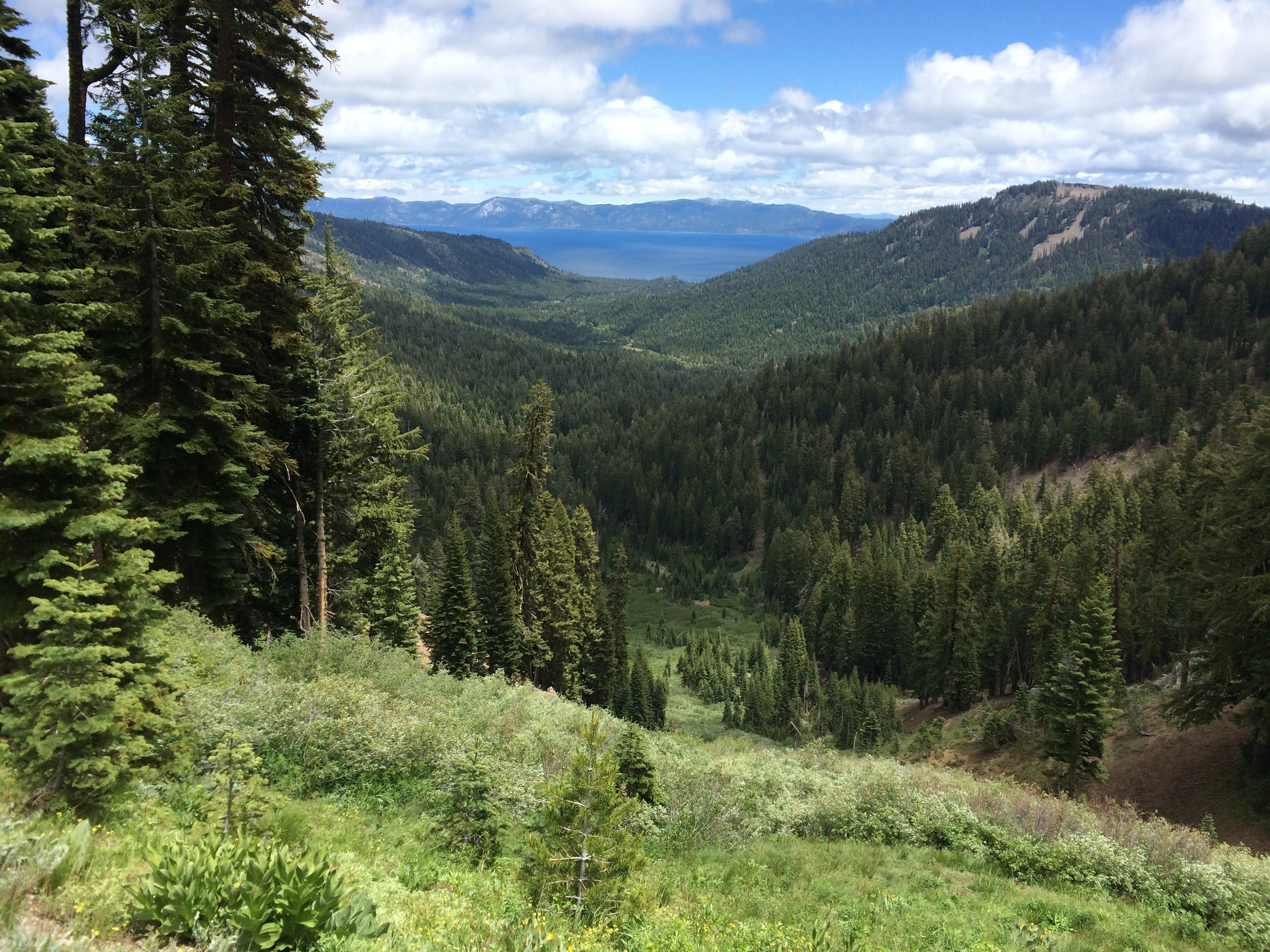
Overlook of thick forests around Lake Tahoe

Joanna being brave on volcanic rocks

Catching the light in a field of yellow flowers at sunset

Climbing down a snowy section, one false move could be dangerous!
I saw (all of) the sign(s)
It opened up my eyes I saw the sign.
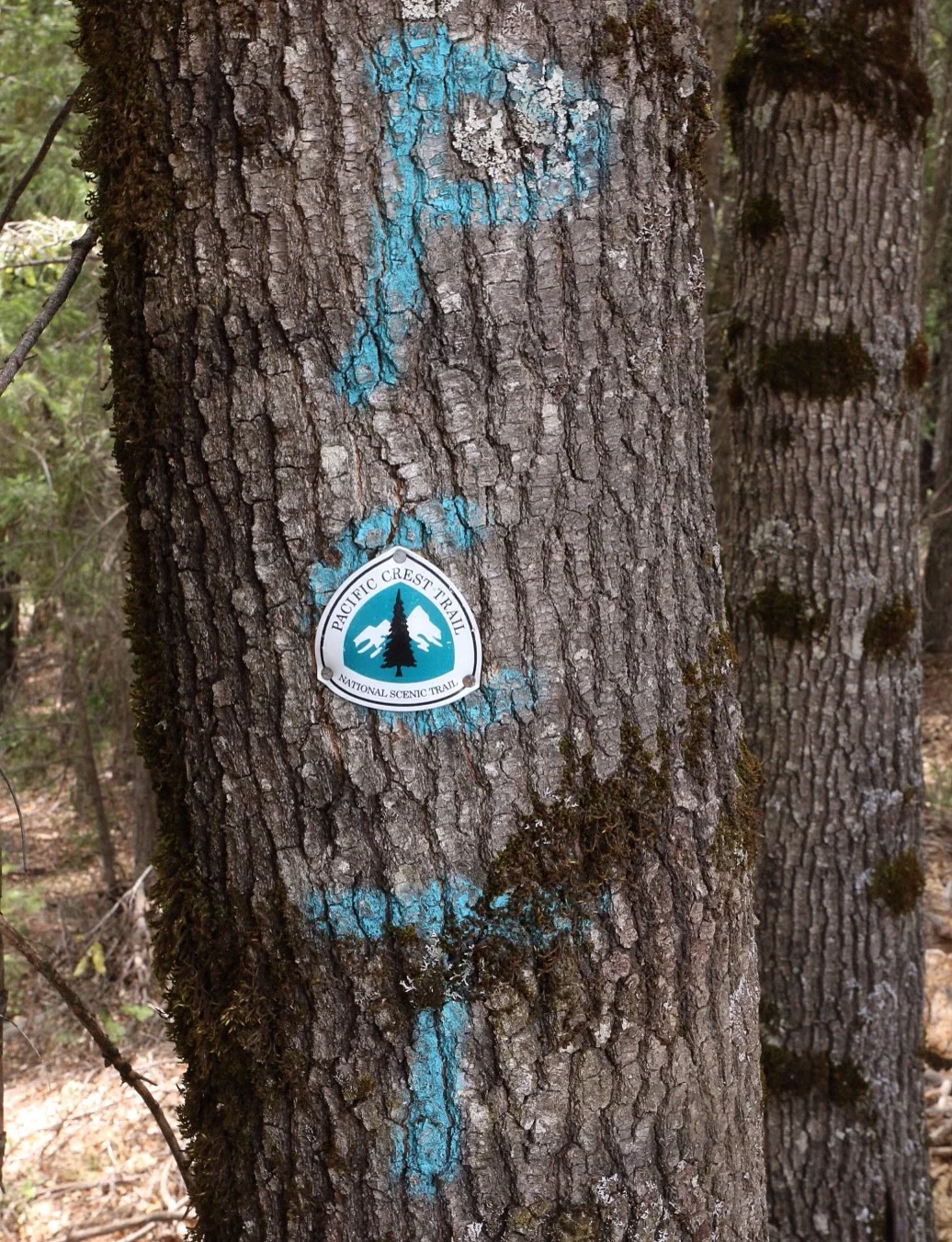
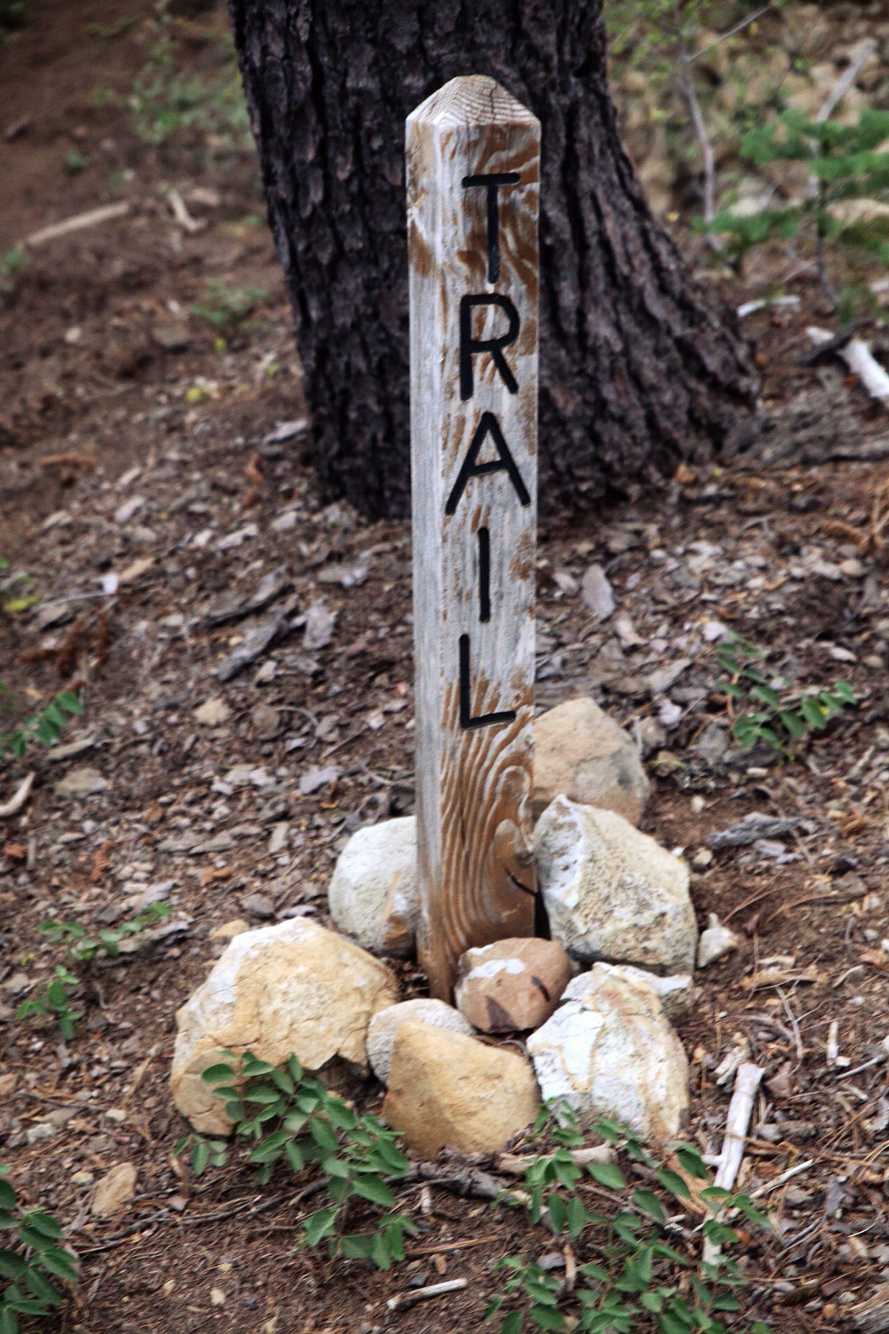
90s Swedish pop bands aside, there are more signs on the PCT in Northern California than any other place I've seen so far. They're everywhere. One might even go so far as to say there are signs on signs on signs. This is by no means to say they are good signs, but simply that they exist. In fact, they're some of the most janky signs I've come across. Even their helpfulness is hit and miss. Nonetheless, the amusement they bring is abundant.


Really guys? C'mon, we can do better than this. Just build a freaking cairn.

Cool arrow, dude.
OMG it's an actual PCT crest, albeit with PCT spray-paint behind it. Notice how the crest isn't riddled with bullets. This one must be new.


This one was my favorite.
Cheers,
Jonathan
Scenes of Northern California pt. 1
NorCal is freaking hot. We again resumed the tactic of hiking out early, taking a really long lunch break during the heat of the day, and then hiking late into the evening. In the Sierra you couldn't pay me to get out of my sleeping bag before 7am due to cold. Now the sun comes up so incredibly early and almost immediately gets hot that I have to intentionally sleep in to stay in my bag past 7am.
One great thing about this section is the mix of moderate to mild terrain, strong legs and long days. Doing 25+ mile days isn't even a big deal anymore, and I love it.
Watching sunsets (and sunrises) in Northern California is a thing of wonder. I delight in seeing the sun's golden hour glow bathe the forested hills in the first and last light of the day.
The clouds are magical. They remind me of clouds in Texas. Beautiful puffy looking ones perfectly scattered across the sky.
Trees here are covered in this neon green mossy stuff that I find incredibly comical. In fact, foliage and plant life in general has increased exponentially.
Not pictured: bugs. All of the bugs. Flies, Mosquitos, spiders ants and tons of others I can't begin to identify.

Mile 1210

Mile 1133

Mile 1106

Mile 1129

Mile 1102
Mile 1203

Mile 1312
Mile 1372

Mile 1250 - Middle Fork Feather River

Mile 1259

Mile 1248

Mile 1327

Mile 1165

Mile 1178

Mile 1174
Cheers,
Jonathan