
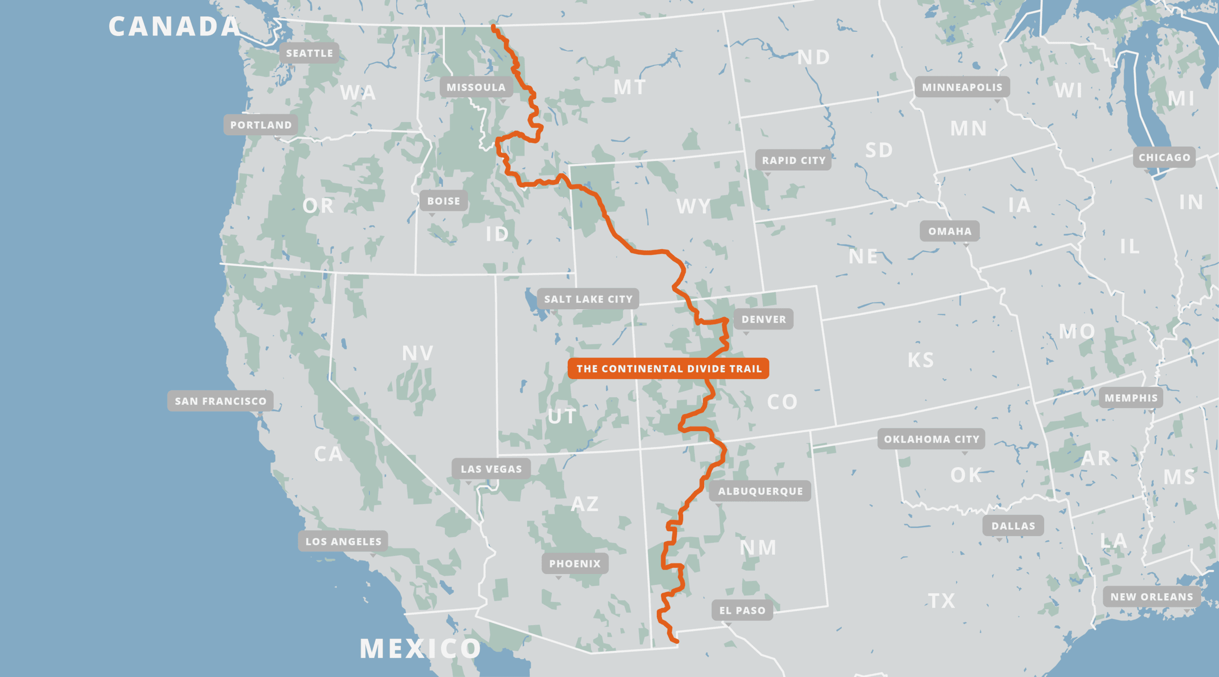
The Continental Divide Trail, Image courtesy of Far Out
The Continental Divide Trail (CDT) extends approximately 3,100 miles from Waterton Lakes National Park in Alberta, Canada to the “Crazy Cook” monument on the US/Mexico border. It dives into remote terrain in Montana’s Bob Marshall Wilderness Complex, bends along the “Idahontana” border, traverses the majestic Wind River range in Wyoming, ascends to 14,276ft on Grays Peak in Colorado, and ends in the Chihuahuan desert of New Mexico.
Starting at the Candian border, the trail leads hikers through three National Parks in the United States: Glacier NP (MT), Yellowstone NP (WY), and Rocky Mountain NP (CO). It also wanders through 25 National Forests and 21 different Wilderness Areas. Unlike on its better-known (and more well-traveled) cousins, the Appalachian and Pacific Crest Trails, there are many sections where thru-hikers take alternate routes rather than sticking to one official pathway. Some notable alternates include routes through Grand Teton National Park (WY), the Wind River High Route (WY), and the Gila River Wilderness (NM).
The CDT isn’t for the faint of heart: it brings hikers into extremely remote and rugged terrain, frequently requires carrying supplies for 6 days or more, and has long stretches where water is scarce. Some people like to say it requires “suffering in solitude”, but the unofficial trail motto is simply: “Embrace the brutality.”