A Wet September
In Colorado, September is usually lovely. The sun shines just about every day with bluebird skies and a cool breeze (hello, state with 300 plus days of sunshine per year!). The afternoon storms, common from May through July, have usually faded away, making September the best time to be in the alpine. Usually. We arrived in Colorado on September 6th. Great timing!

What September in Colorado is supposed to look like
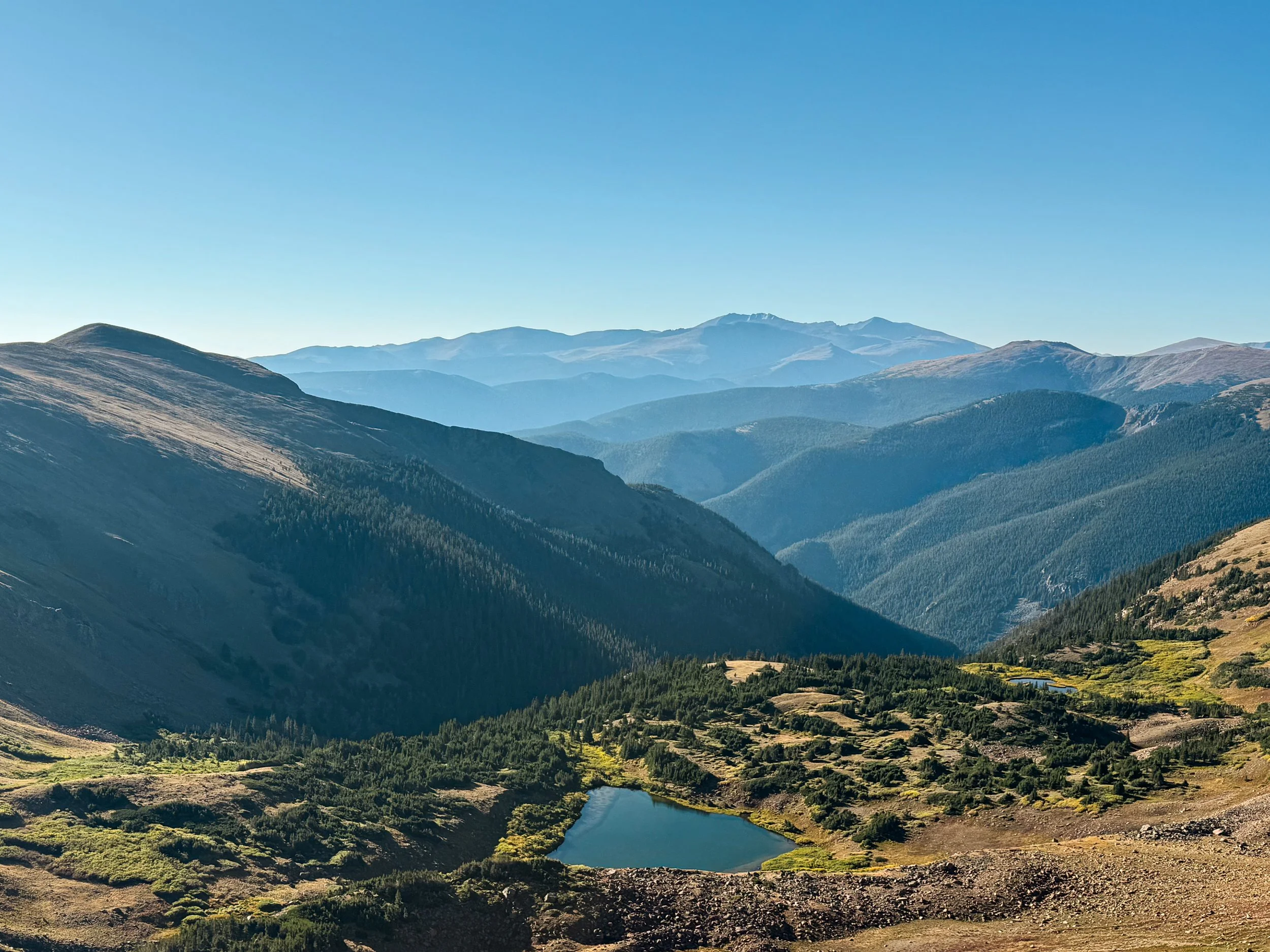
The first day out of Steamboat was idyllic, possibly the most scenic paved road walk we'd ever done, followed by miles of dirt road lined with glowing golden aspens. The sky turned itself the deepest imaginable blue as we climbed up toward Poison Ridge. We camped high on the ridge with a glorious view.
We were headed to the Neversummer range and then on to Rocky Mountain National Park and the Indian Peaks Wilderness. This is all terrain we've played in for a decade. We know these trails, we know the big loops and hidden gems, but we've never connected them all together. So, the next morning, when we caught a gorgeous, glowing, apricot sky at dawn, we were thrilled to be exactly where we were.

Those rosy fingers of dawn near Poison Ridge
The weather started to turn soon after dawn. There were storm clouds gathering around us in every direction as we skirted around some lower peaks, but nothing quite seemed to be moving in our direction. We kept one eye on them for the morning, feeling safe under the cover of the forest with little more than a light sprinkle of rain. Top of mind for us was the summit of Parkview Mountain, our first point on trail above 12k feet and also home to the steepest mile on the CDT.
Above treeline, the weather becomes a critical factor in how we make decisions on trail. Being wet and cold in any terrain can make things miserable, especially wet weather that continues day after day. But above treeline, exposed to high winds and lightning, it becomes dangerous. Storms in the mountains can be incredibly unpredictable and in Colorado, we spend a whole lot more time way, way above treeline.
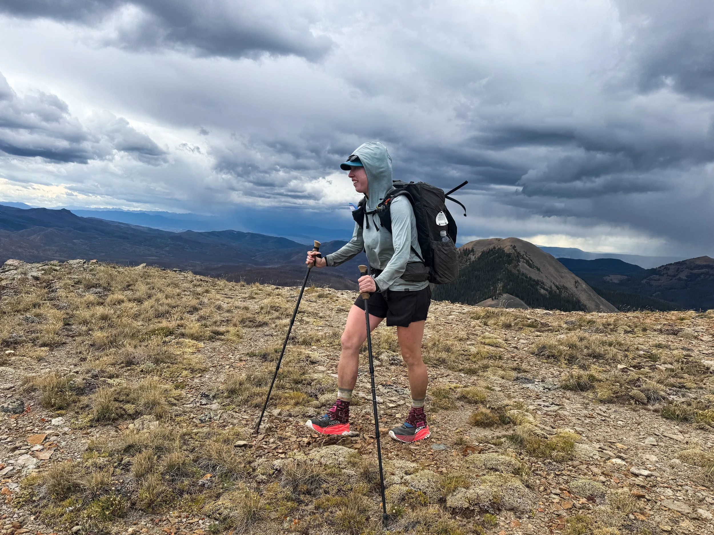
Molly hiking above treeline with storm clouds gathering behind her
Making decisions around weather as a thruhiker is also a little different than when you're just doing a day hike. When you're just out for the day, you can choose your window, choose your location, choose your weather. You can stay home if things aren't looking great. In order to complete a full thru-hike, you simply can't wait out every storm. You can't wait your way to Mexico! There's a dual pressure that's weighing against over-caution: the season isn't all that long and we only carry so many supplies at a time. We might not have enough food to add a day to our itinerary at any given time. Waiting too long can also backfire. Sometimes, the weather ends up coming in later than expected and a mediocre window turns into a no-go situation.
As we climbed above treeline, heading toward Parkview, the wind was so loud that we had to yell to be heard, even hiking 10 feet apart. We waited for a bit at the last little clusters of krummholz, trying to judge whether any of the storms were heading our way. The wind direction seemed to be in our favor. There's also a small shelter on top of Parkview (basically a plywood shack with a lightning rod). With only one mile to the shelter, we decided that we had enough of a window to make it to the top, where we could duck in and then make a decision on when to descend.

Looking back down the ridgeline of Parkview Mountain

Moody skies behind the ridge of Parkview (left)
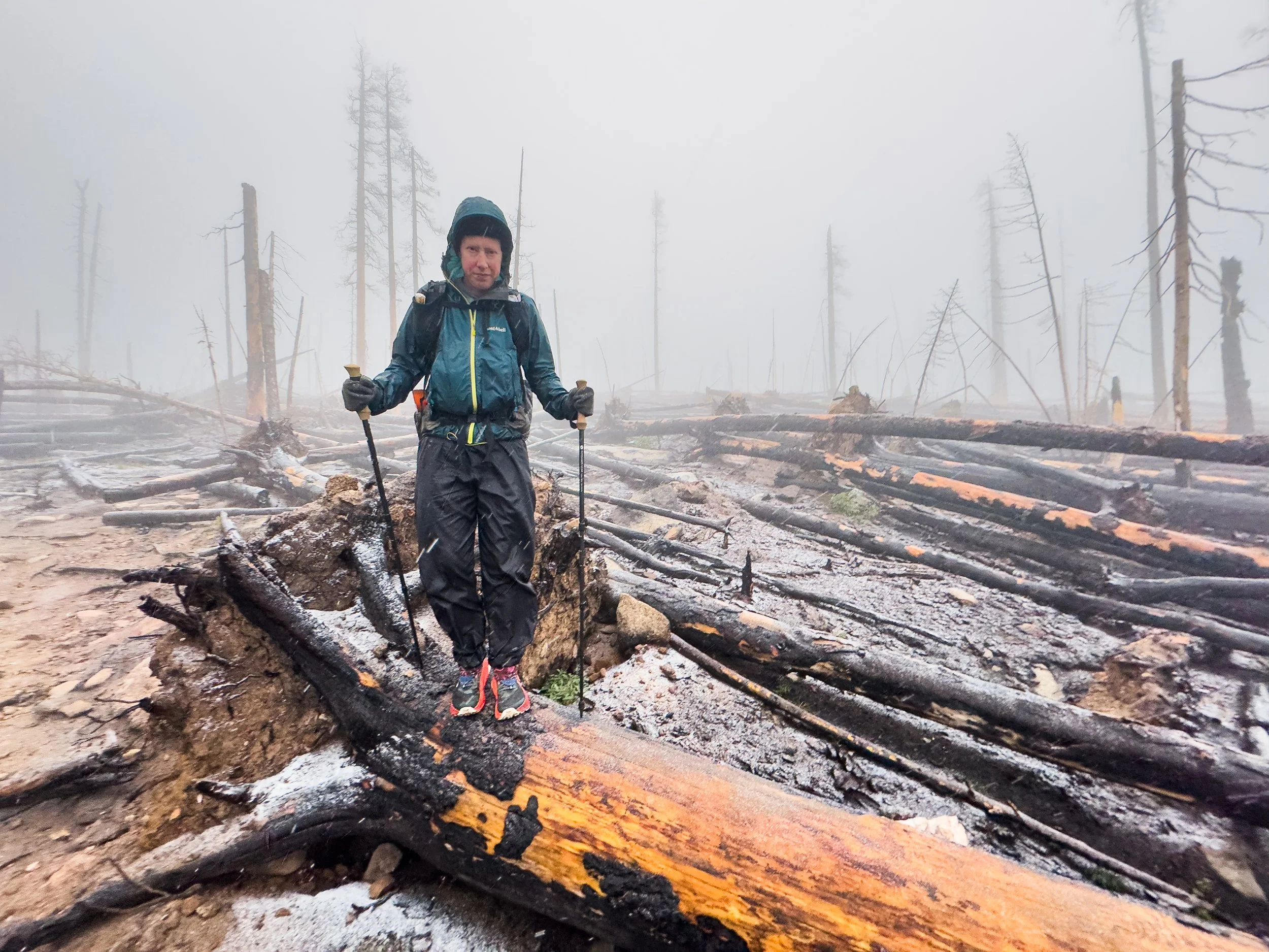
One mile is a quick jaunt. One mile is measured in minutes. One mile is nothing. But one mile with 1100 feet of ascent on near-vertical grass-wall at 12k feet does not feel like nothing when you're 20 miles into your day, have already climbed more than 5000 feet, and you're in a race against the sky. Just few hundred feet up the climb, thunder began to boom a few miles off. The wind was trying its damnedest to blow us right off the mountain, and was pushing us back down with every hard-earned step. I definitely hit my physical limit, then blew right on past it, hiking as fast as I could to try to beat the storm.
I laughed with joy and relief as we came over a ridge and watched the storm move on past. But by the time we got to the shelter, we were both cooked. I put on every layer I owned and sat on the wood floor of the shelter, leaning against my pack and staring into the void, blindly gobbling up as many calories as I could manage with my frozen fingers. The thunder still rumbled nearby, but the storm had indeed missed us by a few miles, as we'd hoped. After a few moments of rest, we peered out of our wind shelter and determined that we needed to get back down below treeline before the window was lost.
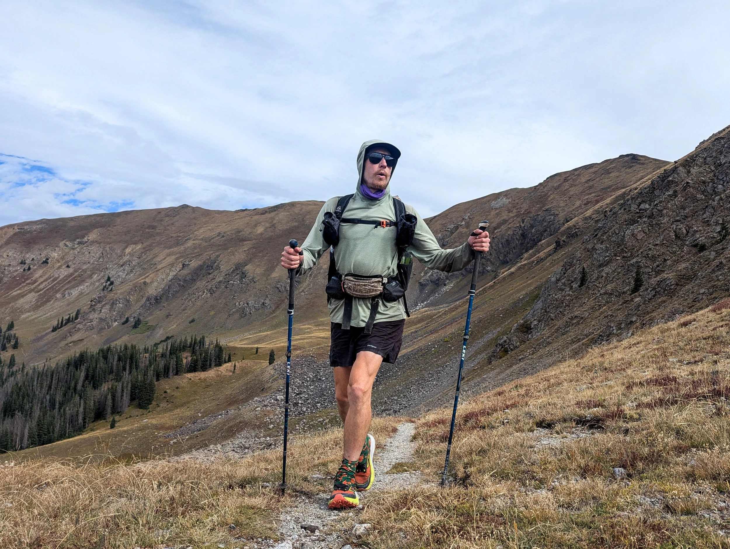
Jonathan already well above treeline with peaks still rising hundreds of feet above
After Parkview, we climbed up and over the Neversummers and headed into Rocky Mountain National Park. It rained a little bit each day between Parkview and the town of Grand Lake, and morale was already a little damp. We were able to dry things out most days, but all of our gear was starting to get a coating of mud and mildew.
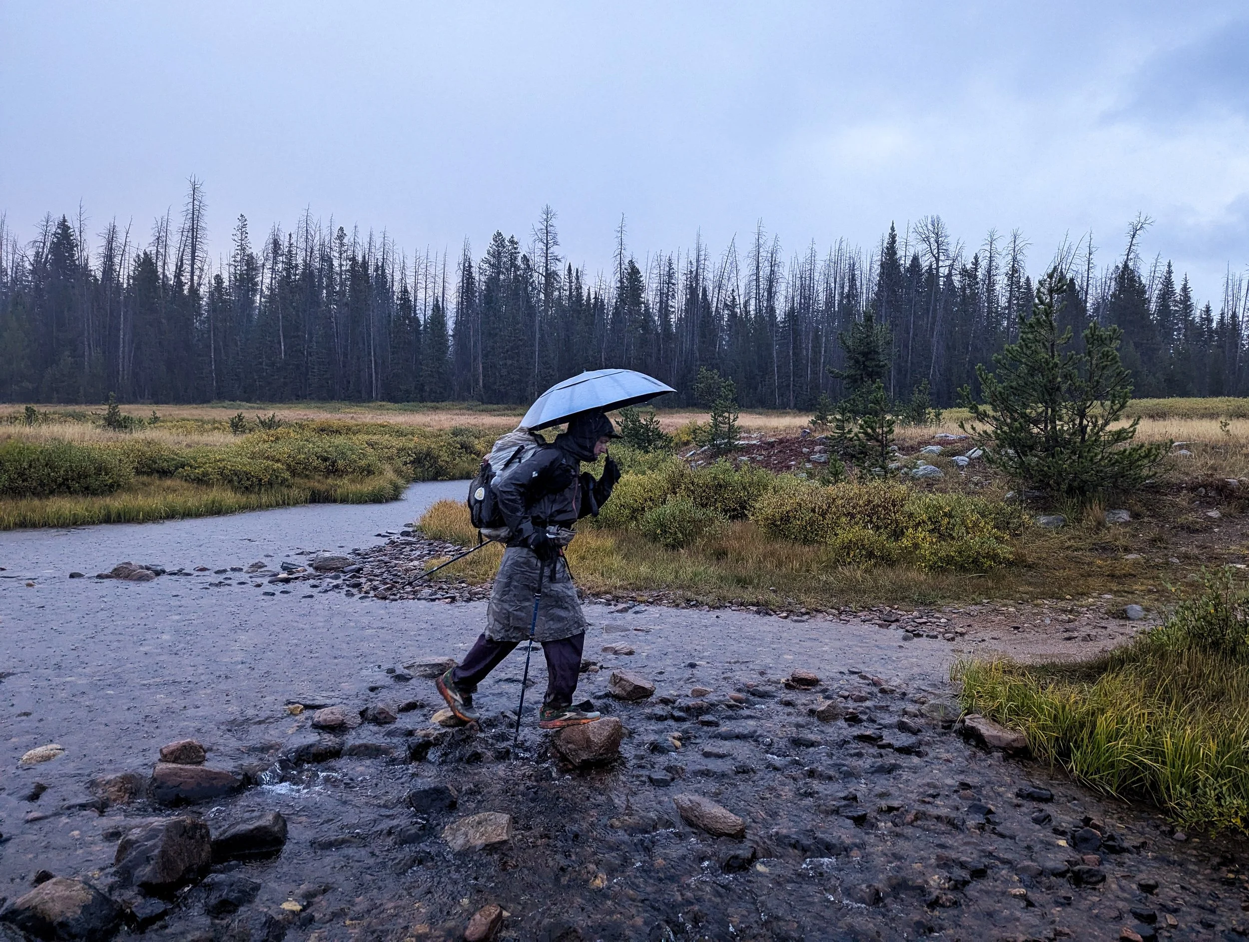
Leaving Grand Lake, we woke up to a steady rain. It was misty as we walked along the Colorado River, fresh from its headwaters on the west side of the Park. That night, it stormed again, huge thunderclaps above us as we headed for camp. The nighttime temperatures had been dropping rapidly and it was freezing cold when we got into the tent. When we woke up, it was 40 degrees and still raining lightly. Neither of us was thrilled to get out of bed, so we "slept in" until around 5:30am and ate breakfast (OK, Snickers bars) in our sleeping bags. We started walking while it was still dark and got used to the drizzle until we started to climb and that drizzle began turning to snow.
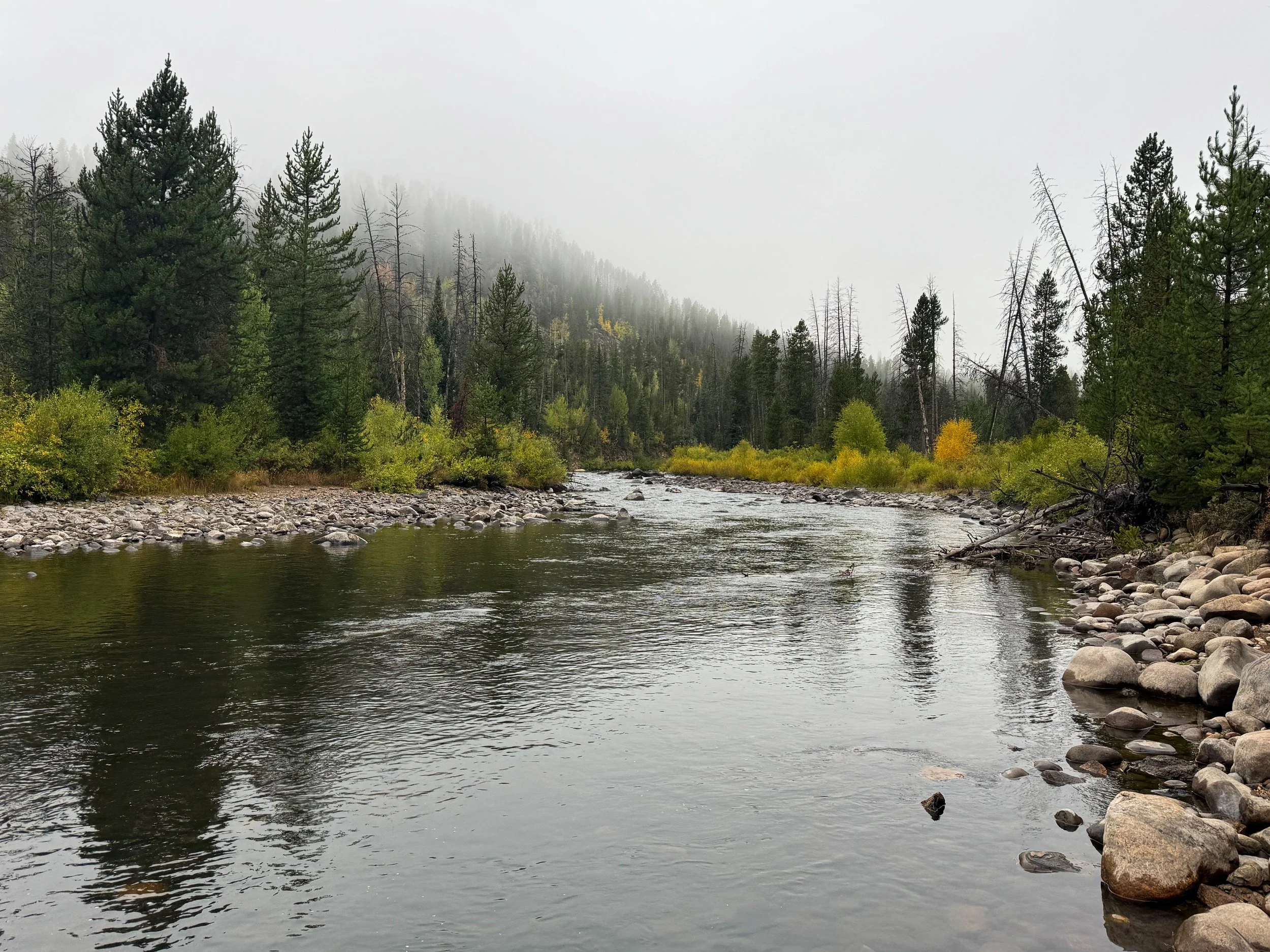
A misty morning along the Colorado River
Another thing to know about these weather decisions: there are times when the decision is about grit. About how much you can handle. And then there are times when you either have the resources or you don't. Times when carrying on is a matter of courage and times when it's a matter of wisdom. That line can be narrow, but judging it correctly can save your life.
Rain turns to snow as we climb up toward the Continental Divide
In flurries of snow, we continued to climb up past the last of the trees toward the divide and toward a very familiar trail. The High Lonesome Trail is part of a loop we've each run a half dozen times or more. But the snow was increasing and the wind was getting intense. Visibility was maybe around 40 feet. The day prior, Jonathan had lost his gloves, so by this point, he was using Molly's socks to keep his hands from freezing. Molly's sleeping pad had also sprung a leak, and the night before, she'd woken up several times to keep from sleeping on the ground. The wind was gusting 30 miles per hour and sandblasting us with ice from the west.

Rime coats the CDT trail marker on the Divide along the High Lonesome loop
We checked in, but carried on for a couple of miles, knowing that we'd have some options for a bail point down toward Boulder to the east or toward Winter Park to the west. From the point where we hit the Divide, the trail stays above 12k feet for several miles before heading even higher up toward James Peak at 13,271ft. So, when we reached the junction for King Lake, we ducked below the ridge to deliberate on the best way forward. We knew we couldn't camp up that high in those conditions, and that our warmer gear was waiting for us in the Front Range (to the east). The winter found us just a little too soon. So, we bailed. We headed down toward King Lake and then six more miles down to the Hessie Trailhead, which is about a 45 minute drive from our home in Boulder. With cell phone service just below the Divide, we made some calls and connected with our friend's dad, Phil, who generously agreed to come scoop us up from the trailhead. A few hours later, we were eating poké in a suburb of Denver where it was 76⁰ and sunny. Ah, mountain weather.
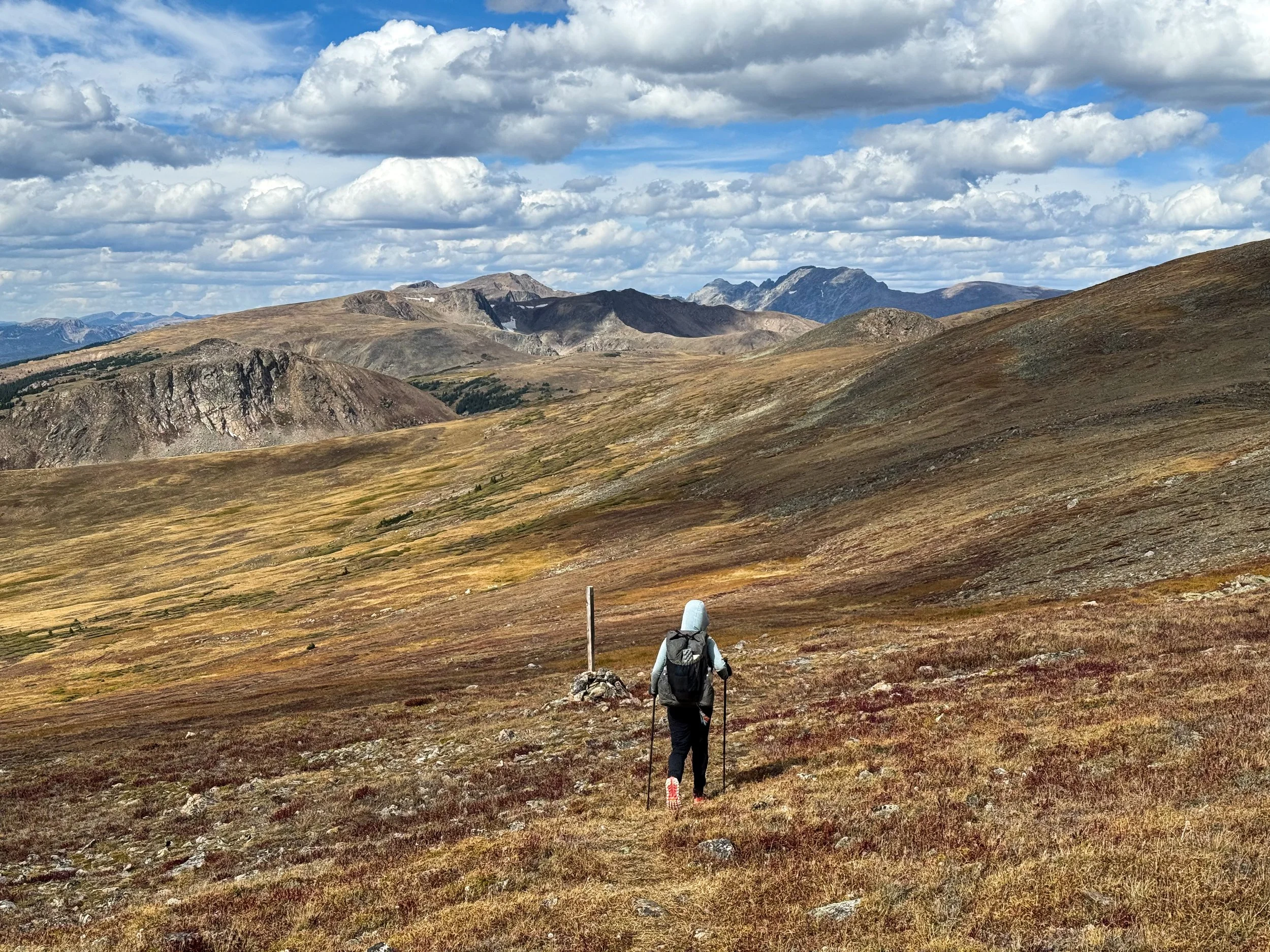
Up for the adventure, Phil kindly agreed to drive us back out the next day to finish out the section we'd planned to complete. The weather was clear and sunny when we hiked north from Berthoud Pass, equiped with new gloves, a new sleeping pad, and several additional warm layers. The snow was gone, except for a few small patches lingering in the deepest shade. In the bright sunshine, we opted for a ridgeline alternate that summited five 13k foot peaks, finally descending from James Peak to the same junction where we'd bailed the previous day. It was unrecognizable. We could see the Denver skyline, not to mention King Lake, which -- though it's right next to the trail -- we hadn't had a glimpse of the day before. What a difference one day can make.
Perfectly clear skies and stunning views, one day later
Permanent snow fields along the ridge, with no trace of the snow from the day before

Molly descends from Mt. Bancroft, heading toward James Peak
Molly walks the Divide back to the junction where we'd bailed the day prior. Snow?! What snow?!
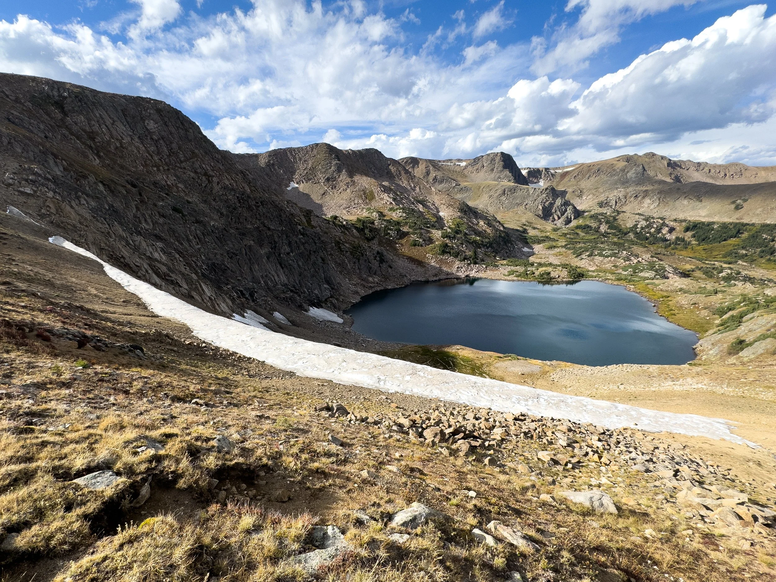
King Lake, Indian Peaks Wilderness
This September has been unseasonably wet and abnormally cold. Later on, after many days of rain and hail, I'd eventually make up several verses of a new hit song called A Wet September, to the tune of A Long December by the Counting Crows. Maybe we were starting to lose it, just a little… In spite of the rain though, we've still seen some incredible views and we're excited for what central and southern Colorado will bring. Bring it on, September!