

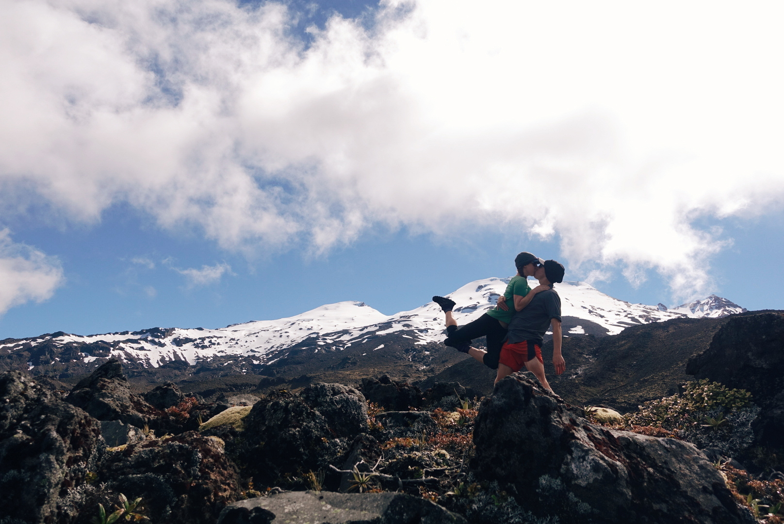
A Taste of the Tararuas
The infamous Tararuas turn out to be one of the toughest, and most rewarding sections of the trail so far.
For hundreds of kilometers, we'd been hearing about the mountains before Wellington from other hikers. "The Tararuas? That's supposed to be the hardest section of the whole trail," they'd say. Our notes cautioned us to carry extra food and be prepared to spend whole days in the huts if bad weather struck. We heard horror stories of gale force winds blowing hikers off ridgelines and many hikers were skipping the section altogether.
Needless to say, we left Palmerston North with great anticipation (and 7 bags of potato chips).
Though the Tararuas have a particularly infamous reputation, the trail only takes a quick dive into the range, about 60km (~40 miles) total. Normally, that would be about two days of hiking for us. Here, we planned for three full days while many of our peers planned for 5 or more.
We spent the first day climbing up into the range, gaining over 3000ft in elevation. The climbing was steep and muddy at times, but nothing we hadn't encountered before in Ratea forest or near Mt. Pirongia. Though it was cool and windy all day, it did not begin to rain in earnest until we reached our home for the night at Te Matawai Hut.

Heavy mist on day #1 in the Tararuas
photo/ Jonathan

Typical New Zealand "trail"
photo/ Jonathan
In New Zealand, it's common practice for wilderness signs to give approximate times for travel between huts along with -- and frequently instead of -- actual distances. This is incredibly irritating, since we tend to move faster than most hikers and regularly beat the recommended time allotments by an hour or more. However, the time frames listed can sometimes help give an idea of how difficult the terrain is expected to be. When we left our hut on day 2, a sign warned that the next 5km (~3 miles) was expected to take us 6-7 hours. Ouch!
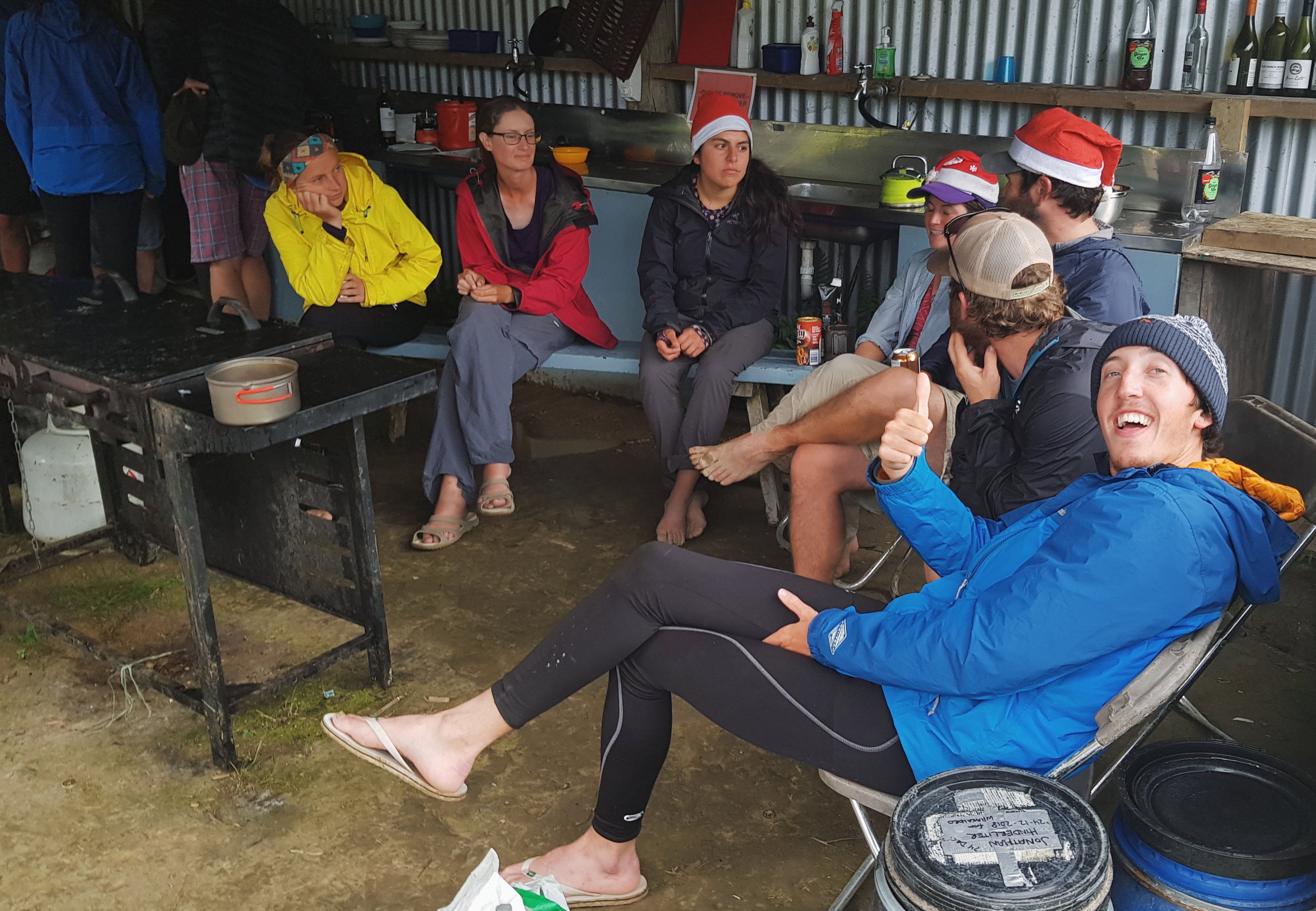
Though we didn't move quite as slowly as the sign projected, the second day in the Tararuas proved to be one of the hardest we've had on the trail so far. It took us 12 hours to do 20 kilometers (just over 12 miles). We were lucky to have great company for the day: Charlie was still traveling with us and we were also joined by another Brit, Andy, as well as an Italian, Alessio, and another American, Justin. We've rarely hiked with so many others on this trail, but the tough terrain was much more fun with a merry hiker train making jokes and swapping stories.

Hiker train!
photo/ Jonathan
Climbing up from Te Matawai, we summited a small peak, then followed a ridgeline for several miles. The ridge was narrow and instead of a rocky spine, the trail was a deep, muddy trench with steep little dips and dives and slippery tussocks along both sides. It was ridiculously slow going, plunging down into knee-deep mud with no escape.

photo/ Jonathan

photo/ Jonathan

Looking back, you can just glimpse Te Matawai Hut with it's little red roof.
photo/ Molly
As we reached the next hut, Dracophyllum, the scenery changed dramatically. We dropped into deep forest of gnarled, ancient beech. Moss covered every surface, so thick that we could plunge our trekking poles into the ground and find no resistance. The air was suddenly damp and cool, and the shade was complete, even under a bright midday sun. We breathed in the earthy smell of rain and soil and green, growing things, and felt like we had entered another realm.

photo/ Jonathan

photo/ Molly

photo/ Jonathan
Between patches of forest, we slipped and scrambled our way across rocky, sometimes muddy slopes to Nichols Hut. Te Araroa has large swaths of trail that are really not maintained as trails at all, but that remain footpaths simply because they are used by trampers. In this case, large sections of trail were completely crumbled away, so that we'd have to hold on to roots and clumps of grass as we hauled our packs up and down through gullies and over piles of downed trees. Luckily, the weather was clear and the final climb up to Mt. Crawford was a steady ascent on (gasp!) actual trail.

Heading up to Mt. Crawford
photo/ Jonathan

Charlie and Jonathan snacking it up on the summit
photo/ Molly
The final descent to Waitewaiwai Hut was ridiculously steep, like some sort of near-vertical forest obstacle course. We arrived at the hut completely exhausted, but still brave enough to jump into the freezing river to rinse off the mud.
What a day!
The final few kilometers of the Tararuas were much like the rest, but we only had one more peak to climb before reaching town at Waikanae. It was a tough section, but left us stoked for more hard mountain trekking as we came closer and closer to the South Island. Onwards to Wellington!

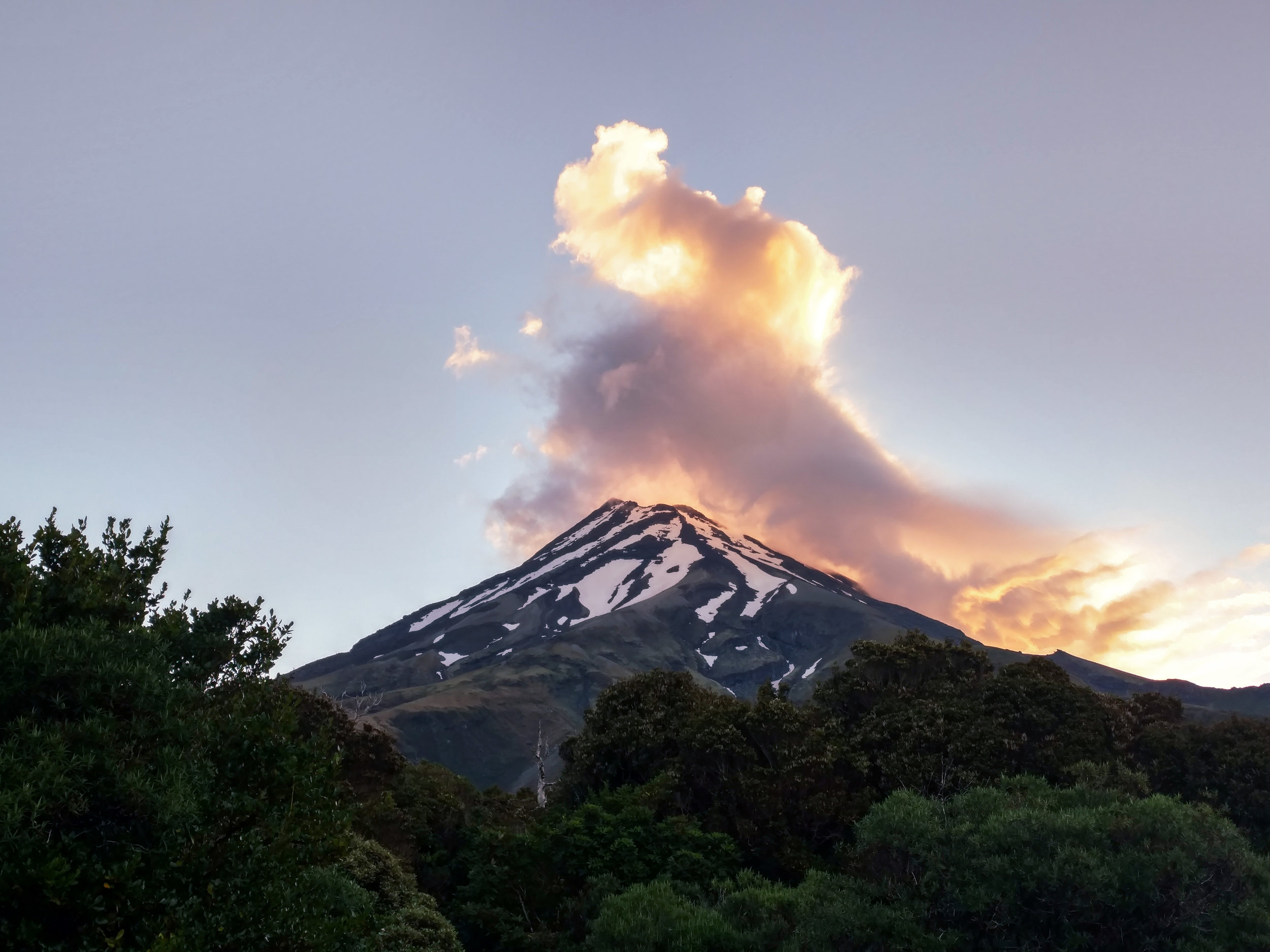
Mt. Taranaki: There and Back Again
When the prescribed trail sucks, you make your own adventure. This time it involved lots of hitchhiking and the best mountain summit we could ask for.
After the Whanganui River, Te Araroa is on paved road for nearly 100 kilometers, mainly along major highways. That's not exactly our idea of a great wilderness experience (plus, walking the roads would have meant spending my whole birthday roadwalking, and who wants that?). So, we decided to skip the whole section and take a suitable, homemade "alternate": hitchhiking 3 hours west from the town of Whanganui, climbing the iconic Mt. Taranaki (aka Mt. Egmont), and then hitching another 4 hours back south to Palmerston North, where Te Araroa heads back out onto real trail.
In total, it took us 3 hitches to get to Taranaki and 5 to get back to Palmerston North. I could probably write a whole post about each one. We've learned a massive amount from talking to locals, and we like to refer to hitchhiking as a sort of “locals roulette” where we meet an incredible variety of people with different backgrounds and perspectives. We nearly always climb out of one hitch with questions saved up for our next ride.
Our drivers on this trip ranged from mid-twenties to mid-sixties and our conversations spanned just as wide a range. One driver, a man about our age, worked as a journalist for a railway trade publication and we learned about international train infrastructure trends. In another car, our driver had a horrifying request: "Explain to me the American healthcare system,” he said. Jonathan and I just looked at each other and laughed... But we hacked our way through and in return, we learned a great deal about the very different healthcare system here.
We talked with drivers about gun rights, folk music, retirement, and gay marriage. Some of these things may seem controversial to Americans, but here, they're just not. It's pretty widely accepted here that gay people should be able to get married and that gun ownership should be regulated -- what seems to fascinate the Kiwis most is that these issues are so divisive in the States.
Our longest ride was two and a half hours with a young woman -- younger than me, anyway -- who wowed us with an extensive and articulately expressed understanding of American politics. She asked about cannabis and how it can simultaneously be federally illegal and yet also legal in our home state of Colorado (go ahead, try explaining this in a way that doesn't make our government sound completely insane). On the final leg of our journey, an older gentleman picked us up in his shiny new Jaguar. It was New Year's Eve and he was on his way to a dialysis appointment. He said wanted to get in one last good deed for 2018.
But back to my birthday, as we were hitching out of Whanganui...
It took us until mid afternoon to reach North Egmont, the town where we'd start our ascent of Taranaki and by the time we arrived, the visitor's center cafe was closed. All hope of a birthday lunch was dashed, and I was feeling very far away from home and from the people I love. If we’re being honest, I was probably more than a little hangry. It wasn't the best birthday morning I’ve ever had.
But things started turning around as my "American birthday" arrived (we're 18 hours ahead, so I casually added most of a day to my celebration). A few hiker friends showed up completely unexpectedly, and we even got some free sausage to add to our celebratory dinner of instant ramen. We had a stunning sunset to finish out the evening and went to bed early -- the alarm was set for 4am.

Halfway through a game of Spades with Troy and Sydney.
photo/ Jonathan
Sunset behind Taranaki
photo/ Molly
I love walking in the predawn hours, my whole world contained in the small circle of light from my headlamp. It was quiet, that morning; the birds had not yet sensed that day was arriving and we had the mountain all to ourselves. We reached treeline just as the first light was spilling over the horizon.

First light from the mountain
photo/ Jonathan

photo/ Troy Larson
The climb up Taranaki is steep -- over 4000 feet in just 3 kilometers (~2 miles). It felt good to be climbing, though. We huffed our way up “The Puffer” before reaching the notorious scree fields and felt a rush of relief when we finally made it to solid rock for the final scramble. When we arrived at the crater, the snow was just beginning to soften. Perfect timing! From there, we only had a short push to the small summit.

A view from The Puffer
photo/ Jonathan

Onwards and upwards
photo/ Troy Larson

Cheesin' near the top
photo/ Troy Larson

Jonathan climbing up through the crater
photo/ Molly
In the Maori tradition, Taranaki is said have fought with Mt. Tongariro over a lady mountain, Pihanga, and to have lost. In his grief, they say, Taranaki ran all the way to the west coast, leaving a deep gorge behind him that filled with his tears to form the Whanganui River (where we’d spent Christmas the week before). The mountain stands completely alone at the edge of the ocean, a perfectly conical volcano in a near-perfectly circular ring of wilderness. Far in the distance, we could see the peaks of Ngauruhoe and Ruapehu rising above the clouds.

photo/ Jonathan

photo/ Jonathan

photo/ Molly

Ngauruhoe and Ruapehu rise above the clouds in the distance, with the Shark's Tooth looming in the foreground
photo/ Jonathan
It took us about 6 hours round trip to complete the climb itself and as we shoe-skied down the scree fields, we patted ourselves on the back for waking up early. We'd had the summit all to ourselves, but a crowd of other hikers snaked out below us. We breezed down past them and made it back to the visitor's center while breakfast was still being served. Double victory!
However, we couldn't yet call our day complete. We wanted to check out some other views of the mountain, and specifically, we wanted to visit the tarns (seasonal alpine pools) where the mountain famously shows its epic reflection. To do that, we needed to hike another 12 km (~7.5 miles) over another mountain and on to the Pouakai Hut. The signs warned us that it would take 9 hours (presumably on fresh legs).
Once again, we wholeheartedly ignored the signs and set out around 1pm. The trail was muddy and steep and brutal for our already-tired legs. Nevertheless, we arrived at the tarn well before sunset. Crossing the boardwalk down to the water, we realized that the tarn was absurdly small, though it looks like a substantial lake in the many (many) Instagram photos from this spot. There was a group of tourists loitering around the tiny pool, waiting for the summit -- now cloaked in clouds -- to appear long enough for the perfect image.
With thick clouds and time to spare, we headed down to the hut for dinner. There, we met Brett and Michelle, a couple from Wellington who were hiking Taranaki's own Round the Mountain track. We sat and chatted until the sky outside began to look more promising, then hiked back up to the tarn to take our own turn waiting for the perfect shot. The sky was moody and there was too much wind for a clear reflection, but with patience, we had the chance to watch the mountain wrestle its way through the mist.

photo/ Jonathan
As the sun began to set on a long, long day, we walked back to the hut with our friends. Brett snapped a #brinsonbanksing moment for us as we reached a hill above the clouds. We climbed into our bunks that night, exhausted and at our very happiest.

photo/ Brett Halkett

photo/ Jonathan

Christmas on the River
A canoe trip down the river for Christmas? Sure, why not.
After a mad dash into National Park, Jonathan and I woke up early to catch the sunrise and call our families one last time before Christmas. It was December 23rd and for the next 5 days, we'd been told that there'd be no service at all.
We were heading out for 5 days on the Whanganui (wh pronounced as an f) and had hired a Deluxe Canadian Canoe for two. It was scheduled to meet us the following day -- Christmas Eve -- in the small village of Whakahoro, which meant we had a long, long, long day of roadwalking ahead of us. Thirty miles and many hours of podcasts later, we dragged our aching feet into camp.

#Mondayvibes
photo/ Jonathan
The next morning, we had a lovely Christmas Eve brunch at the Blue Duck Cafe with some hiker friends and met the canoes to get on the river.

We made it! Time to rest the sore feet for a few days.
photo/ Jonathan
One of the best parts of the river section for us hikers is that we don't have to worry about weight. That means we can eat (and, of course, drink) whatever we want! Almost, anyway. We left our resupply with the canoe company back in Tamarunui before the Tongariro Crossing and Round the Mountain tracks, so we couldn't have much in terms of fresh foods. However, we made the most of the boats by adding heavy refreshments like juice, almond milk, canned soup, and coconut cream to add to our curry.

Molly re-learning to steer a canoe after 20 years. Just like riding a bike!
photo/ Jonathan
Christmas Day was an extremely festive 55 degrees and raining. We sang several classic carols like "I'm dreaming of a wet Christmas," and "Paddling through a Winter Wonderland." In spite of the rain, however, spirits were high.

We're smiling because there's so much food and beer in those barrels.
photo/ some rando on the river
When the rain stopped, we had a... relaxing paddle down the river. Here's Molly hard at work in the front of the boat:

photo/ Jonathan
Christmas dinner consisted of canned Thai pumpkin soup, which we ate around a picnic table with two couples: two Brits and two German ladies, all of whom we'd just met the day before. We camped with a bunch of other hikers and stayed up drinking until all hours of the late evening (like... 9:30pm).
Charlie looking extremely festive with a bunch of other beautiful hiker trash
photo/ Jonathan
Luckily, the weather was much better for the final days of the trip and we loved getting to see the bush from a new perspective. We even found some unique New Zealand artifacts like pumice rocks so light that we'd find them floating down the river next to our canoe.

photo/ Jonathan
"What else floats in water?"
"...very small rocks?"
photo/ Jonathan
While there were rapids throughout the first days, I'd estimate that on day 4, we probably paddled about 40% of the time. There was a lot of extreme relaxation happening -- suitable for a Christmas holiday, I suppose, but we're not really much good at doing nothing. By the end of day 5, we were pretty ready to be done with the river. The Whanganui was a beautiful section of trail and it was great to rest our legs. But at the end of the day, I guess we just like to walk.

photo/ Molly
photo/ Jonathan

Charlie and Jonathan celebrating our arrival in the city of Whanganui
photo/ Jonathan

Round the Mountain
Let's take a side trip off trail around a massive, beautiful volcano.
Mt. Ngauruhoe may be New Zealand's most famous mountain (explanation here, in case you missed our last post), but it is not the largest or most impressive. In fact, its closest neighbor, Mt. Ruapehu, is over 1000 feet higher and far more massive. Ruapehu's highest peak, Tahurangi, stands at 2797 meters high (around 8400 feet) and boasts the North Island's only glaciers (so it is snow-capped year round). It is also still a highly active volcano; the last large eruption occured in 1996, but several smaller eruptions and lahars (large volcanic mudslides) have happened since.

photo/ Jonathan
Though we're here in New Zealand to hike Te Araroa, we've also flown halfway around the world to get here -- we're not about to miss out on amazing sights just because they're off of the defined route. Case in point: the official trail spends only one day (30km or so) in Tongariro National Park. How could we not want to explore more of this amazing place?!
The Round the Mountain track begins where the Tongariro Crossing ends, in the village of Whakapapa. It traverses between Ngauruhoe and Ruapehu, bends south to cross the Rangipo desert, then passes through deep beech forests high on the southern slopes of Ruapehu and crosses the epic Waihianoa Gorge. In total, it is just under 70km (~44 miles) of tough, remote terrain.
The suggested time frame for the hike is 4-6 days, so naturally, we decided to do it in 2...
NOTE: If you happen to be another hiker or traveler who's interested in adding this loop to your trip, I've added a bunch of extra info to the end of this post, including some links and resources that we found helpful, as well as some tips for TA hikers, specifically. Scroll down to check that out or read on to hear about our adventure!
The forecast for our side trip was mixed, but it looked like with a little luck, we might finally get a good look at Ruapehu, which had been hidden in the clouds since we arrived. We set out early from Whakapapa and the trail up to Waihohonu Hut was glorious. Though Ruapehu remained cloaked, we did get a couple more good looks at Ngauruhoe from the south.

photo/ Molly
As soon as we left Waihohonu Hut, the trail turned toward the Rangipo Desert and the landscape began to change. The alpine scrub thinned until we were left in a sea of rock and sand.

photo/ Molly
The desert was surreal after so many miles of dense, wet rainforest. And looking out across the undulating dunes, it was nearly impossible to guess how far we had come or how far we had yet to go.

photo/ Molly
After Rangipo Hut, the track climbed higher up into the mountain gullies, wrought from sharp, black volcanic rock. In the clouds, there were no sounds but the wind and the crunch of our footsteps.

photo/ Molly
In one valley, we found signs reading "EXTREME LAHAR DANGER." They cautioned us to move quickly through the next kilometer and not to pass through if we heard rumbling from above. A lahar is a massive mudslide caused by volcanic activity and the area was overdue. Definitely adds a little spice to constantly be reminded that you're hiking across an active volcano!
The valley was also insanely beautiful, with bright orange mineral deposits against the opaque, ice blue river. Jonathan lived dangerously and paused to snap a quick photo of me crossing a narrow suspension bridge. One person limit!

photo/ Jonathan
The end of the desert comes suddenly; a dense wall of beech forest seems to materialize from nothing, flowing upwards toward the summit over the bare lava. It is cool and shady under the trees and the trail is soft underfoot. Moss covers every surface and dampens the sound, so the world becomes quiet. I felt as though I should whisper.
It was raining as we crossed the boardwalk to our hut that evening, Mangaehuehu.

photo/ Molly
Day 2 was much clearer and the summit came out as we climbed Ohakune Mountain Road. The descent into the Mangaturuturu Valley was one of the most stunning parts of the hike. Everywhere around us, waterfalls poured from the cliffs and tumbled into cold, clear pools. And Ruapehu towered above.

photo/ Jonathan

photo/ Molly

photo/ Molly
The final push toward Whakapapaiti Hut brought the gnarliest trail of the route. The track itself was washed out into a 4-ft deep trench filled with slippery mud. We climbed through thick, high grasses and did our very best to stay vertical, hopping between rocks and holding on to bushes as we clambered up and down the steep gullies.
Our adventure ended with a bit of a race as we met up with the official TA again. Low on food, we needed to resupply in National Park before heading toward the Whanganui River for our canoe adventure. With the shop closing at 7pm, we thrashed our way through the brutal swampy terrain, each slipping and falling in the murky water more than once. But we managed to run the final 12 kilometers in under two hours, still, and made it to the shop with time to spare.
We rewarded ourselves with burgers and ice cream at the local dairy.
photo/ Jonathan
Ruapehu Round the Mountain Info for Hikers:
There are a few things that you need to know about this route before you head out. First, the piece on the Great Walk (between Whakapapa and Waihohonu Hut) is really quite mellow, but the rest of the trail gets a lot gnarlier. You may not go quite as fast as you think you will.
Second, remember that Waihohonu requires booking in advance -- it doesn't really make sense to stay there, anyway, but if you do, make sure it isn't booked up. Your hut pass won't apply there.
Finally, we used a bunch of resources to plan our trip, but the most helpful addition was this app for Android called NZ Topo Map. There's another one with a really similar name that we tested and that was totally useless, so make sure you get the right one! Iphone users may have more options -- if you use one you love, please add a link in the comments!
Here are a couple of other links to resources with detailed descriptions of the routes:
- The DOC site for Round the Mountain. Note that they don't include the ~3km or so ON the road in the totals (just up to and away from the road), so it's actually a bit farther than you think between the Mangahuehu and Mangaturuturu huts and there's a bunch of extra elevation gain.
- This ultrarunning site gives decent descriptions that add some additional terrain info and was the only place we could find info about the total elevation gain (~2000 meters).
- Michael Deckebach's blog is where we first found out about this trail and he has some additional info about this and other alternates for TA hikers.
If you decide to go clockwise, like we did, the hardest terrain is toward the end of the loop. However, there are some advantages for TA walkers in doing it this way: instead of going all the way back into Whakapapa, you can head out to Whakapapaiti hut and rejoin the TA as it passes out toward National Park.
One final note: everyone will recommend to you that this route should be done in 4-6 days. For us, doing it in 2 days (~35km each) worked out just fine. Be smart about your own fitness level and comfort, but if you're a fit hiker used to doing big miles, you may not need to plan quite so much time for the side trip.
Enjoy your hike!

Doomsday
And now, what you've all been waiting for... Mt. Doom!
And now, what you've all been waiting for...
Mt. Doom!
Or, more appropriately, Mt. Ngauruhoe (pronounced "na-re-HO-ee").
The famous mountain sits along the Tongariro Crossing, a well-traveled trail that makes up part of the Great Northern Circuit, one of the Great Walks that we’ve talked about in other posts. The Crossing is a high alpine route that passes through some of the most spectacular terrain on the North Island, topping out around 1850 meters (~5500ft). Mt. Ngauruhoe itself, famous -- of course -- for its role as Mount Doom in the Lord of Rings films, towers above the track at 2291 meters (~6900 ft). The trail also offers stunning over colorful alpine lakes and traverses the stark, barren volcanic landscapes used to craft the forbidding world of Mordor.
Charlie, Jonathan, and I left the Tongariro Holiday Park around 5am, just before first light, and as we reached the northern trailhead for the Crossing, a cold rain began to fall. We climbed through an eerily quiet forest as the rain clouds settled in above us and the temperature began to drop. Above treeline, where the wind whipped across us, we took refuge in an abandoned hut to discuss whether it was safe to continue upward. This is the unglamorous part of being in the mountains: shivering in a drafty hut with goat poop on the table and trash in the corners, doing pushups to stay warm.

Charlie, a British hiker we met a few weeks back, getting a spectacular view of the clouds.
photo/ Jonathan

Trying to stay warm in a very drafty hut while the deluge continued outside.
photo/ Jonathan
With only a few kilometers to go before the high point of the trail and another hut (a maintained one) waiting for us on the other side, we decided to make a go of it.
We soon warmed up again as we made the steep climb to Blue Lake, and as we rounded a corner into the large crater, the rain lightened and the clouds began to lift. Though not exactly ideal, our wet weather did have its upsides: When the sun is shining, tourist buses bring hundreds of novice hikers to flood the trail in a giant train heading north. Our rainy forecast had caused park rangers to cancel the bus services and by the time we saw another hiker, we had nearly reached the trail's high point. In total, we saw maybe 50 people on the trail that day, which seemed like a lot to us until we saw photos of the trail from the day before. When the sun was out, the crowd was -- quite literally -- 10 times as large.
The climb to the Crossing's high point is steep and scree-covered, but it offers phenomenal views out over the Green Lakes, which stand out in seafoam against the reddish volcanic soil. As we reached the top, with Ngauruhoe looming above us, the clouds that had shrouded the summit all morning cleared away. We had a glorious, if suitably moody view of Mount Doom and the Red Crater.

Charlie presses on toward the high point, with no one else in sight.
photo/ Jonathan

photo/ Molly

At last, we reach our goal. The epic views of Red Crater and Ngauruhoe.
photo/ Jonathan

Obligatory selfie in front of Ngauruhoe (Mount Doom).
photo/ Jonathan

Mount Doom seemed like a cool place for a #brinsonbanksing moment.
photo/ Charlie
We had intended to summit Ngauruhoe, but with storms brewing for the afternoon, we decided to play it safe and head down off the mountain. But obviously not before we did some LOTR reenactment...

"Come on, Mr. Frodo. I can't carry it for you, but I can carry you!" -Samwise Gamgee
photo/ Charlie
Ngauruhoe may have achieved international infamy as Mount Doom, but when you see it in person, it's actually dwarfed by a massive neighbor, Ruapehu. With a little window of time to spare before our date with the Whanganui River, we decided to trade a summit of Ngauruhoe for two days circumnavigating Ruapehu on the Round the Mountain track. More on that, coming soon!

One last look back at Ngaruhoe as we descend off its flanks.
photo/ Jonathan

The Wilderness Begins
As we moved south out of Hamilton, we found ourselves climbing Mt. Pirongia, doing our best to avoid hellish hoards of BlackBerry bush thorns, and hiking the lovely Timber Trail.
South of Hamilton, Te Araroa leaves the city streets and -- after a few hours of farmland and gravel road -- the steep climb up to Mt. Pirongia marks the beginning of real, sustained wilderness.
The bush on Pirongia is stunning; more open and airy than the Northland bush. Toward the top, the forest gives way to a dense, tall scrub (maybe 8-10 feet high) that creates a tunnel overhead. The peak itself is the highest point yet and it feels noticeably more alpine than anything we've seen so far. We made it to the mountains!

Heading up Pirongia, the sunlit forest covered in vines.
photo/ Jonathan
We reached another milestone just after the summit of Pirongia, as well: our first DOC hut. New Zealand has an extensive system of backcountry huts maintained by the Department of Conservation. We bought a 6-month backcountry hut pass for $92 NZD (~$65 USD) that covers nearly all of the huts on trail (No more paying for camping everywhere! Hooray!). The huts are more and more common the farther south we go, so we'll rely heavily on this pass, moving forward.
Pahautea Hut, our first one, is relatively new and quite large with space for 20 or so people in bunks and another 5-6 tent sites outside. There's a tap with potable water there and three "long drops" (the kiwi word for a privy). The hut has a large common space with cooking areas and long tables. It also has a wrap-around porch with a spectacular view out over the bush. For backcountry accomodations, the hut was pretty darn swanky.

Sunset from the porch at Pahautea Hut.
photo/ Jonathan
The DOC huts become gathering points for hikers and there were about 15 other TA walkers at the hut with us (the largest group we've seen so far). When we told the others that we planned to do 50km+ the next day, we got a few scoffs because of the tough terrain. But of course, nothing makes us want to do something more than someone telling us we can't...
Around 9am the next morning, we checked our progress and realized that the first 3km (~2 miles) had taken us nearly 3 hours. The mud was deeper and wetter than Ratea in places, and the climb down from Hihikiwi (a small summit after Pirongia) was steep and very slick. In spite of the slow start, however, we still made it to camp by dinnertime. First 50km day, complete!
But that most certainly wasn't the end of it; there was a lot more sufferfest to come.
After resupplying in Te Kuiti, we headed out of town on a poorly maintained trail covered in blackberry brambles. It was narrow and eroded, often leaving no more than a few muddy inches trying their damnedest to send us sliding down toward the river below.
In the morning, spider webs crowded the trail and -- since we desperately needed our poles to keep us on the mountain -- there was no protecting our faces from getting coated in sticky strands. Oh yea, and it was pouring rain. Of course. We deemed the section "blackberry fucking spider hell" and got through with a little blood and a lot of cursing.

This waterfall makes the trail here look much nicer than it was, but it's the only photo we've got of the whole section. Alas, no photos full of blackberry thorns and spiderwebs.
photo/ Jonathan
Thankfully, we had some good trail to look forward to in the following days. The Timber Trail is a popular cycling track, so it is wide, well maintained (and drained), and has a mellow grade throughout. It also passes through stunningly beautiful forest and on our first morning, we wandered through misty, moss-covered trees under a sunrise that turned our world bright green and gold.

Morning light on the Timber Trail.
photo/ Jonathan

Pristine trail in an other-worldly forest? Yes please!
photo/ Jonathan
We sped along with smooth trail underfoot, easily knocking out another 50km+ day (that's 30+ miles for you Yanks) and crossing our 1000km mark, too! Sometimes it's nice to just open up and hike big miles.
The Timber Trail also made for some scenic miles with neat features, including several huge suspension bridges and an old railway tunnel.

141 meter suspension bridge! So cool.
photo/ Jonathan

The track follows an old railway grade, sometimes carved through the rock with walls covered in moss a foot deep or more.
photo/ Molly

A perfect morning.
photo/ Jonathan
The Timber Trail would be an amazing addition to any New Zealand adventure by foot or by bike. So, check it out if you have the chance! End to end, the cycle track is 84km (52 miles), and we were passed by some cyclists riding it in a day. Here's some more info on the Timber Trail, in case you'd like to visit.
And finally, just because this trail never ceases to surprise us and because we have nowhere else to put these amazing photos....

We met an ostrich!
photo/ Jonathan

And Jonathan communed with it.
photo/ Molly
Up next: we check out the one and only Mount DOOM!

Not All Zero Days Are Created Equal
We may not have hiked for three days, but that doesn't mean we didn't have an adventure.
There's not much between Auckland and Hamilton but a lot of road walking and a lot of muddy, swampy, overgrown trail. But there were a few oases: the odd, but extremely welcoming Podge's Place in a small town called Mercer and the Rangiriri Pie Shop with giant homemade meat pies. (Meat pies are not common in the states, but they're everywhere here and we've come to love them as a town-day delicacy).
And this is how the blogs get written.
photo/ Jonathan
Podge's Place is quite possibly the strangest bar I've ever entered, but they let hikers camp for free in the backyard and charge $10 NZD (~$7 USD) for a hiker-sized burger and fries. They also have free showers and free WiFi, which is hard to come by here. Definitely worth a stop!
We were looking forward to a visit with friends in Hamilton as we walked south along the highway. We texted Michael to let him know we'd arrive the next day and he offered to pick us up that night. It's easy to forget how slowly we move on foot (and how circuitous our routes can be) -- he was only 20 minutes away by car.
Michael kindly agreed to give us another shuttle so we could slackpack the section between Huntly and Hamilton the next day. The "trail" out of Hamilton was a beautiful city bike path along the Waikato River. Walking on pavement is never ideal, but the scenery was lovely and the miles went by quickly.
Along the Te Awa River Ride.
photo/ Jonathan
After a quick stop for fried chicken and chips (fries, of course), we headed up toward the Hakarimata Summit.
And I mean straight up.

The trails here are generally either insanely rough or insanely built up. This giant staircase was nearly a mile long and climbed over 1000ft.
photo/ Jonathan

photo/ Molly
After a 40km hike (~25 miles), the nicest thing in the world is to be picked up and brought home for showers and home cooked dinner. Amazing! But to make this even nicer, we made a quick stop on the way home: we picked up a car that Michael offered up for an impromptu adventure. Road trip!

Jonathan learns the basics of righthand drive. Go ahead, just try to do it without turning on the windshield wipers instead of the turn signals. Just try.
photo/ Molly
Michael also offered up two mountain bikes, and we could hardly believe our luck. Who would say no to that?! We'd never mountain biked before, but we were both stoked for the challenge. He sent us straight to Rotorua, an area that's famous for it's volcanic activity in addition to it's world class bike park.
Much like Yellowstone, Rotorua has heated pools, boiling mud, and even geysers. It also has groves of California Redwoods that were planted there a hundred years ago. We got up the next morning and headed straight for the trails.
Other than a quick break for our scenic picnic lunch, we biked until our hands were cramping and all we could think about was our next meal. Sweaty and dusty, we rode back to the car to plot our next move.

photo/ Jonathan

photo/ Molly
If you ever go to Rotorua on a budget, there are a lot of attractions that are really (really!) pricey. But just south of the bike park, we found a free way to revel in Rotorua's thermal resources.
Kerosene Creek is down a short dirt road just off of the highway. There's a small pull off and a few cars were already there, but as soon as we stepped onto the (very) short trail down to the water, we could smell the sulphur. The whole creek is the temperature of a hot tub and there's even a hot waterfall. The perfect way to relax after a day on the bike. (More info here, in case you want to visit!)

Hot waterfall!
photo/ Jonathan
We stayed the night in Rotorua before heading back to Hamilton the next day to see Amy, who was just arriving back from a trip to Cambodia. We ate a luxurious breakfast in town and then took a brief detour to Hanurama Springs on our return journey for one last stroll through the redwoods.

photo/ Jonathan
photo/ Jonathan

Jonathan staring down into the 45 ft deep Te Puna-a-Hangarua at Hanurama Springs (more info here).
photo/ Molly
After 3 glorious days, it wasn't easy to pack up and leave. The only critical thing we forgot? Well, we never took a single picture with Michael and Amy. Means we'll just have to go back to visit again!
Thank you so, so much to Michael and Amy for all of your amazing support and for sharing our stoke for adventure.
Welcome to Auckland
We enjoy city luxuries, but we appreciate them best when they are the exception, rather than the rule.
As you hike toward Auckland, you slowly begin to see the signs of the city. Towns get closer together and more affluent; the traffic is a little steadier. (And you might go an hour or two without seeing a sheep.)
Te Araroa follows the east coast beaches into Auckland's North Harbor. Occasionally, you leave the beach and walk along city sidewalks through suburban neighborhoods that look like they could be anywhere in the world.
Jonathan and I walked into the city in the pouring, sheeting rain. Huddled under the overhang of a parking garage and just feet from the "trail" along the beach, we got online and looked up the local fare. A few blocks away, we found a likely candidate: a Turkish kebab shop with one dollar sign and 4.5 stars.
Watching the rain on the pavement outside, we ate our kebabs and decided to take full advantage of the weird world of city trail. We walked outside and caught a bus to the mall. Yep, that's right, to the mall.
A day earlier, Jonathan's phone met an untimely end in the ocean, and we each had some gear to sort out. He needed a new rain jacket; I'd broken one of my trekking poles and lost a spoon. Cities make these things surprisingly easy.

View of the harbor and downtown Auckland as you arrive via a ferry.
photo/ Jonathan
As it turns out, the city brings with it many luxuries. Our wonderful friends, Abi and Sarah, were gracious enough to let us stay two nights with them in an actual bed with actual sheets and actual pillows. Luxury, I tell you! They also made burritos (luxury) and in the morning, I sat around as long as I wanted and drank french press coffee in clean clothes (triple luxury).
Being on trail has a way of making everyday things feel indulgent. Yet it hardly makes you want to go back to a life where you can indulge every day. You always know, in the back of your mind, that these things bring pleasure exactly because they have become extraordinary.

photo/ Molly
Over the course of our stay in Auckland, we ate Indian food, made giant salads (anti-scurvy safety precaution), ate a whole chicken in one sitting, downed an ample supply of coffee, and even got ourselves some culture: we visited the Auckland War Memorial Museum to learn about the history of the Maori people (native New Zealanders). We also slackpacked 8 miles because, you know, we missed walking... ("Slackpacking" is essentially just walking trail miles without a full pack weight).

The view from atop Mt. Eden.
photo/ Molly
As a side note: The War Memorial museum is nearly on the trail and I'd strongly(!) recommend it to anyone planning to thruhike (or just to visit Auckland, in general). It's $25 for adults and they have a free walking tour that you can just listen to on your cell phone. Super neat!

Sheep in the city. Who knew?!
photo/ Molly
And though there were many parts of the city that were wonderful, hiking through the city had it's discomforts, too. The Auckland suburbs drag on forever, and the pavement is tough on tender feet. More than anything, though, we felt out of place in the city -- like the city didn't want us there at all.
At the end of a long day leaving Auckland, we realized that our destination for the night was not -- as it stated in the trail notes -- 0.9km (0.5 miles) off the trail. It was 9km (5.5 miles). With sore feet and darkness falling, we weren't going to make it. Instead, we looked around at the city park and pitched our tent in a patch of trees. Sleeping in the park sure isn't glamorous, and it's probably (?) not legal, either.
After a restless night, we woke up early and quickly packed up our tent. While we sat on a park bench eating breakfast, a group of suburban moms dressed in bright, clean colors trotted past on their morning jog. Though it was not yet 7am, we walked out of the city past commuters sitting in bumper to bumper traffic.
The city was good to us, but we were glad to be walking out of it, too.

Hikertrash in the big city
We, the dirty hikers, who own naught but what we carry on our backs, who walk everywhere we go, stand in stark contrast to the hustle and bustle of Auckland.
We are thru-hikers. As such, we spend most of our time in the wilderness. Te Araroa, however, isn’t your average backpacking adventure.
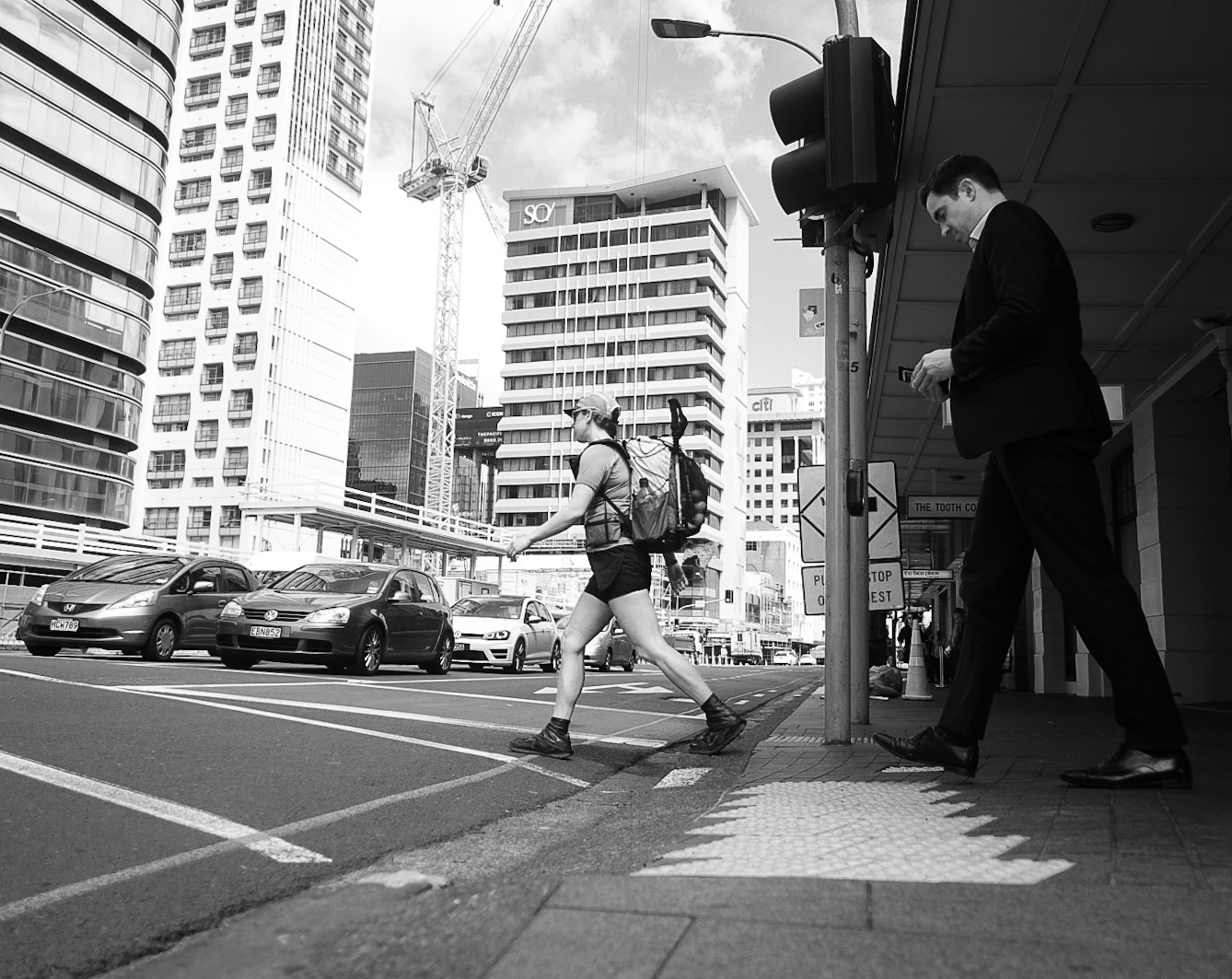
The city of Auckland, New Zealand’s largest city, is at a geographic bottleneck in the country. The city spans the entire width -- from ocean to ocean. So in our journey to hike the length of the country, our lot is to hike straight through this grand city.
We, the dirty hikers, who own naught but what we carry on our backs, who walk everywhere we go, stand in stark contrast to the hustle and bustle of this metropolis. We are not fashionable. We are not groomed. We don’t exactly hustle or bustle.
I took a few photos to document this contrast.
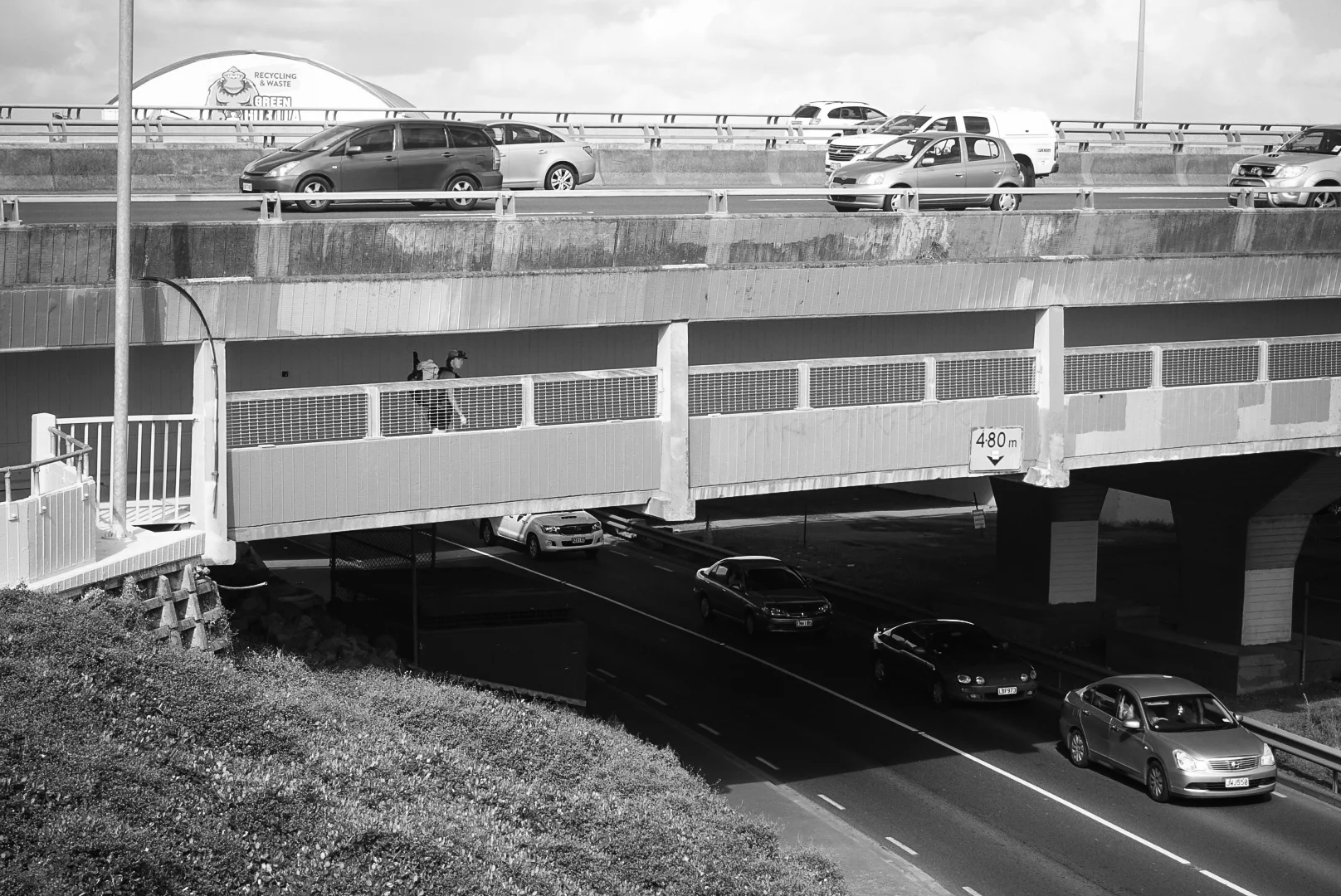
Can you spot the hiker trash?

"...nothing very bad could happen to you there." - Holly Golightly
Just another morning commute.

We pave over the forests and build our own. But after the wilderness, walking through the city feels like trespassing in a world we don't belong to anymore.

Northern Highlights
The Northland was a bit of a logistical nightmare at times, but it had also had some crazy highlights. Here's our "best of" for the Northland.
Although the Northland was a bit of a logistical nightmare at times (as I wrote about here), it had also had some crazy highlights. Here's our "best of" for the Northland:
The Riverwalk
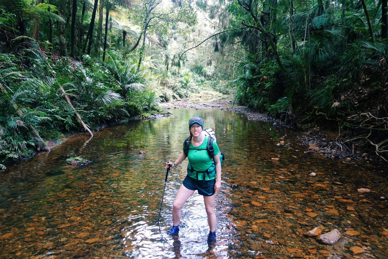
One of my favorite sections of trail so far has been the Papakauri stream, a 3km (~2 mile) riverwalk -- no trail but the stream itself. The Papakauri is only about shin deep in most places, but it was magical to wander through untouched forest by way of the water. Even in the wilderness, trailbuilding reveals the human impact, but through the riverwalk, the only signs of human life were infrequent trail markers that reassured us we were moving in the right direction.
photo/ Jonathan
Puketi Forest & Tane Moana
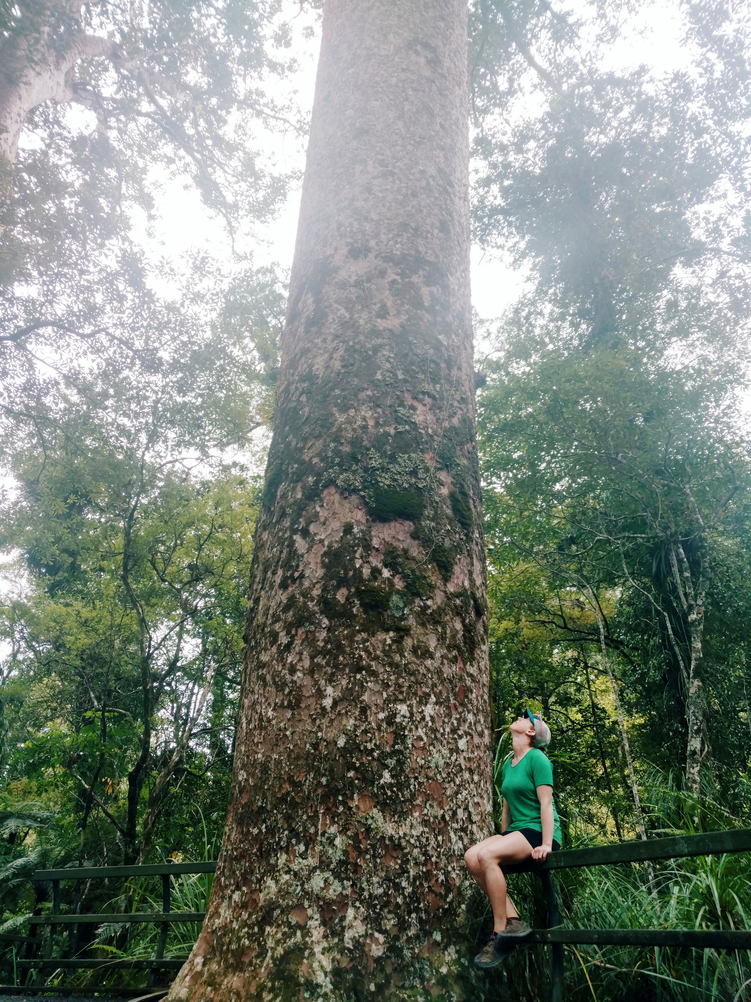
In man places -- including the Riverwalk -- the bush is dense and jungle-like, but in a few places, we've been lucky enough to visit some particularly unique New Zealand terrain: the Kauri forests.
Kauri (Agathis australis) are found only on New Zealand's North Island. They're massive conifers reaching up to 150 feet tall and up to a whopping 48 feet in girth. The oldest surviving tree is estimated to be 1500 years old.
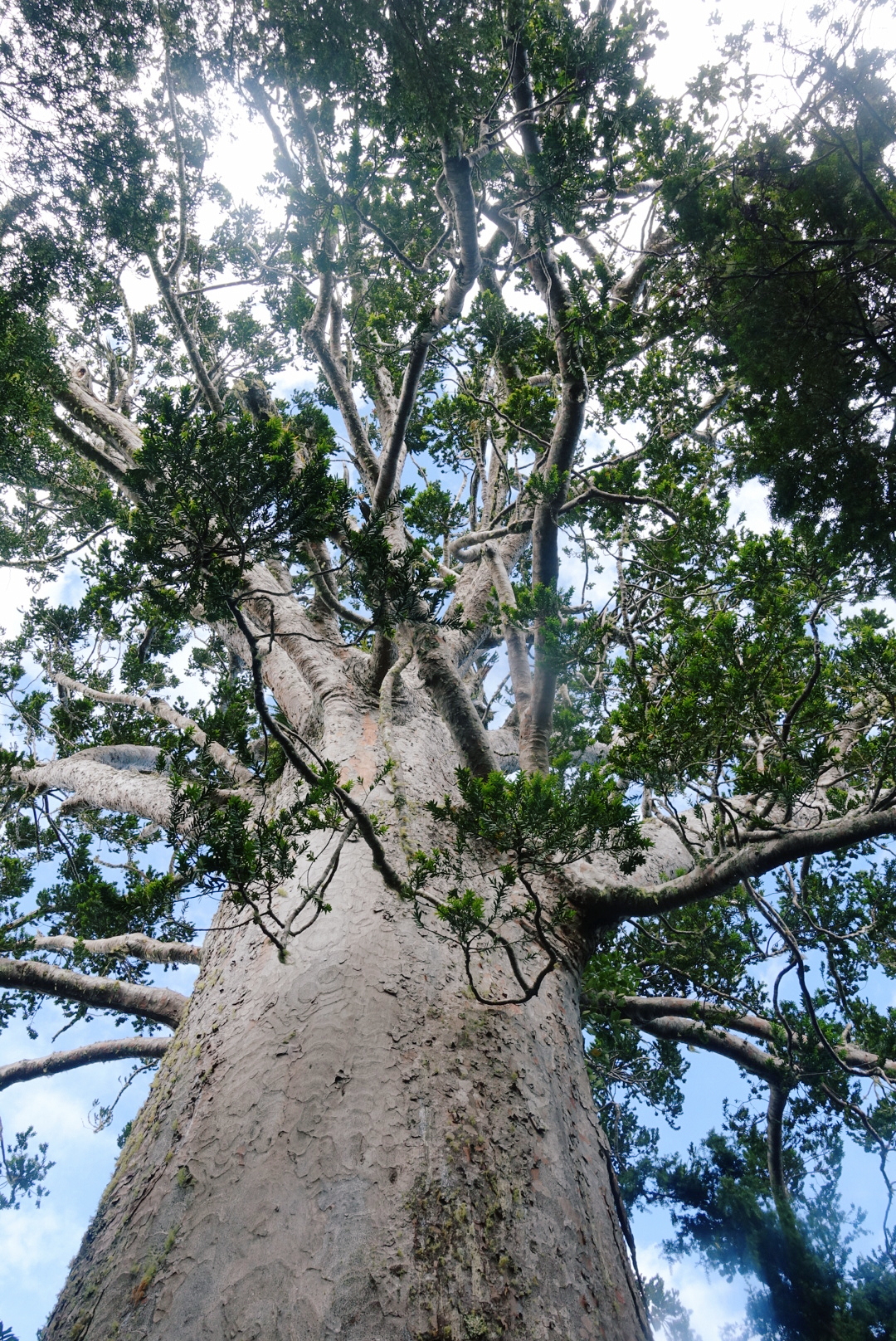
This massive Kauri, named Tane Moana, is believed to be over 1000 years old.
photo/ Jonathan
Kauri trees alter the soil chemistry around them and allow many other rare plants and animals (mainly birds) to thrive. This creates particularly unique forests in New Zealand because a massive number of the species found here are endemic, found nowhere else in the world. The kauri shed their lower branches as they grow, too, so the forests are brighter and airier than other bush.
Sadly, the kauri trees are dying. The usual trail through the Puketi Reserve was closed to hikers due to Kauri Dieback Disease, a fungus that is slowly killing off these forests and that is believed to be spread by humans and some invasive mammals like possums and wild pigs. Still, we've been able to walk through a several kauri forests, including a majestic grove near the edge of Puketi and it's easy to see why we'd want to protect these beautiful forests.
photo/ Jonathan
Impromptu Trail Magic
Some highlights come right in the wake of the lowlights. After a long day of hiking, the last thing you want to see is a sign that says "No Camping Allowed - Next 20 Km."
While we stood next to the sign, trying to decide where to go for the night, a man came out of the nearby house and approached us. He asked if we needed somewhere to stay -- this is the moment when you look around to determine how likely the person is to be a serial killer -- and said we were welcome to camp in the lawn.
When we approached the porch, where he and his wife were drinking their tea (yea, not particularly sketchy, in this case), he offered up the garage and introduced himself. Our lovely hosts, Keith and Raewyn, bought out cots for us and turned on the hot water so that we could take a shower. They showed us outlets where we could charge our phones and gave us the password for their WiFi. They even offered us a cold beer to drink before we turned in for the night.
These things may seem like basic comforts back home, but on the trail, the garage felt like a suite in a luxury hotel. Thank you so much to our hosts for your amazing hospitality and for giving us such a warm welcome to your beautiful country!
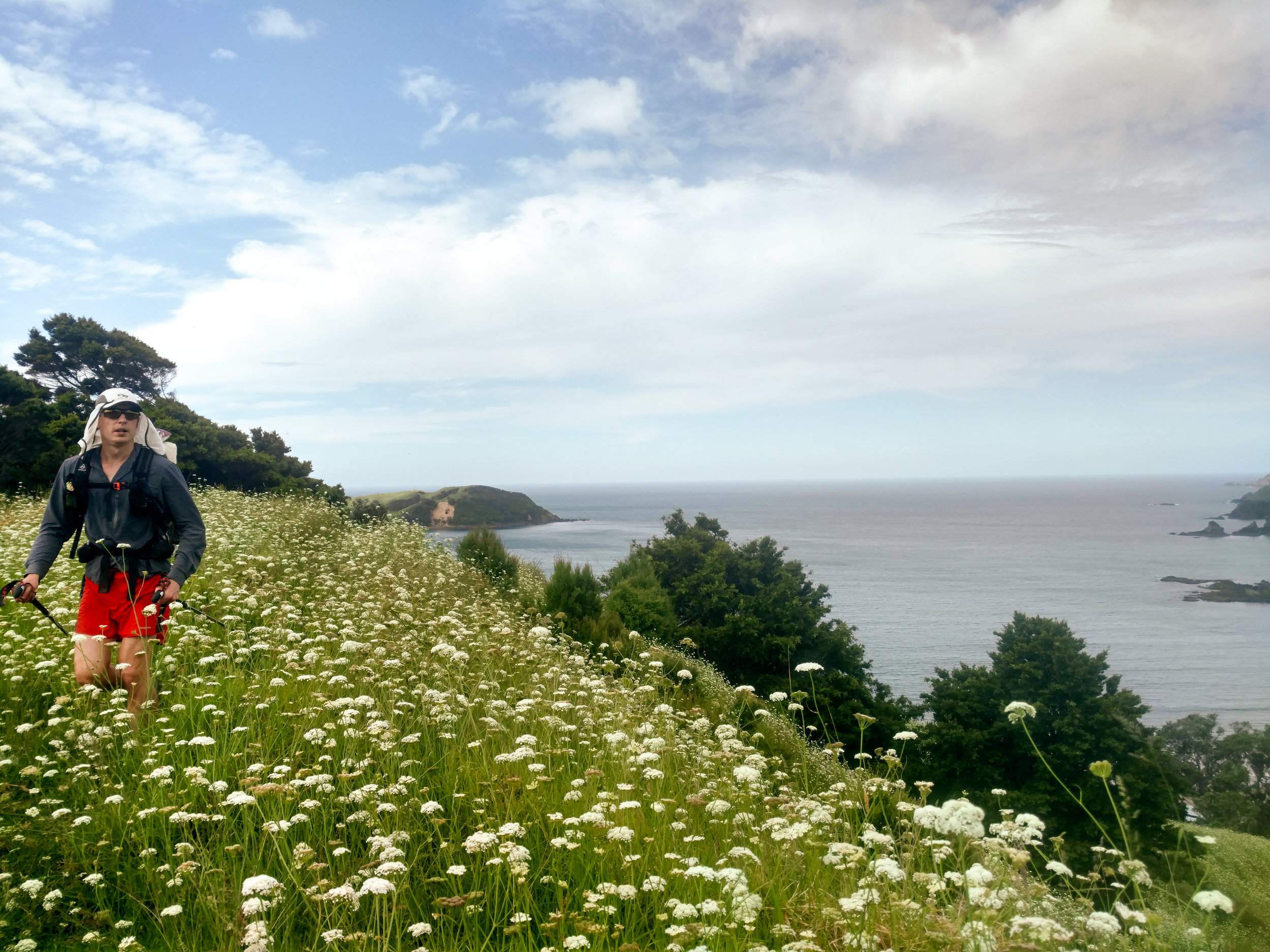
Jonathan tramping through a field of flowers north of Matapouri.
photo/ Molly
Taiharuru Estuary
One morning, joined by an Aussie hiker, we woke up at dawn to catch low tide for an estuary crossing. We donned our sand socks and walked 2 miles of so in the soft mud before reaching the river itself, which was waist deep, even at low tide. Just before reaching the river, we were treated to a picture perfect sunrise. Not a bad start to the day.

photo/ Molly

photo/ Jonathan
The Surprises
One of the perks of having the varied terrain through the Northland is that some of my favorite sections of trail have been total surprises. A short coastal walk between Paihia and Opua turned out to be a charming and well-maintained track right above the beach. And on another day, we practically turned a corner into a ridiculously stunning cliffwalk above the beaches near Mangawhai:

Once in a while, stunning views just pop up through the foliage, like this magical scene outside of Warkworth:

The Northland consists of all of the terrain north of Auckland, New Zealand's largest city at 1.2 million people. The city runs from coast to coast, so the trail runs right through the middle of it. So what's next? Hiker trash take to the city.

Logistics of the Northland
After Ratea, the Northland opens up. The logistics up here can be daunting, but they have their upsides, too...
After Ratea, the Northland opens up. The north is covered in pastures with sheep and dairy cows, small towns dot the landscape, and forestry is a major industry. We've been told by locals that only a tiny percentage of the native bush remains intact, and it shows.
We often cross through several different ecosystems in one day: wake up in a pasture, hike down a gravel road, ascend into a few kilometers of native bush, then descend onto a beach before walking into a town and camping in a grassy park.

The view of the day to come. A long beach walk followed by a steep climb up a mountain in the bush.
photo/ Jonathan
The terrain changes can be disorienting; by afternoon, the morning's campsite feels like the distant past, and it's tough to get into a rhythm with our hiking. The sections of true "track" (trail) feel far too short -- and the sections of roadwalking along state highways seem far too long.
And yet the wild sections are startlingly deep and dense. Sometimes, dropping off of a road, the lights go out in the dense undergrowth, the world turns green, and of course, you squelch instantly into ankle deep mud.

Dense native bush is sure to have spider webs across the trail first thing in the morning. The best defense against a spider to the face is letting someone else go first, but if you're on your own, a second pole will do.
photo/ Jonathan
Private land is a big deal here, too, and the trail runs through (or around) a lot of industrial terrain. We keep a sharp eye out for electric fences as we traverse through muddy pastures, dodging sheep, cows, and all they bring with them (I wrote a note to myself for this post that just read "Mud. Mud. More mud. Mud with poo."). We also walk along logging roads, past orchards, and through people's backyards. We're in and out of towns nearly every day.
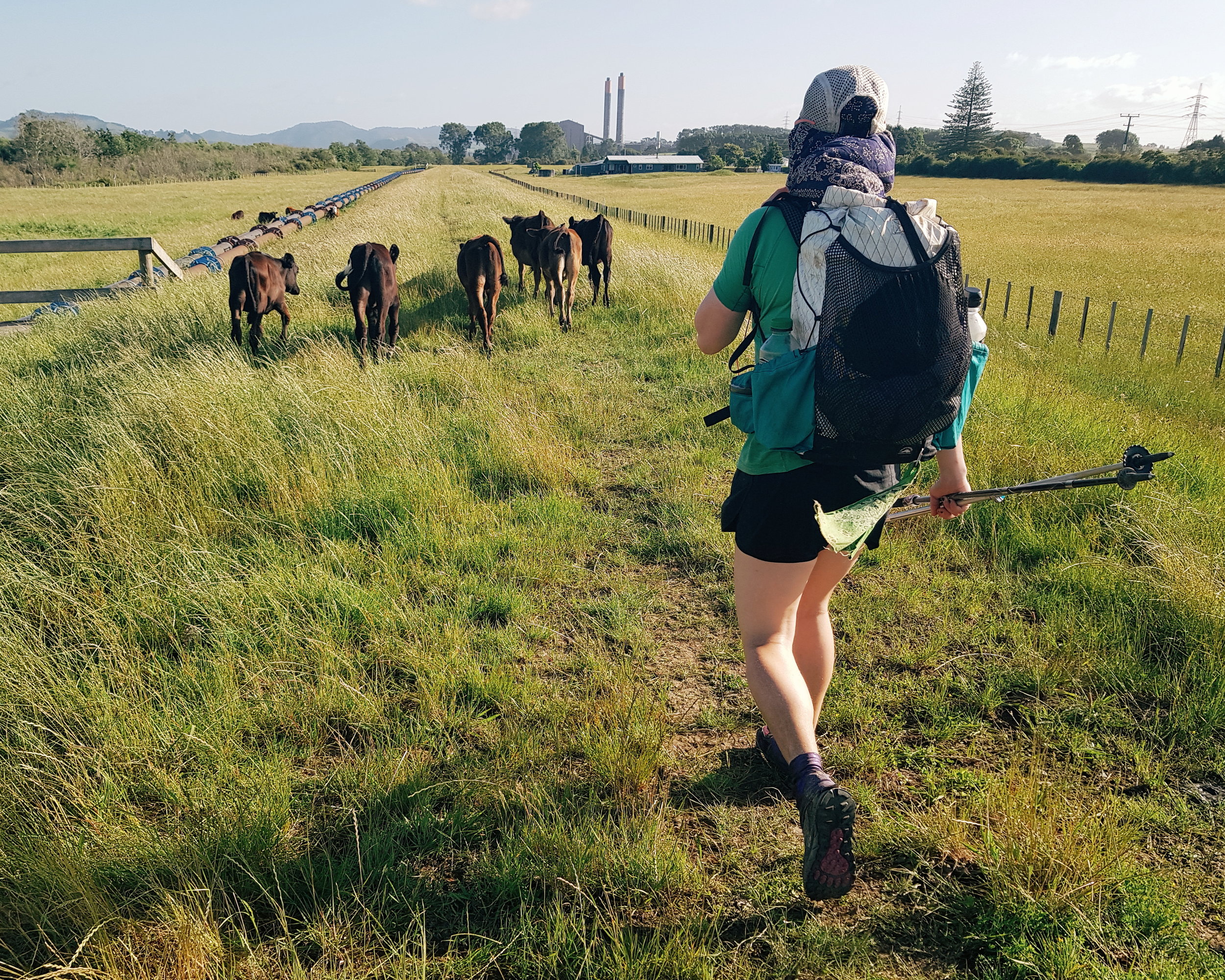
Dairy is a huge industry on the North Island, which means cows, cows, and more cows.
photo/ Jonathan
Paradoxically, this makes the trail both far more convenient and far more complicated than hiking through true wilderness.
Because of all of the private land, there and heaps of rules about where you can and cannot (mostly cannot) camp. Free camping (or freedom camping, as they call it here), is nearly impossible in many sections and we've had to pay for camping far more than we'd like. There are Holiday Parks (campgrounds) all over the place, but it's awkward to time your days around specific stopping points, rather than just hiking until you're tired and setting up camp. Coming from a trail like the PCT, it's also frustratingly expensive.

The better roadwalks are on dirt or gravel through pastures and forests. These rolling hills are pretty characteristic of the Northland.
photo/ Jonathan
Another unusual logistical hurdle here: the ocean. Much of the trail follows along the east coast, which makes for some exceptionally beautiful views, but has caused us a few headaches, too. At several points the trail crosses rivers, estuaries, and even large harbors that require transport by boat.
We've been able to do several smaller crossings on foot, but they've required us to plan around the tide. Even at low tide, a couple of crossings have been chest deep for me and I've had to loft my pack overhead to keep it dry.

River crossings get pretty legit around these parts.
photo/ Jonathan
Several of the beachwalks also require that you pass at low tide. When you're moving 3 miles per hour, it takes a fair bit of planning to hit a tight time window. We use an app that gives us low and high tide times, and we'll sometimes plan several days in advance to make sure that we hit all of the water sections at the right times of day.
The rivers that are too big to cross are another story. Sometimes, we have a phone number in our notes and just hope someone answers. Once, we got a name and phone number for a guy who smuggled us across a harbor like stolen goods. Another time, we got to a river with no way to cross and a friendly local flagged us down to offer us a ride. Phew! (Especially because we were on a time crunch for the next low tide...).
While the trail logistics here can make my head spin, being near towns all of the time does have it's upsides. One day, Jonathan and I stopped in two different towns to get fish and chips for both lunch AND dinner while still knocking out 30+km. Another day, we hiked 20km, got coffee and breakfast, enjoyed some cider and ice cream in a park, caught a boat, and then hiked another 10km to camp.

When you go through town this often, sometimes you stop for a midday cider.
photo/ Jonathan
We have barely carried more than 2 days of food at a time, and the snack opportunities have been ample. It's hard to resist hot food once the hiker hunger starts setting in.
Another unique asset on this trail is New Zealand's total obsession with public toilets. They're everywhere! Every beach and small town has one and they're sprinkled through the cities like Starbucks through Seattle.
I love a good poop in the woods as much as the next guy when it's sunny and the view is right. But when you've been soaked all day, a dry privvy is pretty game changing.

Paihia was super into the public bathroom. Note the toilet sconce on the wall and toilet planters on the roof.
photo/ Molly
The Northland had its own kind of chaos, but there were some phenomenal highlights, too. Look for another post coming soon with some of our favorite sections.
Cheers,
Molly

Into the Bush
Let's get muddy.
As soon as we started out from Cape Reinga, we started hearing about Ratea Forest. We heard horror stories of broken trekking poles and shoes lost in thigh deep mud.
After miles and miles of flat terrain on roads and beaches, though, we felt the relief of using new muscles as we began to climb toward the beginning of the forest.

Climbing up the road, we get a quick preview of the thick, wet forest that lies ahead.
photo/ Molly
And then we were in it. The mud in Ratea sets in immediately. The trails are steep -- not a switchback in sight -- and the only way to climb the mud slide is to find purchase on the roots that hold puddles of thick water. Sometimes, you can tow yourself up on the trees and vines. We last maybe a kilometer of hopping from root to root before we plunge into a knee deep mud well.
It's a bit like a game at first, staying out of the deepest mud. "Well, you wanted an adventure trail!" Jonathan shouts back cheerily.

Heading up and into the muck.
photo/ Jonathan

So much mud!
photo/ Jonathan
The forest is as beautiful as it is rugged. Everything is green and growing, and the undergrowth is thick with ferns and tangles of vines. The trees themselves house not only lichens and mosses but other full trees and tussocks of grass that grow along the branches and in every elbow. The meadows above us keep our own path cool and dark, and we hardly feel the rain, although we can hear it on the canopy overhead.
We don't see any wildlife on the ground here, and the forest floor seems eerily empty. But we are kept company by the birds, whose chirps and songs follow us through the mud. The Tui sound almost mechanized until they give a sort of honk or snort when they miss a note. Others peep mercilessly and some let loose sudden screams and shrieks.
Our pace through Ratea is almost painfully slow, and it's better not to check how far we've come. The final climb up to Ratea Summit seems to drag on for hours.
When we finally arrive at the top, we look with horror at the mud pit -- is this our campsite?! Exploring a short side trail though, we see the forest open up and we leap with joy onto a flat, grassy patch perched improbably amidst the ferns.
Two other tents are already set up, and the sun breaks through the clouds for a moment, giving us a glimpse of the farmland and rolling hills outside of the bush.
We introduce ourselves and put up the tent, then stand there staring at it, soaked and filthy. One of the other campers emerges to bathe in the tiny patch of sunlight. The other gives a muffled greeting and says "Nice to meet you, but sorry, I'm never coming out."
We use our wet socks to scrub the mud off of our legs, then wait for them to dry a bit so that we can scrape off the larger chunks of grass and dirt before putting on our sleep pants (which are sacred and not to be gotten wet). We finally climb into the tent and can barely stay awake to cook our ramen.

Disrobing the filthy, muddy socks as we settle into camp for the night.
photo/ Molly
The next morning we wake up early, pull on our wet, mud-filled socks, say goodbye to our neighbors' tents and begin our long, slippery slide down from the summit. We're in for another long day of mud, but we know there's a burger waiting for us at the Mangamucka Dairy when we finally reach the road.

Climbing down the treachorously steep and slippery slopes out of Ratea.
photo/ Jonathan
When we reach the forest's boundary the sun is shining and it's shockingly bright under the open sky. We blink and stand dazed for a few minutes before heading down through soft, grassy pastures to the gravel road below.
It's not until dinnertime, as we're cooking up our ramen and peanut butter feast that we realize it's Thanksgiving.

Getting a glimpse of sunshine as we exit the depths of the forest.
photo/ Molly
Long Walks on the Beach
So, when you say you like long walks on the beach... exactly how long were you thinking?
Jonathan and I had an absolutely stunning start to Te Araroa. It was sunny and warm with a cool breeze. The perfect day for a walk on the beach.

photo courtesy of Kez

Perched above it all, we got a good look at where we would be spending the first three days of our hike.
photo/ Jonathan
Camping along the beach here is incredibly restricted, which lead to a bit of a dilemma: walk 14km (~8 miles) and sit around in camp all afternoon, or push for 40km (~25 miles) and potentially arrive after dark. We arrived at the start close to 11am, but, excited to get moving, we opted to push for a long first day.
And our first day was pretty glorious.

photo/ Jonathan
We frolicked barefoot in the surf, applied and reapplied (and reapplied) sunscreen, and generally rejoiced in our new life on the trail.
Even in the sunshine, though, the beach is hard on your body. Somewhere around mile 20, the sand started feeling like concrete. We limped into camp around 9:30pm.
Luckily, the next day was all sunshine and rainbows...

photo/ Jonathan
Except that rainbows come from rain. And on Day 2, things got rainy.

photo/ Molly
And then not rainy...

photo/ Jonathan
And then rainy again... about every hour.
Once you hit 90 Mile Beach, there are no breaks from the sand. You try to walk as close to the water as possible so that you don't just slide around with every step, but the hard sand is brutal on your body and there's no protection from the elements.
With the frequent rainstorms came constant wind. When things were dry enough for us to sit down for a break, the sand would blow into our eyes and our food. As anyone who has spent time in the desert can attest, sand is the glitter of the natural world. It just. Gets. Everywhere.

photo/ Jonathan
Maybe 3 miles from the end, we also got hailed on. And not tiny, wimpy hail, either. Big, chunky hail that was blowing sideways at our bare legs (and came on so fast we didn't even have time to put on the rain kilts). Let's just say that the storm ended with us crouched in the fetal position for several minutes as we waited for it to pass.

photo/ Jonathan
So, when you say you like long walks on the beach... exactly how long were you thinking?

The Sabre of Destiny
Basically we had a choice: wait another day in Auckland or hitchhike 6 hours north.
Planning details is not, shall we say, one of my strengths. Nor is it one of Jonathan's. So, I suppose it shouldn't have been surprising that we forgot to buy bus tickets in advance.
We arrived in Auckland at 5am with a lovely place to land, a friend who gave us a bed to sleep in and an ample supply of coffee to revive us from our flight. We had intended to wake up refreshed the next morning to start our journey to Cape Reinga and the start of the trail. But of course, when we got online to buy tickets everything was sold out.
Basically we had a choice: wait another day (2 actually) in Auckland or hitchhike the 6 hours north to Cape Reinga at the tip of the north island. And since we're responsible, cautious travelers... we naturally decided to hitch.
36 hours, 2 bus rides, and 11 hitches later, we found ourselves at the start of Te Araroa. These are just a few of our first impressions of New Zealand.
The first hitch -- when you haven't done it in a while -- always feels a bit ridiculous. Standing on the side of the road with a stupid grin and a thumbs up. But after the first ride you get into the spirit and feel (slightly) less silly.

Holding out the Sabre of Destiny
photo/ Jonathan
One of the best parts of hitching is getting to meet a huge array of people. We got rides in trucks chock full of dirty work gear, a rental hybrid, and even, wait for it... a police car. (No mom, I didn't get arrested).

photo/ Molly

We found a giant "pineapple" after being dropped off by the police officer.
photo/ Molly
Not only did we learn that NZ police generally don't carry guns, but when a cop car rolled up on us hitching, we most certainly assumed we would get some sort of talking to. But hitching is legal here and the cop, Simon, asked where we we're headed and gave us a ride to the next town. Imagine that!
We also noticed right away that there are tons of people here from abroad. We ran into a guy from Pakistan, a woman from Ireland, a South African, and a German in addition to getting rides from several Kiwis.

An RV hitch we got on day three of the hike. RV hitches are a coveted and high class hitch.
photo/ Jonathan
And there were definitely some patterns in our conversations. Kiwis, born here or not, *love* their country. Not in an in-your-face way, like Americans, but in a rather endearing, quiet way. All of our drivers told us about what an amazing time we'd have in their country and how friendly the people here are. Funnily enough though, every single one of them warned us that "You might meet some bad folks, so [insert advice for how we should protect ourselves]."
I don't think an American has ever said this me. I think Americans just assume that we're all assholes, so we don't generally warn against the one bad dude someone might meet.
The funniest repeat conversation was that two drivers told us that we were near the town that won the "best toilet in New Zealand" award and were assured that this was a real thing. And sure enough, the NZ Herald reported that Wairoru won "Best Loo" and "flushed away the competiton."
Nearly everyone also proudly pointed out sections of native bush (forest). It's pretty rare for Americans to have any idea of what's native to their area or not, but Kiwis are incredibly aware of this due to massive problems with habitat loss and invasive species. I'll write another post about this issue specifically. Meanwhile, look for another post coming soon about 90 mile beach and our first foray in the native bush in Ratea forest.
Cheers,
Molly

U.S. Goodbye Tour 2018
We leave tomorrow! Here’s some final thoughts on planning, preparation, and the insanity of international adventure.
Need an idea for how to make your international travel even more complicated than it already is? Well, here it is in two short steps:
Decide to leave your trip open ended, and definitely don’t set a return date.
Schedule a three state, two week goodbye tour during daylight savings time.
After months of preparation and planning, we’re finally ready to go. We’ve double- and triple-checked every piece of gear down to the last hair tie and milligram of ibuprofen. We’ve taken three flights so far and leave tomorrow for the final leg of the journey to Cape Reinga and the start of the trail.
Our first international adventure has certainly been a learning experience already. We decided early on that after flying around the world, we didn’t want to be forced to rush home once we’d finished the trail. And although this has admittedly made preparations a hundred times more complicated, there’s nothing in the world I’d exchange for the feeling of total freedom that comes from not knowing what’s next and not having to decide.
One of the best things about thru-hiking is that it’s a world of “Sure… why not?!” You meet someone and soon you’re picking strawberries for their wedding guests or drinking root beer floats in the middle of the wilderness or watching the world cup in an RV with 30 strangers or dancing until dawn at a pre-Burn festival you didn’t know existed. Sometimes not having a plan just means you’re open to whatever the world throws at you. And we’re pretty hungry to experience that freedom again.
Without an end date or a return flight, we did have to close up shop on our lives in Boulder. We quit our jobs, sold our car, and drove all of the rest of our worldly possessions to St. Louis with the help of Jonathan’s family (huge thank you to Vicki, Rose, and Victor for all of your help!). Everything we didn’t absolutely need we sold, gave away, or threw out. We had a whole lot of random loose ends to tie up, too: student loans, car insurance, health insurance, streaming subscriptions, phone services, and more. I swear, there’s no better way to declutter your house or your finances.
But the tour? I’m not even going to try to justify the tour.
Some nut job thought it’d be a fun idea to fly from Boulder to Vermont to St. Louis to Houston before taking a 15-hour direct flight to Auckland. So, for two weeks, we’ve been hauling our stuff around the country, saying goodbye to friends and family. And while it has had some amazing highlights, two straight weeks of social time (4, if you count our last two weeks in Boulder) is more than we normally get in a year. We’re exhausted!
Thank you so, so much to everyone who made the tour worth it.
And now, wish us luck and bon voyage! We’ll be offline until we get our New Zealand phone plans up and running. Meanwhile, you can check our our final gear lists or read a review of the tent we’re taking with us. We’ll be posting reviews of all of the gear we’re using, but if there’s something you’re curious about, let us know!

Cheers,
Molly and Jonathan

Flatiron Fun-fest
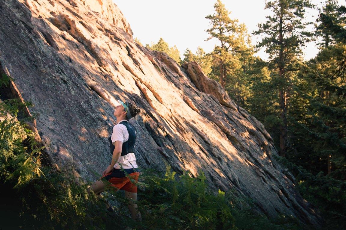
Jonathan decides to test his endurance in the Flatirons by attempting 14 long scrambles in one day.
Over the past year, I have spent a great deal of time scrambling the flatirons, the giant rocks ornamenting the skyline of Boulder, Colorado. For the uninitiated, here’s a quick primer: scrambling is doing easy rock climbs without a rope. The routes are still considered technical rock climbs, but they are of a very easy grade. Boulder is very unique, in that the flatirons above town have dozens of these easy routes that are hundreds of feet long. Scrambling these long routes combines the endurance of running with the technical aspects of climbing.
Scrambling has helped me with the headspace required to be hundreds of feet off the ground with the only “safety equipment” being my own fitness and my shoes. It has helped me learn the routes on these beautiful rocks, along with the access routes to and between them.
Somewhere along the way, I decided it would be a fun test of my endurance to attempt 14 scrambles in one day. No ropes. No special gear. Just me, my shoes, some food and water, and a whole lot of scrambling. The linkup I chose was actually inspired by Bill Wright, who I ran into one day last fall while he was doing a “top ten easy climbs in a day” linkup.
The word “easy” might be misleading there… while each individual climb is graded no higher than a 5.6, these climbs are long and strenuous, and the steep bushwhacking between them doesn’t offer much of a rest. Linking up the flatirons requires traveling off-trail for most of the day and keeping a cool head all the while to make sure that each move is safe and controlled. After all, if you slip, in many places the resulting fall could be hundreds of feet down.
Though my linkup was inspired by Bill’s, I added some of my own favorites to the mix. Here’s the alternative linkup that I created:
Central Shanahan Crag - Southeast Ridge (4th class)
The Slab - SYZYGY (5.2)
Southern Goose Egg - East Face (5.2)
Seal Rock - East Face North Side (5.4)
Front Porch - Tiptoe Slab (5.2)
Stairway to Heaven (5.3)
Angel’s Way (5.0)
Fifth Flatiron - East Face South Side (5.5)
Fourth Flatiron - East Face Standard Route (5.4)
Third Flatiron - East Face South Side (5.5)
Third Flatiron - Winky Woo (5.4) [only non-east face route)
Second Flatiron - South Sneak (5.2)
Sunset Flatironette - Chase the Sun (5.4)
First Flatiron - Direct Route (5.6)
As the chosen day approached, two logistical details became increasingly relevant. First, the high temperature for the day steadily rose in the forecasts from 76˚ to 86˚… not ideal. I had hoped for a day that was a bit cooler. It turns out that these giant, exposed, east-facing slabs of rock soak up the heat, which would leave me practically baking on the rock. On the up-side, though, by choosing a weekend, it meant that Molly was available willing to crew for me. Since this was going to be a monumental undertaking, I welcomed the support. Molly ended up being so much more than a mobile aid station. She was encouraging; she helped keep me grounded through a really brutal day.
And so, at 6am on this chosen Sunday, I embarked on my mission from the Cragmoor trailhead. Molly wished me well, kissed me goodbye, and watched me hike off into the darkness. I actually started the day off with company, though. Nick Zepeda, a friend, coworker, and badass adventure photographer joined me for the first route. I usually scramble by myself, so it was nice to have a friend tag along for the start. The sunrise was stunning as we summited Central Shanahan Crag.
Nick approaching the summit of Central Shanahan Crag just as the sun rose. It was pretty serene start to the day!
Photo: Jonathan
We quickly bushwacked to the bottom of The Slab, where I left Nick and embarked on the next climb of the day. The next few routes went off without much incident. I was feeling good. Strong, even. My favorite climb of the day was the fourth route: Seal Rock’s east face - north side route. It was 850 feet of super-fun climbing.

Ticking off route #1 of the day. 13 more to go!
Photo: Nick Zepeda
Checking my line up SYZYGY on The Slab, my second route of the day.
Photo: Nick Zepeda
Unfortunately, it was directly thereafter that I hit a snag in my day. The local power company had closed the one piece of “real trail” I would be using for the day to do work on the power lines. To ignore the closure could mean $1000 fine or jail time. I decided to turn around and headed back to the start. Bummer! But not the end of my day.
Nick drove me to a nearby trailhead (NCAR, for those of you who know the area) where I could get back onto open trails. Not a big deal. I could still complete the linkup, even if it wasn’t the exact route I had planned. On my way to the next route, I met Molly at my first “aid station.” I knew I would be pounding tons of water to combat the heat, but I didn’t expect to be so thirsty quite so early in the day. Things were heating up!
Off I went to Front Porch, Stairway to heaven, and Angel’s Way. At this point in the day, I began to realize just how challenging things would get. I made sure to take my time in order to conserve energy.
After this grouping, I headed over to the five “major” (read: numbered) flatirons, which would hold the remainder of my routes for the day. By this point in the day, it was freaking hot. I found my way to the Fifth Flatiron, but not before first getting on the wrong damn rock. Whoops! Oh well, not the first time I’ve made such a mistake. I got through the Fifth and made my way to to the base of the Fourth, where Molly was waiting at my next mobile aid station. I proceeded to drink an appalling amount of water before heading upwards once more.
At aid station #2, I was halfway done with the day. Seven routes down, seven to go.
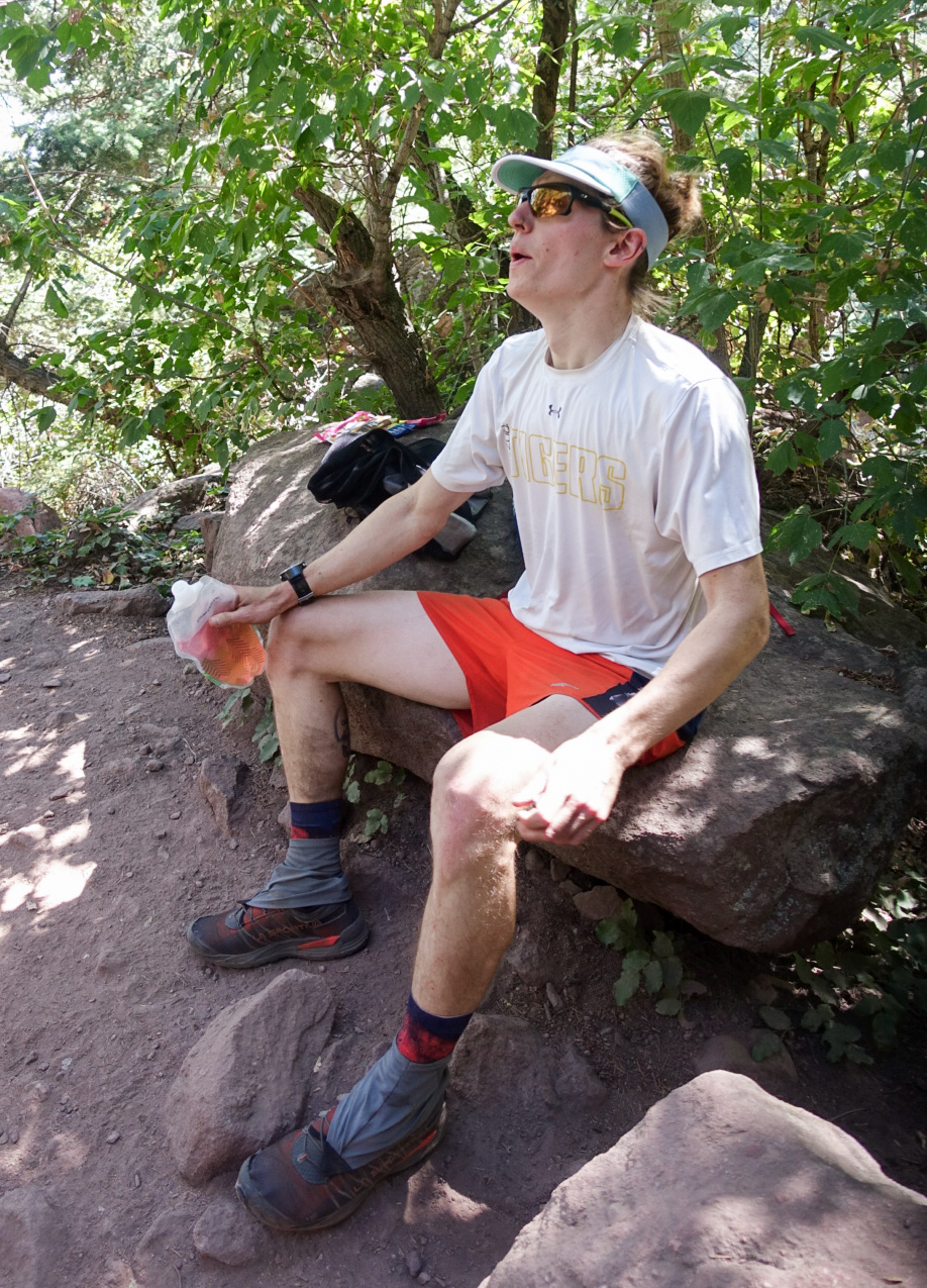
Alrready feeling hot and tired at the halfway point.
Photo: Molly
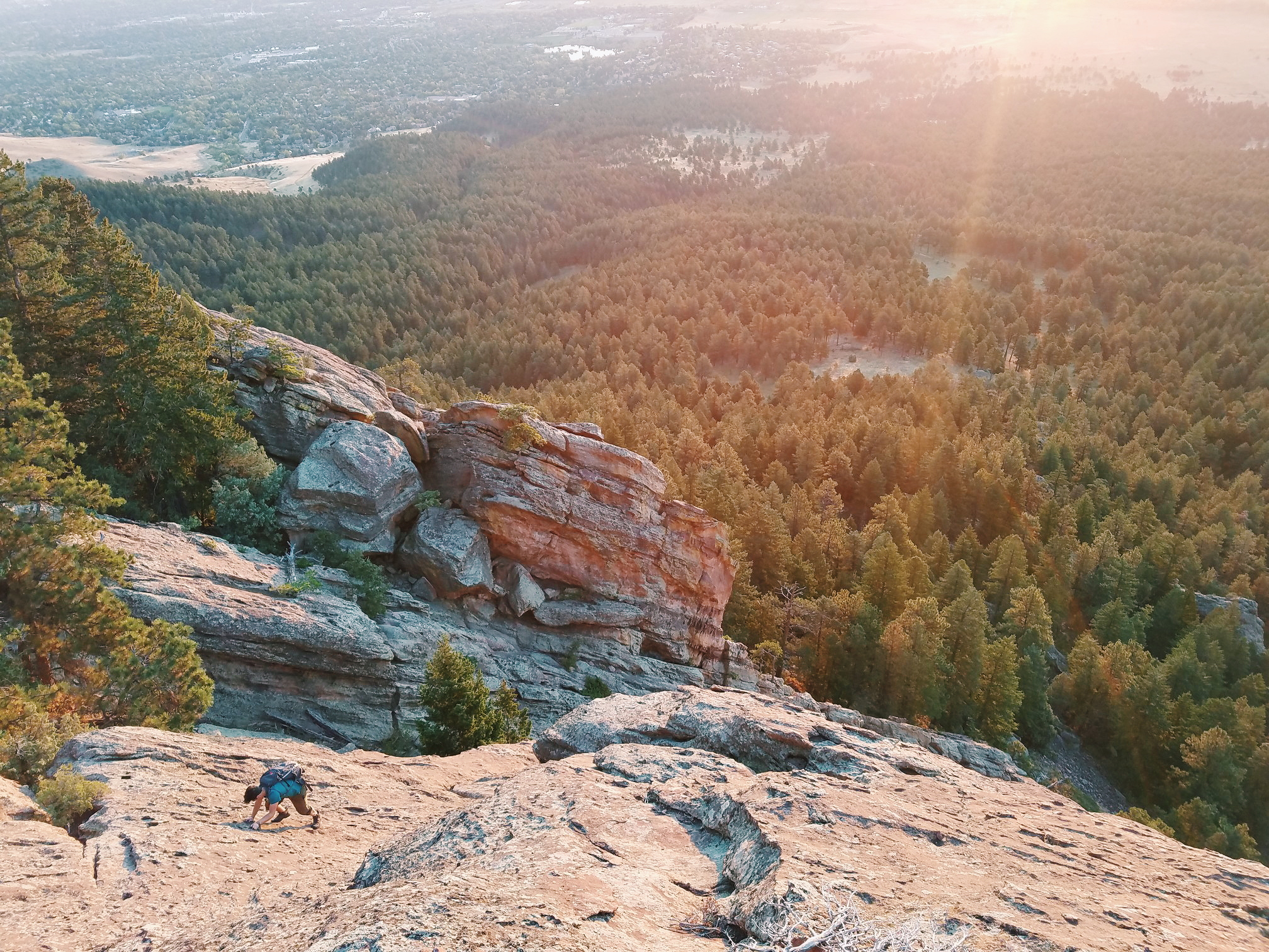
Then I got on the east face of Fourth Flatiron and started up it. This was the low point of the day. I had begun cramping pretty much all over my body. My feet, my hamstrings, and my calves bore the worst of the tightness and fatigue. The Fourth Flatiron is 1,000 vertical feet that is actually three separate pieces of rock. It felt like such an ordeal to get to the top of this one. I was pretty fried while trying to get off the summit. Luckily, the downclimb is a single move.
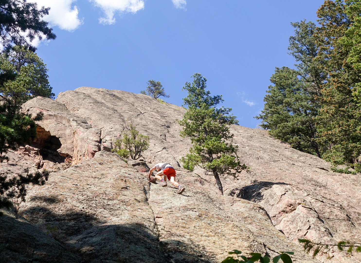
East Face of the Fourth Flatiron. Route 8 of 14.
Photo: Molly
From there, things got better. Sort of. A few clouds came in with a gentle wind. The breeze and the reprieve from the sun helped cool me down, which helped my sanity. My body as whole, though, continued to feel just awful through the rest of the day. My cramping would only get worse. The bottoms of my feet were as sore as they have ever been in my life. Oh, and the fatigue. It turns out that this sort endeavor is tiring (shocking, I know). In spite of the physical distress, the rest of the day felt successful. I was going pretty slowly by this point, but I was still able to make the moves I needed in order keep myself safe while maintaining forward progress.
I love climbing the Third Flatiron. The 1,300 foot East Face Left route was the longest of the day. In spite of the strain on my body, I still enjoyed the hell out of this route. The downclimb off the Third is the longest and most serious downclimb of the day. I was glad that it went off without incident. I then climbed up the more vertically inclined, but relatively short, Winky Woo before coming back down the Third a second time.
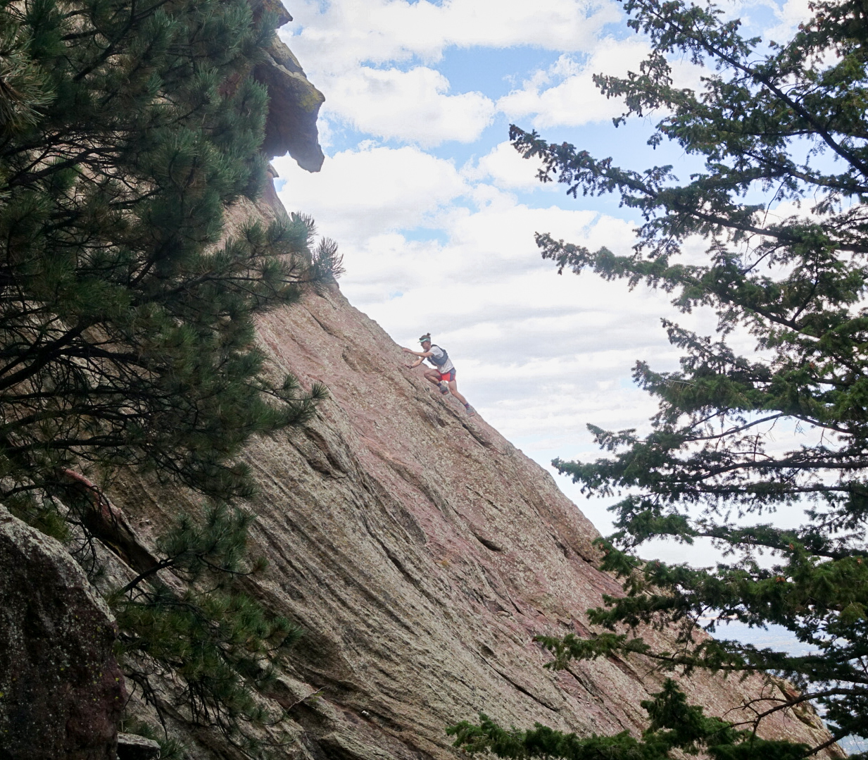
South Sneak of the Second Flatiron. Route 12 of 14.
Photo: Molly
Molly was a sight for sore eyes when I reached the base of my route up the Second Flatiron. Molly gave me water, food, and a much needed push to finish what I had started. With only three routes remaining, I knew I could bring this thing to a successful close. I’ll be honest, though, it was nice to hear it coming from someone else.
I plodded up the Second Flatiron and Sunset Flatironette before arriving at the last route of my day: the 1,000 foot East Face Direct route of the First Flatiron. This route is the one I have climbed the most often. I know it well, but it was also the hardest route along my linkup, stacking up at a grade of 5.6. My hamstrings really tried to revolt on this route, seizing up on alternating legs as I made each move of the first 100 feet. This quickly let up, allowing me more uninhibited movement for the remaining 900 feet of climbing.
After dismounting the First, I began to hobble my way back down to the Chautauqua trailhead, signifying the end of my day. Molly met me half a mile up the trail to cheer me me on as I cried and willed myself to run the final stretch. That was one helluva day!
Running in the final stretch to Chautauqua trailhead. I’m pretty sure those people on the left of the photo are getting family pictures taken.
Photo: Molly
Finished! So tired! Sitting in dirt!
Photo: Molly
Final stats:
Time: 11h 22m
Distance: 15 miles
Vertical gain: 9,900’
Number of routes climbed: 14
For anybody that’s interested I’ve included a link to the Strava event.
Cheers,
Jonathan

Our Next Adventure: Thru-Hiking New Zealand
This November, Jonathan and Molly embark on a 3000km thru-hike of New Zealand’s Te Araroa. Read on to learn more about our next epic adventure!
90% of the conversations between hiker trash basically revolve around two things: food and poop. But once in a while, you do actually hear a hiker talk about that thing they’re doing all day every day. You know… hiking.
And when hikers talk about hiking, they love most of all to talk about any trail other than the one they're currently on. “Trail X is harder than this one.” “Have you done trail Y?” “I’m definitely doing trail Z next.”
Very early in my first thru-hike on the Appalachian Trail (2012) and before I really knew what I'd gotten myself into, another hiker told me about a mystical, international thru-hike involving canoes, an epic ocean beach walk, the gnarliest forests imaginable, and some insanely tall mountains. With all the zeal and confidence of someone who'd made it 100 miles into her first trail (read: a full-blown n00b), I decided then and there that I would, one day, hike that trail.
A few thousand trail miles later, this trail stayed stuck in my imagination. This year, I somehow managed to convince my crazy partner, Jonathan, that we should quit our jobs, put all of our stuff in storage, and fly halfway around the world and be homeless in the woods. Again.

Meet Te Araroa.
"Te Araroa" means "The Long Pathway" in New Zealand's native language, Maori. The trail stretches 3,000km (~1,864mi) from Cape Reinga at the northern tip of New Zealand's North Island to Bluff at the southern tip of the South Island.
The trail starts off with "90 mile beach" along the Tasman Sea, then veers up into a series of forests with some of the gnarliest terrain on the trail. It then passes through Auckland, New Zealand's largest city, before heading into a realm of ever-changing terrain types: farmland, rainforest, and even... wait for it... Mordor. That's right, the trail ventures daringly close to the one and only Mount Doom (otherwise known as Mt Ngauruhoe). There's even a section where hikers take to a river and canoe for several days! And that's just the North Island.
The South Island is home to the Southern Alps. The high point, Aoraki / Mount Cook, soars from sea level to 12,218ft and another one of this island's destinations, the Milford Sound, was apparently called the Eighth Wonder of the World by Rudyard Kipling. The trail here goes through two national parks and includes a number of New Zealand's famous Great Walks.
There are so many reasons that this trail has intrigued us, but here are a few of the juiciest:
1. Flora and fauna.
From the world's only alpine parrot to the world's tiniest dolphins, New Zealand has some insane plants and animals that just can't be found anywhere else.
2. Sheep-to-people.
That's right: New Zealand's sheep-to-person ratio is about 6:1, meaning that there are far more sheep there than people. Not a bad place for two people who love Merino wool as much as Jonathan and I do.
3. Tramping ≠ hiking.
“Tramping” is what New Zealanders call hiking or trekking, but it’s not exactly the same thing. In New Zealand, a good deal of the tramping goes cross-country, without a real dirt pathway or trail. Navigation is more complex and though nowhere in NZ is more than 80 miles from the ocean (according to Thermarest, anyway), it still gets pretty wild out there.
As you might imagine, adding international travel to a thru-hike complicates pretty much everything involved in the logistics and planning. But that’s part of the appeal, too. Jonathan and I are looking for an adventure that pushes us in every way: unpredictable weather, tough and unfamiliar terrain, 15-hour flights… trying to figure out which noodle brands in NZ offer the best calorie-to-weight ratios. All of the important ways.
Over the past 3 and a half years in Colorado, we’ve both grown a lot. Jonathan has grown into a new industry, now managing a sushi restaurant in downtown Boulder. I’ve also made a career change (or several) and will leave Boulder having managed a crowd of over 3000 writers and built out a suite of business analytics for a growing startup. We’ve also grown as adventurers, adding skills in all different types of rock climbing, backcountry snow travel, and ultra-running.
But now, it’s time to go back to the life that we dream about in our spare time. The life where we sleep in a new place every night, where we’re smelly and tired and sore. The life where we’re free.
Once hiker trash, #hikertrashforlife.
Stay tuned for more about our gear list, buying flights and travel insurance, and our pre-trip gear test adventure.
Spring into the Mountains (with help from Red Ace)
Spring is in the air and Dan shares his latest adventures, along with a sweet lil discount code from Boulder company, Red Ace.
Winter is in the rearview mirror. One week into April, spring is in the air, change is everywhere.

Meet Jake. Jake doesn't know he's a model. Jake pulls on a 5.11 start.
Benefits of having a great growing group of friends and the variety of climatic zones to play in - I've had a lot of luck with days spent outside. Also, I have to thank Red Ace Organics. They've sent us a case of an amazing supplement to demo on our long days out - a great natural way to boost energy between climbs or keep moving without crashing. They've also provided a 15% discount code for any of our readers (captainsofus)!
In February I got a couple unexpected days of cragging in while the sun was out and beating down in the lowlands. I had the chance to practice some trad climbing and rope skills on North Table Mesa with new and old climbing partners (despite back pain from an accident over a year ago). A week later Jonathan, Molly, and I headed out on our first group multi-pitch route in Clear Creek Canyon. When our rope became stuck, I had to ascend to free it before all three of us could repel down. It was definitely a great education experience.
I could write several posts about climbing goals, skills and safety, and how much I love vertical exploration. After teaching with the Boy Scouts and Avid 4 Adventure, I've gained an affinity for rock pulling so I'm happy the weather close to home is warming.

Frizzle really pushing the meaning of "cross-country" skiing.
This winter at altitude I discovered Backcountry Cross-country skiing. This sport is a perfect match - low impact and helps me strengthen my core and back while improving my balance (great therapy). It's also an accessible way to avoid the crowded, groomed trails and resorts. Jonathan, Molly and I made a full day together in-bounds at Eldora practicing good technique and putting some miles on our equipment before trying things out on a national forest trail.
I'll take this moment to say that sometimes groomed, designated trails are great — route-finding in the snow when conditions aren't good can require creative solutions. We had hoped for more fresh snow, but the storm didn't drop any so we modified our route. Nothing risky, but we did have hop a stream or two. Adventurski!!!
As the spring warms the lowlands and weather hits the mountains, I am continuously looking to grow, explore, and adventure outside. Stay tuned for more.
- Dan (Soapbox)

Check out their website. Use our discount code for 15% off: captainsofus
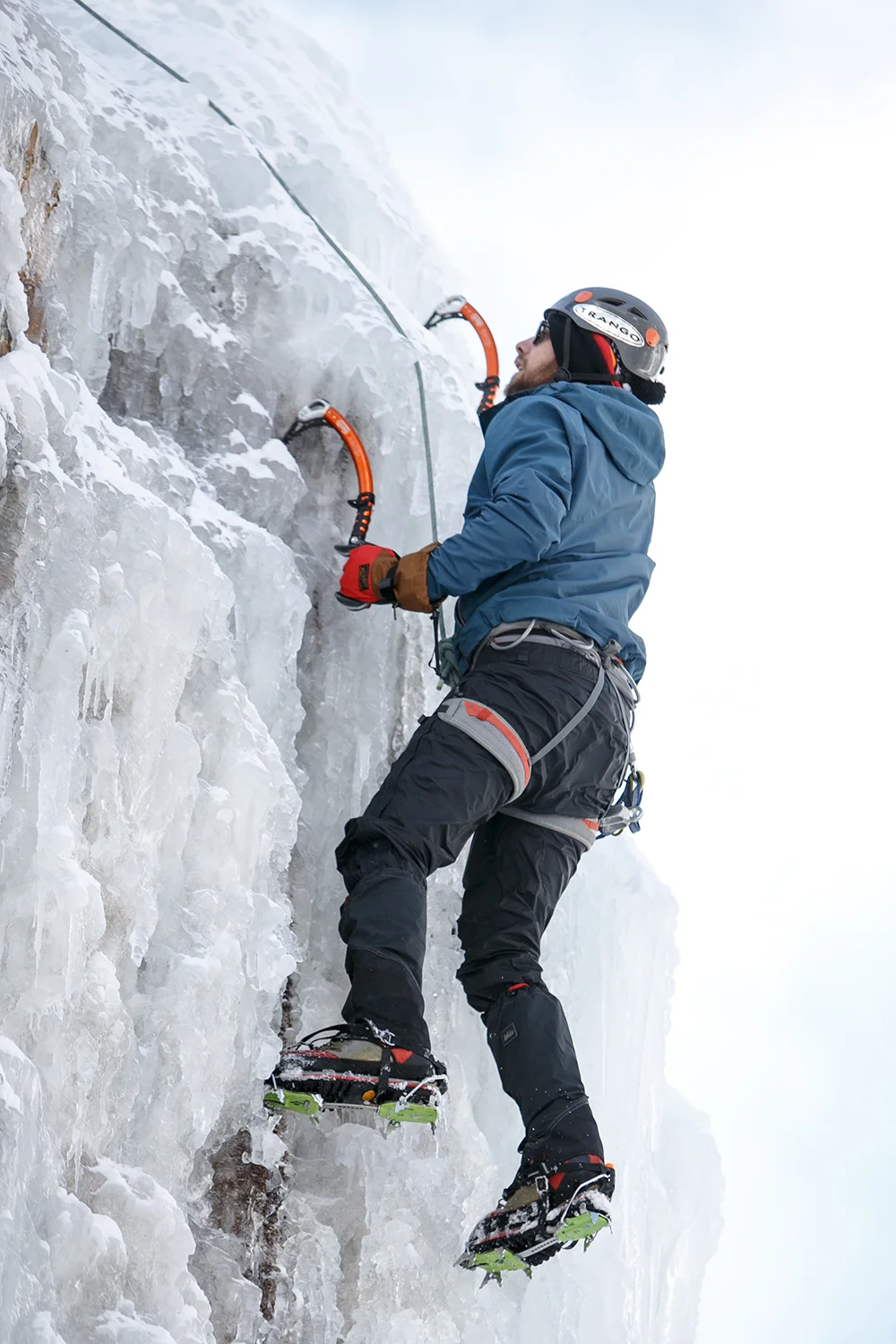
Ouray Ice Fest
The captains strap on their crampons and learn to ice climb at Colorado’s Ouray Ice Festival.
Welcome to 2017!
Since the Captains moved to Colorado over a year ago, we’ve gotten much more familiar with the amazing rock climbing in the Front Range and beyond. This weekend, however, we ventured out into new territory at the 2017 Ouray Ice Festival.
Late Thursday night, Dan, Jonathan, and I rolled into the tiny town of Ouray, CO and made the first of many stops at “Mr. Grumpy Pants,” a local brewery with a healthy serving of mountain attitude. Ouray and the surrounding canyons make up one of the world’s best ice climbing destinations and the 3-mile long Ouray Ice Park is less than a mile from town, right along the Uncompahgre River.

A 7:00am view of Ouray from outside of town to the South.
Although the town has just 800 residents, the Ouray Ice Fest attracts more than 3,000 people each year. Proceeds from the festival benefit Ice Park itself, which costs over $200,000/year to create and maintain. For the low, low cost of a $5 “gear card,” it’s really an amazing opportunity to demo some top notch gear, climb in a world-famous ice park, and see some of the world’s top ice climbers compete.
While many of the Ice Fest’s visitors stay in hotels and shower after each day of climbing, the Captains -- lacking resources for that kind of vacation -- enjoyed the Ice Fest in classic dirtbag style. By day, we used the brewery as a home base to warm ourselves by the fire (and take in the local delights, naturally), and by night, the team ventured outside of town, where Dan stayed cozy in his Subaru Forrester while Jonathan and Molly took refuge in their tent.
With winter camping gear, climbing accoutrement, food for the weekend, and 3 sets of cross-country skis, the trusty Forrester carted around our beautiful “pile of toys,” as one observer put it. And boy, did we put those toys to good use.

Day 1 of the Fest was warm and sunny (around 32°F), as we started swing tools and figuring out how to walk up walls of ice. If you’ve never climbed ice or seen someone do it, it’s basically the most ridiculous hobby ever. You strap sharp pointy things to your feet (crampons), hold sharp pointy things in your hands (ice tools), then walk your way up vertical ice flows on tiny sharp points of contact. As you might expect, we are all in love with it.
Here are Dan and Jonathan getting after it on day 1:


Although we quickly found that the rumored crowds were a reality, we were lucky to find our people at the base of the wall: two of our neighboring climbers were recent PCT hiker trash! Sharing ropes with the crowds meant more climbing for all.
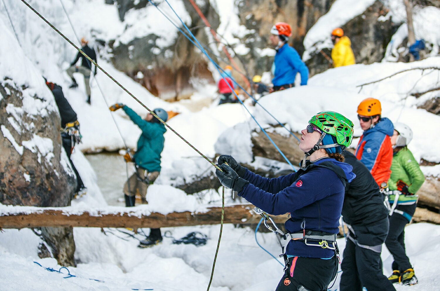
Molly belays amidst a sea of festival-goers.
Later that evening, we packed in a quick nordic tour on the pass above town, then stole the chance to night climb outside of the park on a natural waterfall right next to our camp site.
What a day!

Jonathan topping out on the last climb of Day 1.
And just in case you were starting to think, “this hobby isn’t quite silly enough,” well, don’t you worry; it only gets sillier.
Rather than simply climbing up walls of ice, on day 2 we ventured into the world of mixed climbing (“mixed” referring to a mixture of rock and ice). Since climbers are wearing gloves and carrying picks, the “rock climbing” involved is not what you might imagine. Rather, climbers use the picks on their tools to pull themselves up using tiny ledges and small cracks in the rock.
Here’s Molly just starting out on her first ever mixed route:

After an abbreviated day of climbing, we headed back to the car to cook up some hot chocolate and whiskey on the side of the road. Dan captured the dirtbag glory of this moment, featuring an avalanche shovel/wind-screen and a metal file to stir our tasty beverage:

We had to warm up quickly because the Mixed Competition was just getting good!
Back in the Park, elite climbers were speeding their way up the mixed route known as “Mighty Aphrodite” to a steel tower with plastic climbing holds. The climber who achieves the highest point on this route in the fastest time is declared the winner -- and this competition is known for its challenging routes. In 2015, not a single climber made it to the top.
This year’s route:

We were lucky enough to watch several amazing climbers, including a 15-year-old (?!) from the U.S. Youth Mixed Climbing Team (who knew that even existed?). And I had a fangirling meltdown when I got to see Ines Papert, a world champion mixed and ice climber and registered super-human. Ines not only took first place in her division for this competition, but she also won her division handily for the speed climbing competition the following morning.
Here’s Ines rocking a figure 4 on her way to the win:

With a long drive ahead on Day 3, we woke up early and claimed our route, 130ft of beautiful blue ice. Our toes were freezing, but the burritos were warm and this last climb was a group favorite.
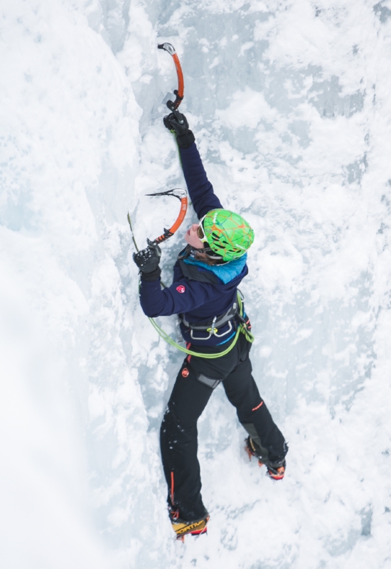

All in all, the weekend was a fantastic adventure and an amazing introduction to ice. This certainly won’t be the last time you’ll see us swinging tools.
Cheers,
Jonathan, Molly, and Dan

Our Next Adventure: The Colorado Trail
The Captains of Us are back in action! This August, Jonathan and Molly will undertake another crazy adventure: attempting to fastpack the 485-mile long Colorado Trail (CT) in just 14 days.
Remember that one time when Dan and Jonathan thru-hiked the PCT?
Well today, I'm happy to announce that the Captains of Us are back in action! This August, Jonathan and Molly will undertake another long-distance adventure: attempting to fastpack the 485-mile long Colorado Trail (CT) in just 14 days.
Jonathan and Molly living it up on the PCT in Washington
To give you all some perspective on why this might be a little bit crazy, let me explain a bit more about the CT. One of the countries "short long trails," the CT runs from Denver to Durango through eight major mountain ranges, seven national forests, and six wilderness areas. The majority of the trail is over 10,000ft in elevation and the high point sits at 13,334ft on Coney Summit in the San Juans. Most thru-hikers take between 4-6 weeks to complete the trail, according to The Colorado Trail Foundation, averaging about 15 miles per day. In order to complete our hike in 14 days, Jonathan and I will need to hike an average of 34.6 miles per day; that's more than a 50k per day, on average.
Here is a map of the trail to give you an idea of where we'll be, and an elevation profile to show you the dips and climbs that equal a grand total of approximately 75,000ft of elevation gain:
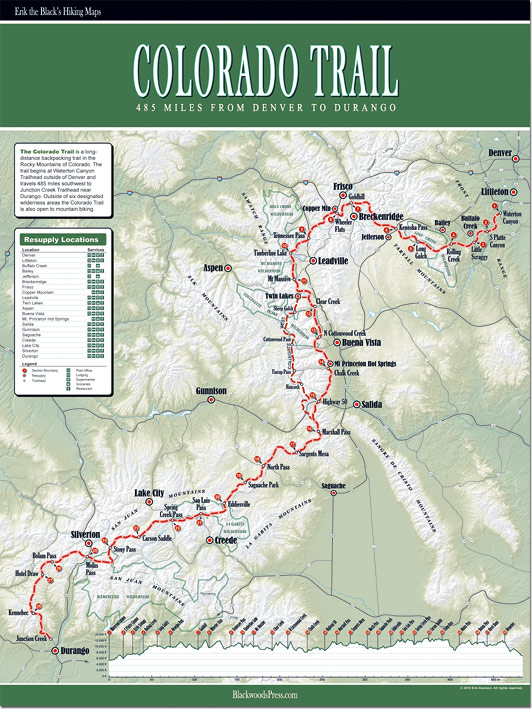
For a number of reasons, including travel logistics and differences in the terrain, Jonathan and I have decided to go against the usual flow of backpackers and hike from Durango to Denver, instead of the reverse. This means that we will encounter higher and more challenging terrain first, while our bodies are fresh, and move into the lower and (slightly) more easy-going terrain during the second week. While most hikers need time to get used to carrying a pack and hiking for days on end, we're going to have to be ready to put the miles in on day one.
As I mentioned above, we're going to be "fastpacking" the trail, rather than doing a traditional thru-hike. The line between these two forms of travel is a bit fuzzy, but you can think of fastpacking as a combination of backpacking and trail running, or, in our case, the lovechild of thru-hiking and ultra-running. Fastpackers, in general, travel lighter, faster, and farther than most backpackers. For this trip, we'll be carrying ultra-light packs with lots of front-access for food and water, to avoid long stops. Our pack base weights will probably fall around 8lbs each, and we'll be sharing gear to help keep our loads to a minimum. Don't worry mom, I promise we'll be carrying a tent.
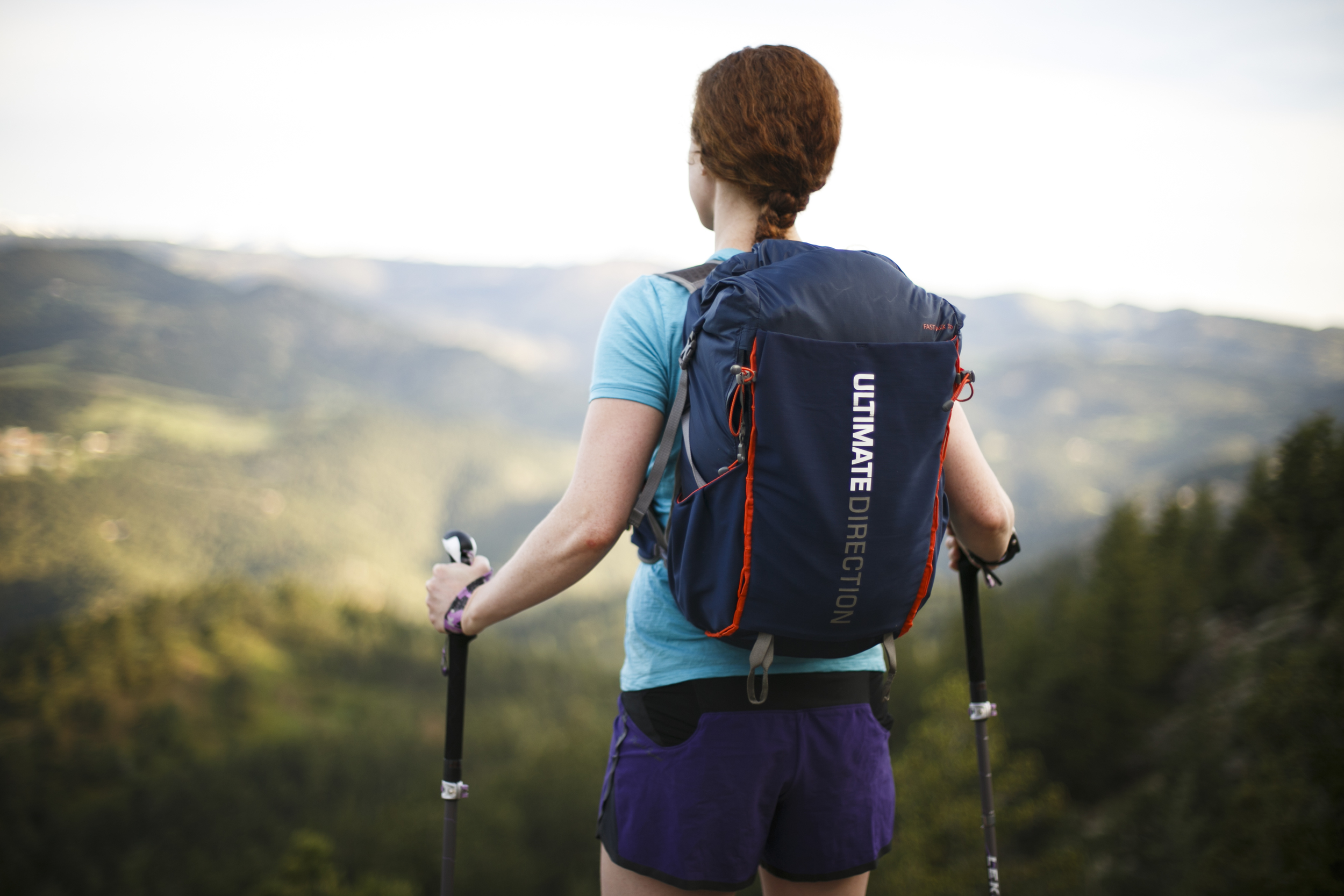
Our Fastpack 30L vests from Ultimate Direction will help us carry our gear in a small and compact space to ensure that it feels secure as we run along the trail.
Usually, when I explain this concept to people, I get one of two responses: either, "Is that even possible?!" or "Why on earth would you ever want to do that?!"
The answer to the first question is actually pretty easy: who knows?! We'll get back to you when we're done hiking. There are actually a few runners who have completed the trail in just 9 or 10 days, although most were supported. The current unsupported record is just under 11 days, set by Shawn Forry in 2012. Makes 14 days sound downright leisurely, right?
While this is certainly going to be a challenge for us, Jonathan and I have been planning this trip for a while, and we will be doing a lot of training to get our bodies ready. Check out this blog post I wrote about setting challenging, but realistic adventure goals. And seriously, where's the fun in going on an "adventure" that you already know is possible?
As for the second question, of why we want to do this, well I guess that's a little more personal. Jonathan and I like to push our physical limits, and we love to spend time in the mountains, sleeping out under the stars. This trail in particular will be a phenomenal opportunity to bask in the beauty of the Rocky Mountains and our new home state of Colorado. We can't afford to take four or five months off this year for a longer thru-hike, so we have decided to make the absolute most of our two-week vacation. Gotta pack it in when you can, right?
Catching the sunrise on Independence Pass. Sometimes, you have to wake up when the world is sleeping to see the things no one else sees.
Stay tuned for updates about our gear, food, resupply schedule, and training regimen!
Cheers and happy summer,
Molly