

Walks, Great and Tussocky
When you have the opportunity to take a 20-mile detour on one of the most lauded trails in all of New Zealand, you take the damn detour.
We climbed out of the car at the Routeburn trailhead and thanked our drivers, a chatty American couple who'd been living in New Zealand for several years. The first thing we saw was a pair of keas picking at someone's windshield wipers and rooting through the bag of trash they had left under their car (If you missed our post about Arthur's Pass, keas are the world's only alpine parrot.) They're incredibly mischievous, highly intelligent, and they love to tear shit apart. Also, trash. They love trash. Think of them as the smaller and (only slightly) less fearsome cousins of those bears in the Adirondacks that learned how to open bear cannisters.

This print we saw from Glenn Jones Art pretty much sums it up.
Actually, there were quite a few parallels between Routeburn and the busiest national parks in the US. This was our first Great Walk of the South Island and it was packed. The trail was at an easy grade and was ultra well-maintained, so we picked up some speed and proceeded to pass -- best guess -- 150 people in the first 10 kilometers (~6 miles). Could have been more.
Several of the groups we passed were being "guided" along the trail, which has basically no offshoots, idiot-proof signage, and huts with rangers every 4 miles. Oh, and 150 PEOPLE walking in a giant line. There's even a full-on hotel, Yosemite Valley style, which is 5 miles from the trailhead and which provides food and bedding so you don't need to carry your own.
Routeburn is one of the most famous Great Walks, so the huts and camping along the route are insanely expensive (it's around $100 US for a hut and $50 per person to camp). That was a little, shall we say, out of our budget. Luckily, the whole of Routeburn is only 32 kilometers (~20 miles), so we just planned to knock out the whole thing that day and sleep in a hut along the Greenstone Track where our hut passes were valid.
We started hiking around 10am and despite the morning crowds, the scenery did not disappoint. We even got to stop at some fancy huts where we could pick up clean water and take breaks away from the sandflies, as needed. We also got a quick glimpse of why the lodging is so expensive: there are vault toilets all along the trail and they fly the vaults in and out with helicopters. A+ for LNT-friendly shitters (Leave No Trace).

photo/ Jonathan

photo/ Molly
We hit the highpoint of the trail just in time to get a view before thick clouds began rolling in.

photo/ Jonathan
Apparently, there is beautiful scenery off the back side of the track, but we didn't see much of it. We waited around for a while near the high point to see if the rain would pass, but a steady drizzle set in and we decided that it was time to move on. It was still a lovely walk down toward Greenstone and as a bonus, the crowds thinned dramatically. By 3pm or so, everyone else had apparently called it a day and we nearly had the trail to ourselves outside of a few stragglers near the huts.

One good thing about rain? Waterfalls! Earland Falls is a 574 foot waterfall that drops right onto the path. Super epic feature of this trail!
photo/ Jonathan
We got a few peek-a-boo views as we descended toward the last hut, then got a spectacular sunset over the Greenstone valley. Our hut for the night was a beauty with flush toilets and all. Flash as! (That's kiwi for "swank af" or -- for old people -- "extra fancy.")

McKellar hut was a welcome sight as dusk approached.
photo/ Molly
The Greenstone Track, which we followed back to the official Te Araroa route, was simply lovely. The walking was easy, the weather was perfect, and we hardly saw another person (just a ranger out there checking hut passes). We wandered through pastureland and cruised along soft forest paths.

Walking down the Greenstone Valley
photo/ Jonathan
Back on the TA, we trekked through more beautiful forest, with a couple of gorgeous views back toward Routeburn. Then we walked until reaching Jonathan's very favorite part of the trail: miles and miles and miles (and miles) of swampy, slippery tussock. Sometimes, there was a trail. More often, we followed vague traces of previous hikers through the dense ground cover, constantly losing the trail because the markers were buried in the grass.

Crawling under barbed wire fences is a totally normal part of trail, right? Oddly enough, this one had its own waypoint in our guide app.
photo/ Jonathan
The last day into Te Anau turned out to be a very, very wet one. We woke up early and got a good 20 kilometers (~12 miles) in before we felt the first drops, but the storm caught up to us as we walked the gravel road toward Te Anau. We donned warm hats, gloves, wool shirts, and full rain suits, and picked up our pace, trying to stay warm as the wind slashed cold rain directly into our faces.

A storm is coming, but why is the sky pink?! (Early morning, facing northwest).
photo/ Jonathan

Trying to beat the storm. Spoilers, we didn't.
photo/ Jonathan
We graciously accepted a ride from a kind passerby and rode the last 10 kilometers in style, sitting in the back of a work van on a big plastic tub, surrounded by tools and bits of wire. Though he had only offered a ride to the highway, the driver took pity on us and instead of leaving us at the end of the gravel to hitch in the rain, he brought us along with him into town. We made a beeline to the nearest cafe and dripped our way to a cozy seat and a hot beverage.

Five Lakes and Two Wheels
Jonathan and Molly trade in their two feet for two wheels, then take a tour of New Zealand's alpine lakes.
Lake Tekapo marks the beginning of a long stretch of lake hopping from Tekapo to Lake Pukaki, then Lakes Ohau, Wanaka, Hawea, and finally Lake Wakatipu in Queenstown. All of these lakes are massive, gorgeously blue alpine beauties set below the Southern Alps.
The first leg of this journey, from Tekapo to Twizel, follows a gravel cycle trail along a series of canals. It's flat, exposed, and though there are stunning views, they don't change much for about 35 miles. To liven up the flats, we opted for two wheels instead of two feet.
Our bikes arrived at 8:30am and we rode off feeling gleefully free of our packs, which were being shuttled directly to Twizel.

photo/ Molly
About halfway through our ride, we soared down a long, smooth descent toward the stunning Lake Pukaki and joined a gravel cycle trail along the lakeshore. The glaciers of Mount Cook National Park beckoned in the background. Of course, we couldn't resist a quick stop at the Salmon Shop at the south end of Lake Pukaki, which offers up local New Zealand king salmon sashimi.

photo/ Jonathan

photo/ Molly
A note for hikers/travelers interested in doing this ride: We used BeSpoke Bike Tours, which I can highly recommend. It ran us $65 NZD per person with a group of 3+ and the super friendly owner, Annie, shuttled our packs to Twizel and met us at the end. The bikes arrived with full water bottles and small packs where we could store sunscreen and a few snacks for the ride. The trail is mainly gravel with a bit of paved road and is suitable for anyone relatively fit, even with no mountain biking experience at all.
The next two days were filled with big climbs and beautiful views. After walking around Lake Ohau, we headed up through blissfully shady beech forest to an unnamed pass where, miles and miles from any town, we found a small spring gushing out of the mountainside. Someone had planted a pole next to it with two small hooks holding little copper mugs for passing trampers to sample some pure NZ spring water. There wasn't a sign and it would have been easy to miss, but the little act of camaraderie made me smile. Of course, we stopped for a sip.

Dawn vibes in the valley
photo/ Jonathan
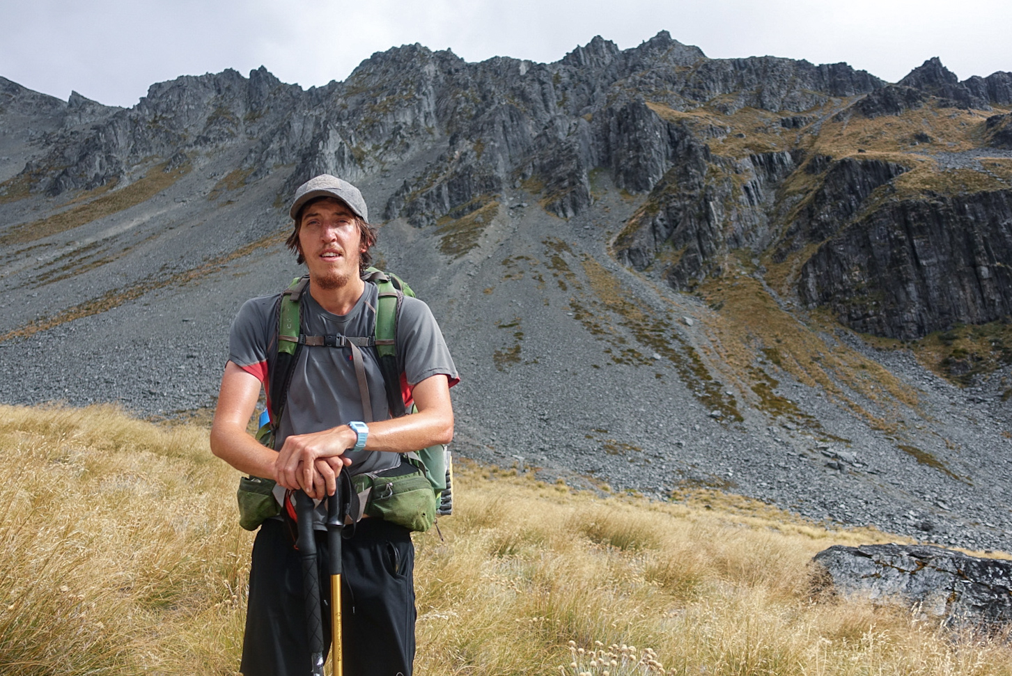
Charlie takes in the view on the climp to Martha saddle.
photo/ Jonathan
We had two more substantial climbs to surmount before Lake Hawea and they couldn't have been more different. The steady grind to Martha Saddle was tussocky with jagged ridges rising towering above a wide, rocky 4WD track. But the climb to Breast Hill was steep and scrappy; we hauled ourselves up steep walls of soil on roots and trees, kicking steps into the dirt. Just as we reached the summit of Breast Hill, the clouds began to thin and we glimpsed a fleeting view of the lake before descending the wild, jagged ridgeline toward the water. We'd been wondering where all of New Zealand's switchbacks had been hiding, but as we zig-zagged down interminable 100-foot-long runways, we wondered no longer.

photo/ Jonathan

Descending the steep ridges off of Breast Hill.
photo/ Jonathan
From Lake Hawea, the trail follows roads and bike trails leading directly into Wanaka. Wanaka is a small ski town that has grown substantially in recent years, but retains a core of van dwellers and adventurous types who staff the many cafes, gear shops, and kayak rental kiosks along the beach. It sits in a little cove at the southern end of another perfect mountain lake. We stayed at a cozy "backpackers" (hostel) with a communal kitchen that was constantly filled with people chattering in French, Dutch, and German. It had a big grassy yard with picnic tables and laundry drying on the lines.
For hikers: This is a must-stay hostel -- definitely our favorite one in New Zealand -- but you may need to book ahead from Twizel or Lake Hawea. Check it out here.
Wanaka would be our first zero day on the South Island and it truly was everything we dreamed it could be. The day started out with a jog along the beach to visit #thatwanakatree at dawn.

Don't let the tranquil image fool you; this little tree is an international Instagram star.
photo/ Jonathan

Perfect morning light on the shores of Lake Wanaka
photo/ Jonathan
After breakfast, Jonathan, Charlie, and I rented a set of frisbee golf discs, grabbed a six pack, and headed up to the local course. Charlie and I still managed to enjoy ourselves while getting thoroughly trounced, then Jonathan led us all back to town for victory burritos. Mexican food is (very) rare here and since Kiwis think black pepper is too spicy, decent burritos are pretty much impossible to find. Burrito Craft did not disappoint. Two Americans were working at the counter and the spice scale ranged from 0-10 with severe warnings on everything above a 5.
For dinner that evening, we hit up a trendy spot on the waterfront that was so jam-packed that the three of us (as the hikertrash that we are) just decided to take our plates outside and sit on the sidewalk, rather than waiting for a table or standing awkwardly in the corner. We got a good laugh as an older woman, clearly a tourist from China, stopped to openly take a photo of us sitting cross-legged with our plates in our laps. It made us feel a bit like zoo animals, but at the end of the day, my only regret is that I didn't have the presence of mind to whip out my phone and snap a shot of her, as well.

Molly working on her putting game
photo/ Jonathan

Jonathan absolutely slaughtering the competition
photo/ Molly
Of all of the towns we visited along the trail, none quite captured our hearts as much as Wanaka. It was hard to leave the next morning, though we softened the blow a bit with a third (yea... third) round of the locally made Black Peak Gelato. Kiwis have a weird obsession with "Hokey Pokey" ice cream (vanilla ice cream with chunks of honey comb), but my favorite unique local flavor was definitely the feijoa sorbet. Feijoa is apparently called pineapple guava in the states, though I'd never heard of it before coming here. To me, it tastes a like a delicious tropical version of a granny smith apple mixed with pineapple and papaya.

Blackpeak Gelato has a very special place in our hearts.
photo/ Molly
We walked out of town, ice cream cones in hand, and strolled along the lakeshore admiring the massive peaks of Mt. Aspiring National Park in the distance.

What We've Been Waiting For
As soon as we reached the foothils of the Richmond Range, Jonathan and I felt like we'd finally found the New Zealand we'd come to see.
As soon as we reached the forests of the Richmond Range, Jonathan and I felt like we'd finally found the New Zealand we'd come to see: big, rocky mountains, steep climbs, and epic views. With Colorado as our base for the last few years, this terrain made us feel right at home. By comparison, the whole rest of the trail suddenly felt like a warm up.
With perfect weather and a lot of stoke, we conquered this section in just four and a half days (the DOC-recommended time frame is 8-10). A lot of hikers around us seemed to struggle with the tougher terrain, however. When we arrived our first hut on day 1, they looked at us like we were monsters as we told them that we'd come from Havelock, 30 miles north.

photo/ Jonathan
Our second day in the Richmonds spanned one of the most memorable sections of the trail so far. Each heartbeat of the elevation profile brought us higher and higher until finally, right at the end of the day, we crested over a saddle where the view ahead was all jagged mountains and the view behind reached all the way back down to the ocean below. This was both one of the hardest days on trail and one of the most rewarding.

photo/ Jonathan
We shared our campsite at Slaty Hut that night with an awesome group of fellow hikers, some new friends and several that we'd caught up to again after our Wellington vacation. We ate dinner with Eran, an Israeli guy who we met way back on 90 mile beach, as well as Lancelot and Benjamin, two French Canadians we had met in Waikanae, Abby, another American, and Matthew, the only ultralight Kiwi on trail (it's a bit of a running joke for us that Kiwis seem to carry as much weight as they possibly can).
One more highlight that I'd be remiss to bypass? One of the huts had a flush toilet! This was obviously a major subject of discussion for thru-hikers and we'd all gone out of our way to visit. That's called #hikertrash luxury... Don't worry, we did not take a photo.
Everything about the Richmond Range was stunning. On day three, we climbed over two peaks, Mt. Rintoul and Little Rintoul, on the sketchiest and steepest trail so far. And on day four, we hiked up the Wairoa River then headed into the wild colors of the Red Hills. I think the photos of these sections probably speak best for themselves.

photo/ Jonathan

photo/ Jonathan

photo/ Jonathan

photo/ Molly

photo/ Molly

photo/ Jonathan

photo/ Jonathan

photo/ Jonathan
As will be common for most of the South Island, we passed backcountry huts every five miles or so. Here, the huts were crowded and a couple of nights, we actually opted to sleep in the tent just because the huts were so darn hot. But the huts were wonderful for taking midday breaks, giving us a brief refuge from the ever persistent sand flies, nasty little nibblers who give painful bites that drive you insane with itchiness the next day. They don't seem to bother us while hiking, but if you stop for too long, the swarm is never far behind.
With big miles and big mountains, our hiker hunger in this section reached a whole new level. We hiked into St. Arnaud with our food bags empty and headed straight for hot pies. Lucky for us, we happened to arrive on Sunday afternoon, just in time for the famous all-you-can-eat BBQ buffet at the Alpine Lodge. The lodge set up a hiker table (yea, they see us coming a mile away) and we all got our money's worth before staggering back to the hostel to sleep off the food coma.
From St. Arnaud, we head directly up into Nelson Lakes National Park with two more high elevation passes ahead. Bring on the mountains!

Onwards to Wellington!
We wrap up the North Island with more beach than bush and get our first taste of Wellington.
From Waikanae to Wellington, Te Araroa becomes a lot more civilized. It wanders through a scenic estuary boardwalk, over a stunning coastal walkway, and along sandy beaches. On the first day, we got breakfast before leaving Waikanae, stopped for lunch along the beach, ate ice cream cones in Porirua, then nabbed a pre-dinner pie in Pukerua Bay before camping next to the ocean. Pretty good for 22 miles of walking, I'd say.

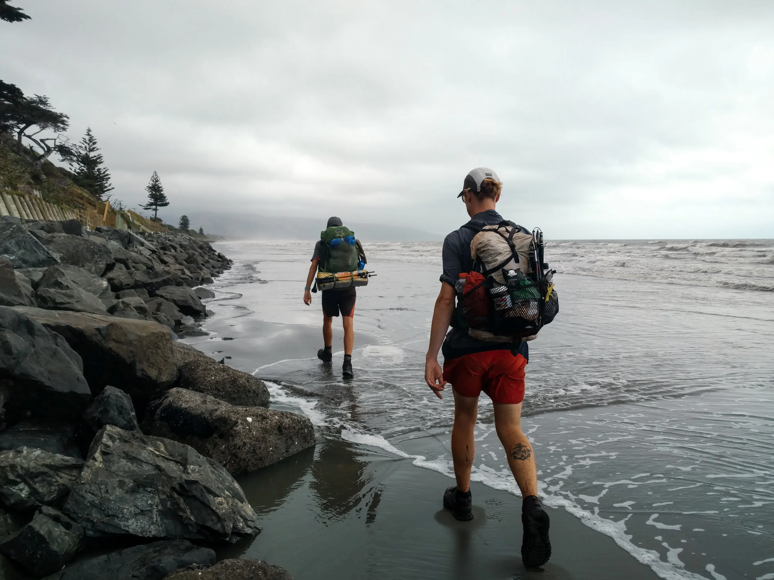
Molly surveying our final beach walk
photo/ Jonathan
Jonathan and Charlie get their feet wet at high tide
photo/ Molly

Ocean views from the Escarpment Track coastal walkway near Paekakariki
photo/ Jonathan

A massive suspension bridge along the Escarpment Track
photo/ Jonathan

HIKING SO HARD.
photo/ Molly

Beachfront camping with beautiful hiker trash
photo/ Jonathan
We had one of our odder camping experiences at a homestay just west of Wellington. Our host was an older gentleman, Alan, who met us in a dressing gown of some sort and apologized for being in his pajamas, though it was well after 4pm. Later, he found us drinking tea and offered us a "digestive" (sort of like a sweet cracker) because "that's what the queen has with her tea" (he was originally from Singapore and spoke with a distinct British accent). There were several other random people, clearly not hikers, who'd been living in the garden there for an indeterminate length of time. In the shower, there was a lengthy treatise on why one should dry oneself inside the shower and definitely not outside ("...you could even put your shirt on inside the shower and it would keep you nice and warm").
Unlike Auckland, Wellington does not sprawl for miles and miles. It is a smaller city, about 400 thousand people, tucked away at the southern tip of the North Island and bordered by water to the east and south. To the north and west of its small downtown are the foothills of the Tararuas. The city itself is built in and around the hills; it has tiny streets winding up and down them in what appears to be a completely patternless chaos. Downtown Wellington is right on the sound, with a beautiful waterfront full of public art and (somewhat shockingly) clean, sandy beaches.
We hiked into Welly, as it is fondly known here, over the top of Mt. Kaukau and wandered through the city's green spaces, walking through the botanic gardens directly down into the city center. The trail passes directly beneath the "Beehive," where New Zealand's government center is housed (look for it in the lower right side of the photo below -- you'll quickly understand the name).

Downtown Wellington from above
photo/ Jonathan

Hiker trash on Lambton Quay in Welly's city center
photo/ Jonathan

We ate delicious Vietnamese food at a place called "Where's Charlie?"
photo/ Jonathan
After downtown, the trail sneaks back into green space to head up Mount Victoria (where it also passes another LOTR filming location). We loved that even while passing through a major city, the trail was scenic and hilly, but the southern terminus of the North Island was a bit of a weird experience. We descended to a small city park where we wandered around for a bit before locating the tiny plaque signifying that we'd completed the North Island. Not exactly a grand finale... But then again, we still have another island still to go!

We finished the North Island!
photo/ Jonathan
The walk through Wellington was, overall, a completely different experience than hiking through Hamilton or Auckland. There was a ton of green space, beautiful ocean views, and some climbing to break up the day. We finished the day feeling excited to explore the rest of the city and ready for some well-deserved rest.

Northern Highlights
The Northland was a bit of a logistical nightmare at times, but it had also had some crazy highlights. Here's our "best of" for the Northland.
Although the Northland was a bit of a logistical nightmare at times (as I wrote about here), it had also had some crazy highlights. Here's our "best of" for the Northland:
The Riverwalk
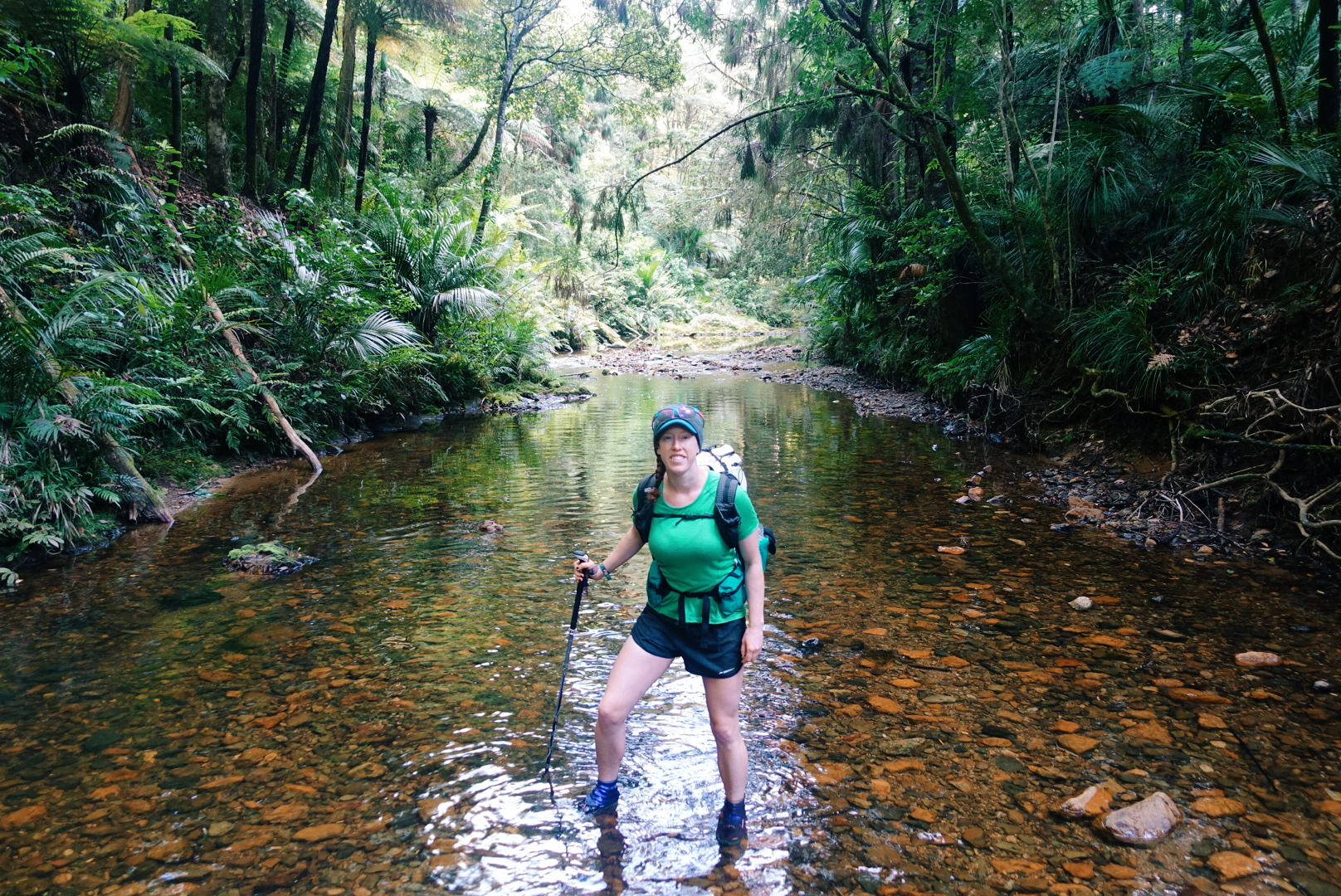
One of my favorite sections of trail so far has been the Papakauri stream, a 3km (~2 mile) riverwalk -- no trail but the stream itself. The Papakauri is only about shin deep in most places, but it was magical to wander through untouched forest by way of the water. Even in the wilderness, trailbuilding reveals the human impact, but through the riverwalk, the only signs of human life were infrequent trail markers that reassured us we were moving in the right direction.
photo/ Jonathan
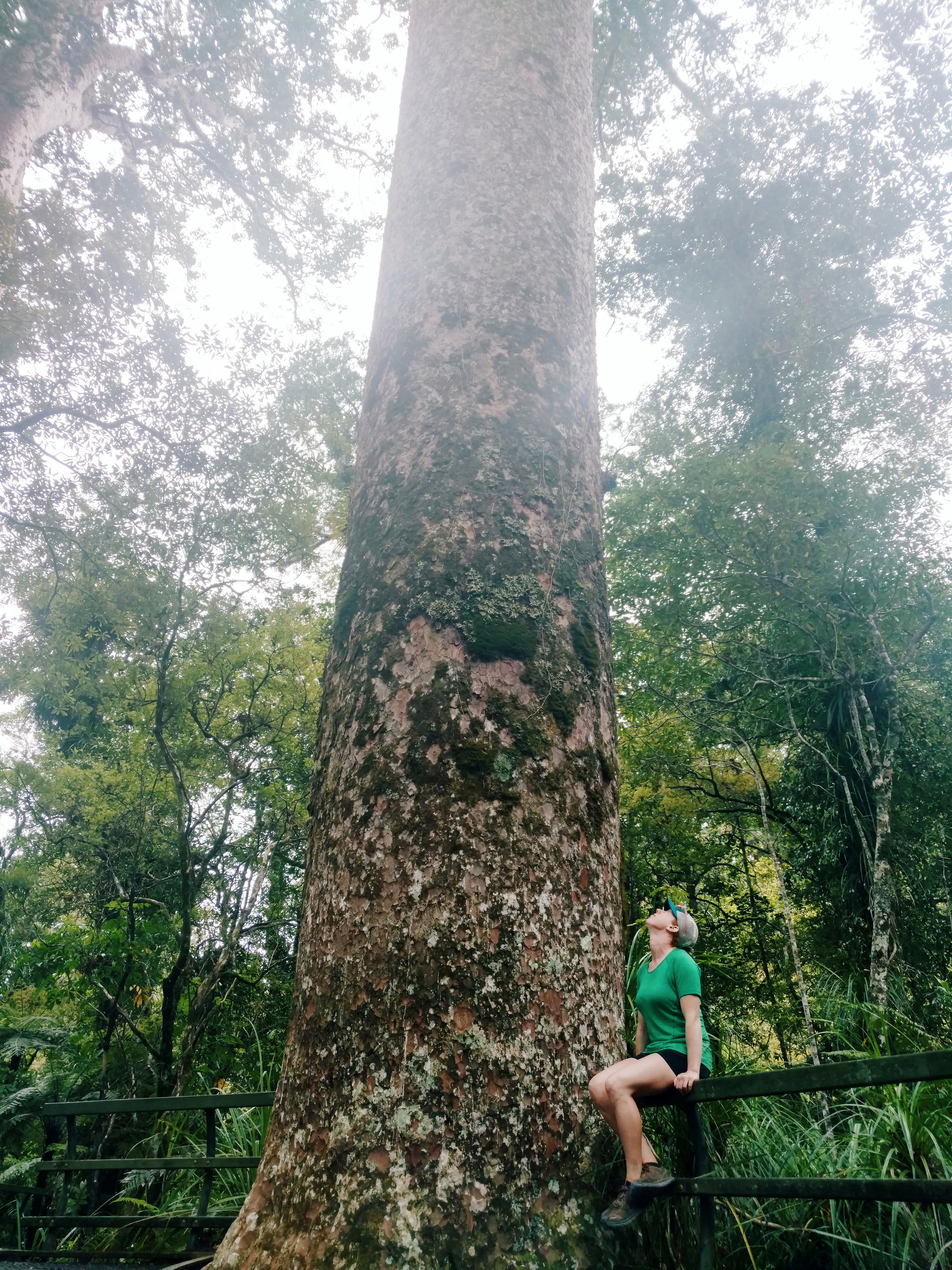
Puketi Forest & Tane Moana
In man places -- including the Riverwalk -- the bush is dense and jungle-like, but in a few places, we've been lucky enough to visit some particularly unique New Zealand terrain: the Kauri forests.
Kauri (Agathis australis) are found only on New Zealand's North Island. They're massive conifers reaching up to 150 feet tall and up to a whopping 48 feet in girth. The oldest surviving tree is estimated to be 1500 years old.
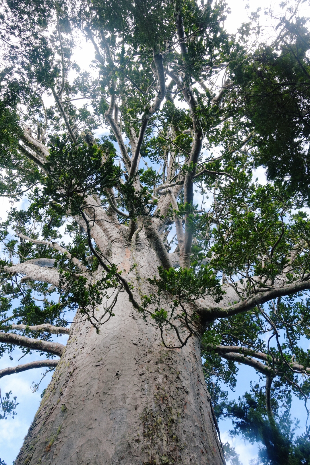
This massive Kauri, named Tane Moana, is believed to be over 1000 years old.
photo/ Jonathan
Kauri trees alter the soil chemistry around them and allow many other rare plants and animals (mainly birds) to thrive. This creates particularly unique forests in New Zealand because a massive number of the species found here are endemic, found nowhere else in the world. The kauri shed their lower branches as they grow, too, so the forests are brighter and airier than other bush.
Sadly, the kauri trees are dying. The usual trail through the Puketi Reserve was closed to hikers due to Kauri Dieback Disease, a fungus that is slowly killing off these forests and that is believed to be spread by humans and some invasive mammals like possums and wild pigs. Still, we've been able to walk through a several kauri forests, including a majestic grove near the edge of Puketi and it's easy to see why we'd want to protect these beautiful forests.
photo/ Jonathan
Impromptu Trail Magic
Some highlights come right in the wake of the lowlights. After a long day of hiking, the last thing you want to see is a sign that says "No Camping Allowed - Next 20 Km."
While we stood next to the sign, trying to decide where to go for the night, a man came out of the nearby house and approached us. He asked if we needed somewhere to stay -- this is the moment when you look around to determine how likely the person is to be a serial killer -- and said we were welcome to camp in the lawn.
When we approached the porch, where he and his wife were drinking their tea (yea, not particularly sketchy, in this case), he offered up the garage and introduced himself. Our lovely hosts, Keith and Raewyn, bought out cots for us and turned on the hot water so that we could take a shower. They showed us outlets where we could charge our phones and gave us the password for their WiFi. They even offered us a cold beer to drink before we turned in for the night.
These things may seem like basic comforts back home, but on the trail, the garage felt like a suite in a luxury hotel. Thank you so much to our hosts for your amazing hospitality and for giving us such a warm welcome to your beautiful country!
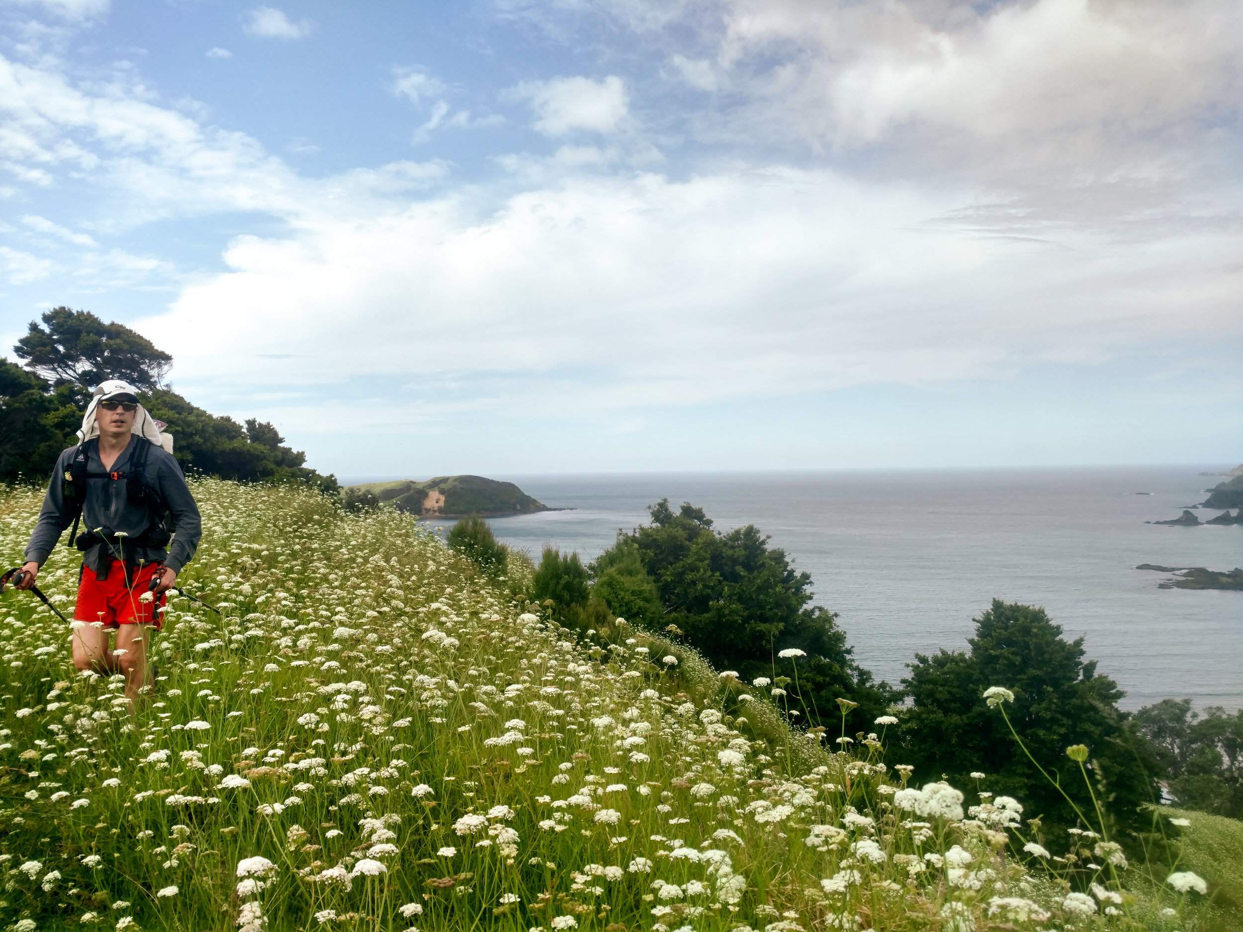
Jonathan tramping through a field of flowers north of Matapouri.
photo/ Molly
Taiharuru Estuary
One morning, joined by an Aussie hiker, we woke up at dawn to catch low tide for an estuary crossing. We donned our sand socks and walked 2 miles of so in the soft mud before reaching the river itself, which was waist deep, even at low tide. Just before reaching the river, we were treated to a picture perfect sunrise. Not a bad start to the day.

photo/ Molly

photo/ Jonathan
The Surprises
One of the perks of having the varied terrain through the Northland is that some of my favorite sections of trail have been total surprises. A short coastal walk between Paihia and Opua turned out to be a charming and well-maintained track right above the beach. And on another day, we practically turned a corner into a ridiculously stunning cliffwalk above the beaches near Mangawhai:

Once in a while, stunning views just pop up through the foliage, like this magical scene outside of Warkworth:

The Northland consists of all of the terrain north of Auckland, New Zealand's largest city at 1.2 million people. The city runs from coast to coast, so the trail runs right through the middle of it. So what's next? Hiker trash take to the city.

Logistics of the Northland
After Ratea, the Northland opens up. The logistics up here can be daunting, but they have their upsides, too...
After Ratea, the Northland opens up. The north is covered in pastures with sheep and dairy cows, small towns dot the landscape, and forestry is a major industry. We've been told by locals that only a tiny percentage of the native bush remains intact, and it shows.
We often cross through several different ecosystems in one day: wake up in a pasture, hike down a gravel road, ascend into a few kilometers of native bush, then descend onto a beach before walking into a town and camping in a grassy park.

The view of the day to come. A long beach walk followed by a steep climb up a mountain in the bush.
photo/ Jonathan
The terrain changes can be disorienting; by afternoon, the morning's campsite feels like the distant past, and it's tough to get into a rhythm with our hiking. The sections of true "track" (trail) feel far too short -- and the sections of roadwalking along state highways seem far too long.
And yet the wild sections are startlingly deep and dense. Sometimes, dropping off of a road, the lights go out in the dense undergrowth, the world turns green, and of course, you squelch instantly into ankle deep mud.

Dense native bush is sure to have spider webs across the trail first thing in the morning. The best defense against a spider to the face is letting someone else go first, but if you're on your own, a second pole will do.
photo/ Jonathan
Private land is a big deal here, too, and the trail runs through (or around) a lot of industrial terrain. We keep a sharp eye out for electric fences as we traverse through muddy pastures, dodging sheep, cows, and all they bring with them (I wrote a note to myself for this post that just read "Mud. Mud. More mud. Mud with poo."). We also walk along logging roads, past orchards, and through people's backyards. We're in and out of towns nearly every day.
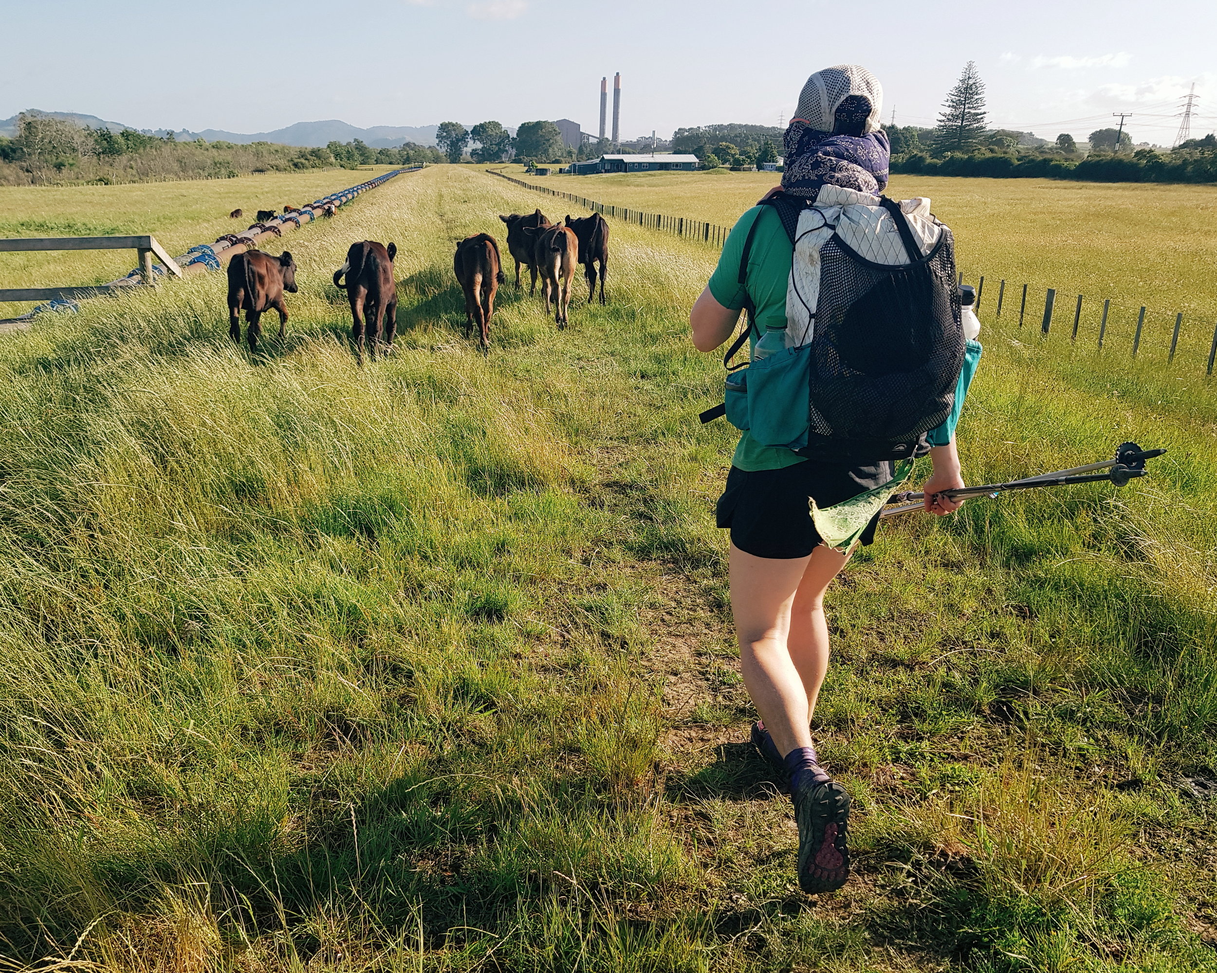
Dairy is a huge industry on the North Island, which means cows, cows, and more cows.
photo/ Jonathan
Paradoxically, this makes the trail both far more convenient and far more complicated than hiking through true wilderness.
Because of all of the private land, there and heaps of rules about where you can and cannot (mostly cannot) camp. Free camping (or freedom camping, as they call it here), is nearly impossible in many sections and we've had to pay for camping far more than we'd like. There are Holiday Parks (campgrounds) all over the place, but it's awkward to time your days around specific stopping points, rather than just hiking until you're tired and setting up camp. Coming from a trail like the PCT, it's also frustratingly expensive.

The better roadwalks are on dirt or gravel through pastures and forests. These rolling hills are pretty characteristic of the Northland.
photo/ Jonathan
Another unusual logistical hurdle here: the ocean. Much of the trail follows along the east coast, which makes for some exceptionally beautiful views, but has caused us a few headaches, too. At several points the trail crosses rivers, estuaries, and even large harbors that require transport by boat.
We've been able to do several smaller crossings on foot, but they've required us to plan around the tide. Even at low tide, a couple of crossings have been chest deep for me and I've had to loft my pack overhead to keep it dry.

River crossings get pretty legit around these parts.
photo/ Jonathan
Several of the beachwalks also require that you pass at low tide. When you're moving 3 miles per hour, it takes a fair bit of planning to hit a tight time window. We use an app that gives us low and high tide times, and we'll sometimes plan several days in advance to make sure that we hit all of the water sections at the right times of day.
The rivers that are too big to cross are another story. Sometimes, we have a phone number in our notes and just hope someone answers. Once, we got a name and phone number for a guy who smuggled us across a harbor like stolen goods. Another time, we got to a river with no way to cross and a friendly local flagged us down to offer us a ride. Phew! (Especially because we were on a time crunch for the next low tide...).
While the trail logistics here can make my head spin, being near towns all of the time does have it's upsides. One day, Jonathan and I stopped in two different towns to get fish and chips for both lunch AND dinner while still knocking out 30+km. Another day, we hiked 20km, got coffee and breakfast, enjoyed some cider and ice cream in a park, caught a boat, and then hiked another 10km to camp.

When you go through town this often, sometimes you stop for a midday cider.
photo/ Jonathan
We have barely carried more than 2 days of food at a time, and the snack opportunities have been ample. It's hard to resist hot food once the hiker hunger starts setting in.
Another unique asset on this trail is New Zealand's total obsession with public toilets. They're everywhere! Every beach and small town has one and they're sprinkled through the cities like Starbucks through Seattle.
I love a good poop in the woods as much as the next guy when it's sunny and the view is right. But when you've been soaked all day, a dry privvy is pretty game changing.

Paihia was super into the public bathroom. Note the toilet sconce on the wall and toilet planters on the roof.
photo/ Molly
The Northland had its own kind of chaos, but there were some phenomenal highlights, too. Look for another post coming soon with some of our favorite sections.
Cheers,
Molly