
Into the San Juans


The San Juan mountains of southwestern Colorado are some of the highest and most rugged mountains on the CDT. There are thirteen mountains in the range over fourteen thousand feet in elevation and huge swaths of land above ten, eleven, twelve thousand feet. The San Juans are also home to Colorado's largest wilderness area, the Weminuche Wilderness, which covers nearly 500,000 acres. These are some of the wildest, most remote corners of Colorado.

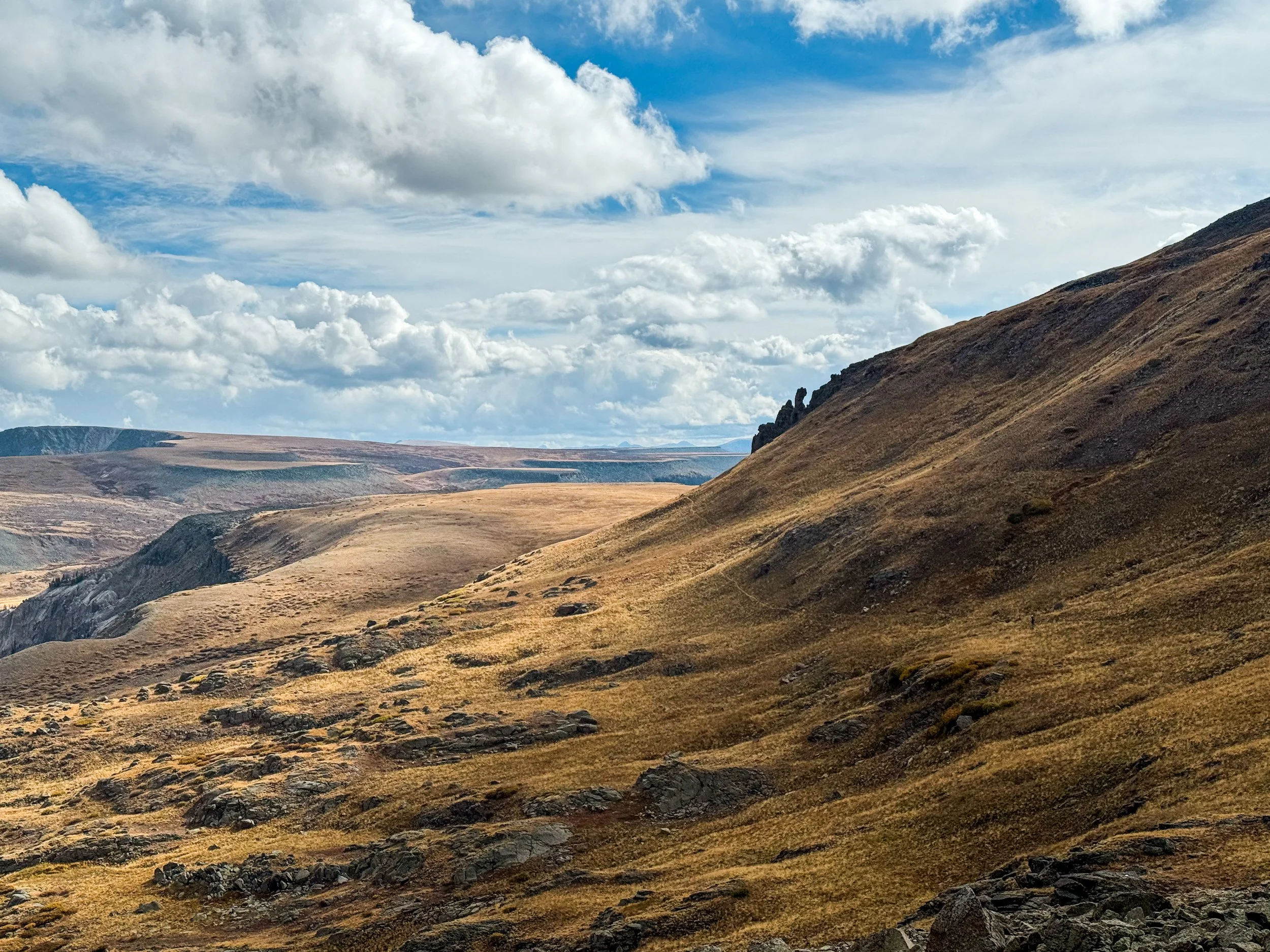
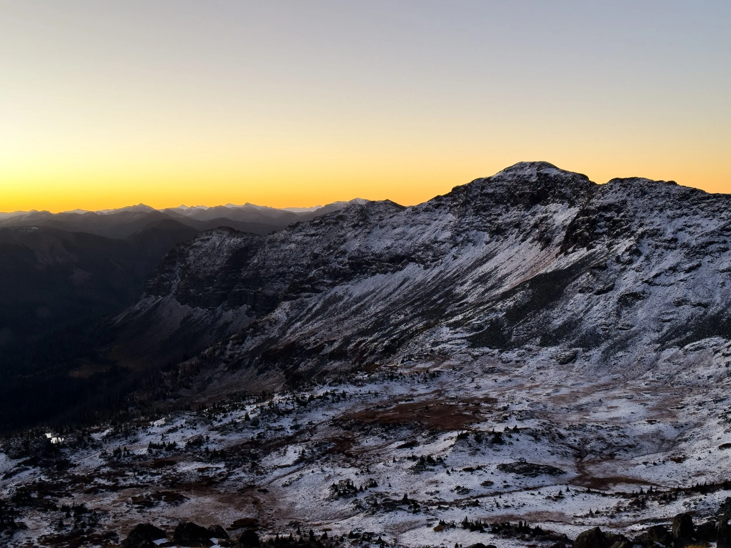
The easternmost 14er in the San Juans is called San Luis Peak. It is not on the official CDT but it's close; the trail runs over a saddle about 1500 feet shy of the summit. The peak is remote and difficult to access without a rugged off-road vehicle (or a whole lot of hiking). The forecast looked great and the night before was cold and clear. We decided to go for it.

Descending from San Luis Peak toward the CDT
There was frost on the grass as we started up the Stewart Creek Trail in the dark. We passed a small cow moose in the weedy creekbed. We'd camped near two other hikers, Ohm Boy and Scurvy. Ohm Boy (named for his pack, the ULA Ohm) passed us on the climb, also heading for the peak. As we reached the first ridge, thick clouds gathered to the west and it was beginning to spit snow. Ah, mountain weather.
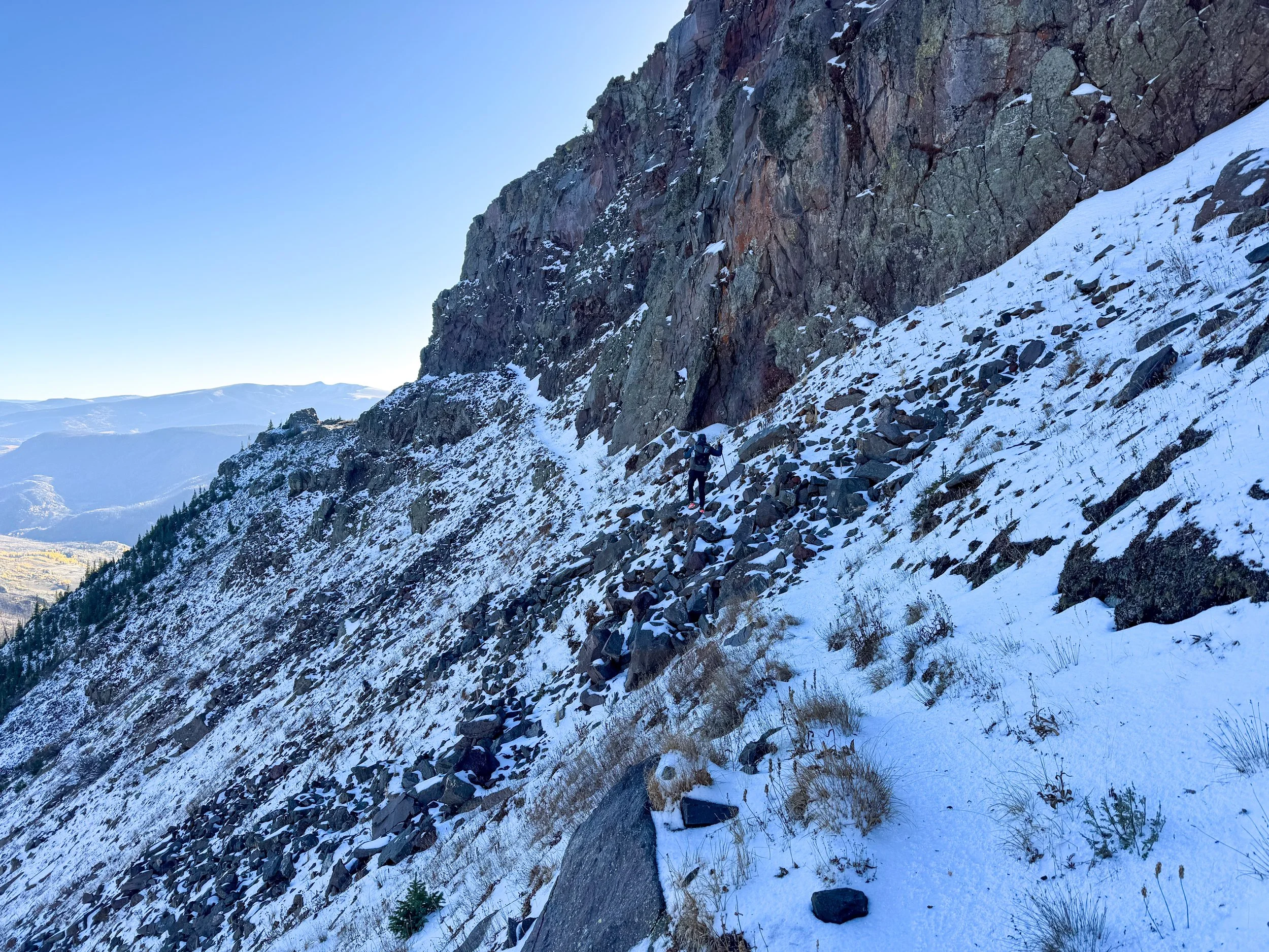
When we crested the ridge, the wind was howling and we couldn't see the peak anymore. Onward and upward we climbed. With limited visibility, we were tricked by each new false summit. I could barely see Jonathan, hiking twenty feet behind me. The wind was whipping snow and hail across the trail. By the time we reached the final push, there was an inch of snow on the ground. We could see Ohm Boy's footprints intermingled with a coyote's tracks leading all the way up to the summit. It was slick and rocky, and with the wind in our faces, every step took an enormous effort.
On the summit of San Luis, there is a rock bivvy (a small half circle of rocks built into a wall to give climbers a temporary reprieve from the wind). We clambered inside and sat down for a quick snack, exhausted. Just as we prepared to descend, the wind died down and the clouds parted, drifting away from the peak to reveal stunning views down into the valleys below and out toward the surrounding mountains. Forgetting the freezing, exhausting climb, we gleefully basked in the sunshine and pointed to spiky peaks, aspen-lined hillsides, and the CDT winding away into the distance.
We stayed above 12k feet for most of that afternoon, climbing up to narrow ridgelines and then down the tundra into grassy valleys with huge, craggy peaks above us. As we've come further south, we've noticed the treeline rising. In northern Colorado, treeline falls in the high elevens (11,700 or 11,800 feet), but by the time you reach the San Juans, it has crept upward to the low twelves. As we climbed up onto Snow Mesa, we were still well above the trees.
The view out across Snow Mesa
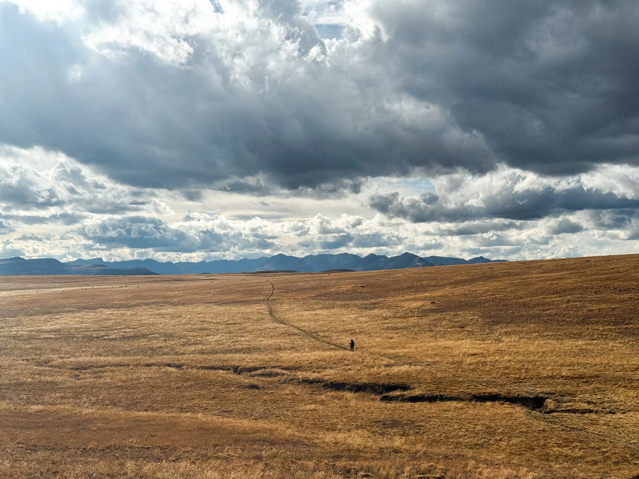
Walking across the flat top of Snow Mesa, 12,288ft
We walked for three miles across the flat top of the mesa with Uncompagre Peak looming in the distance. At the edge of the mesa, the trail looks like it falls off the edge of the world. It descends down a steep, rocky ravine toward a thick forest of pines and spruce, then aspens glittering in the sunshine and breeze before reaching Spring Creek Pass and the highway to Lake City. Ohm Boy was already at the road, so we stuck out our thumbs and joined him. Our first taste of the San Juans had been a 28 mile day with over 7k feet of vert. We were wiped out but excited for what the rest of the northern San Juans would bring.
We caught a ride to Lake City with a mechanic who plows roads in the winters in Colorado and works on snow cats in Antarctica all summer (for those who may not be familiar, snow cats are large vehicle used for transportation, plowing, and grooming snow). His smelly, but very snuggly mutt cuddled up against me in the truck as we asked him all about his work.
In Lake City — our last stop before entering the Weminuche Wilderness — we stayed at a hostel with a restaurant downstairs and a bakery next door. We met Chew Toy and Side Quest at the hostel and saw some familiar faces at the grocery store: Beanie Baby and Cookie Monster, who we hadn't seen since Montana!
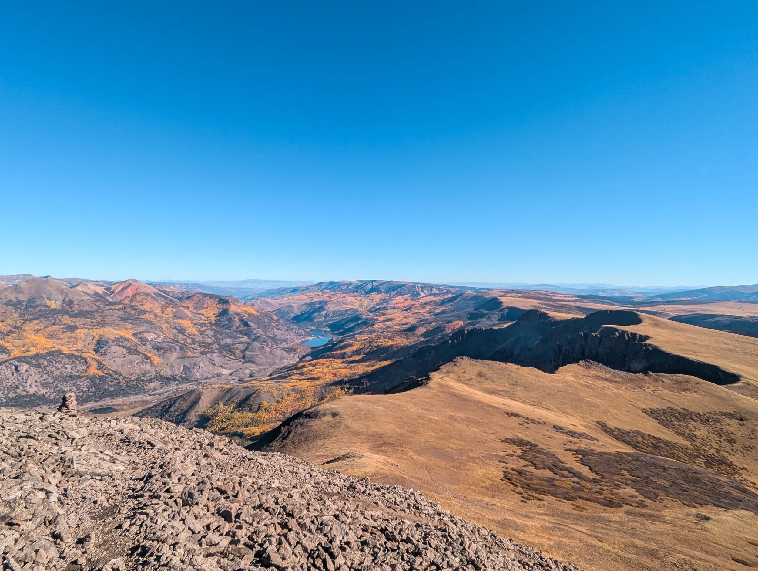

The first two days in the Weminuche were cloudless, breezy, and absolutely stunning. The trail runs through an alpine moonscape; not a tree in sight, herds of elk roaming the tundra, massive, imposing peaks in every direction. The peaks of Vestal Basin rose along the skyline, reminding us of our scrambling trip back in 2022 (I saw Vestal Peak and thought to myself, "Dang, that looks like a gnarly climb!" before realizing that we had, in fact, already climbed it).

Looking back toward Vestal Basin

Sunrise on our second full day in the Weminuche Wilderness


The sun sets over the headwaters of the Rio Grande
On the evening of the second day, clouds began to gather once again. We raced past the Window and the Rio Grande Pyramid as it started to rain. We were safely in our tent by the time the deluge began: rain, hail, thunder, and lightning striking directly overhead. In the dark, we saw Beanie Baby and Cookie Monster hike past in the rain, having come over the pass by the Window as the storm was raging. They later said they'd seen massive trees dropping around them as they sped down the valley, heading for lower ground.

Storm clouds gathering on the horizon

A rainbow over Rio Grande Pyramid, 13,827ft
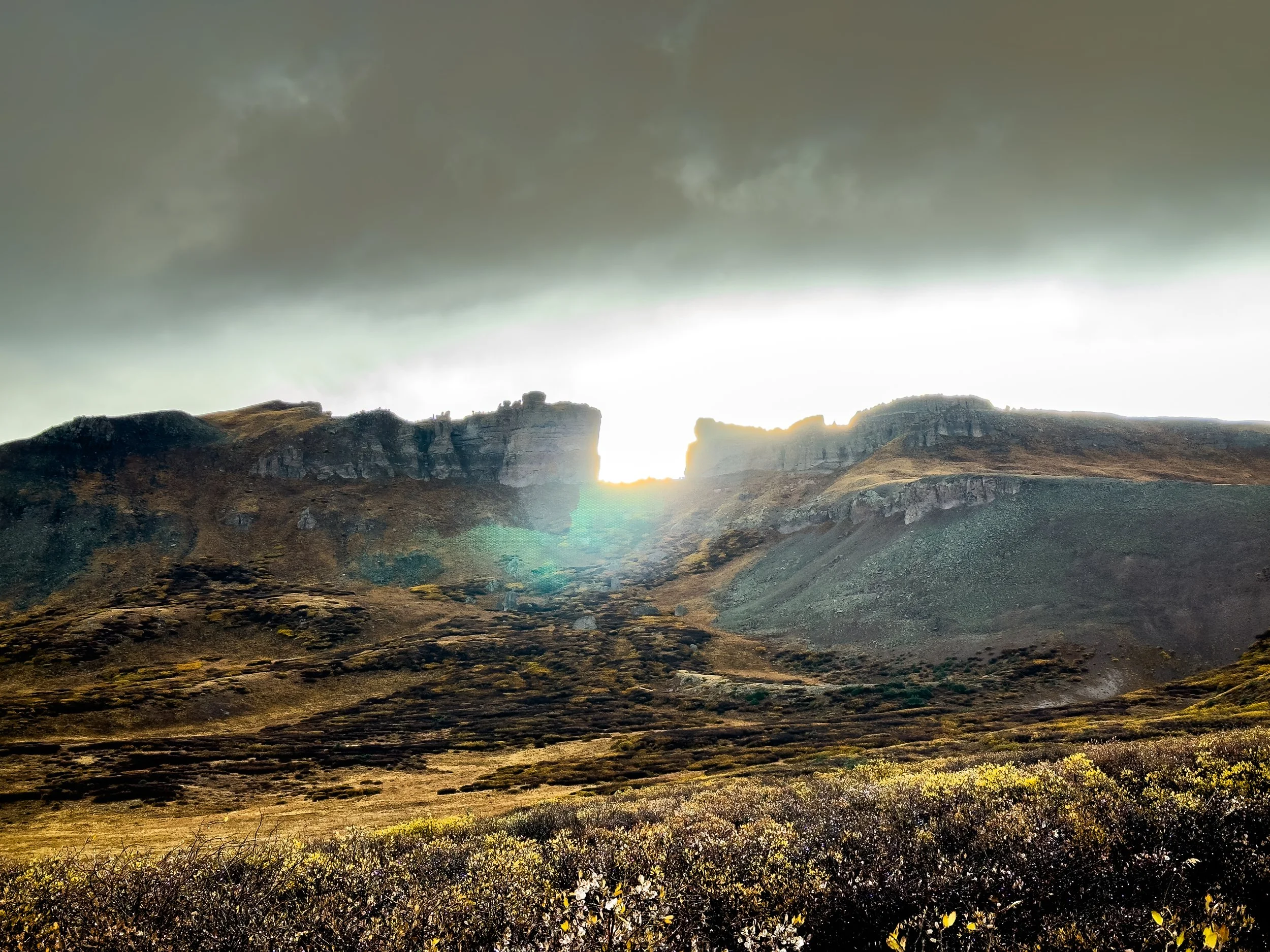
The setting sun perfectly illuminates the Window during a break in the storm
It rained most of the night, turning to snow just before dawn. We slept in, not excited to hike in thundersnow in the 6am dark. Around 8:30am, we finally left the tent and hiked down the valley as the thunderstorm picked up steam again. At the valley floor, we faced a decision: continue on the red line or bail down to a lower route that could take us into town if needed. The sky was clearing and our forecast was optimistic about the afternoon, so we decided to brave the high country.
It rained a little bit more, off and on. We made it across a broad valley and began to climb again before it started to flurry again. The snow was manageable as we climbed higher, but the temperature was plummeting, and our rain gear was wet from the morning's storm. Once in a while, we caught glimpses of the sun, peeking through the clouds. Then, the snow would begin to blow, and all we could see was white. As we climbed over 12k feet once again, I had to lean against the wind to keep my feet on the trail. I crouched down and marched, poles out wide to support me as my pack created a sail. We pulled our buffs over our faces and powered on.
The snow started to build up. An inch at first, then two, then three. We made it over our first high point, but we were getting colder and colder. Without anywhere to shelter, we couldn't stop to eat or drink. At one point, finding a couple of small krummholz trees to huddle behind, neither of us could work our hands well enough to open a bar, so we bit through the plastic, desperate for a few calories.
Heading up the next rise, less than a mile before we'd descend into lower terrain, I got fully blown off my feet, toppled over by the wind. Jonathan was behind me, walking like a troll to hold his ground. With freezing hands and feet, we decided to put up a bivvy in whatever wind break we could find and focus on just getting warm again. We charged down a valley with no trail and set up the tent in the best shelter we could find.
For two hours, we sat in the tent in our sleeping bags, doing everything we could to get warm. We broke open the emergency hand warmers, ate all the calories we could manage, and held down our little tent, a thin cover of dyneema against gusts of frozen wind. The sun began to creep out around 1pm, as the forecast has predicted, and we emerged from the tent, warm enough to carry on. We climbed through snowdrifts up to our knees, the wind still gusting hard enough to push me off the trail if I wasn't careful.

After the snow storm, the sun began to reappear and we got a glimpse of the changed landscape.
The descent was a quick one. We were eager to get down into the valley where the ridge would provide some wind protection. The trail was muddy as we descended below the snow line, and it stuck to our shoes, so we half-skiied, half-slid down back to safety. At the low point, we found a decent site and set up camp. It was perhaps the hardest fifteen miles I've ever hiked.

Molly descends toward lower ground, relieved to be heading toward a warmer, safer evening.
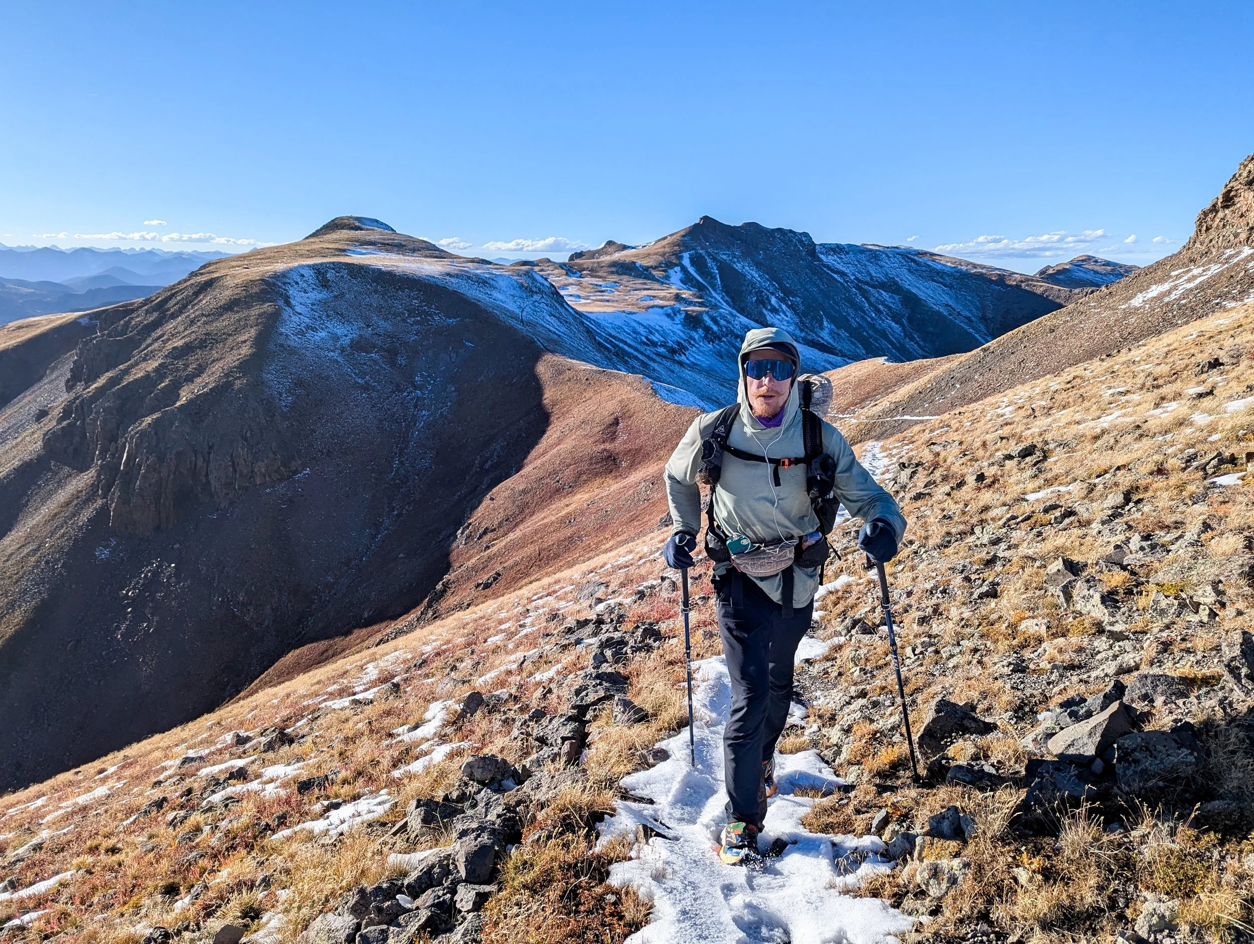
The next morning, there was not a cloud in the sky. A crust of snow sparkled across our moonscape, now an alpine wonderland. It was cold as we climbed once again into the snow, but we could see the dawn glowing on the horizon. We stopped to bask in the first light of morning, warming our frozen fingers and letting it wash over our faces for a moment. Then, onward! We had a big day ahead: another 28 miles up high with almost 7k feet of elevation gain.
Sunrise glows on the horizon the morning after the snowstorm
Molly traverses the Knife's Edge in snowy conditions. Most of it was completely navigable, but for one short section, we had to kick steps into a steep, snow-covered slope.
As morning turned to afternoon, the snow began to melt rapidly, leaving the trail a slippery, muddy mess. There was often no escape, so we plodded, pleaded, and plowed ahead with a pound of sticky mud coating each sneaker. And yet, the views continued to astound us: ridges covered in tiny spruce trees, wild rock walls, wide alpine lakes, and now and again, a glimpse out toward the low country of New Mexico.
The last morning in the Weminuche held more of the same: beautiful views and terrible mud. We made it to the road just after lunchtime and hitched into Pagosa Springs, directly to a Hmong restaurant with some of the best food we've had on trail. We love you, Colorado. We took the next day off, visiting the free hot springs, drinking real coffee for a change, and our only formidable mountain for the day was made entirely of nachos.

