
The Southern Terminus
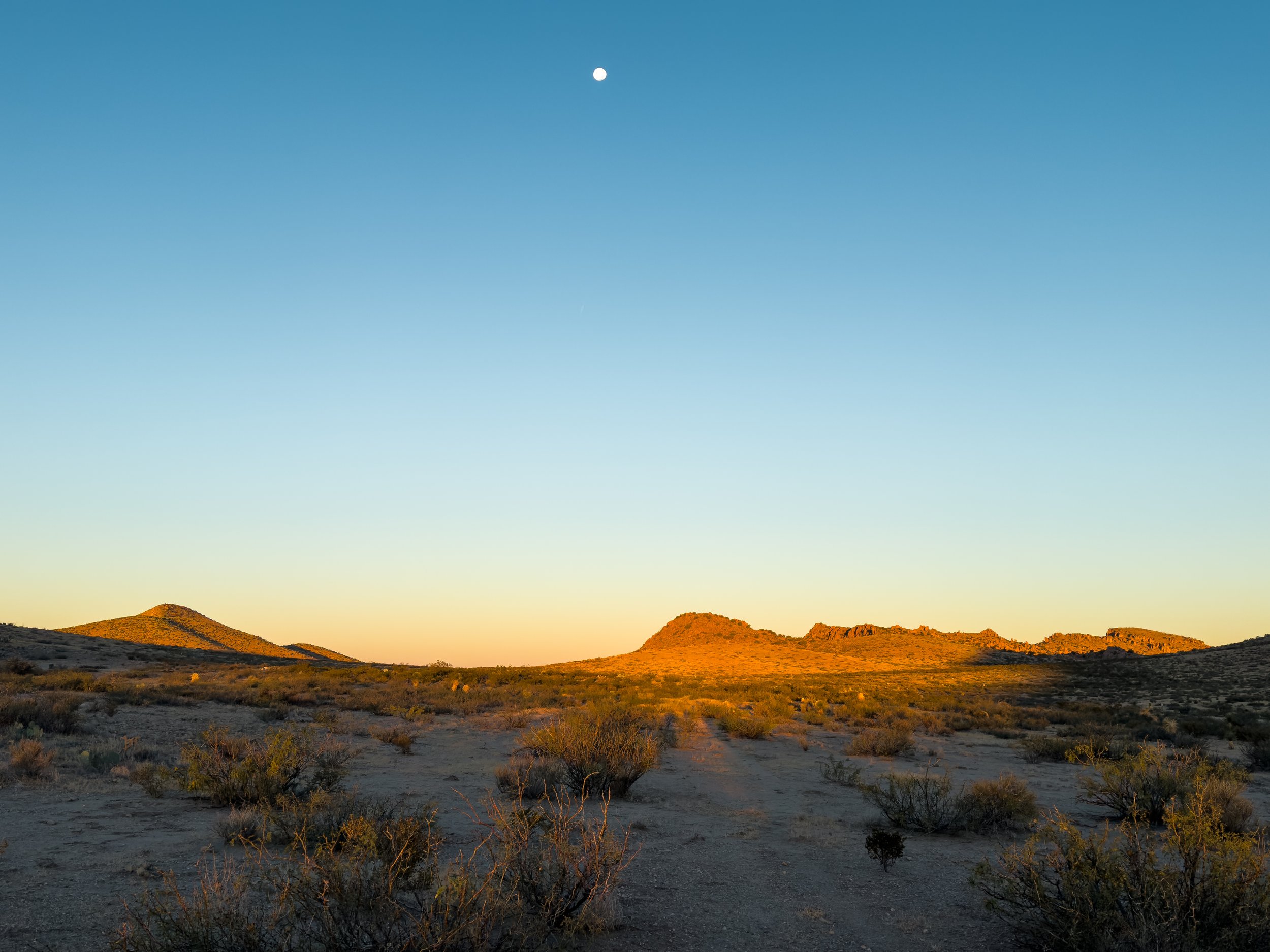
Standing outside of the tent, looking down at the lights of Lordsburg – our final resupply stop on the CDT – I am glad that we didn’t get a room in town for the night. We only have a few more nights on the trail and I don’t feel any need to be indoors, though it means foregoing showers for another four days (it has been three already). Out here, it’s quiet. There’s a full moon, and the desert is luminous. We go through our evening routine, the same one we’ve done every night now for almost all of the 143 days on trail. It’s simple. We don’t get distracted or pulled in different directions.
Down there, it looks chaotic. There are so many lights; so many people moving around after dark. It’s not quite 7pm, but we’ve already had dinner, and it’s very nearly bedtime. I feel a glimmer of worry about reintegrating after trail. About being down among those lights. About no longer having just one single purpose. About being unmoored from this one goal: walk south. I breathe in the clean air, finish brushing my teeth, and climb into the tent. My body is settling down for the night. I have slept better on the trail than I have slept in years.
We took our last zero day in Silver City on November 2nd, the day the clocks rolled back for Daylight Saving Time. It didn’t make any sense for us to adjust to an arbitrary change of the clocks, so we simply didn’t. We rolled our own alarms back an hour to keep our schedule aligned with the sun and carried on as if nothing had changed. This meant waking up at 4:15am, making camp each night around 5:30pm, and heading to bed by 7pm for our last week on the trail.
The road walk out of Silver City on highway 180 was tolerable at 5am, but as the morning began to heat up, unfortunately, so did the traffic. After thirteen miles on pavement, we were beyond relieved to turn off onto a dusty dirt road. For the three days between Silver City and Lordsburg, water was, once again, our primary concern. At one tank, we met a hunter who was posted up in a blind waiting for deer to come down for a drink. He shared his tactics for hunting squirrels while we filtered our six liters and didn’t blink at us dunking our CNOC (dirty water bag) into the algae-covered water. The next source was also spring-filled tank, a large, rusty metal half-cylinder full of electric-green water, which thankfully filtered out cold and clear.
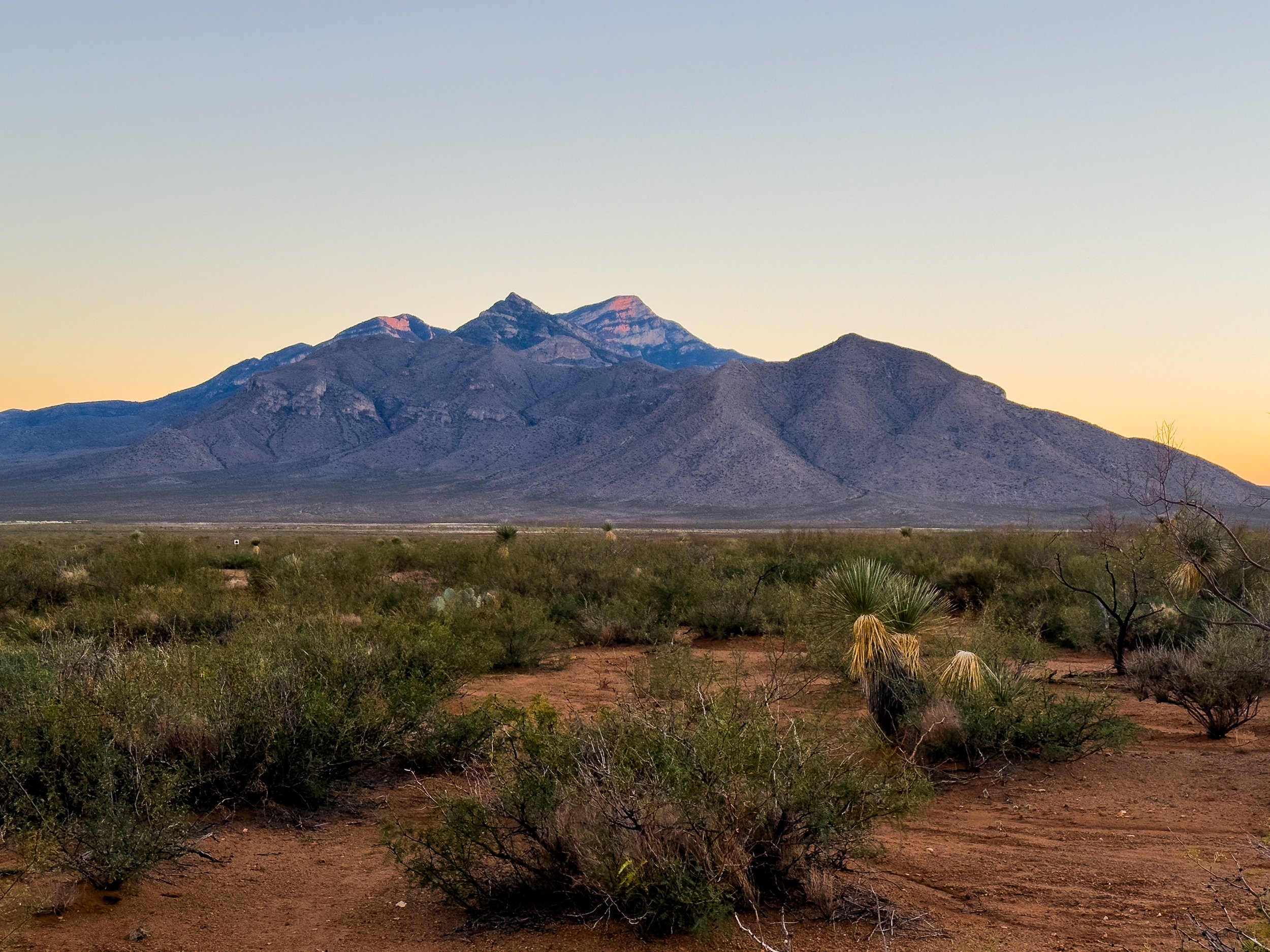
Before dropping down to Lordsburg and the low Chihuahuan desert, we had one more gentle climb up to Burro Peak, the last mountain on the CDT. We relished our last few miles in the forest, knowing that shade would be a limited commodity for the rest of our journey. The view from the top was pretty, if perhaps a bit modest by CDT standards. Still, there weren’t a whole lot of views out across the desert in New Mexico, so we appreciated it all the same. Descending from the summit, we found our last water source for the section, a water cache nearly 30 miles north of Lordsburg. There were 10 gallon jugs full of fresh, clean water stashed behind a large juniper tree near a trailhead, along with three twelve-packs of soda, cans of iced tea, and a cooler full of cookies and doughnuts. The trail angels left two buckets for seats, so we sat down and had a proper tea party.
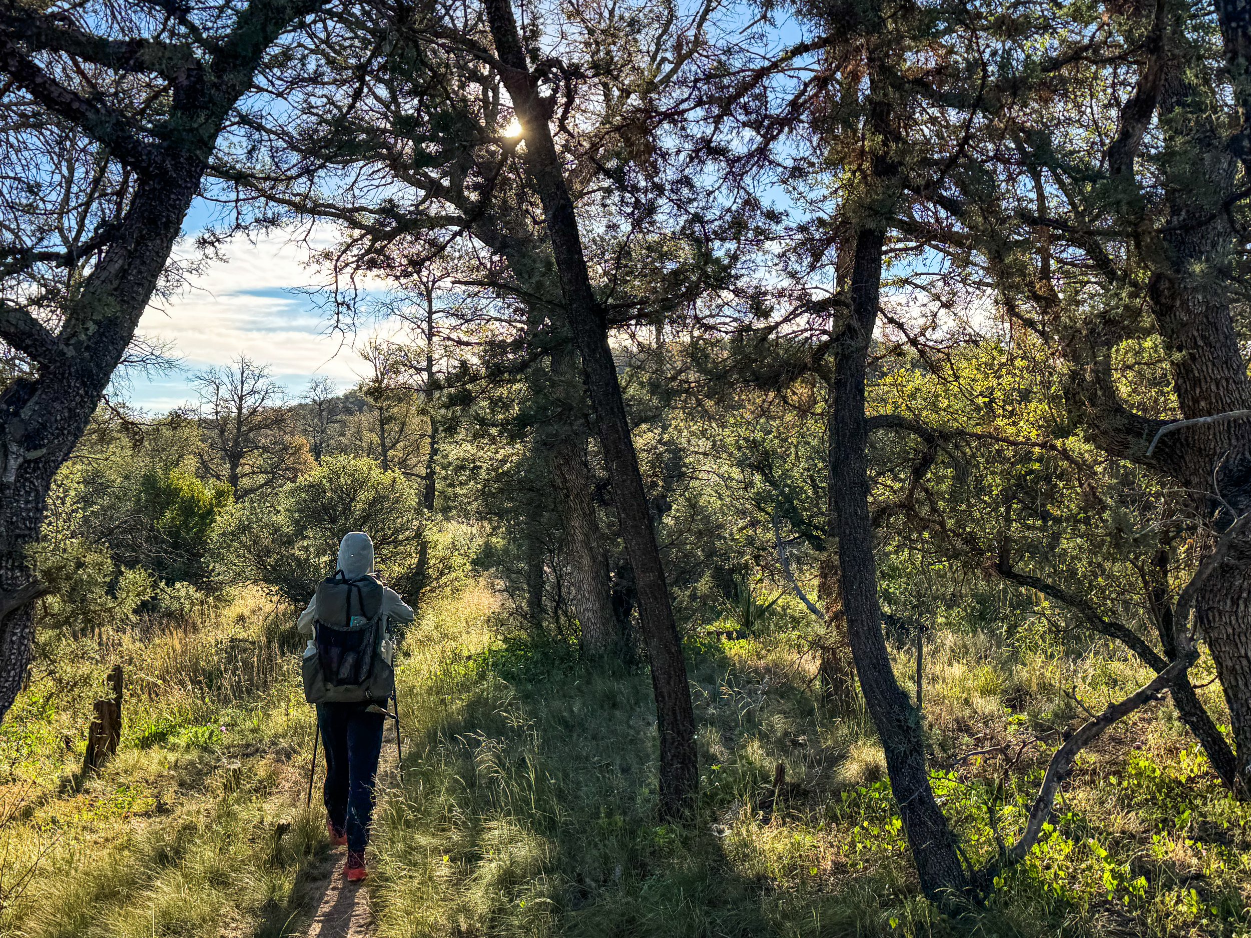
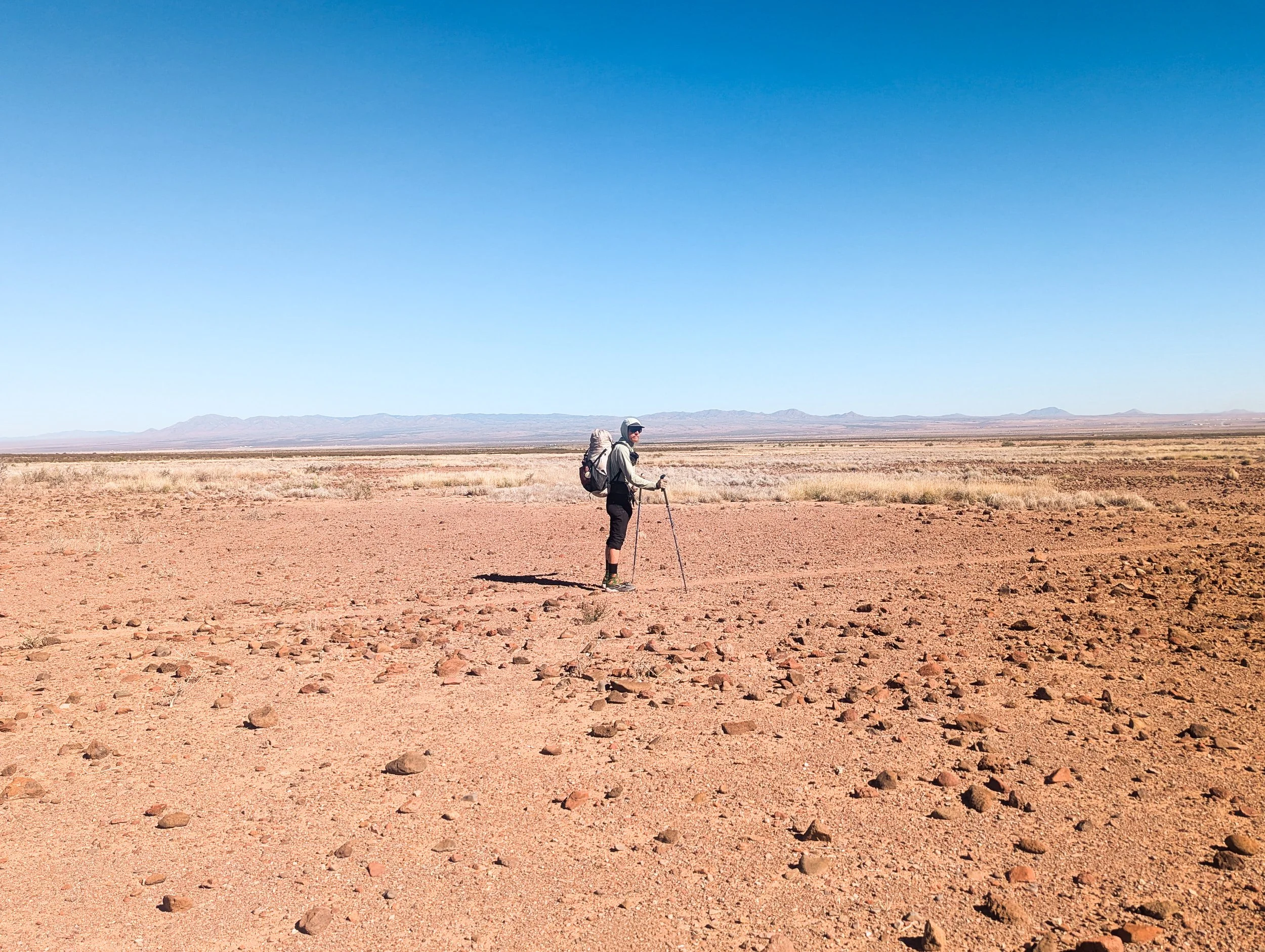
The last fifteen miles into Lordsburg are perhaps the hottest, flattest, sandiest miles on the entire CDT (which we can tell you has a few hot, flat, sandy miles). We started to see new kinds of desert flora: giant Arizona barrel cacti, fuzzy-looking pincushions, and tree-like yucca plants taller than Jonathan. We were thankful to be in southern New Mexico in November, rather than in the spring or summer when temperatures are frequently in the high 90s. Even so late in the year, the sun was intense, and there was nowhere to hide from the heat of the day.
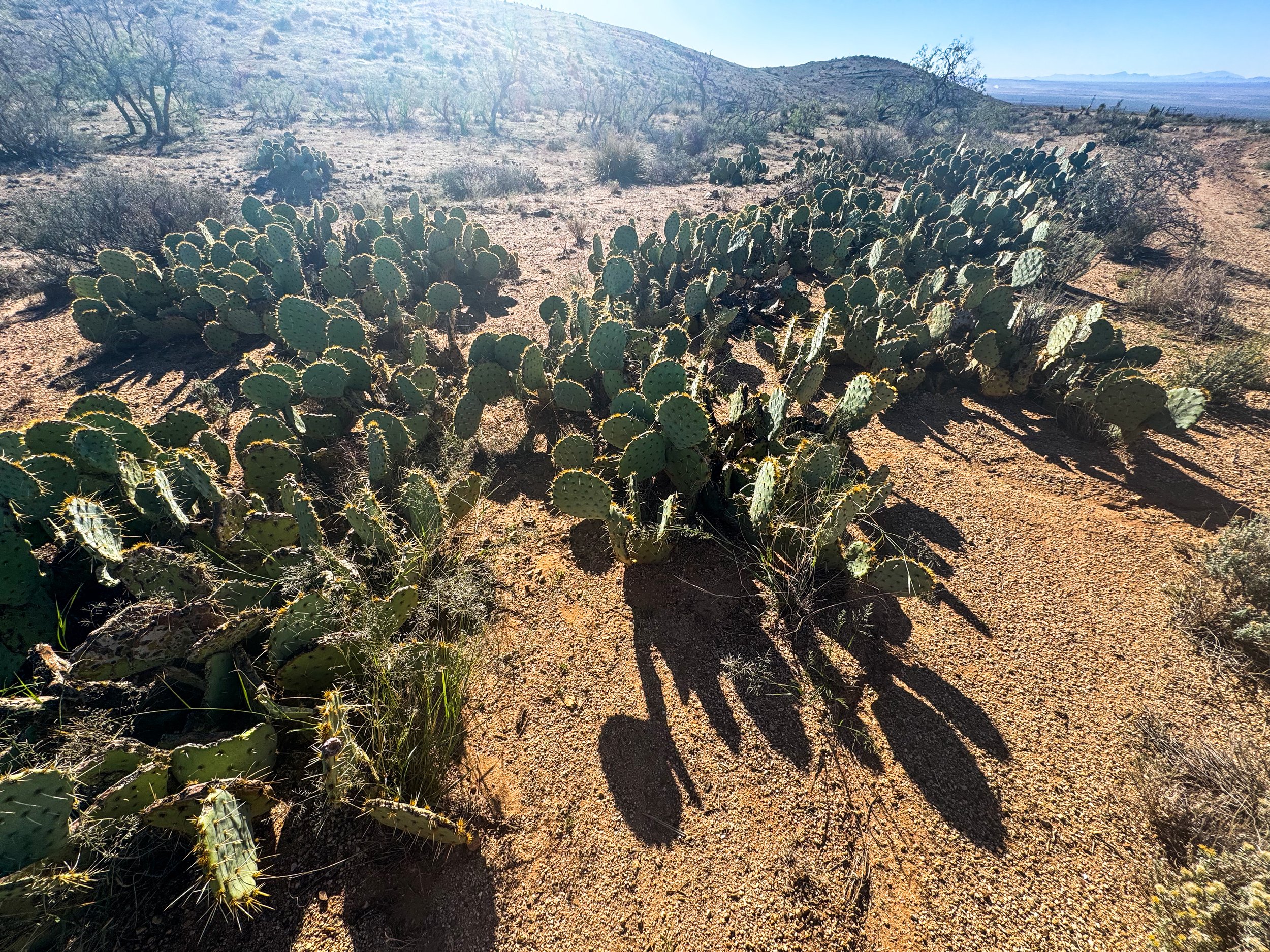
Prickly Pear cacti
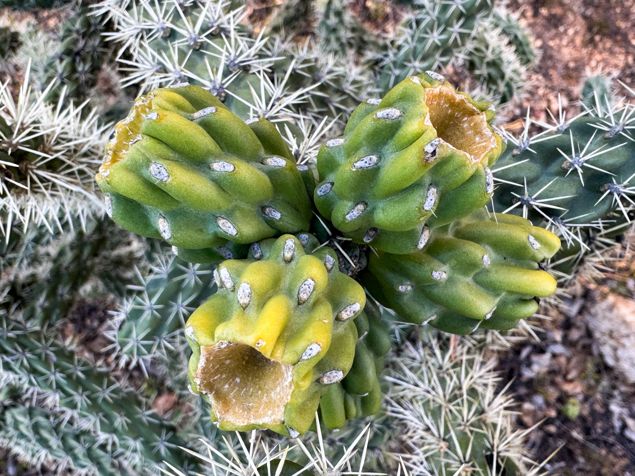
Unripe prickly pear fruit
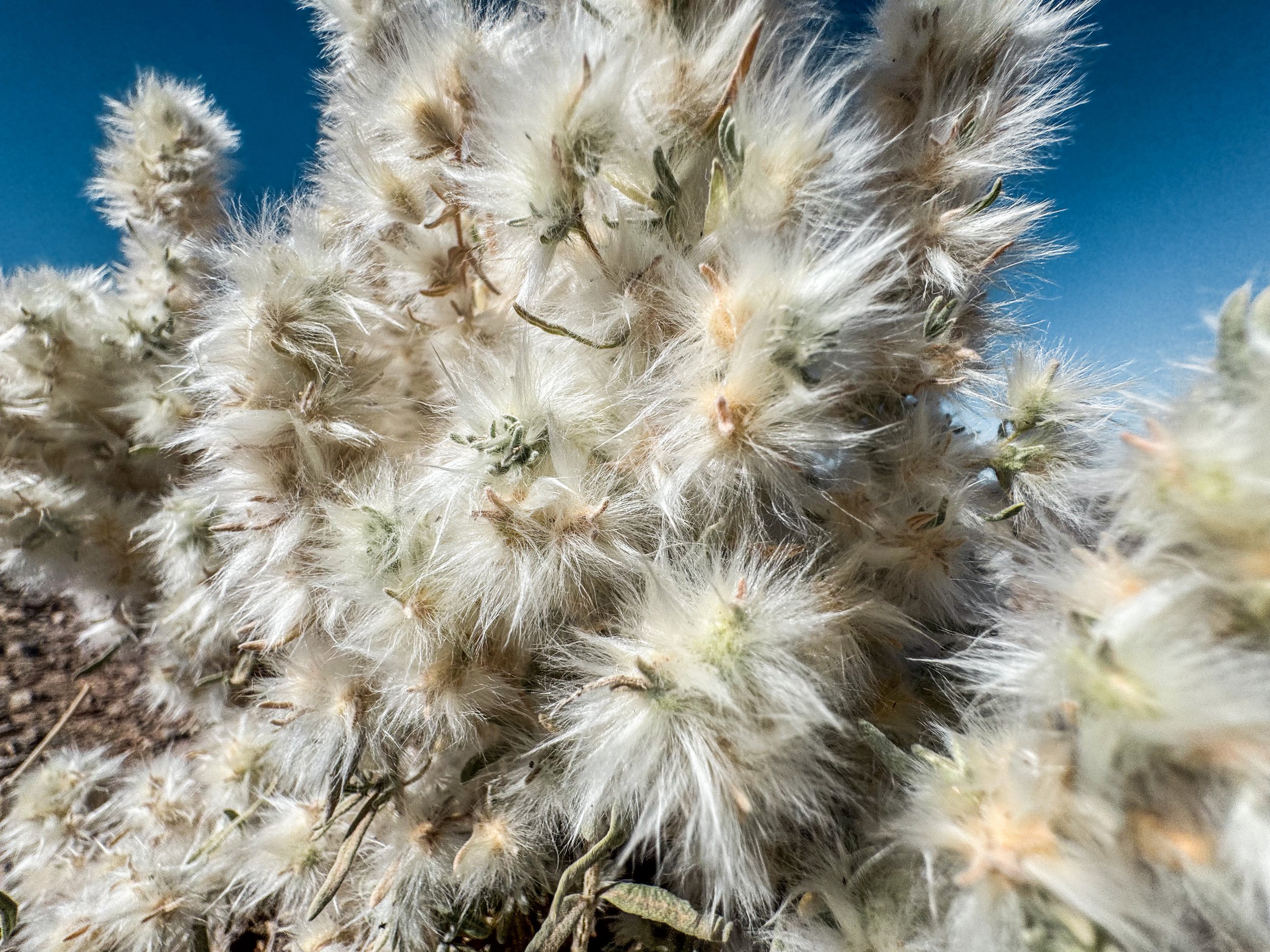
Winterfat
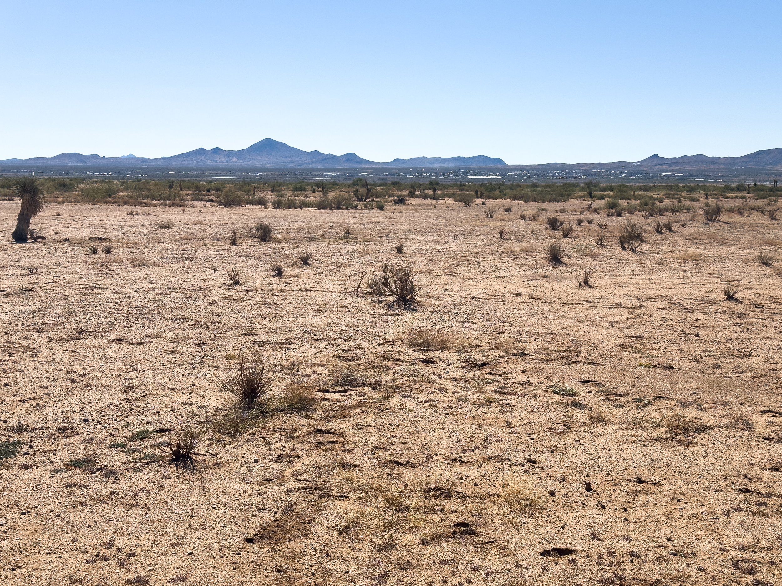
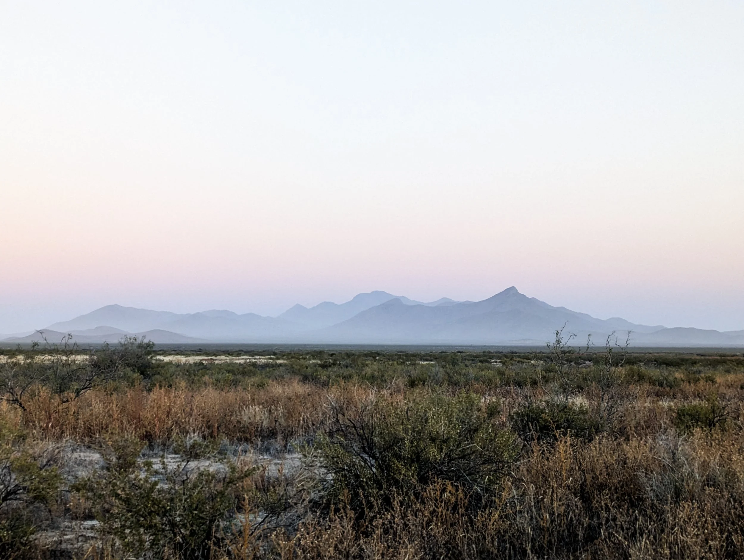
Looking west toward Lordsburg from about 10 miles away
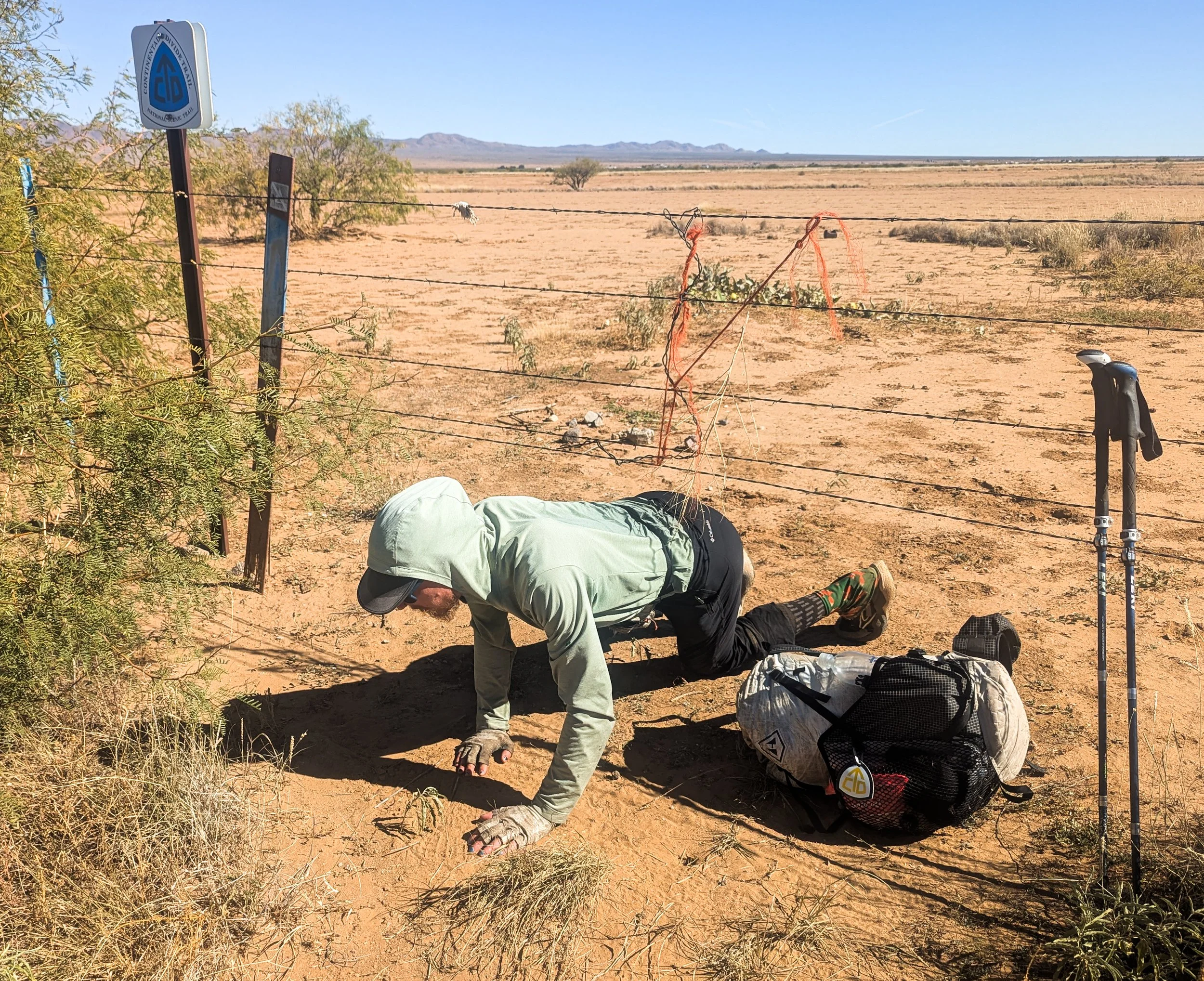
The CDT had to throw at least a little more shenanigans our way before we finished. Here’s Jonathan crawling under a fence next to the highway into Lordsburg on the official CDT.
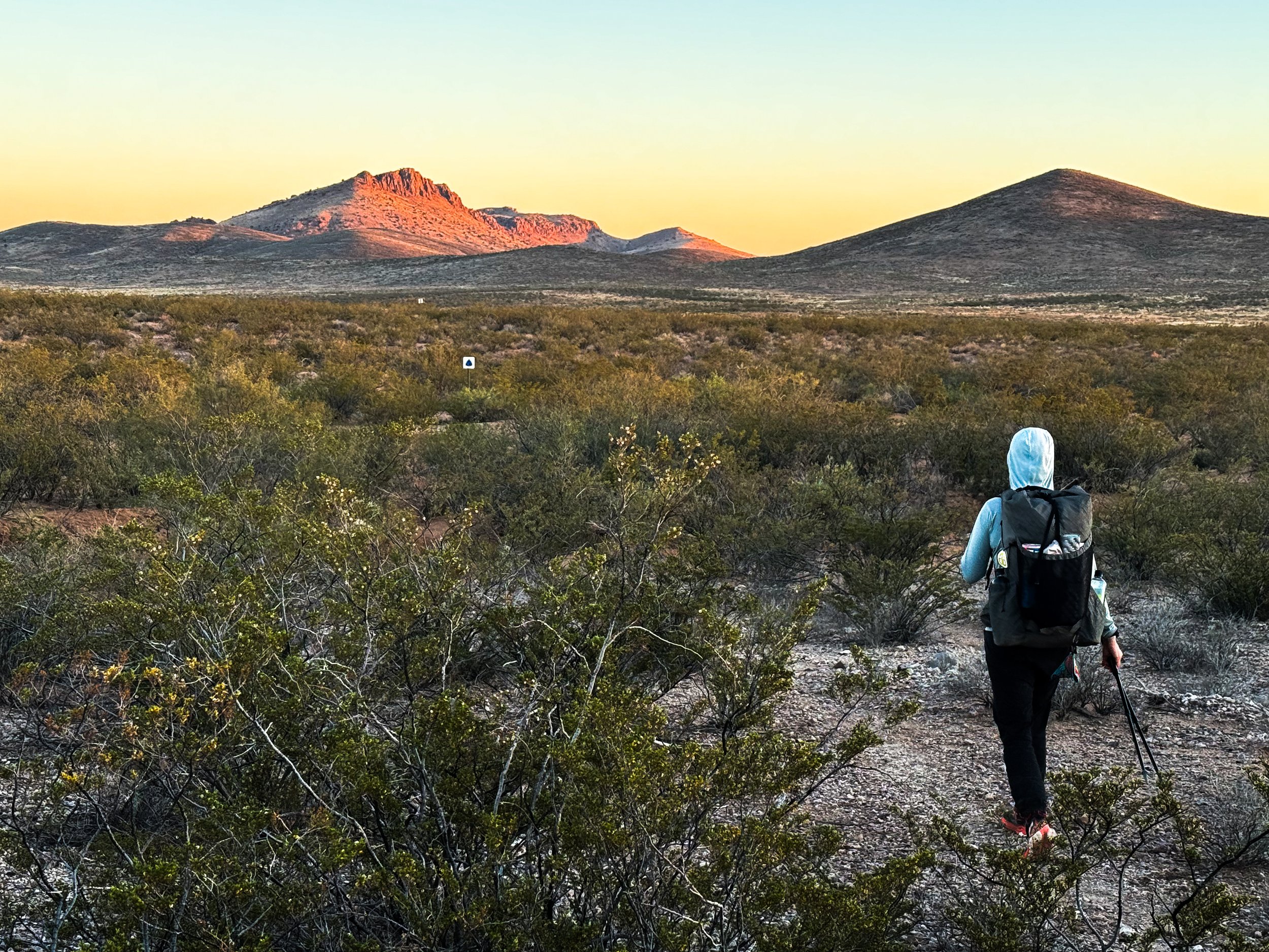
South of Lordsburg, the trail was thankfully more solid and less sandy. The walking was easy albeit fairly monotonous. We listened to some podcasts during the heat of the day, but in the mornings, we reminisced about our favorite (and least favorite) sections of trail. In this hot, exposed terrain, we cherished these cool, dark mornings when we’d navigate through the spiny forest of cacti and yucca using the reflective trail markers that trailed off far into the distance. While the sunrise put on a spectacular show, we'd argue over the top five views and made a list of the best and worst parts of living on the trail (on the good list: “Seeing so many beautiful sunrises”; on the bad list: “Can never find a comfortable seat”). We slowly began to realize that the trip was really coming to an end.
Reflective CDT trail markers leading us off into the distance as the sun begins to set.
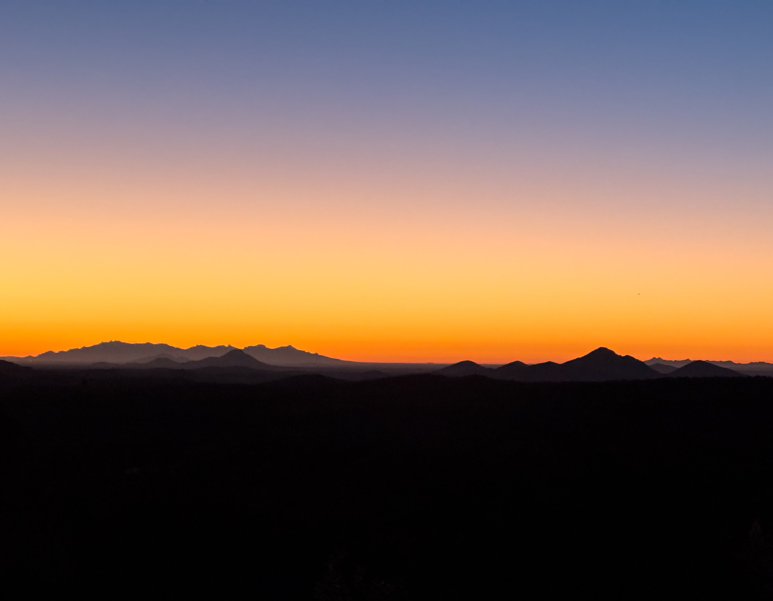
The last rays of sunshine glow on Big Hatchet Peak.
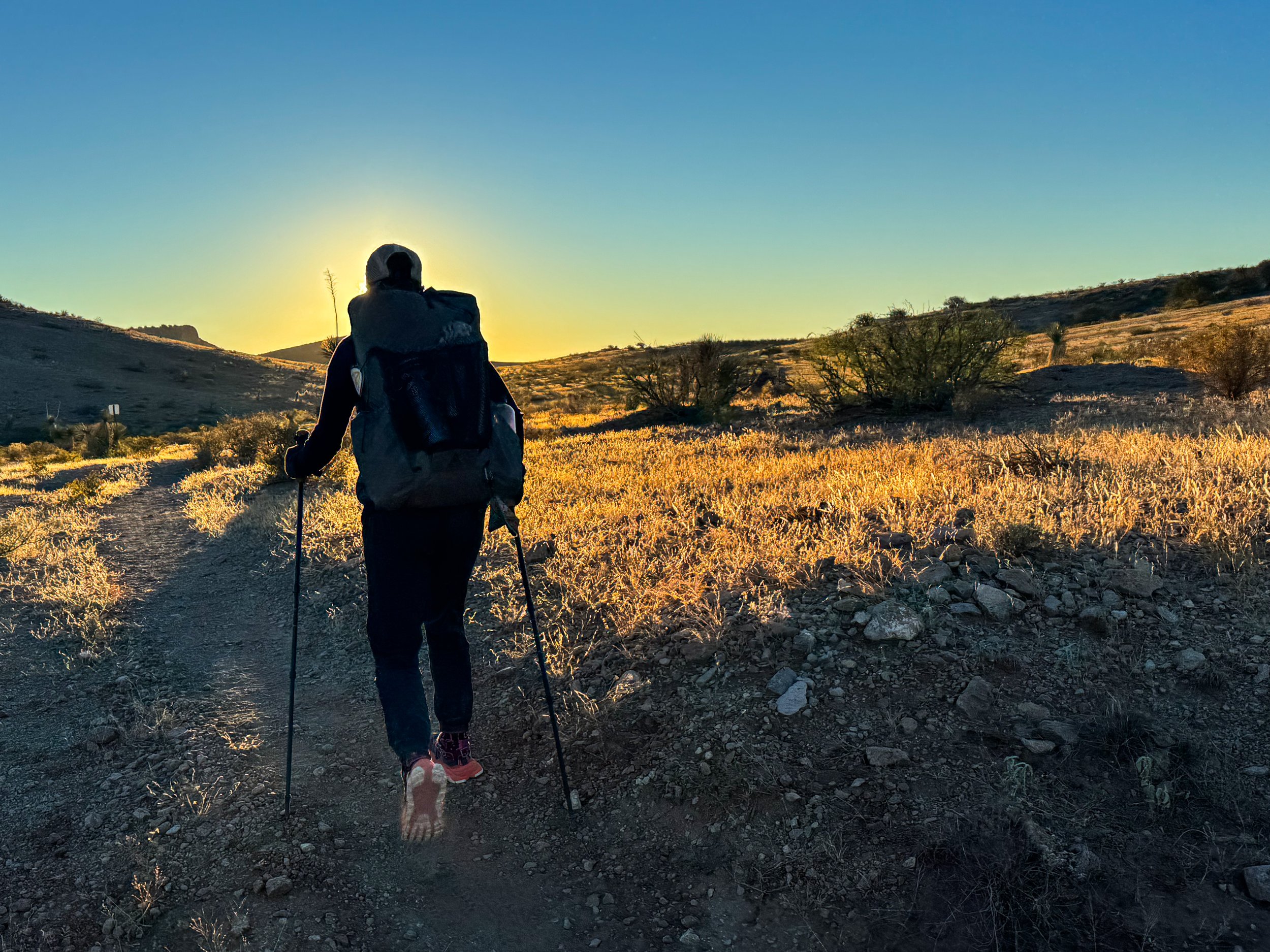
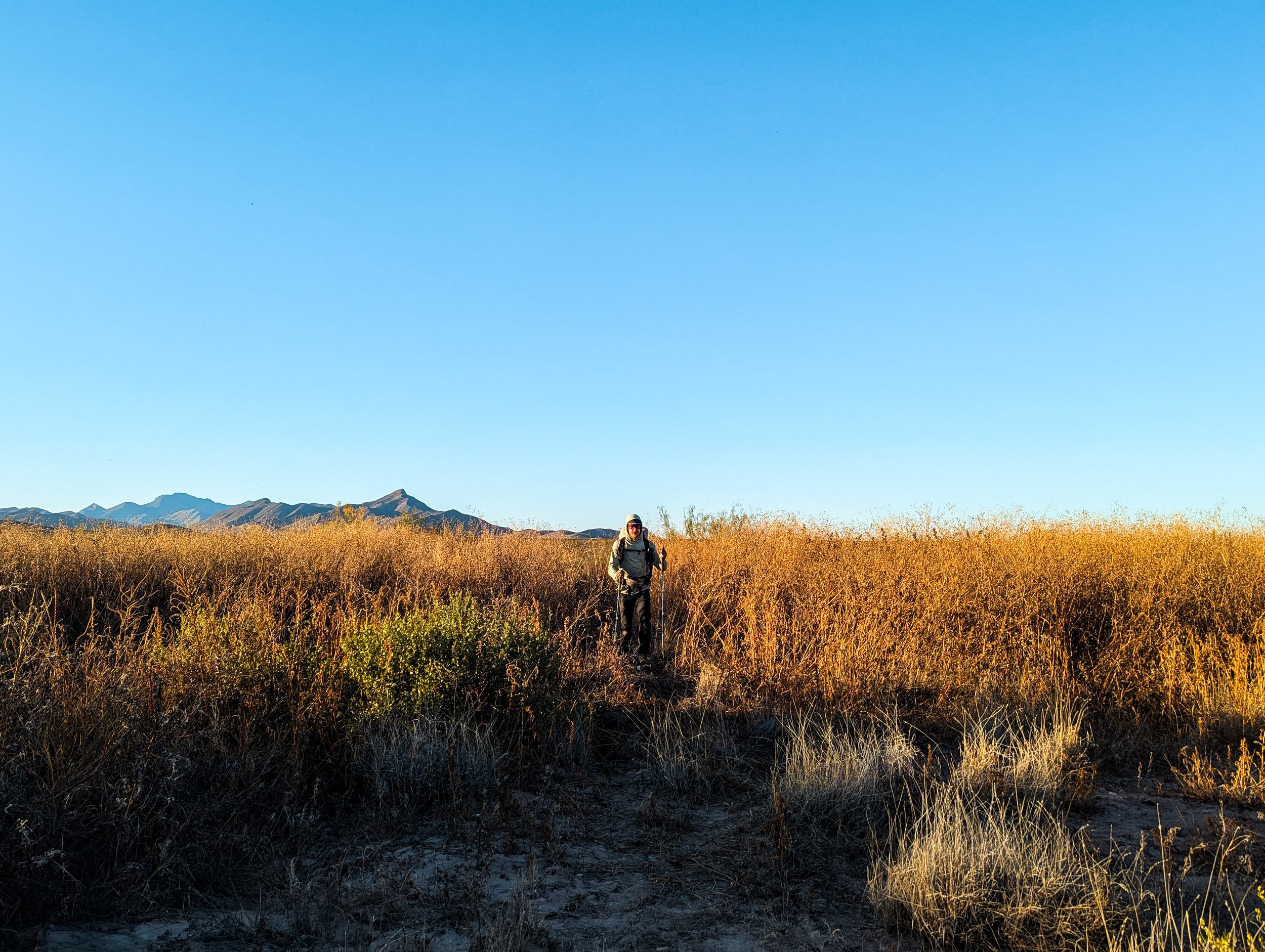
By sunrise, we had already been walking for an hour and a half.
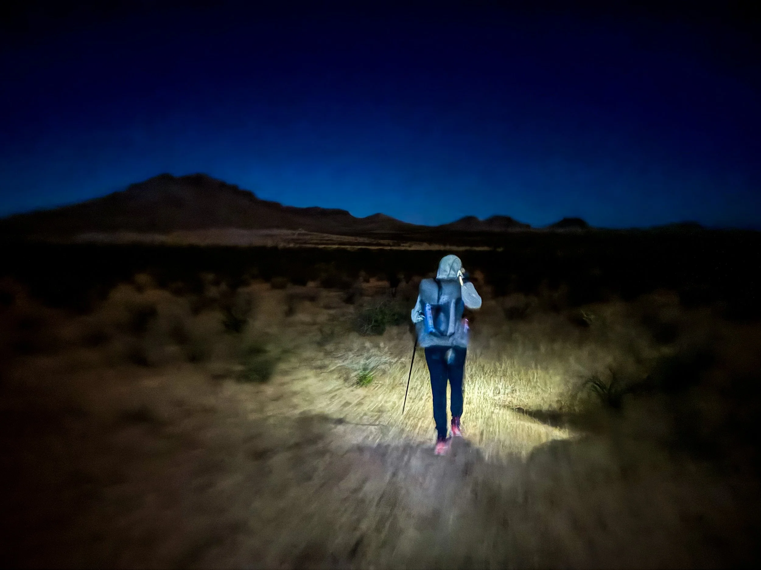
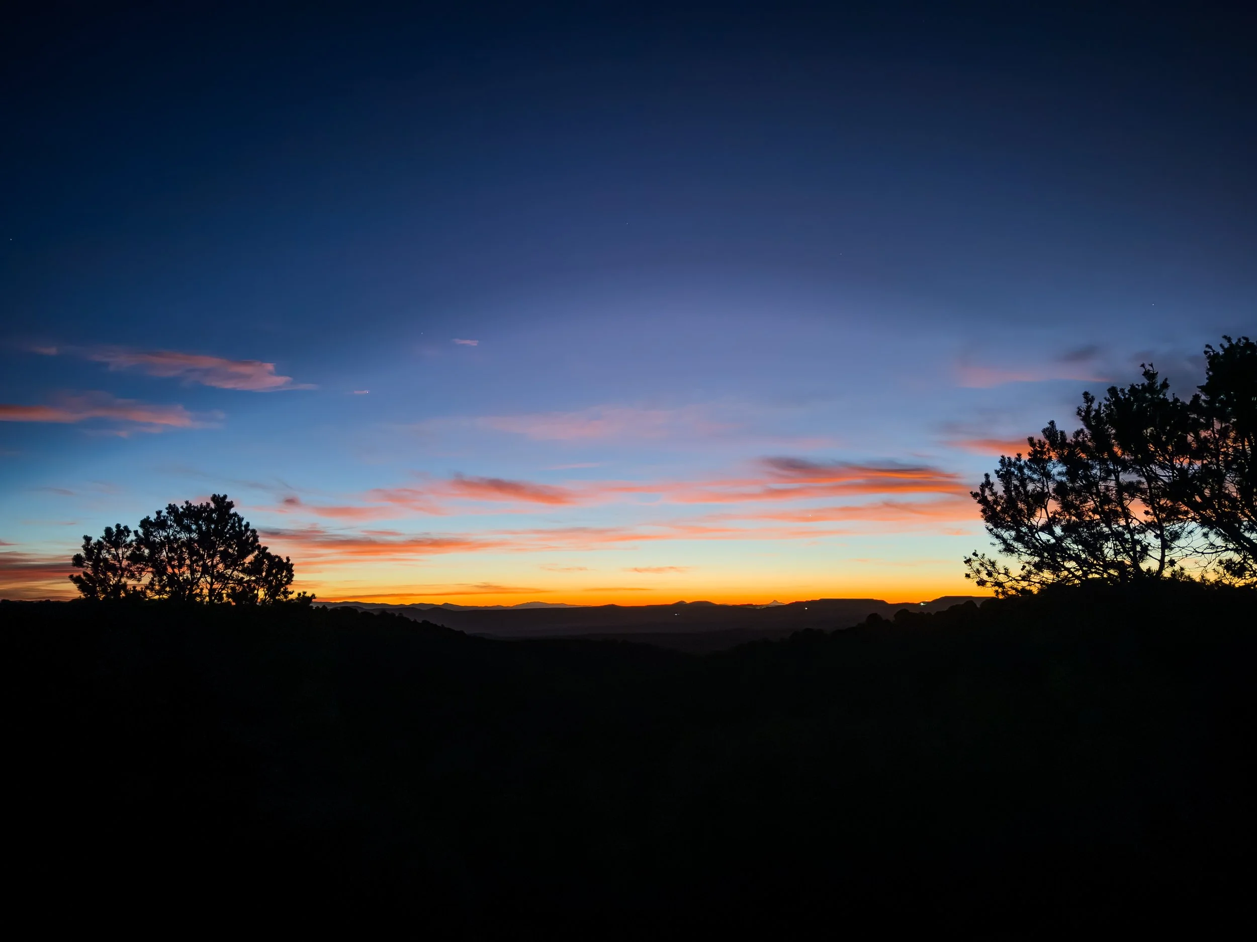
It is hard to capture what it feels like to hike in the desert at night. In the forest, you feel like you’re in a tunnel with only the light from your own headlamp. In the desert, the slightest glow in the sky lets you see the skyline around you.
We’ve seen far more sunrises on the CDT than in the rest of our lives combined.
On the second to last day, we finally met our finishing crew: Full Circle, Free Samples, Toddler Snacks, and The Show. We all camped together that night, laughing at the oddity of meeting new hikers less than fifty miles from the border. The others slept in the next morning, while the two of us carried on toward the monument. Though we’d resupplied ourselves for thousands of miles at this point, somehow, we had not purchased enough snacks in Lordsburg . We were running out of food. This wasn’t exactly dire (we weren’t going to starve out there), but man… we were hungry. We’d rationed out our snacks to make sure we could each have something left for our last day on trail.
On that last day, while we were taking our customary shade break under the only tree for miles around (it literally had a waypoint on our map for “Big Tree”), an ATV pulled up with two hunters. The driver climbed out dressed in a complete head-to-toe camo combat suit and two silver-plated pistols, one on each hip. He introduced himself as Joe and asked if there was anything we needed, “Food? Water?” We both perked up at the mention of additional sustenance, and we told Joe we’d certainly accept some calories if he could spare them. He walked back around to the passenger side of the vehicle and rustled around for a moment. Then, like some sort of tactical Santa Claus, Joe emerged from behind the ATV with a sack full of clementines and an entire 18-inch long pastrami sandwich. We could have cried with joy. Before he left, Joe also handed us each a shooter of Fireball, insisting that we have something to celebrate with at the monument. We graciously accepted, and he drove off into the desert.
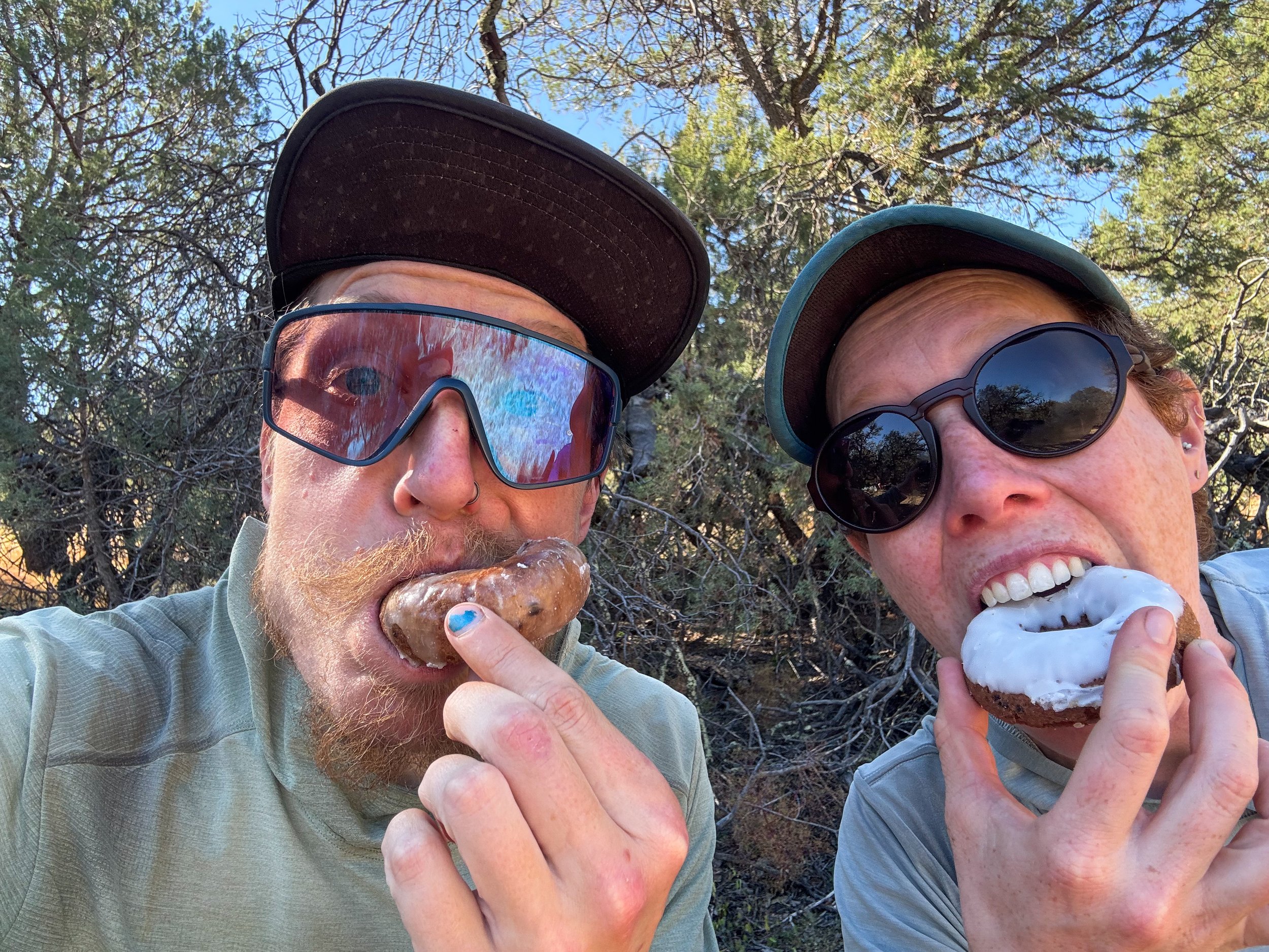
Molly and Jonathan cheesin’ with doughnuts from the water cache before Lordsburg.
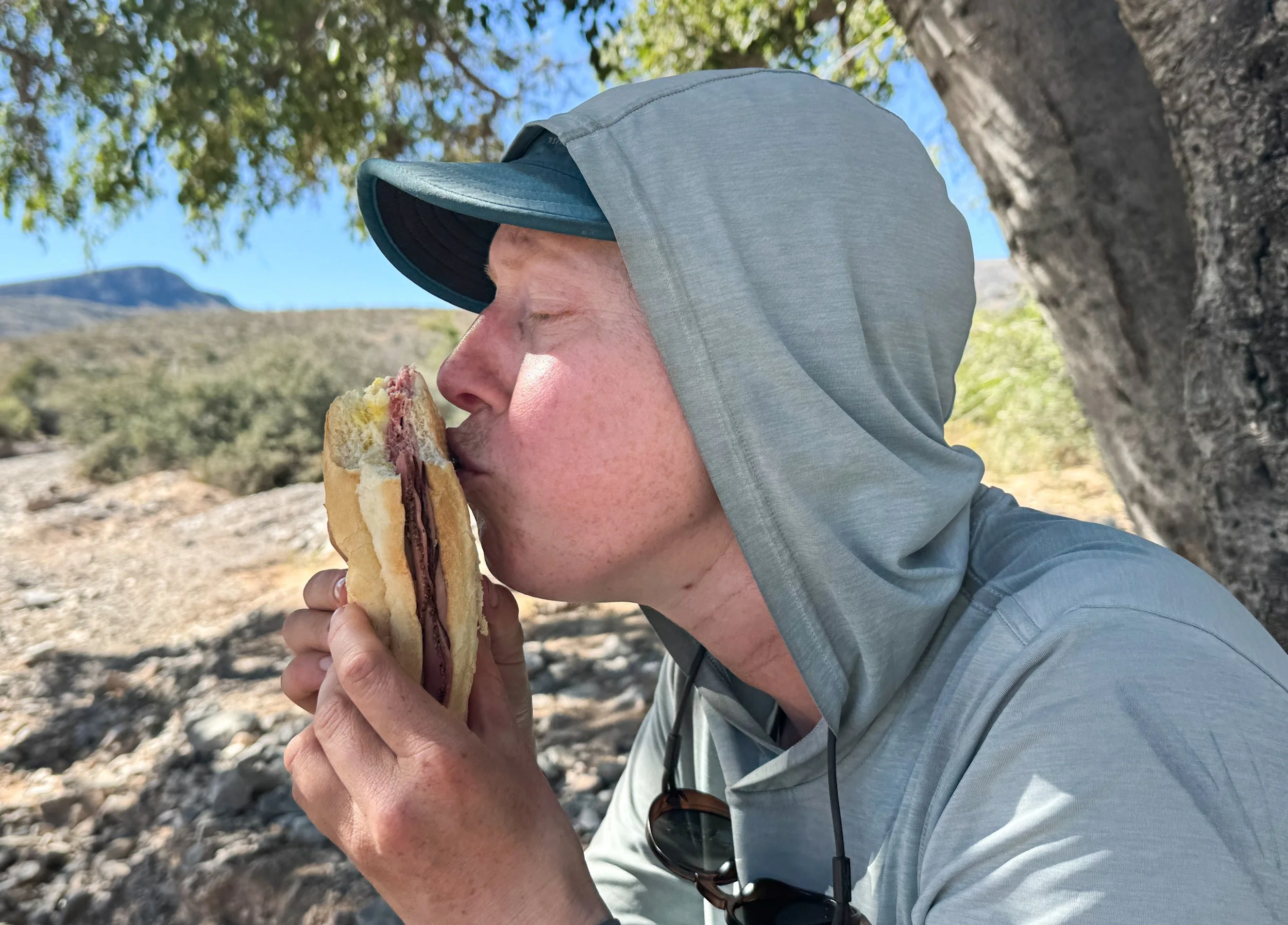
It’s hard to express how grateful we felt for this prepackaged pastrami sandwich.

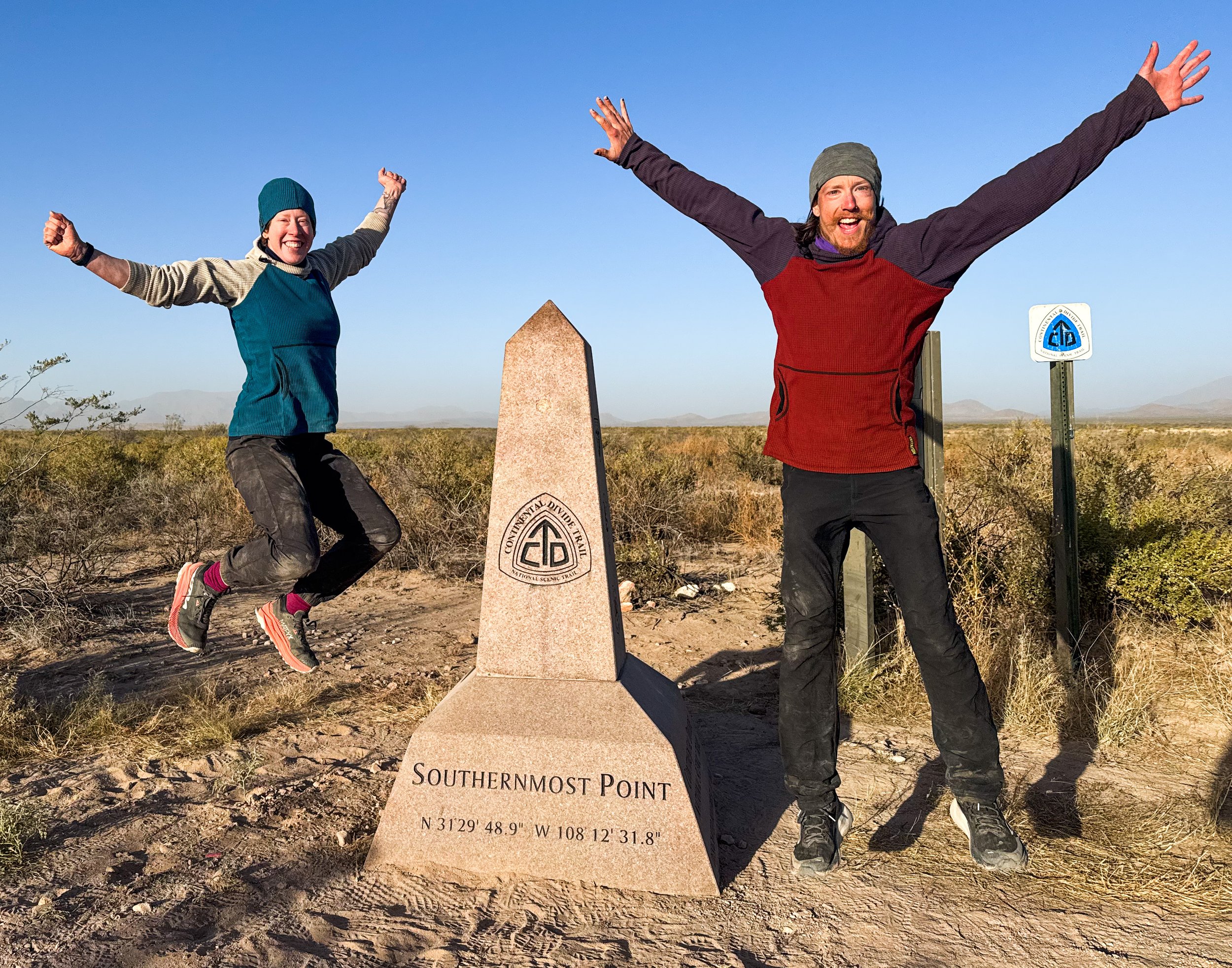
The final miles of the CDT slope down gently toward the border. The American side is brushy and overgrown, but just across the fence in Mexico, there’s a massive farm, busy with tractors, barking dogs, and trucks driving back and forth. The border itself is only marked by a standard barbed wire fence. There’s a CDT monument next to the final trail marker, and a small structure with a corrugated metal roof to provide a little shade. For a mile around the terminus, the land recently came under the control of the US Army, causing an uproar in the hiking community (for good reason, in that the absurd order attempted to block international hikers from accessing the monument). In theory, it now requires permits or DOD escorts for entry, but we never saw any signs of Army oversight. The border patrol had been watching us for days at this point, and clearly weren’t concerned.
We approached the monument around sunset, and a small plane flew down low overhead, circling around a few times to get a good look at us. Molly threw up a peace sign, then walked up to the monument and burst into tears. We hugged and cried and laughed and danced around the monument. It is theoretically possible that we could have stepped through a rather conveniently-sized gap in the fence to put our feet down in Mexico. We took a few silly photos, then leaned up against the monument to cook dinner and reminisce about everything we’d gone through in the past five months. Then, we set up camp under a dark and gorgeously starry sky.
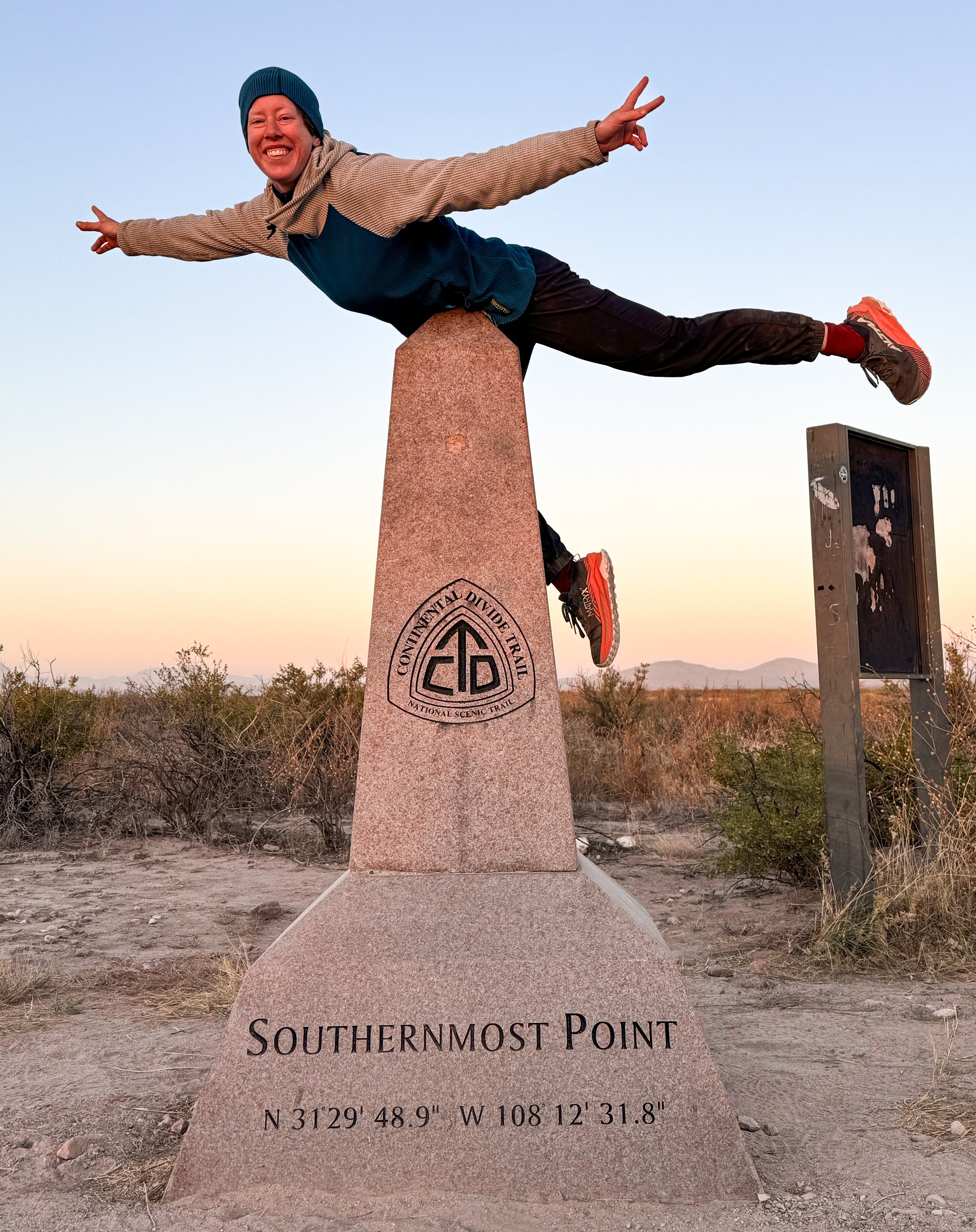
Molly is still an airplane.
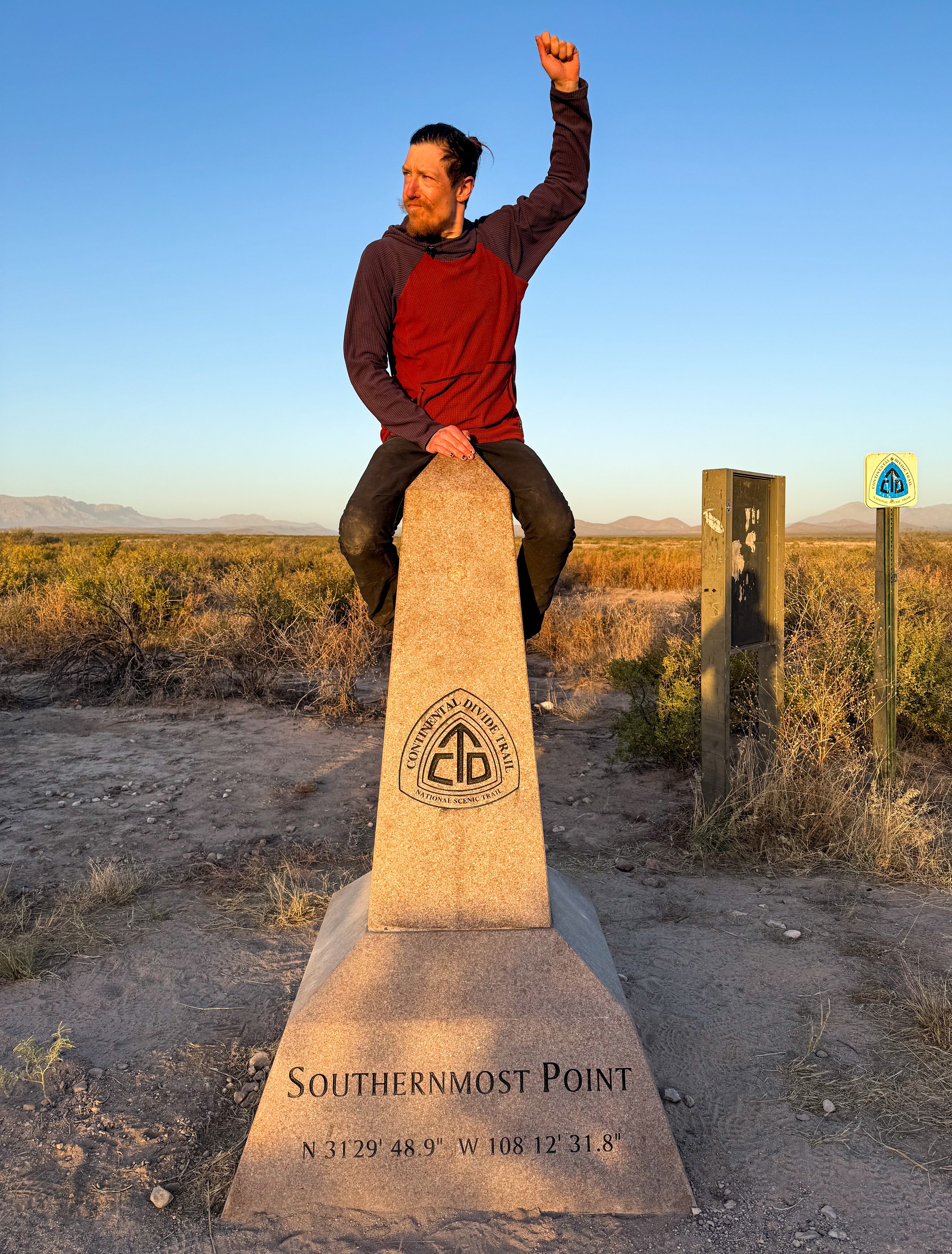
Ride ‘em, cowboy!
The full finishing crew arrived the next morning. There was a dust storm and the sun rose over Mexico in a burnt orange ball. We made a tunnel with our arms for Toddler Snacks and The Show and cheered them to the finish line (then we all did the same for Full Circle and Free Samples, when they showed up an hour later). The shuttle driver, Tim, appeared around 9:30am to take us back to civilization.
Tim is a fascinating person: a retired veteran who has hiked the Florida trail three separate times and who has given thousands of rides to and from the southern border on a donation-only basis. As we drove back down the gnarly, rutted roads, he told us stories about paddling the full length of the Mississippi River. It took about two hours to get back to the highway, then another two hours to Las Cruces where we got a hotel for the night before catching a ride north to Albuquerque with another hiker named Woody and his adorable pup, Mya. We celebrated our finish in the most hiker trash way we could think of. We bought a bottle of prosecco and two bag salads from Walmart. Then, we went back to our hotel room, drank prosecco from plastic water cups, ate our salads straight from the bags, and went to bed before 8pm.
And that, my friends, was that! Or… was it?
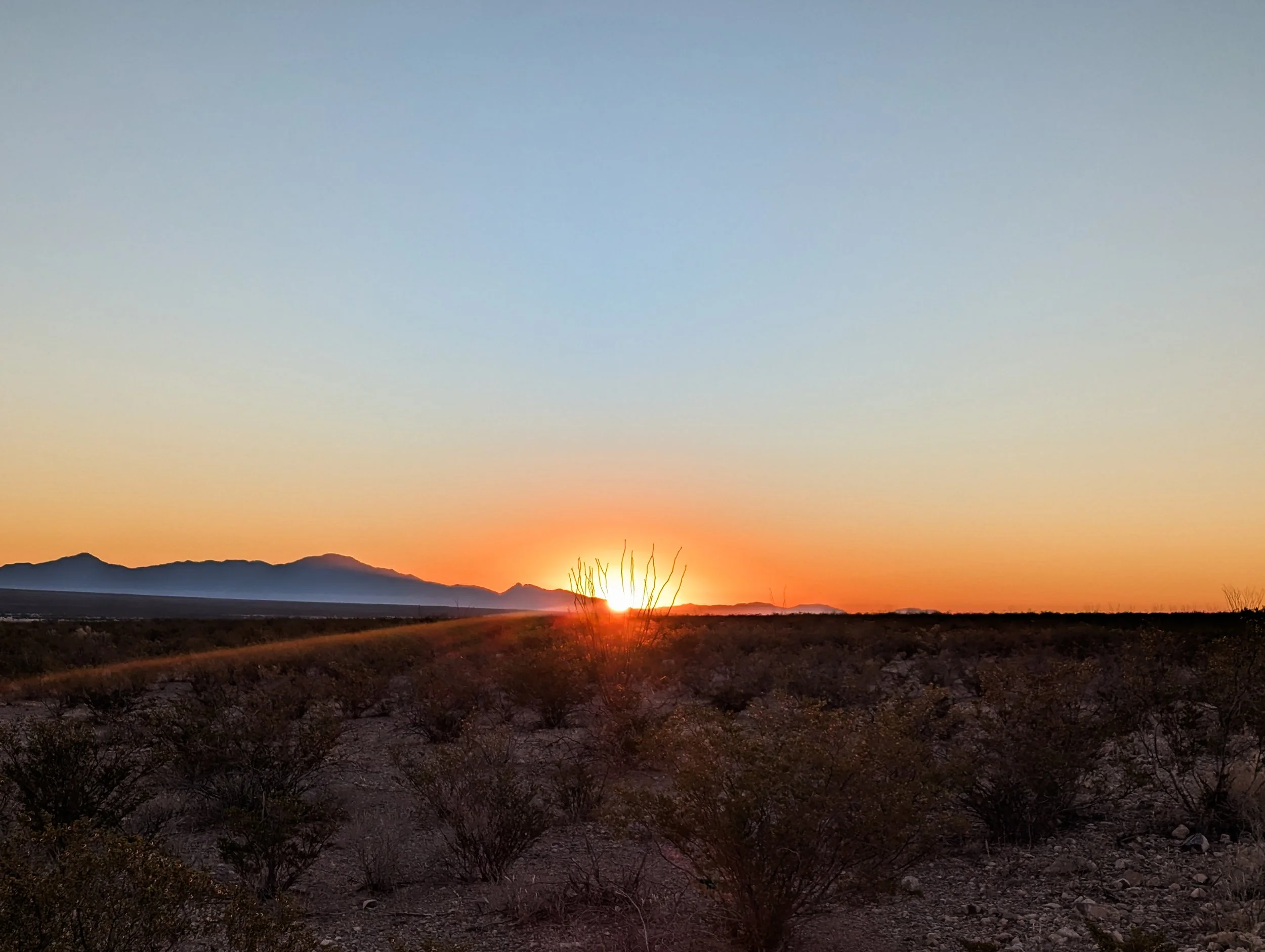
Dusty skies at sunrise looking east from the Crazy Cook monument.