
Unfinished Business
When we left Pinedale, Wyoming on August 25th, we left behind a gap. The point where we left the trail was within the evacuation zone for the Dollar Lake Fire, which we wouldn’t be allowed to enter again. Instead, we returned to the official trail by hiking an extra eleven miles from Elkhart Park up to the CDT about fifty miles south of where we’d left it.
We didn’t like the gap. Specifically, we didn’t like that the fire had forced us to break our self-imposed rules for hiking the CDT. We wanted to form a continuous path of footsteps from the Canadian border to the Mexican border (we call this “connecting footsteps”). This rule is hardly universal for thru-hikers. Many hikers will hitchhike past roadwalks or sections of trail. Some hikers have rules about which direction they hike or only hiking the official trail (vs taking alternate routes). We understand that this is all a little ridiculous. But it’s ALL a little ridiculous, you know? And the gap just bothered us. As soon as we created the gap, we began plotting to close it.
After celebrating our completion of the CDT at the Mexican border, we began researching alternate route options and looking into Pinedale’s weather over the previous weeks. It was November in Wyoming, so it was by no means guaranteed that the trail up north would still be passable on foot. We asked some locals about trail conditions and checked with the local Forest Service office. Everyone told us the same thing: there’s not much snow, and the trail should be just fine as long as you come before the next storm. It hadn’t snowed in several weeks, so with snow incoming the following weekend, we packed up the car to head north right away.
We contacted some CDT trail angels based out of Pinedale who’d helped us out earlier in the trail, a couple called Irish and ReRun. Most people would probably have raised an eyebrow at our itinerary, but these are thru-hikers! They enthusiastically agreed to help us finish off our last miles of the CDT. We left our Subaru at their house on Friday, and they dropped us off at Elkhart Park shortly after noon. It was chilly and overcast, but dry at the trailhead. We headed off into the afternoon hoping to make it about nine miles that evening before making camp.
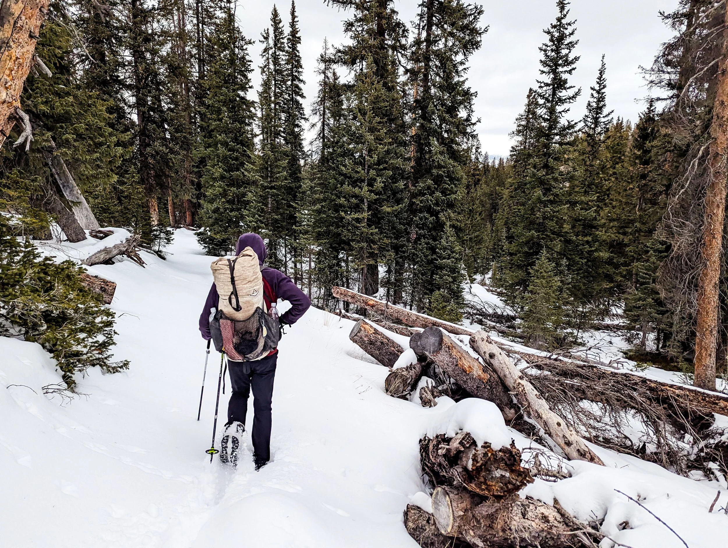
The trail was easier to follow on our first day, where we could see the log cuts and clear path through the trees.
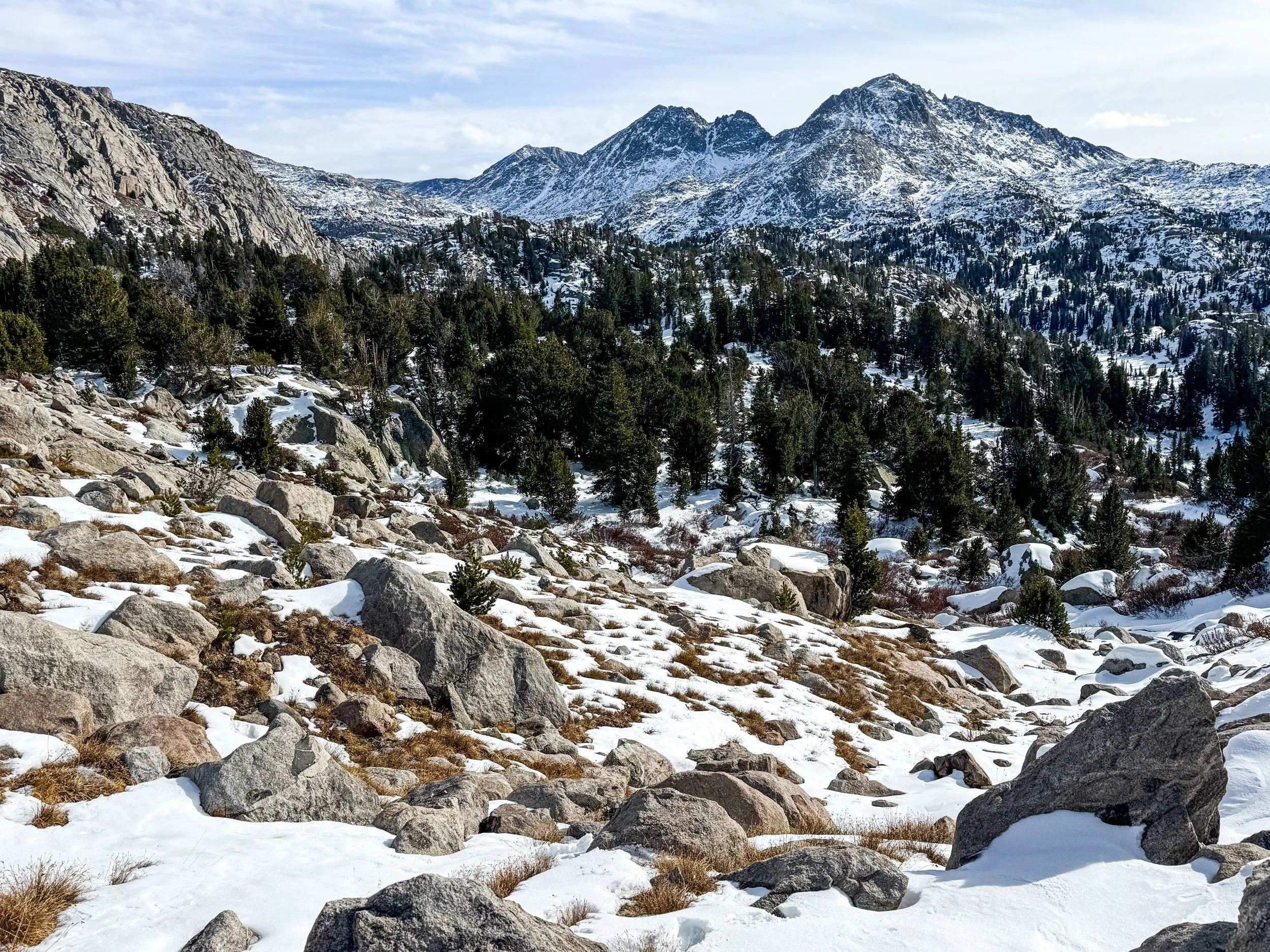
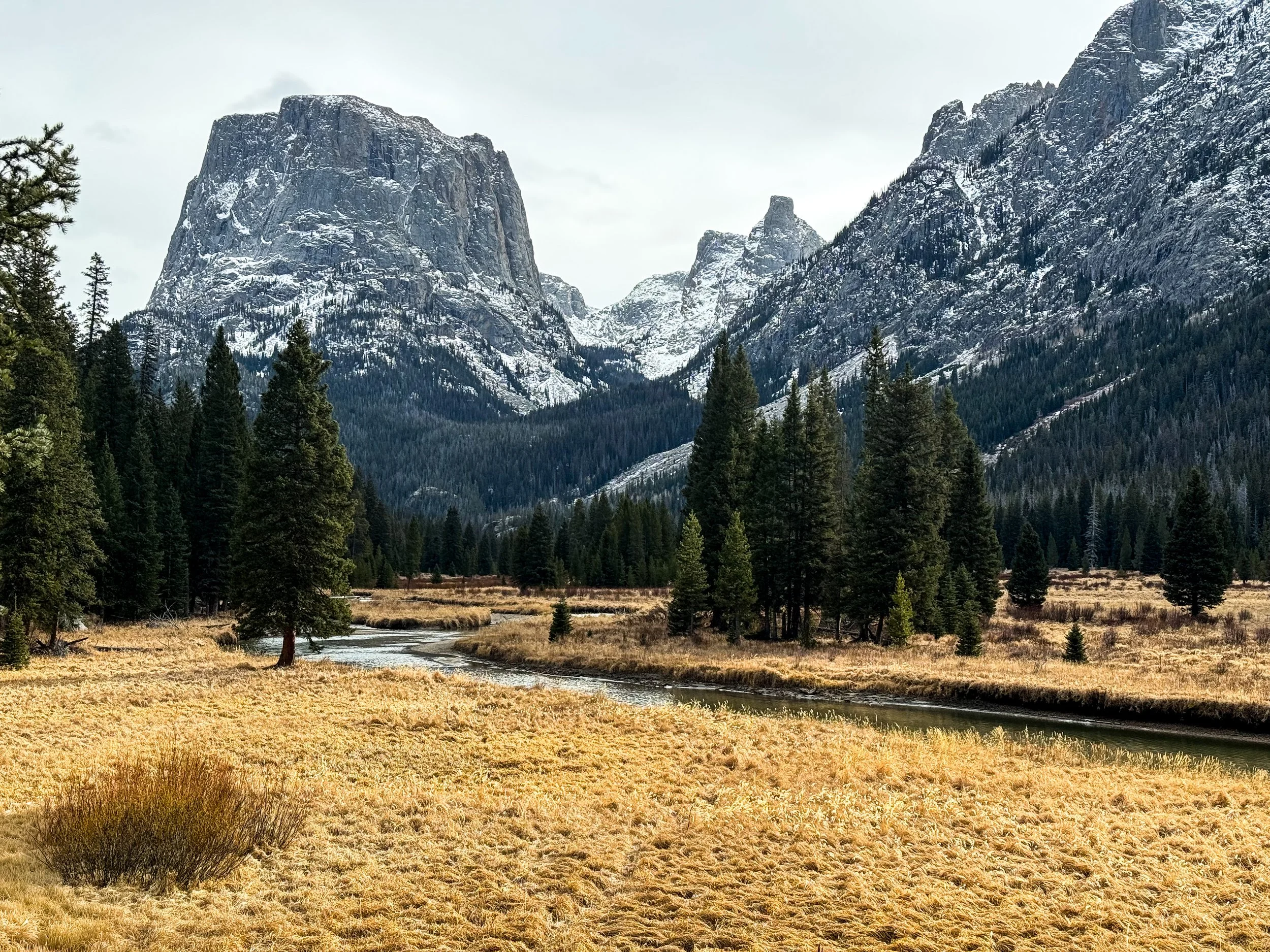
We found the snow pretty quickly, but the trail had been packed down by other hikers heading up to a north-facing viewpoint called Photographer’s Point. The last time we’d been there, the smoke had been so thick that we could barely tell that the Wind River mountains were spread out before us. This time, low clouds settled over the peaks, but we could see the base of the range.
After the popular viewpoint, the snow was deeper and the hiking slower than we expected. There were fewer footprints ahead of us, then none. Toward evening, we began to encounter snowdrifts up to our knees in the deep valleys heading up toward the CDT, but just as night was falling, we found a beautiful patch of dry pine needles to pitch our tent. We pulled off our cold, wet socks and dove immediately into our bags. We’d only made it about seven miles.
In retrospect, this is probably the point at which we should have cut our losses and turned around. We were still hopeful that once we climbed out of the deep, shady valleys and onto sun-exposed rocks, we’d have some clearer trail. We only had one high point to get up and over, then most of our route would be well below the snowline. So, on Saturday morning, we woke up once again in the dark, donned our thick, waterproof socks, and set off into the snow.
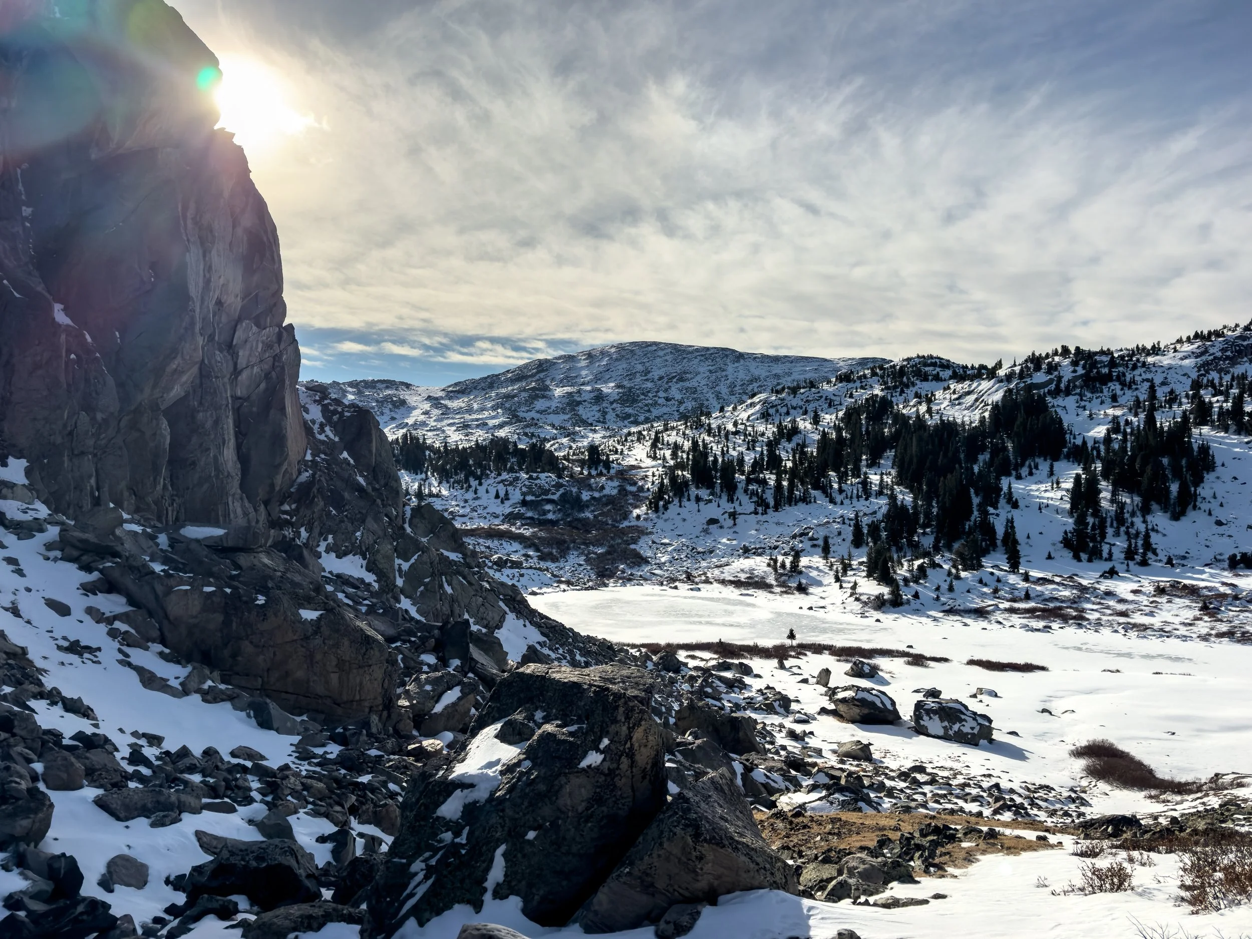
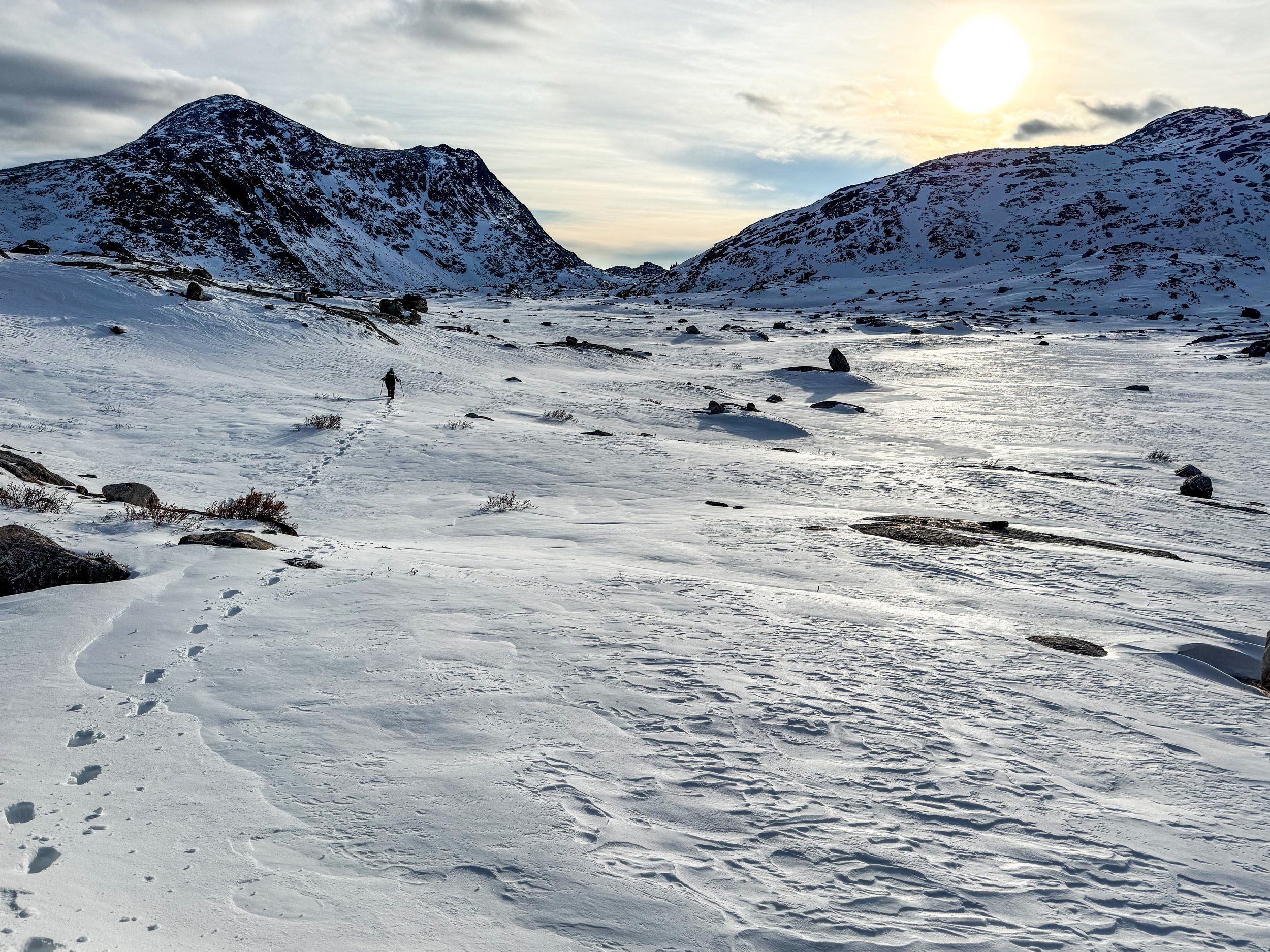
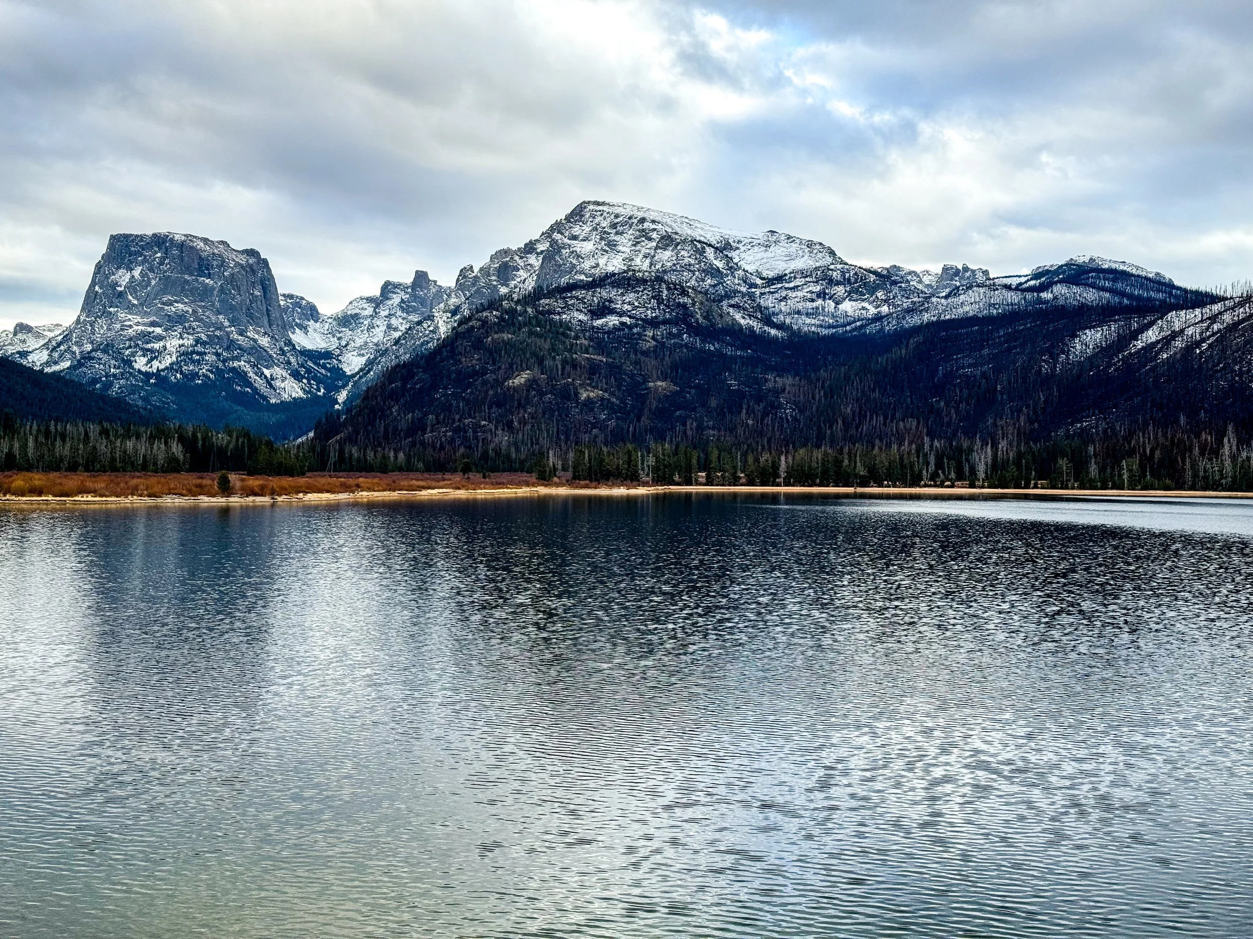
Looking north toward Lester Pass shortly after rejoining the official CDT.
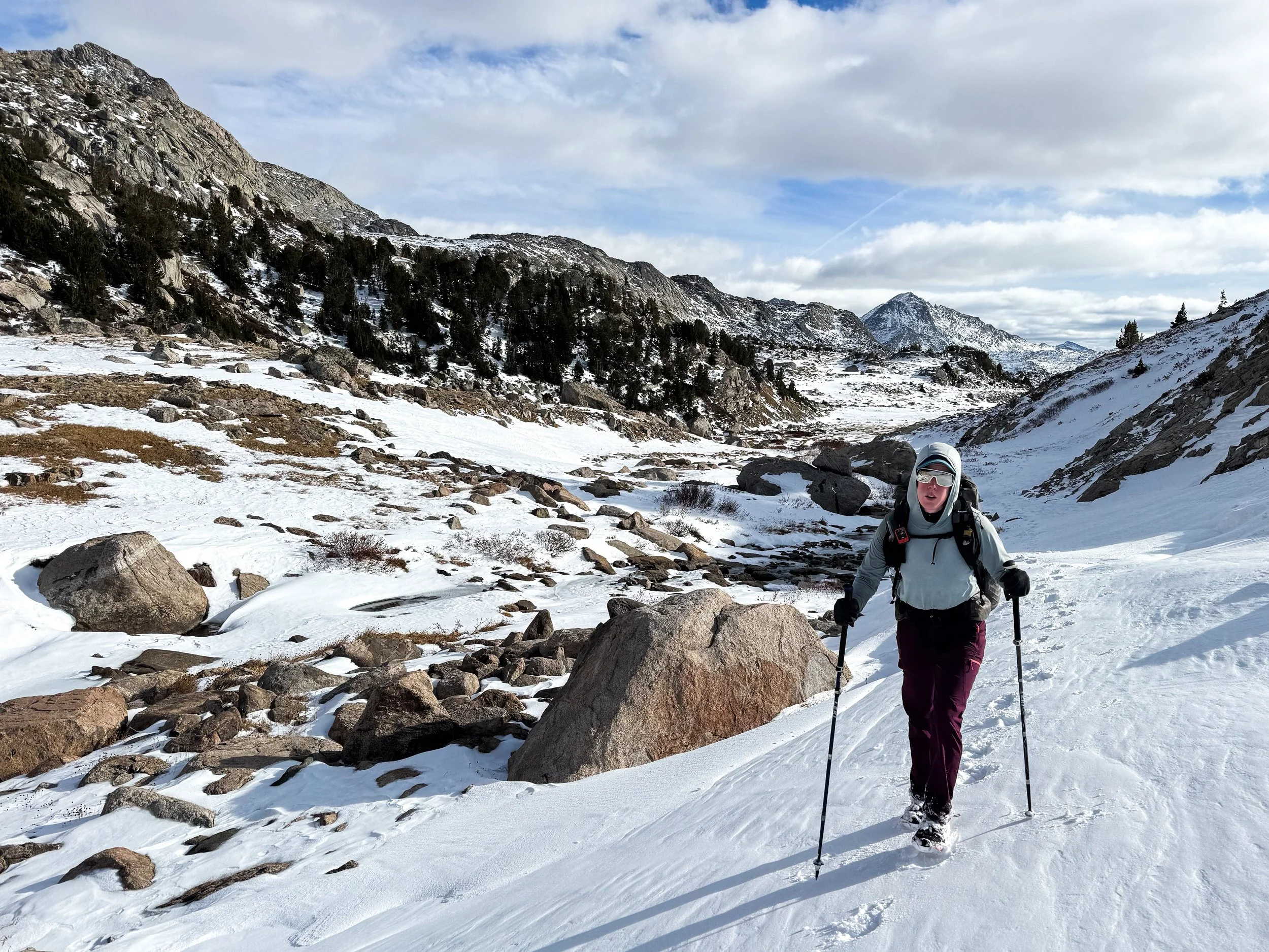
Molly is deep in the pain cave as we dig deep to make as much progress as we can on a demoralizing day. If only we had brought some flotation (backcountry skis or snowshoes) with us. Alas.
We realized pretty quickly that it would be a very long day. Without snowshoes or skis, our feet were constantly under a foot of snow. Though the outside temperature was comfortable, our poor toes were freezing in spite of the waterproof socks. We stopped to add another pair of socks underneath and pulled out the toe warmers we’d brought along for this scenario. Except they were duds. We tried another pair. Duds as well.
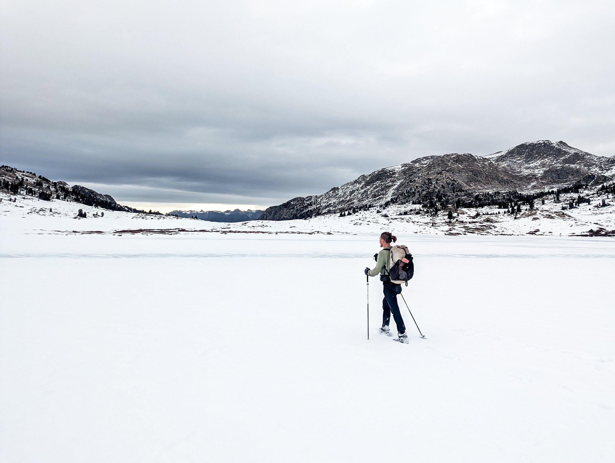
We reached the CDT mid-morning, hiking about one mile per hour, each step punching through a crust of wind-affected snow into unconsolidated powder up to our knees. We’d planned to hike about 22 miles that day, but we knew by this point that we’d never make it that far by nightfall. We passed a series of frozen lakes and eventually threw on micro-spikes to walk directly on the ice, staying near the edges where the ice was thickest.
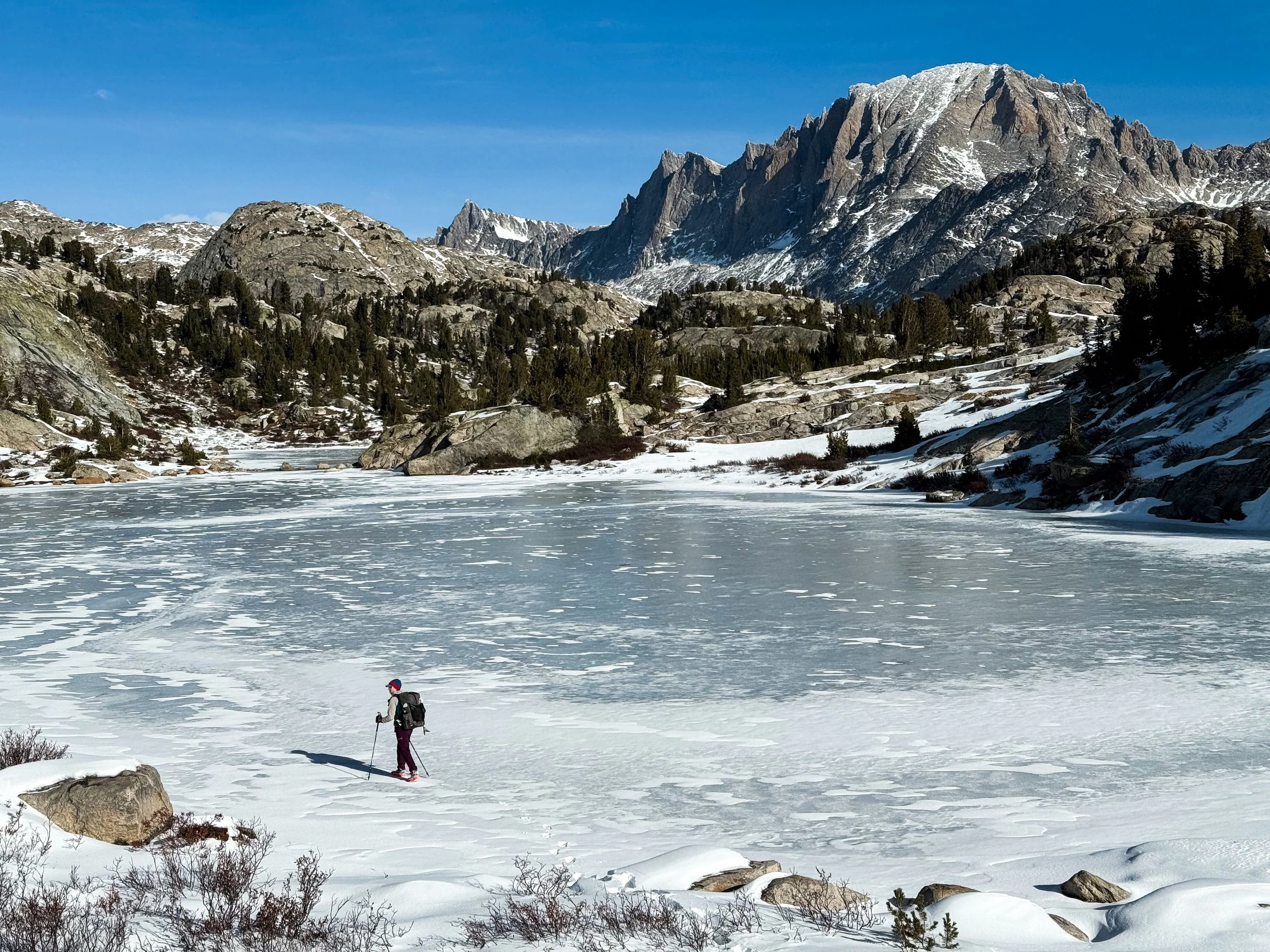
Molly hikes along the edge of Little Seneca Lake.
In spite of the immense challenge that this adventure posed, we had to admit that it was still a stunning landscape to traverse.
Onward and upward, we fought our way forward. The trail was completely invisible under the snow and every once in a while, one of our feet would plunge down into the icy water of a creek, still flowing underneath. We were completely alone up there in that frozen landscape, though we followed many sets of moose tracks and saw a black bear, galloping away across the snow in the distance.
We reached our high point in late afternoon and were dismayed to look down across another vast expanse of open snow. By 5pm, the temperature was dropping rapidly. We’d hiked less than thirteen miles, but we were absolutely exhausted. We looked around for a flattish spot in the snow, and decided we had to make camp, though we were still much higher than we’d planned for. We tamped down the snow, set up the tent and struggled our way out of frozen socks and shoes. Our pants were frozen up to mid-calf, so coated in ice they could stand up on their own. We got into our sleeping bags and sat in the tent for a while trying desperately to warm up our feet. Molly’s toes were so frozen, she wasn’t sure what she’d find when she took off her socks. We put on every layer that wasn’t snow-covered, and she held each foot until it began to thaw.
Molly trudges through knee-deep snow with no sign of a trail anywhere in sight. This adventure was lonely, scary, beautiful, and brutal.
We’d expected to be camping around 8,500ft (and well below the snow line), but found ourselves still near 10,700ft with about 22 miles of trail to the closest trailhead. Though the trail would quickly begin to descend, it wasn’t clear how many more of those miles would be deep under the snow. We messaged Irish and ReRun to update them on our plans – we hoped to make it to the closer trailhead by the next evening before nightfall, if possible.
Navigating in the snow is a challenge in the best of times. It’s tough to tell what you’ll find underfoot, and it’s much harder to read the landscape for clues as to where the trail might lead (down along that creek, up and over this ridge, around this little bump or that larger one). All of this is massively compounded in the dark. Without being able to see the peaks around us, the following morning was a frustrating process of trial and error. We were using two apps to help us stay on route, but that meant checking our phones constantly in the freezing cold air. Molly had opened the last pack of toe warmers to try and get through the coldest part of the day, and mercifully, this last set finally worked.
With each waypoint along the trail, we’d set a new goal. It’s 0.6 miles to the creek. Only two miles to the pass! One more mile until we descend below 10k. Each time we’d hit a goal, we’d find more snow ahead. When one of us got demoralized, the other would step ahead and start breaking trail to give them some reprieve. It went on like this for about seven hours.
More frozen lakes that we walked (mostly) along the edge of. We fully recognize how sketchy this looks. You don’t need a leave a comment letting us know.
Finally, the point where we started descending considerably and began to see an end to our post-holing slog through the snow.
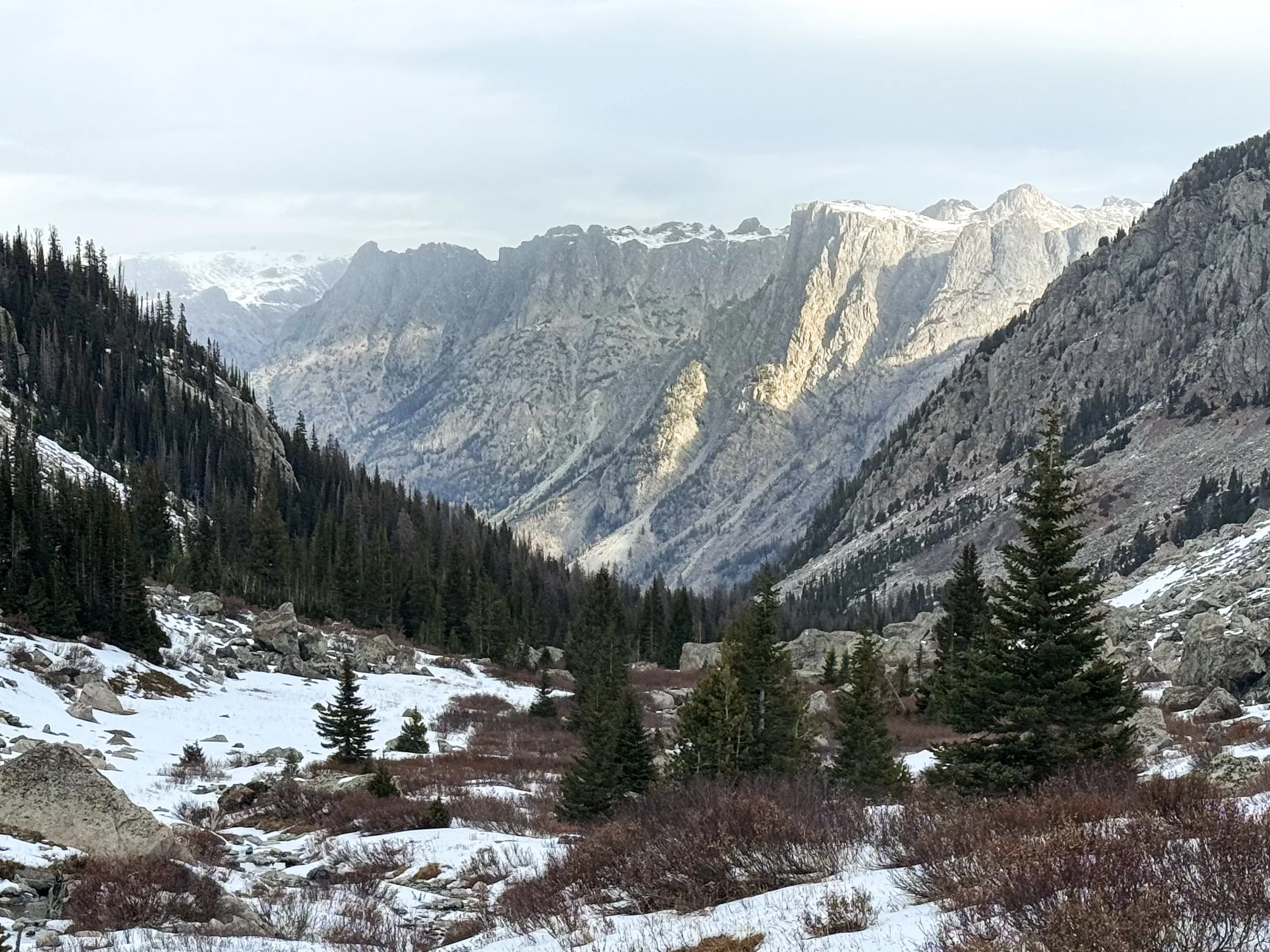
Finally, we began to follow a trench in the snow that we could reliably identify as the trail. Heading downhill without needing to constantly check our direction, our progress became much faster. Eventually, the snow was only at our ankles, then just crunching underfoot. When we reached our last set of switchbacks, where we began to find dry trail, we stopped to take our first real break.
Around 1pm, we reached the valley floor, where we could simply stroll along the Green River. I doubt we’ve ever appreciated a clear trail as much as we did in that moment. But we still had almost 12 miles left to the trailhead, so we put in a podcast, put our heads down, and kept on walking. Across the Green River Lakes, we saw the blackened remnants of the Dollar Lake Fire. When we finally made it to the trailhead around 4:45pm, Irish and ReRun met us with hot cocoa and blankets. It meant so much to have friends who we could count on to give us a safe landing after this last trial of the CDT.
BEAUTIFUL, MAJESTIC, SOLID GROUND. By this point, hiking at a normal pace on hard dirt felt magical.
Closer to the trailhead, we got a stunning view across the Green River Lakes.
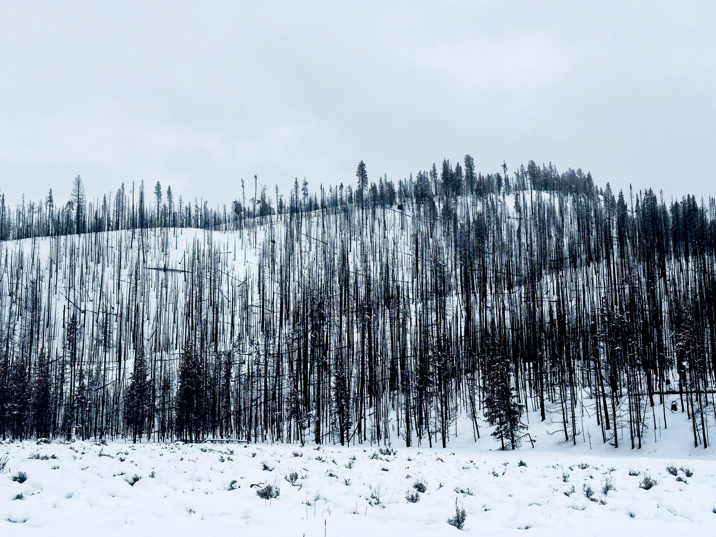
Burned remnants of the Dollar Lake Fire, which three months prior threw a big ol’ wrench in our plans for the Wind River Range. It had grown to over twenty thousand acres before being extinguished by an early snowfall.
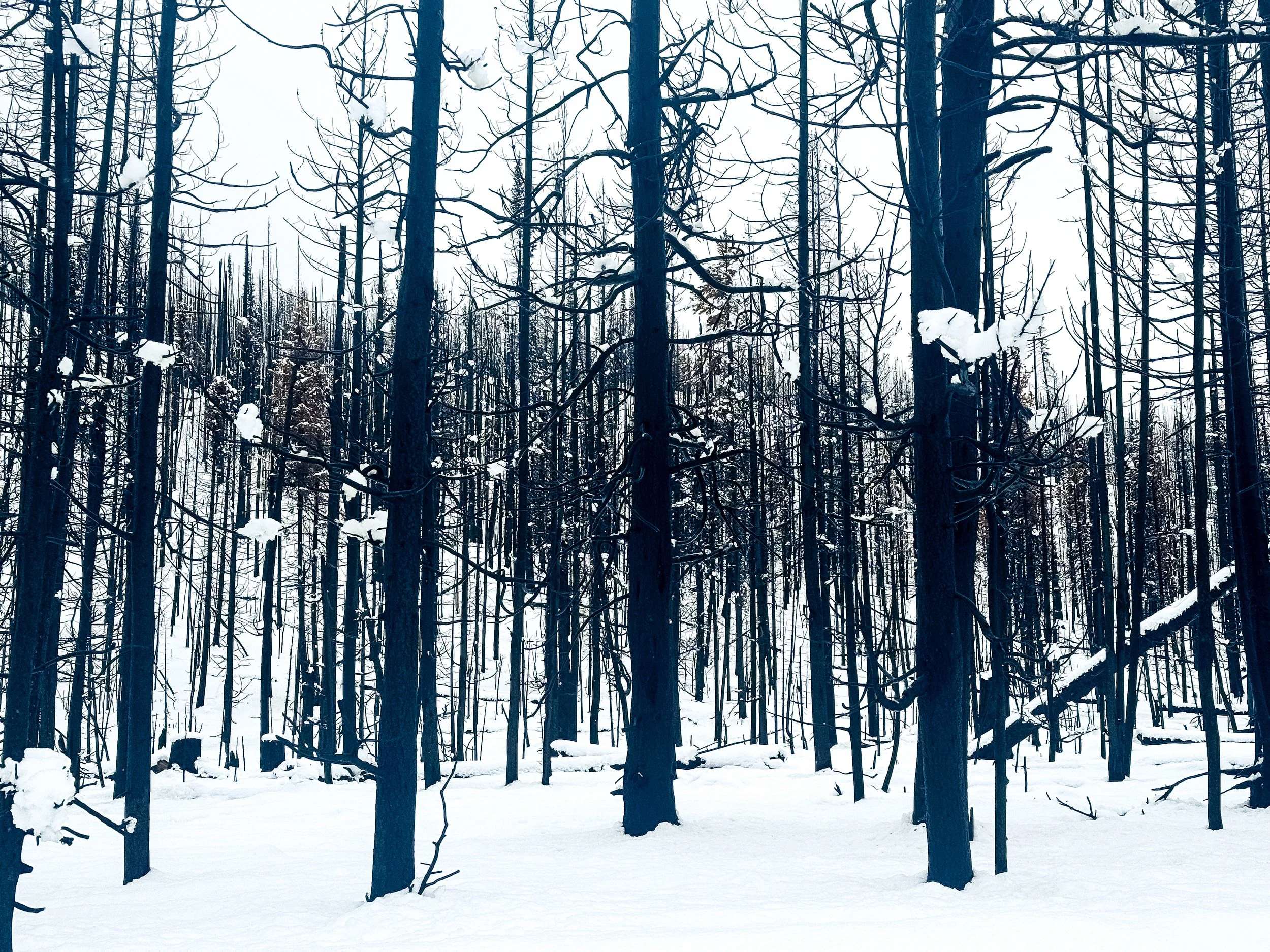
At a quick glance, the burned forest looks like deciduous trees that have lost their leaves for winter. On closer inspection, these are all charred evergreens, starkly black against the fresh snow.
A key personality trait of the thru-hiker is that we instantly forget all of the trials and tribulations of the trail once we’re warm and dry again. It was gently snowing on the drive back to Pinedale, but we knew without speaking that we’d be back out again the next day. We still had sixteen miles left to connect our footsteps from the Green River Lakes trailhead to the junction of Union Pass Road, where we’d been picked up back in August. We simply could not leave sixteen miles of flat road walking between us and a completed CDT. So the following morning, we headed out for one last day on the trail in four inches of fresh snow.
Our last day on the CDT was unlike any other. It was the first day on trail when we each walked completely alone. Jonathan dropped Molly off at the first road junction and she began walking south toward the Green River Lakes Trailhead. Then Jonathan drove to the trailhead, left the car, and walked back toward her. We high-fived in the middle, then Molly completed her CDT hike back at the trailhead, picked up the car, and drove north to meet Jonathan for his last few steps. As we walked those last few miles, we both felt at peace. It was time to be done, time to head home. We had successfully completed a fully connected footpath from Canada to Mexico along the spine of the Rockies.
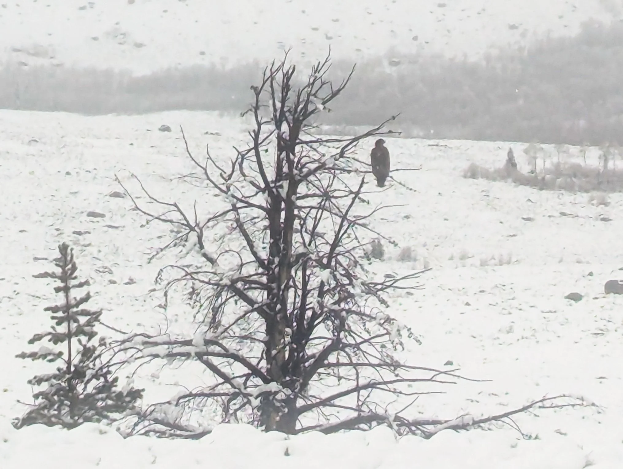
A huge golden eagle watched over Molly’s last few miles of trail.
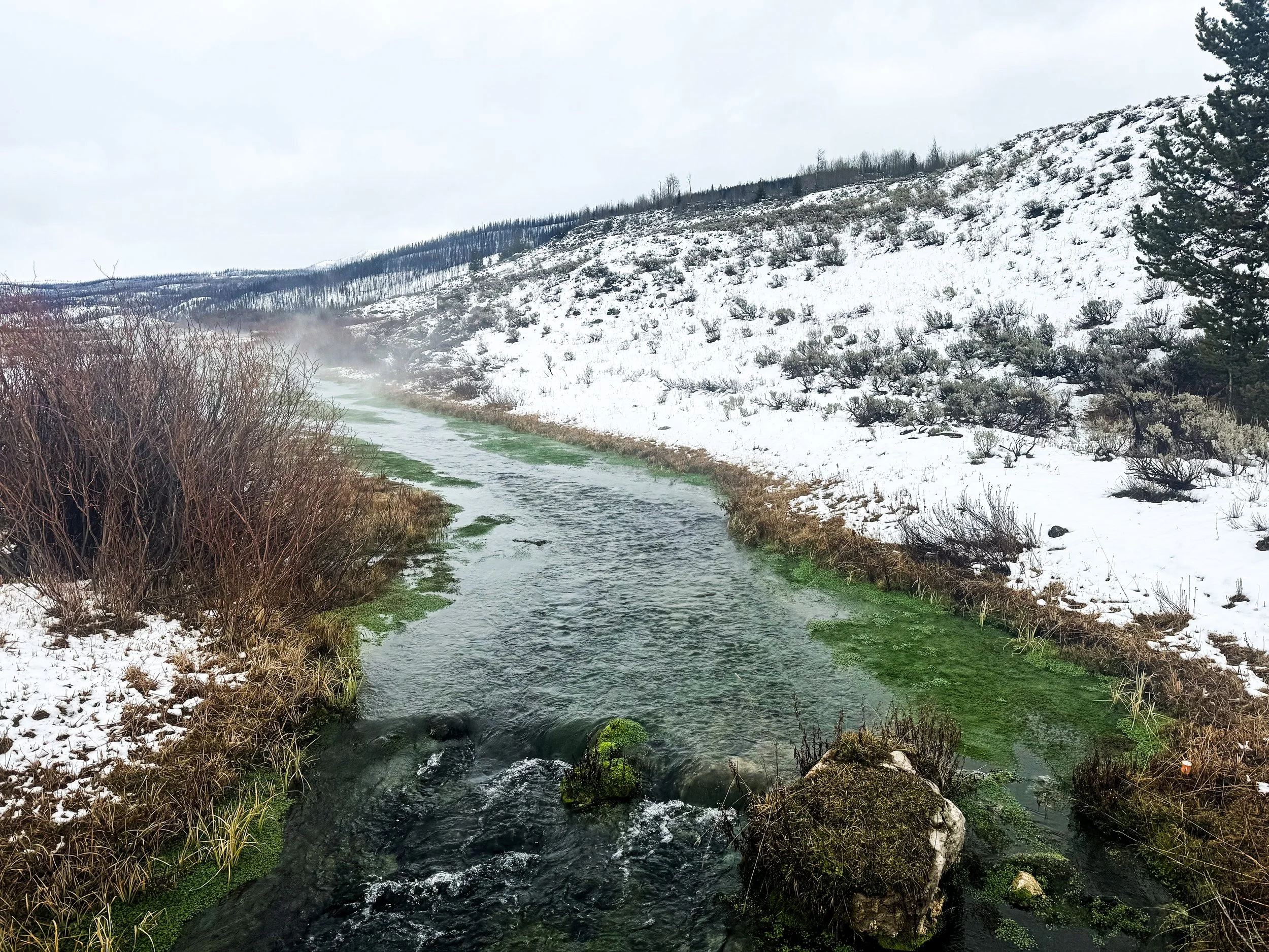
Geothermal activity in the area creates some warm streams with a strong sulfur smell and some surprising colors.
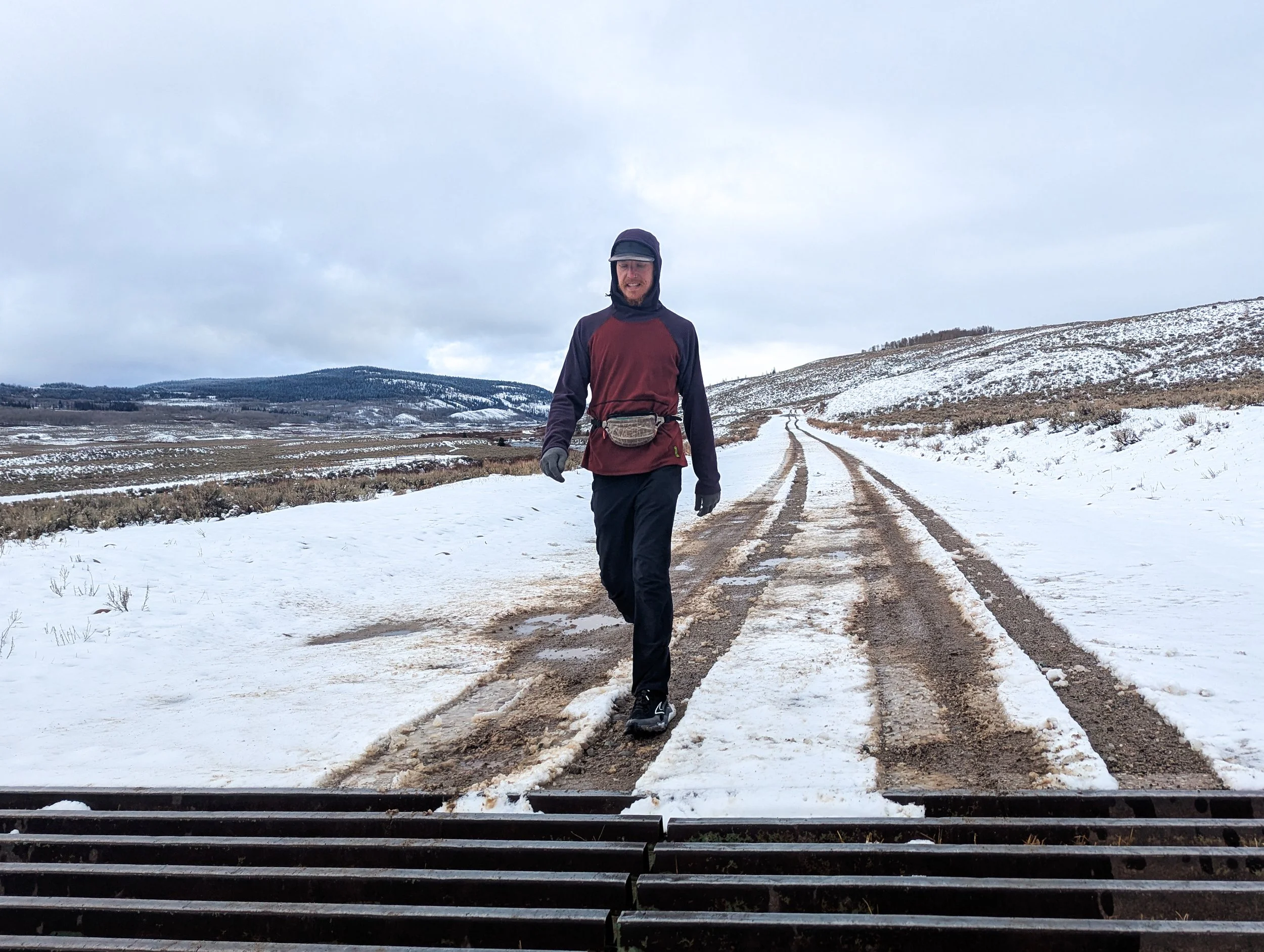
Jonathan completes the final few steps of his CDT journey to create a fully connected footpath from Canada to Mexico.
Thank you so much to all of you for following along on this wild journey of ours! We have truly loved hearing from you (and seeing some of you!) along the way. We’ve come to the end of our trail journal for now, but we’ll post some stats from the trip next week and perhaps some reflections on the trip, now that we’ve had some time to process it. We feel so lucky to have been able to spend this summer exploring the Rocky Mountains, and we are grateful to all of you who helped us make it possible.