

Onwards to Wellington!
We wrap up the North Island with more beach than bush and get our first taste of Wellington.
From Waikanae to Wellington, Te Araroa becomes a lot more civilized. It wanders through a scenic estuary boardwalk, over a stunning coastal walkway, and along sandy beaches. On the first day, we got breakfast before leaving Waikanae, stopped for lunch along the beach, ate ice cream cones in Porirua, then nabbed a pre-dinner pie in Pukerua Bay before camping next to the ocean. Pretty good for 22 miles of walking, I'd say.

Molly surveying our final beach walk
photo/ Jonathan
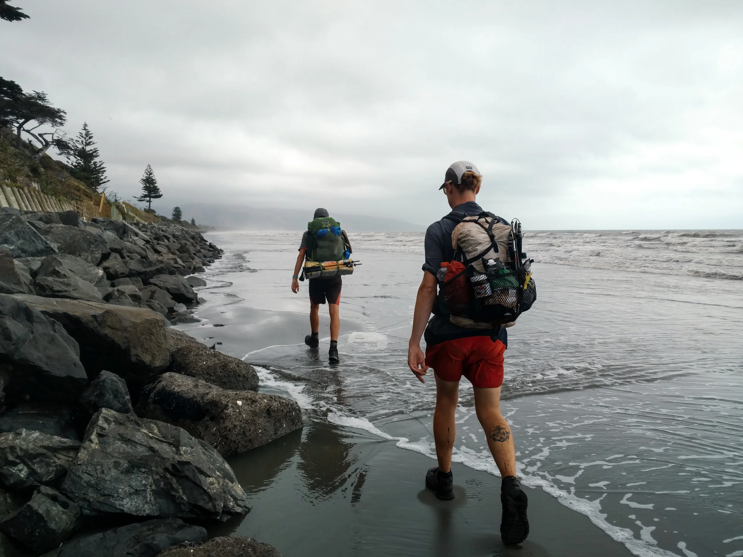
Jonathan and Charlie get their feet wet at high tide
photo/ Molly

Ocean views from the Escarpment Track coastal walkway near Paekakariki
photo/ Jonathan

A massive suspension bridge along the Escarpment Track
photo/ Jonathan

HIKING SO HARD.
photo/ Molly

Beachfront camping with beautiful hiker trash
photo/ Jonathan
We had one of our odder camping experiences at a homestay just west of Wellington. Our host was an older gentleman, Alan, who met us in a dressing gown of some sort and apologized for being in his pajamas, though it was well after 4pm. Later, he found us drinking tea and offered us a "digestive" (sort of like a sweet cracker) because "that's what the queen has with her tea" (he was originally from Singapore and spoke with a distinct British accent). There were several other random people, clearly not hikers, who'd been living in the garden there for an indeterminate length of time. In the shower, there was a lengthy treatise on why one should dry oneself inside the shower and definitely not outside ("...you could even put your shirt on inside the shower and it would keep you nice and warm").
Unlike Auckland, Wellington does not sprawl for miles and miles. It is a smaller city, about 400 thousand people, tucked away at the southern tip of the North Island and bordered by water to the east and south. To the north and west of its small downtown are the foothills of the Tararuas. The city itself is built in and around the hills; it has tiny streets winding up and down them in what appears to be a completely patternless chaos. Downtown Wellington is right on the sound, with a beautiful waterfront full of public art and (somewhat shockingly) clean, sandy beaches.
We hiked into Welly, as it is fondly known here, over the top of Mt. Kaukau and wandered through the city's green spaces, walking through the botanic gardens directly down into the city center. The trail passes directly beneath the "Beehive," where New Zealand's government center is housed (look for it in the lower right side of the photo below -- you'll quickly understand the name).

Downtown Wellington from above
photo/ Jonathan

Hiker trash on Lambton Quay in Welly's city center
photo/ Jonathan

We ate delicious Vietnamese food at a place called "Where's Charlie?"
photo/ Jonathan
After downtown, the trail sneaks back into green space to head up Mount Victoria (where it also passes another LOTR filming location). We loved that even while passing through a major city, the trail was scenic and hilly, but the southern terminus of the North Island was a bit of a weird experience. We descended to a small city park where we wandered around for a bit before locating the tiny plaque signifying that we'd completed the North Island. Not exactly a grand finale... But then again, we still have another island still to go!

We finished the North Island!
photo/ Jonathan
The walk through Wellington was, overall, a completely different experience than hiking through Hamilton or Auckland. There was a ton of green space, beautiful ocean views, and some climbing to break up the day. We finished the day feeling excited to explore the rest of the city and ready for some well-deserved rest.

A Taste of the Tararuas
The infamous Tararuas turn out to be one of the toughest, and most rewarding sections of the trail so far.
For hundreds of kilometers, we'd been hearing about the mountains before Wellington from other hikers. "The Tararuas? That's supposed to be the hardest section of the whole trail," they'd say. Our notes cautioned us to carry extra food and be prepared to spend whole days in the huts if bad weather struck. We heard horror stories of gale force winds blowing hikers off ridgelines and many hikers were skipping the section altogether.
Needless to say, we left Palmerston North with great anticipation (and 7 bags of potato chips).
Though the Tararuas have a particularly infamous reputation, the trail only takes a quick dive into the range, about 60km (~40 miles) total. Normally, that would be about two days of hiking for us. Here, we planned for three full days while many of our peers planned for 5 or more.
We spent the first day climbing up into the range, gaining over 3000ft in elevation. The climbing was steep and muddy at times, but nothing we hadn't encountered before in Ratea forest or near Mt. Pirongia. Though it was cool and windy all day, it did not begin to rain in earnest until we reached our home for the night at Te Matawai Hut.

Heavy mist on day #1 in the Tararuas
photo/ Jonathan

Typical New Zealand "trail"
photo/ Jonathan
In New Zealand, it's common practice for wilderness signs to give approximate times for travel between huts along with -- and frequently instead of -- actual distances. This is incredibly irritating, since we tend to move faster than most hikers and regularly beat the recommended time allotments by an hour or more. However, the time frames listed can sometimes help give an idea of how difficult the terrain is expected to be. When we left our hut on day 2, a sign warned that the next 5km (~3 miles) was expected to take us 6-7 hours. Ouch!
Though we didn't move quite as slowly as the sign projected, the second day in the Tararuas proved to be one of the hardest we've had on the trail so far. It took us 12 hours to do 20 kilometers (just over 12 miles). We were lucky to have great company for the day: Charlie was still traveling with us and we were also joined by another Brit, Andy, as well as an Italian, Alessio, and another American, Justin. We've rarely hiked with so many others on this trail, but the tough terrain was much more fun with a merry hiker train making jokes and swapping stories.

Hiker train!
photo/ Jonathan
Climbing up from Te Matawai, we summited a small peak, then followed a ridgeline for several miles. The ridge was narrow and instead of a rocky spine, the trail was a deep, muddy trench with steep little dips and dives and slippery tussocks along both sides. It was ridiculously slow going, plunging down into knee-deep mud with no escape.

photo/ Jonathan

photo/ Jonathan

Looking back, you can just glimpse Te Matawai Hut with it's little red roof.
photo/ Molly
As we reached the next hut, Dracophyllum, the scenery changed dramatically. We dropped into deep forest of gnarled, ancient beech. Moss covered every surface, so thick that we could plunge our trekking poles into the ground and find no resistance. The air was suddenly damp and cool, and the shade was complete, even under a bright midday sun. We breathed in the earthy smell of rain and soil and green, growing things, and felt like we had entered another realm.

photo/ Jonathan

photo/ Molly

photo/ Jonathan
Between patches of forest, we slipped and scrambled our way across rocky, sometimes muddy slopes to Nichols Hut. Te Araroa has large swaths of trail that are really not maintained as trails at all, but that remain footpaths simply because they are used by trampers. In this case, large sections of trail were completely crumbled away, so that we'd have to hold on to roots and clumps of grass as we hauled our packs up and down through gullies and over piles of downed trees. Luckily, the weather was clear and the final climb up to Mt. Crawford was a steady ascent on (gasp!) actual trail.

Heading up to Mt. Crawford
photo/ Jonathan

Charlie and Jonathan snacking it up on the summit
photo/ Molly
The final descent to Waitewaiwai Hut was ridiculously steep, like some sort of near-vertical forest obstacle course. We arrived at the hut completely exhausted, but still brave enough to jump into the freezing river to rinse off the mud.
What a day!
The final few kilometers of the Tararuas were much like the rest, but we only had one more peak to climb before reaching town at Waikanae. It was a tough section, but left us stoked for more hard mountain trekking as we came closer and closer to the South Island. Onwards to Wellington!