

Northern Highlights
The Northland was a bit of a logistical nightmare at times, but it had also had some crazy highlights. Here's our "best of" for the Northland.
Although the Northland was a bit of a logistical nightmare at times (as I wrote about here), it had also had some crazy highlights. Here's our "best of" for the Northland:
The Riverwalk
One of my favorite sections of trail so far has been the Papakauri stream, a 3km (~2 mile) riverwalk -- no trail but the stream itself. The Papakauri is only about shin deep in most places, but it was magical to wander through untouched forest by way of the water. Even in the wilderness, trailbuilding reveals the human impact, but through the riverwalk, the only signs of human life were infrequent trail markers that reassured us we were moving in the right direction.
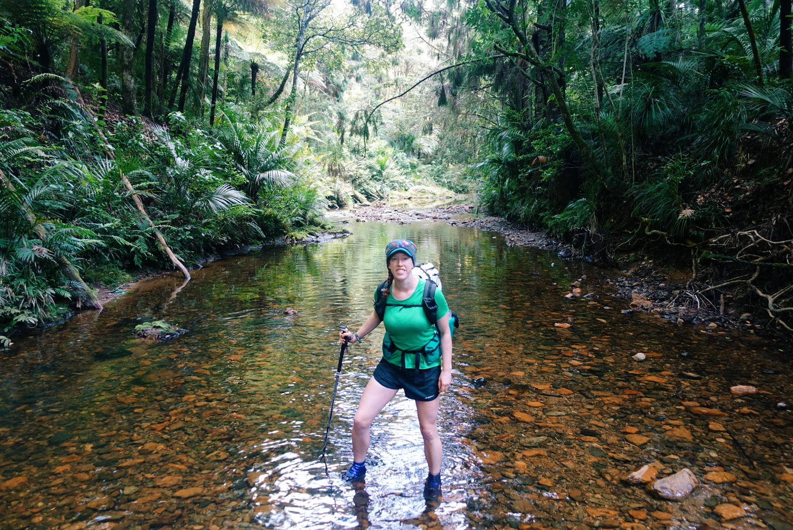
photo/ Jonathan
Puketi Forest & Tane Moana
In man places -- including the Riverwalk -- the bush is dense and jungle-like, but in a few places, we've been lucky enough to visit some particularly unique New Zealand terrain: the Kauri forests.
Kauri (Agathis australis) are found only on New Zealand's North Island. They're massive conifers reaching up to 150 feet tall and up to a whopping 48 feet in girth. The oldest surviving tree is estimated to be 1500 years old.
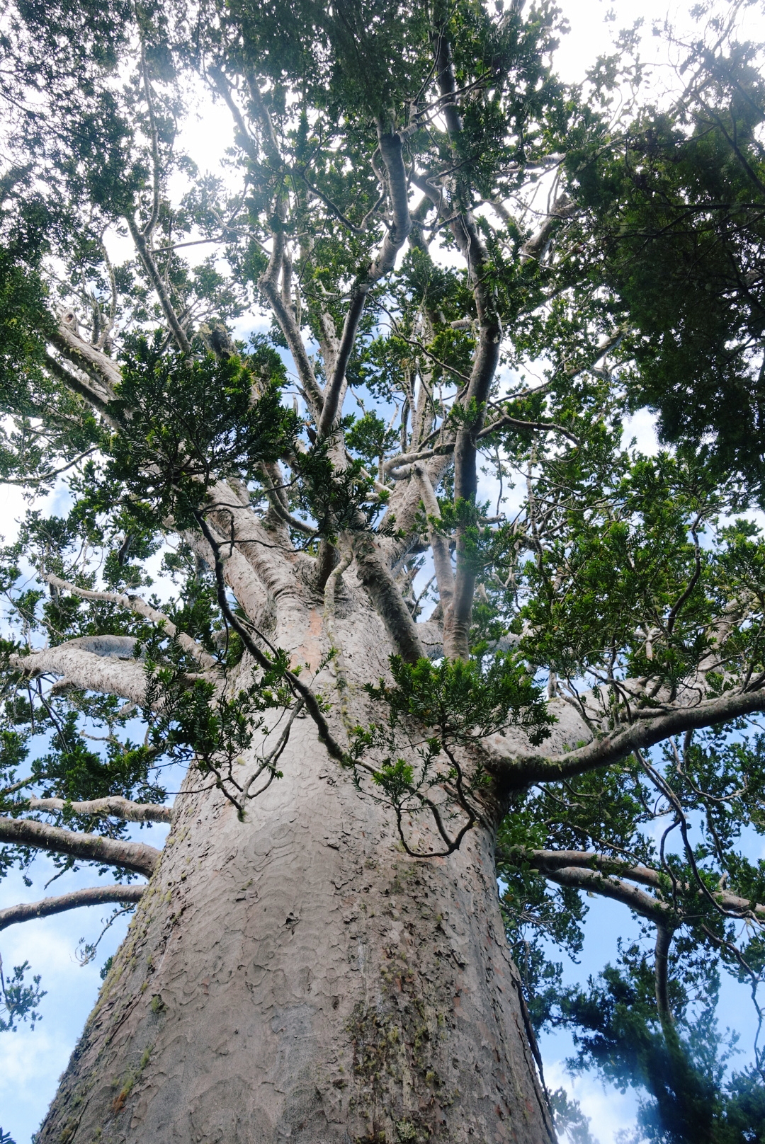
This massive Kauri, named Tane Moana, is believed to be over 1000 years old.
photo/ Jonathan
Kauri trees alter the soil chemistry around them and allow many other rare plants and animals (mainly birds) to thrive. This creates particularly unique forests in New Zealand because a massive number of the species found here are endemic, found nowhere else in the world. The kauri shed their lower branches as they grow, too, so the forests are brighter and airier than other bush.
Sadly, the kauri trees are dying. The usual trail through the Puketi Reserve was closed to hikers due to Kauri Dieback Disease, a fungus that is slowly killing off these forests and that is believed to be spread by humans and some invasive mammals like possums and wild pigs. Still, we've been able to walk through a several kauri forests, including a majestic grove near the edge of Puketi and it's easy to see why we'd want to protect these beautiful forests.
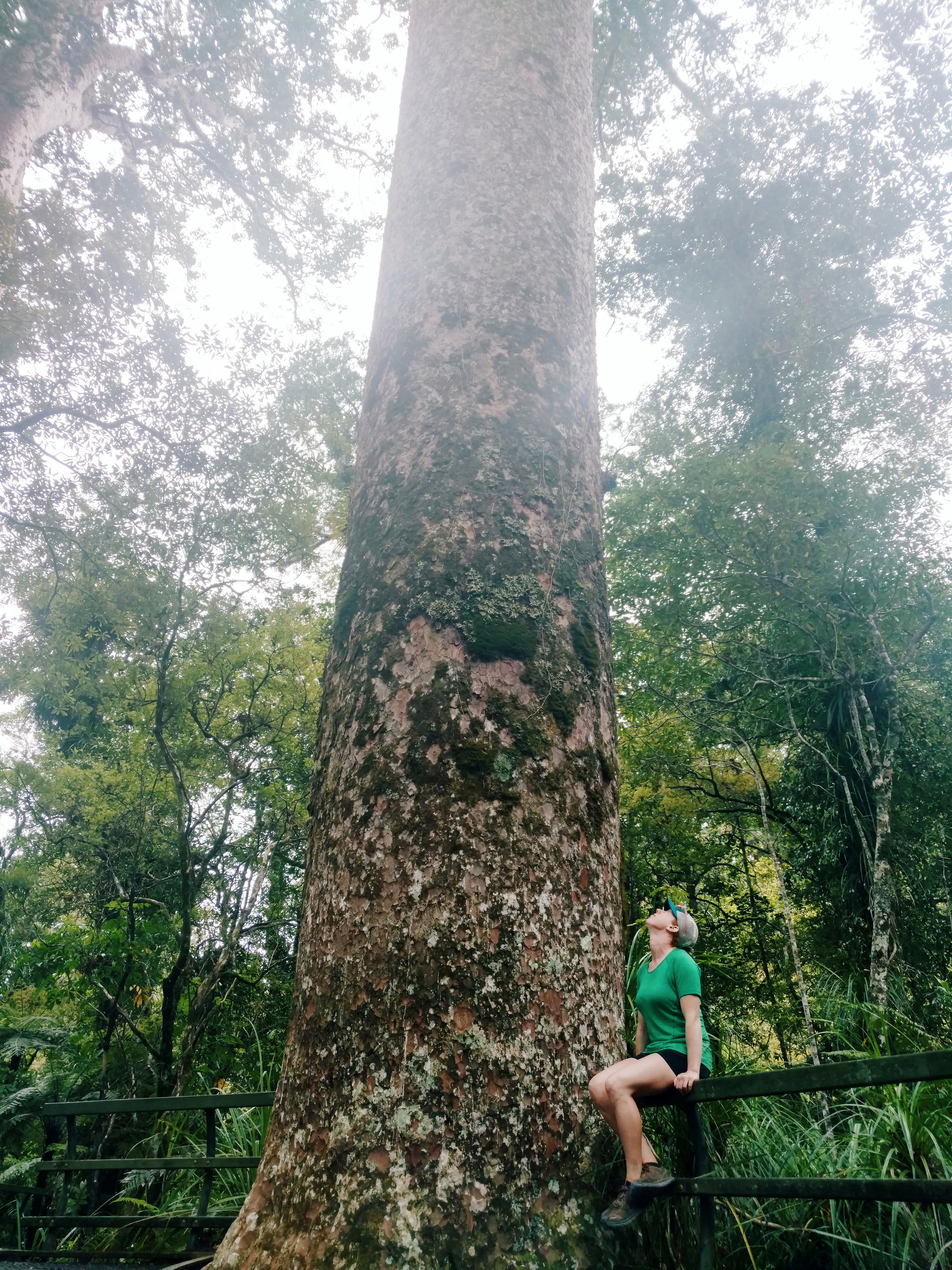
photo/ Jonathan
Impromptu Trail Magic
Some highlights come right in the wake of the lowlights. After a long day of hiking, the last thing you want to see is a sign that says "No Camping Allowed - Next 20 Km."
While we stood next to the sign, trying to decide where to go for the night, a man came out of the nearby house and approached us. He asked if we needed somewhere to stay -- this is the moment when you look around to determine how likely the person is to be a serial killer -- and said we were welcome to camp in the lawn.
When we approached the porch, where he and his wife were drinking their tea (yea, not particularly sketchy, in this case), he offered up the garage and introduced himself. Our lovely hosts, Keith and Raewyn, bought out cots for us and turned on the hot water so that we could take a shower. They showed us outlets where we could charge our phones and gave us the password for their WiFi. They even offered us a cold beer to drink before we turned in for the night.
These things may seem like basic comforts back home, but on the trail, the garage felt like a suite in a luxury hotel. Thank you so much to our hosts for your amazing hospitality and for giving us such a warm welcome to your beautiful country!
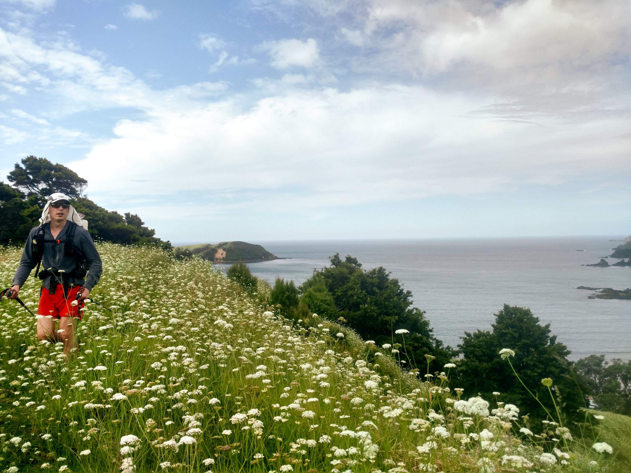
Jonathan tramping through a field of flowers north of Matapouri.
photo/ Molly
Taiharuru Estuary
One morning, joined by an Aussie hiker, we woke up at dawn to catch low tide for an estuary crossing. We donned our sand socks and walked 2 miles of so in the soft mud before reaching the river itself, which was waist deep, even at low tide. Just before reaching the river, we were treated to a picture perfect sunrise. Not a bad start to the day.

photo/ Molly

photo/ Jonathan
The Surprises
One of the perks of having the varied terrain through the Northland is that some of my favorite sections of trail have been total surprises. A short coastal walk between Paihia and Opua turned out to be a charming and well-maintained track right above the beach. And on another day, we practically turned a corner into a ridiculously stunning cliffwalk above the beaches near Mangawhai:

Once in a while, stunning views just pop up through the foliage, like this magical scene outside of Warkworth:

The Northland consists of all of the terrain north of Auckland, New Zealand's largest city at 1.2 million people. The city runs from coast to coast, so the trail runs right through the middle of it. So what's next? Hiker trash take to the city.

Logistics of the Northland
After Ratea, the Northland opens up. The logistics up here can be daunting, but they have their upsides, too...
After Ratea, the Northland opens up. The north is covered in pastures with sheep and dairy cows, small towns dot the landscape, and forestry is a major industry. We've been told by locals that only a tiny percentage of the native bush remains intact, and it shows.
We often cross through several different ecosystems in one day: wake up in a pasture, hike down a gravel road, ascend into a few kilometers of native bush, then descend onto a beach before walking into a town and camping in a grassy park.

The view of the day to come. A long beach walk followed by a steep climb up a mountain in the bush.
photo/ Jonathan
The terrain changes can be disorienting; by afternoon, the morning's campsite feels like the distant past, and it's tough to get into a rhythm with our hiking. The sections of true "track" (trail) feel far too short -- and the sections of roadwalking along state highways seem far too long.
And yet the wild sections are startlingly deep and dense. Sometimes, dropping off of a road, the lights go out in the dense undergrowth, the world turns green, and of course, you squelch instantly into ankle deep mud.

Dense native bush is sure to have spider webs across the trail first thing in the morning. The best defense against a spider to the face is letting someone else go first, but if you're on your own, a second pole will do.
photo/ Jonathan
Private land is a big deal here, too, and the trail runs through (or around) a lot of industrial terrain. We keep a sharp eye out for electric fences as we traverse through muddy pastures, dodging sheep, cows, and all they bring with them (I wrote a note to myself for this post that just read "Mud. Mud. More mud. Mud with poo."). We also walk along logging roads, past orchards, and through people's backyards. We're in and out of towns nearly every day.
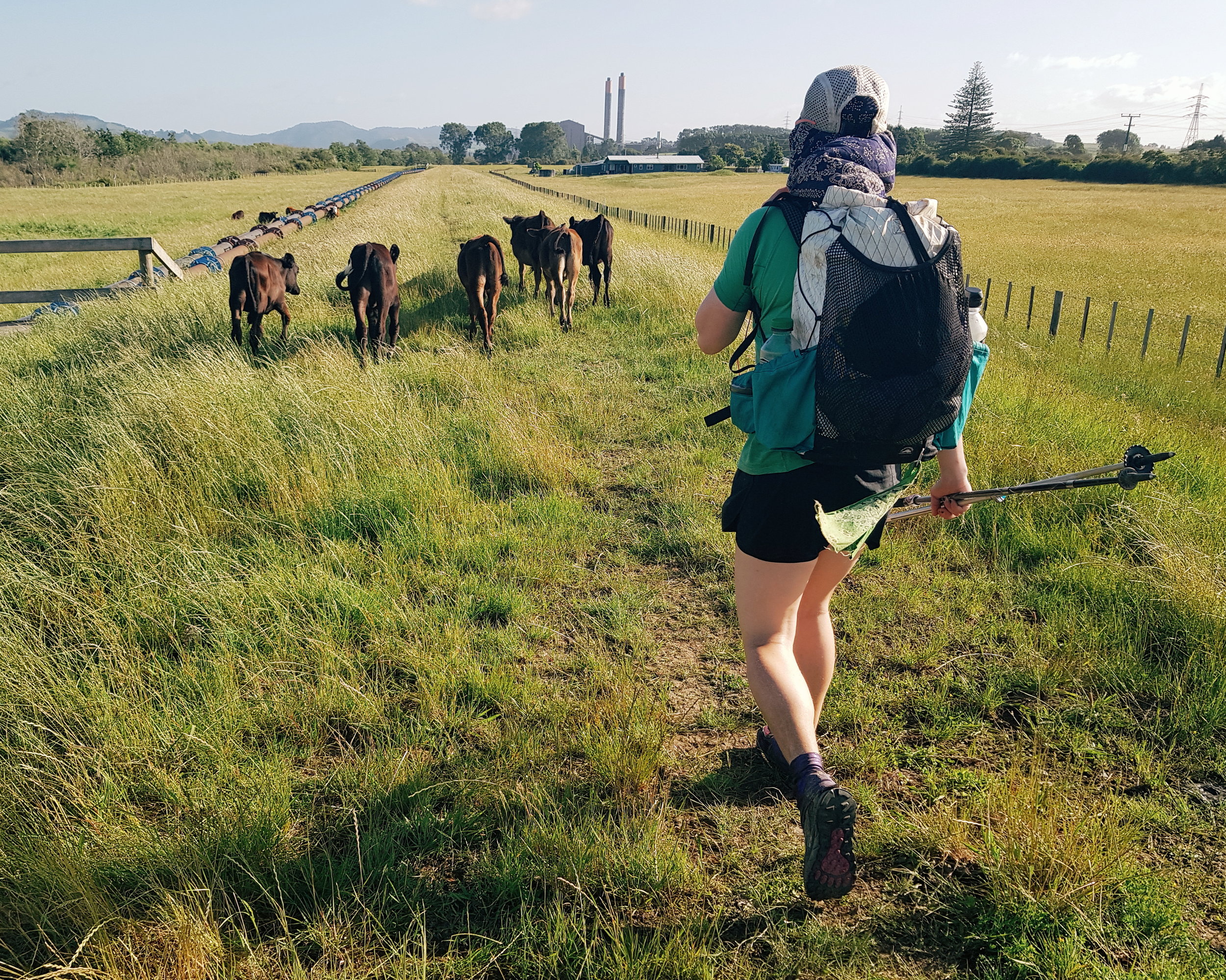
Dairy is a huge industry on the North Island, which means cows, cows, and more cows.
photo/ Jonathan
Paradoxically, this makes the trail both far more convenient and far more complicated than hiking through true wilderness.
Because of all of the private land, there and heaps of rules about where you can and cannot (mostly cannot) camp. Free camping (or freedom camping, as they call it here), is nearly impossible in many sections and we've had to pay for camping far more than we'd like. There are Holiday Parks (campgrounds) all over the place, but it's awkward to time your days around specific stopping points, rather than just hiking until you're tired and setting up camp. Coming from a trail like the PCT, it's also frustratingly expensive.

The better roadwalks are on dirt or gravel through pastures and forests. These rolling hills are pretty characteristic of the Northland.
photo/ Jonathan
Another unusual logistical hurdle here: the ocean. Much of the trail follows along the east coast, which makes for some exceptionally beautiful views, but has caused us a few headaches, too. At several points the trail crosses rivers, estuaries, and even large harbors that require transport by boat.
We've been able to do several smaller crossings on foot, but they've required us to plan around the tide. Even at low tide, a couple of crossings have been chest deep for me and I've had to loft my pack overhead to keep it dry.

River crossings get pretty legit around these parts.
photo/ Jonathan
Several of the beachwalks also require that you pass at low tide. When you're moving 3 miles per hour, it takes a fair bit of planning to hit a tight time window. We use an app that gives us low and high tide times, and we'll sometimes plan several days in advance to make sure that we hit all of the water sections at the right times of day.
The rivers that are too big to cross are another story. Sometimes, we have a phone number in our notes and just hope someone answers. Once, we got a name and phone number for a guy who smuggled us across a harbor like stolen goods. Another time, we got to a river with no way to cross and a friendly local flagged us down to offer us a ride. Phew! (Especially because we were on a time crunch for the next low tide...).
While the trail logistics here can make my head spin, being near towns all of the time does have it's upsides. One day, Jonathan and I stopped in two different towns to get fish and chips for both lunch AND dinner while still knocking out 30+km. Another day, we hiked 20km, got coffee and breakfast, enjoyed some cider and ice cream in a park, caught a boat, and then hiked another 10km to camp.

When you go through town this often, sometimes you stop for a midday cider.
photo/ Jonathan
We have barely carried more than 2 days of food at a time, and the snack opportunities have been ample. It's hard to resist hot food once the hiker hunger starts setting in.
Another unique asset on this trail is New Zealand's total obsession with public toilets. They're everywhere! Every beach and small town has one and they're sprinkled through the cities like Starbucks through Seattle.
I love a good poop in the woods as much as the next guy when it's sunny and the view is right. But when you've been soaked all day, a dry privvy is pretty game changing.

Paihia was super into the public bathroom. Note the toilet sconce on the wall and toilet planters on the roof.
photo/ Molly
The Northland had its own kind of chaos, but there were some phenomenal highlights, too. Look for another post coming soon with some of our favorite sections.
Cheers,
Molly