

Five Lakes and Two Wheels
Jonathan and Molly trade in their two feet for two wheels, then take a tour of New Zealand's alpine lakes.
Lake Tekapo marks the beginning of a long stretch of lake hopping from Tekapo to Lake Pukaki, then Lakes Ohau, Wanaka, Hawea, and finally Lake Wakatipu in Queenstown. All of these lakes are massive, gorgeously blue alpine beauties set below the Southern Alps.
The first leg of this journey, from Tekapo to Twizel, follows a gravel cycle trail along a series of canals. It's flat, exposed, and though there are stunning views, they don't change much for about 35 miles. To liven up the flats, we opted for two wheels instead of two feet.
Our bikes arrived at 8:30am and we rode off feeling gleefully free of our packs, which were being shuttled directly to Twizel.

photo/ Molly
About halfway through our ride, we soared down a long, smooth descent toward the stunning Lake Pukaki and joined a gravel cycle trail along the lakeshore. The glaciers of Mount Cook National Park beckoned in the background. Of course, we couldn't resist a quick stop at the Salmon Shop at the south end of Lake Pukaki, which offers up local New Zealand king salmon sashimi.

photo/ Jonathan

photo/ Molly
A note for hikers/travelers interested in doing this ride: We used BeSpoke Bike Tours, which I can highly recommend. It ran us $65 NZD per person with a group of 3+ and the super friendly owner, Annie, shuttled our packs to Twizel and met us at the end. The bikes arrived with full water bottles and small packs where we could store sunscreen and a few snacks for the ride. The trail is mainly gravel with a bit of paved road and is suitable for anyone relatively fit, even with no mountain biking experience at all.
The next two days were filled with big climbs and beautiful views. After walking around Lake Ohau, we headed up through blissfully shady beech forest to an unnamed pass where, miles and miles from any town, we found a small spring gushing out of the mountainside. Someone had planted a pole next to it with two small hooks holding little copper mugs for passing trampers to sample some pure NZ spring water. There wasn't a sign and it would have been easy to miss, but the little act of camaraderie made me smile. Of course, we stopped for a sip.

Dawn vibes in the valley
photo/ Jonathan
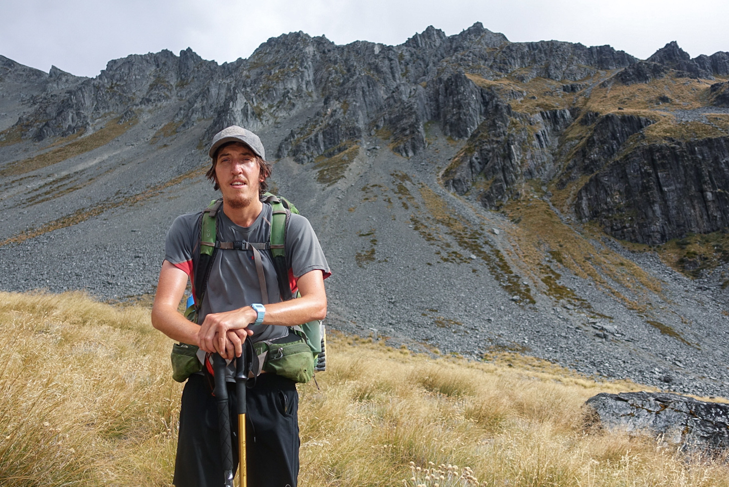
Charlie takes in the view on the climp to Martha saddle.
photo/ Jonathan
We had two more substantial climbs to surmount before Lake Hawea and they couldn't have been more different. The steady grind to Martha Saddle was tussocky with jagged ridges rising towering above a wide, rocky 4WD track. But the climb to Breast Hill was steep and scrappy; we hauled ourselves up steep walls of soil on roots and trees, kicking steps into the dirt. Just as we reached the summit of Breast Hill, the clouds began to thin and we glimpsed a fleeting view of the lake before descending the wild, jagged ridgeline toward the water. We'd been wondering where all of New Zealand's switchbacks had been hiding, but as we zig-zagged down interminable 100-foot-long runways, we wondered no longer.

photo/ Jonathan

Descending the steep ridges off of Breast Hill.
photo/ Jonathan
From Lake Hawea, the trail follows roads and bike trails leading directly into Wanaka. Wanaka is a small ski town that has grown substantially in recent years, but retains a core of van dwellers and adventurous types who staff the many cafes, gear shops, and kayak rental kiosks along the beach. It sits in a little cove at the southern end of another perfect mountain lake. We stayed at a cozy "backpackers" (hostel) with a communal kitchen that was constantly filled with people chattering in French, Dutch, and German. It had a big grassy yard with picnic tables and laundry drying on the lines.
For hikers: This is a must-stay hostel -- definitely our favorite one in New Zealand -- but you may need to book ahead from Twizel or Lake Hawea. Check it out here.
Wanaka would be our first zero day on the South Island and it truly was everything we dreamed it could be. The day started out with a jog along the beach to visit #thatwanakatree at dawn.

Don't let the tranquil image fool you; this little tree is an international Instagram star.
photo/ Jonathan

Perfect morning light on the shores of Lake Wanaka
photo/ Jonathan
After breakfast, Jonathan, Charlie, and I rented a set of frisbee golf discs, grabbed a six pack, and headed up to the local course. Charlie and I still managed to enjoy ourselves while getting thoroughly trounced, then Jonathan led us all back to town for victory burritos. Mexican food is (very) rare here and since Kiwis think black pepper is too spicy, decent burritos are pretty much impossible to find. Burrito Craft did not disappoint. Two Americans were working at the counter and the spice scale ranged from 0-10 with severe warnings on everything above a 5.
For dinner that evening, we hit up a trendy spot on the waterfront that was so jam-packed that the three of us (as the hikertrash that we are) just decided to take our plates outside and sit on the sidewalk, rather than waiting for a table or standing awkwardly in the corner. We got a good laugh as an older woman, clearly a tourist from China, stopped to openly take a photo of us sitting cross-legged with our plates in our laps. It made us feel a bit like zoo animals, but at the end of the day, my only regret is that I didn't have the presence of mind to whip out my phone and snap a shot of her, as well.

Molly working on her putting game
photo/ Jonathan

Jonathan absolutely slaughtering the competition
photo/ Molly
Of all of the towns we visited along the trail, none quite captured our hearts as much as Wanaka. It was hard to leave the next morning, though we softened the blow a bit with a third (yea... third) round of the locally made Black Peak Gelato. Kiwis have a weird obsession with "Hokey Pokey" ice cream (vanilla ice cream with chunks of honey comb), but my favorite unique local flavor was definitely the feijoa sorbet. Feijoa is apparently called pineapple guava in the states, though I'd never heard of it before coming here. To me, it tastes a like a delicious tropical version of a granny smith apple mixed with pineapple and papaya.

Blackpeak Gelato has a very special place in our hearts.
photo/ Molly
We walked out of town, ice cream cones in hand, and strolled along the lakeshore admiring the massive peaks of Mt. Aspiring National Park in the distance.

Onwards to Wellington!
We wrap up the North Island with more beach than bush and get our first taste of Wellington.
From Waikanae to Wellington, Te Araroa becomes a lot more civilized. It wanders through a scenic estuary boardwalk, over a stunning coastal walkway, and along sandy beaches. On the first day, we got breakfast before leaving Waikanae, stopped for lunch along the beach, ate ice cream cones in Porirua, then nabbed a pre-dinner pie in Pukerua Bay before camping next to the ocean. Pretty good for 22 miles of walking, I'd say.

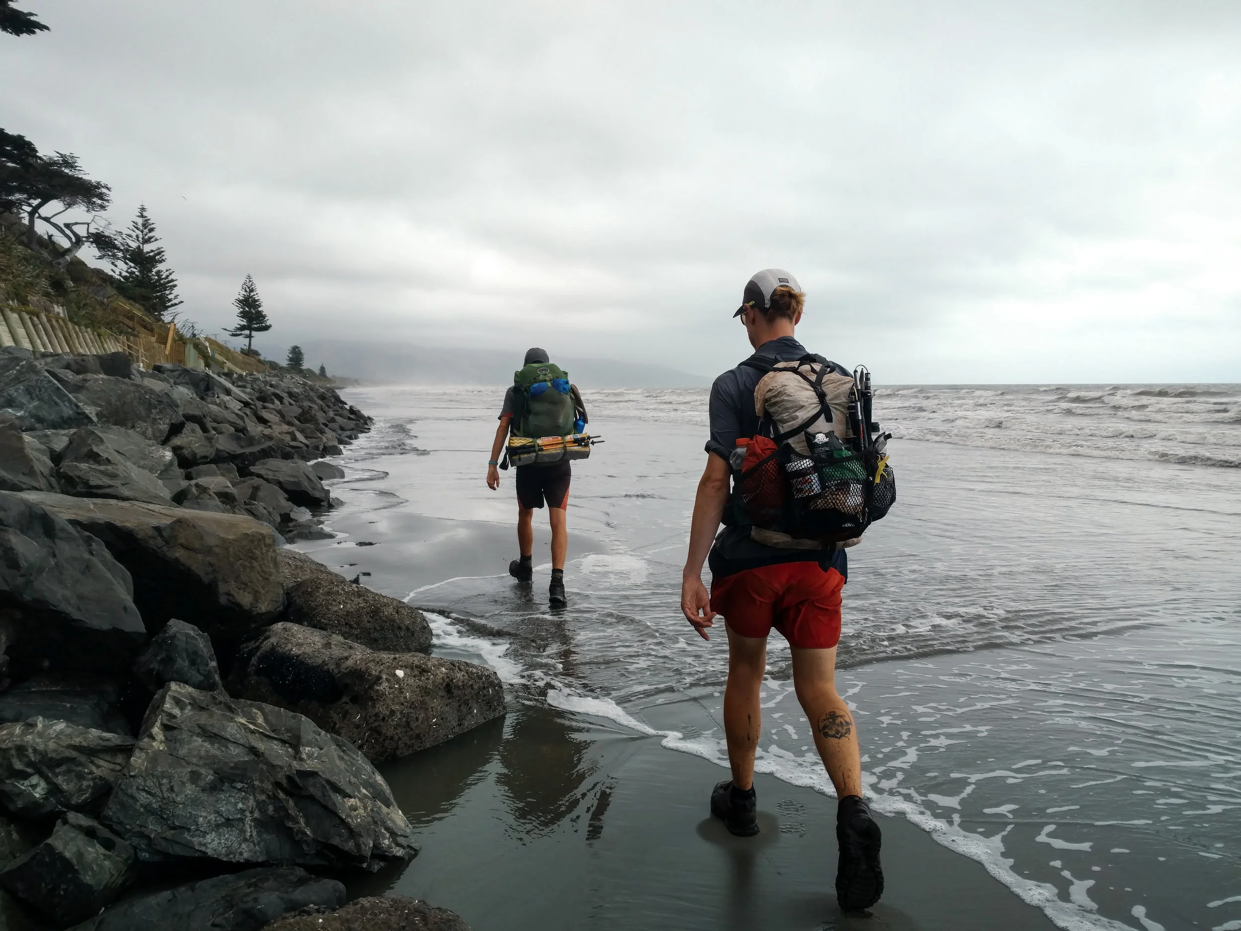
Molly surveying our final beach walk
photo/ Jonathan
Jonathan and Charlie get their feet wet at high tide
photo/ Molly

Ocean views from the Escarpment Track coastal walkway near Paekakariki
photo/ Jonathan

A massive suspension bridge along the Escarpment Track
photo/ Jonathan

HIKING SO HARD.
photo/ Molly

Beachfront camping with beautiful hiker trash
photo/ Jonathan
We had one of our odder camping experiences at a homestay just west of Wellington. Our host was an older gentleman, Alan, who met us in a dressing gown of some sort and apologized for being in his pajamas, though it was well after 4pm. Later, he found us drinking tea and offered us a "digestive" (sort of like a sweet cracker) because "that's what the queen has with her tea" (he was originally from Singapore and spoke with a distinct British accent). There were several other random people, clearly not hikers, who'd been living in the garden there for an indeterminate length of time. In the shower, there was a lengthy treatise on why one should dry oneself inside the shower and definitely not outside ("...you could even put your shirt on inside the shower and it would keep you nice and warm").
Unlike Auckland, Wellington does not sprawl for miles and miles. It is a smaller city, about 400 thousand people, tucked away at the southern tip of the North Island and bordered by water to the east and south. To the north and west of its small downtown are the foothills of the Tararuas. The city itself is built in and around the hills; it has tiny streets winding up and down them in what appears to be a completely patternless chaos. Downtown Wellington is right on the sound, with a beautiful waterfront full of public art and (somewhat shockingly) clean, sandy beaches.
We hiked into Welly, as it is fondly known here, over the top of Mt. Kaukau and wandered through the city's green spaces, walking through the botanic gardens directly down into the city center. The trail passes directly beneath the "Beehive," where New Zealand's government center is housed (look for it in the lower right side of the photo below -- you'll quickly understand the name).

Downtown Wellington from above
photo/ Jonathan

Hiker trash on Lambton Quay in Welly's city center
photo/ Jonathan

We ate delicious Vietnamese food at a place called "Where's Charlie?"
photo/ Jonathan
After downtown, the trail sneaks back into green space to head up Mount Victoria (where it also passes another LOTR filming location). We loved that even while passing through a major city, the trail was scenic and hilly, but the southern terminus of the North Island was a bit of a weird experience. We descended to a small city park where we wandered around for a bit before locating the tiny plaque signifying that we'd completed the North Island. Not exactly a grand finale... But then again, we still have another island still to go!

We finished the North Island!
photo/ Jonathan
The walk through Wellington was, overall, a completely different experience than hiking through Hamilton or Auckland. There was a ton of green space, beautiful ocean views, and some climbing to break up the day. We finished the day feeling excited to explore the rest of the city and ready for some well-deserved rest.

A Taste of the Tararuas
The infamous Tararuas turn out to be one of the toughest, and most rewarding sections of the trail so far.
For hundreds of kilometers, we'd been hearing about the mountains before Wellington from other hikers. "The Tararuas? That's supposed to be the hardest section of the whole trail," they'd say. Our notes cautioned us to carry extra food and be prepared to spend whole days in the huts if bad weather struck. We heard horror stories of gale force winds blowing hikers off ridgelines and many hikers were skipping the section altogether.
Needless to say, we left Palmerston North with great anticipation (and 7 bags of potato chips).
Though the Tararuas have a particularly infamous reputation, the trail only takes a quick dive into the range, about 60km (~40 miles) total. Normally, that would be about two days of hiking for us. Here, we planned for three full days while many of our peers planned for 5 or more.
We spent the first day climbing up into the range, gaining over 3000ft in elevation. The climbing was steep and muddy at times, but nothing we hadn't encountered before in Ratea forest or near Mt. Pirongia. Though it was cool and windy all day, it did not begin to rain in earnest until we reached our home for the night at Te Matawai Hut.

Heavy mist on day #1 in the Tararuas
photo/ Jonathan

Typical New Zealand "trail"
photo/ Jonathan
In New Zealand, it's common practice for wilderness signs to give approximate times for travel between huts along with -- and frequently instead of -- actual distances. This is incredibly irritating, since we tend to move faster than most hikers and regularly beat the recommended time allotments by an hour or more. However, the time frames listed can sometimes help give an idea of how difficult the terrain is expected to be. When we left our hut on day 2, a sign warned that the next 5km (~3 miles) was expected to take us 6-7 hours. Ouch!
Though we didn't move quite as slowly as the sign projected, the second day in the Tararuas proved to be one of the hardest we've had on the trail so far. It took us 12 hours to do 20 kilometers (just over 12 miles). We were lucky to have great company for the day: Charlie was still traveling with us and we were also joined by another Brit, Andy, as well as an Italian, Alessio, and another American, Justin. We've rarely hiked with so many others on this trail, but the tough terrain was much more fun with a merry hiker train making jokes and swapping stories.

Hiker train!
photo/ Jonathan
Climbing up from Te Matawai, we summited a small peak, then followed a ridgeline for several miles. The ridge was narrow and instead of a rocky spine, the trail was a deep, muddy trench with steep little dips and dives and slippery tussocks along both sides. It was ridiculously slow going, plunging down into knee-deep mud with no escape.

photo/ Jonathan

photo/ Jonathan

Looking back, you can just glimpse Te Matawai Hut with it's little red roof.
photo/ Molly
As we reached the next hut, Dracophyllum, the scenery changed dramatically. We dropped into deep forest of gnarled, ancient beech. Moss covered every surface, so thick that we could plunge our trekking poles into the ground and find no resistance. The air was suddenly damp and cool, and the shade was complete, even under a bright midday sun. We breathed in the earthy smell of rain and soil and green, growing things, and felt like we had entered another realm.

photo/ Jonathan

photo/ Molly

photo/ Jonathan
Between patches of forest, we slipped and scrambled our way across rocky, sometimes muddy slopes to Nichols Hut. Te Araroa has large swaths of trail that are really not maintained as trails at all, but that remain footpaths simply because they are used by trampers. In this case, large sections of trail were completely crumbled away, so that we'd have to hold on to roots and clumps of grass as we hauled our packs up and down through gullies and over piles of downed trees. Luckily, the weather was clear and the final climb up to Mt. Crawford was a steady ascent on (gasp!) actual trail.

Heading up to Mt. Crawford
photo/ Jonathan

Charlie and Jonathan snacking it up on the summit
photo/ Molly
The final descent to Waitewaiwai Hut was ridiculously steep, like some sort of near-vertical forest obstacle course. We arrived at the hut completely exhausted, but still brave enough to jump into the freezing river to rinse off the mud.
What a day!
The final few kilometers of the Tararuas were much like the rest, but we only had one more peak to climb before reaching town at Waikanae. It was a tough section, but left us stoked for more hard mountain trekking as we came closer and closer to the South Island. Onwards to Wellington!

Northern Highlights
The Northland was a bit of a logistical nightmare at times, but it had also had some crazy highlights. Here's our "best of" for the Northland.
Although the Northland was a bit of a logistical nightmare at times (as I wrote about here), it had also had some crazy highlights. Here's our "best of" for the Northland:
The Riverwalk
One of my favorite sections of trail so far has been the Papakauri stream, a 3km (~2 mile) riverwalk -- no trail but the stream itself. The Papakauri is only about shin deep in most places, but it was magical to wander through untouched forest by way of the water. Even in the wilderness, trailbuilding reveals the human impact, but through the riverwalk, the only signs of human life were infrequent trail markers that reassured us we were moving in the right direction.
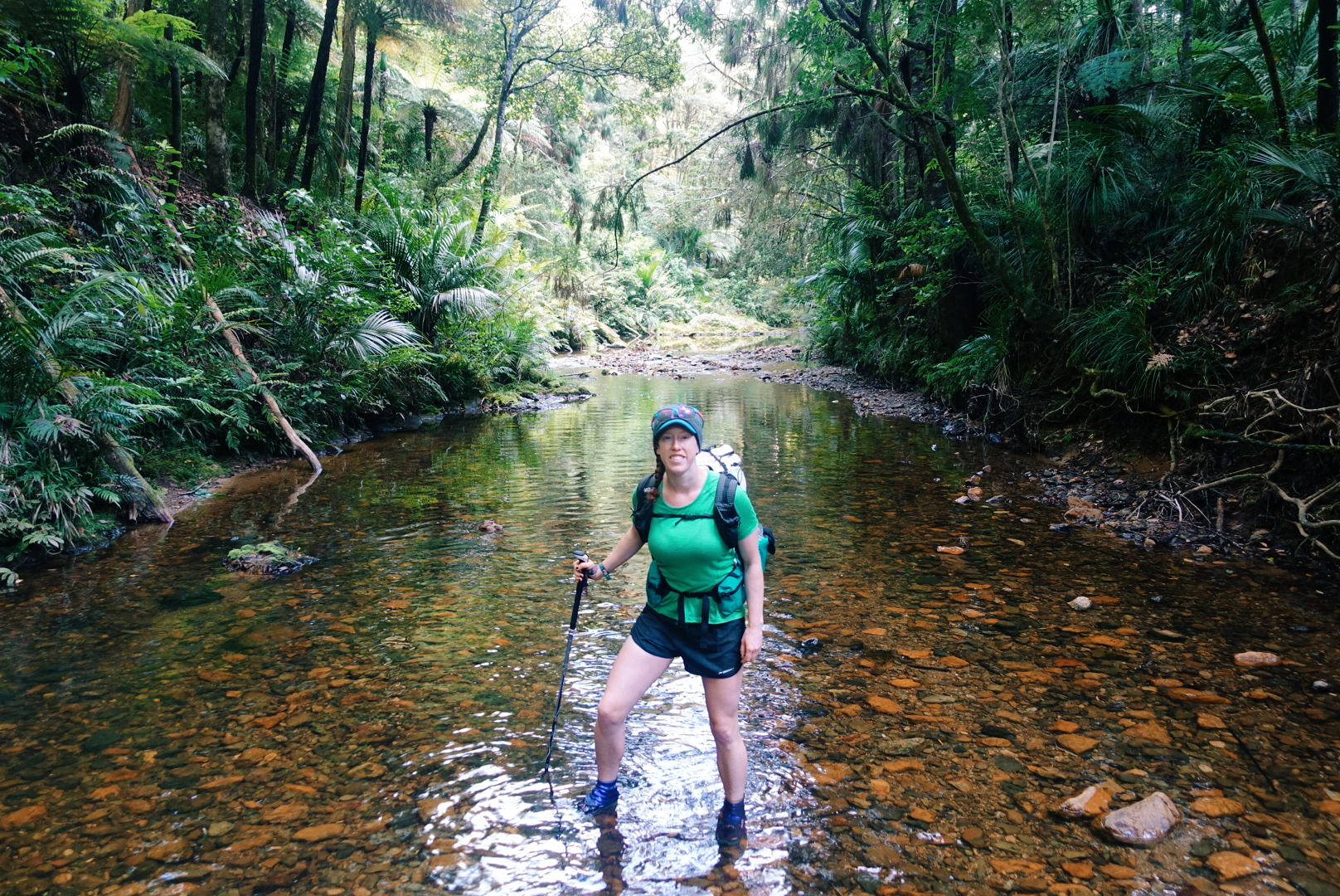
photo/ Jonathan
Puketi Forest & Tane Moana
In man places -- including the Riverwalk -- the bush is dense and jungle-like, but in a few places, we've been lucky enough to visit some particularly unique New Zealand terrain: the Kauri forests.
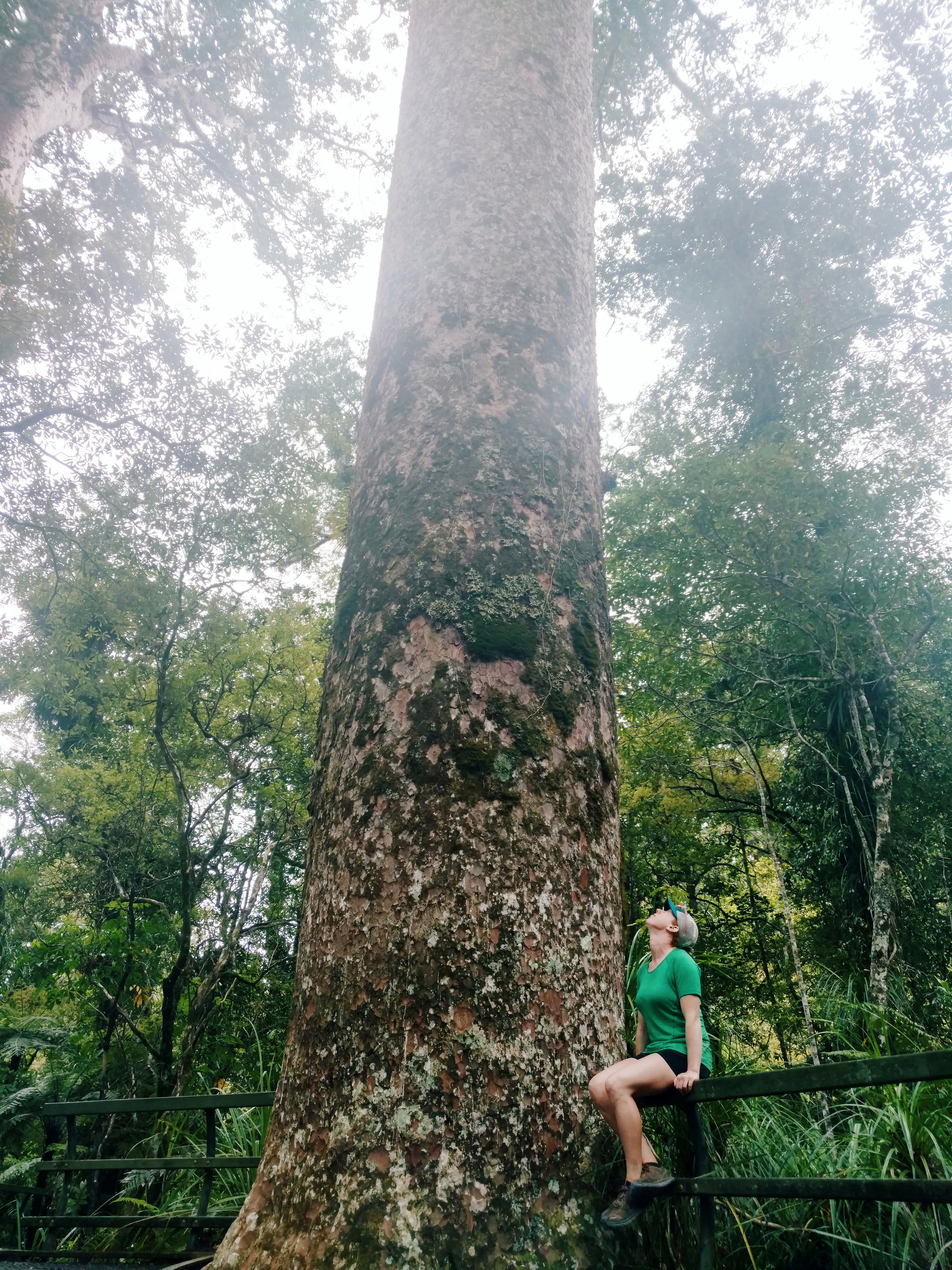
Kauri (Agathis australis) are found only on New Zealand's North Island. They're massive conifers reaching up to 150 feet tall and up to a whopping 48 feet in girth. The oldest surviving tree is estimated to be 1500 years old.
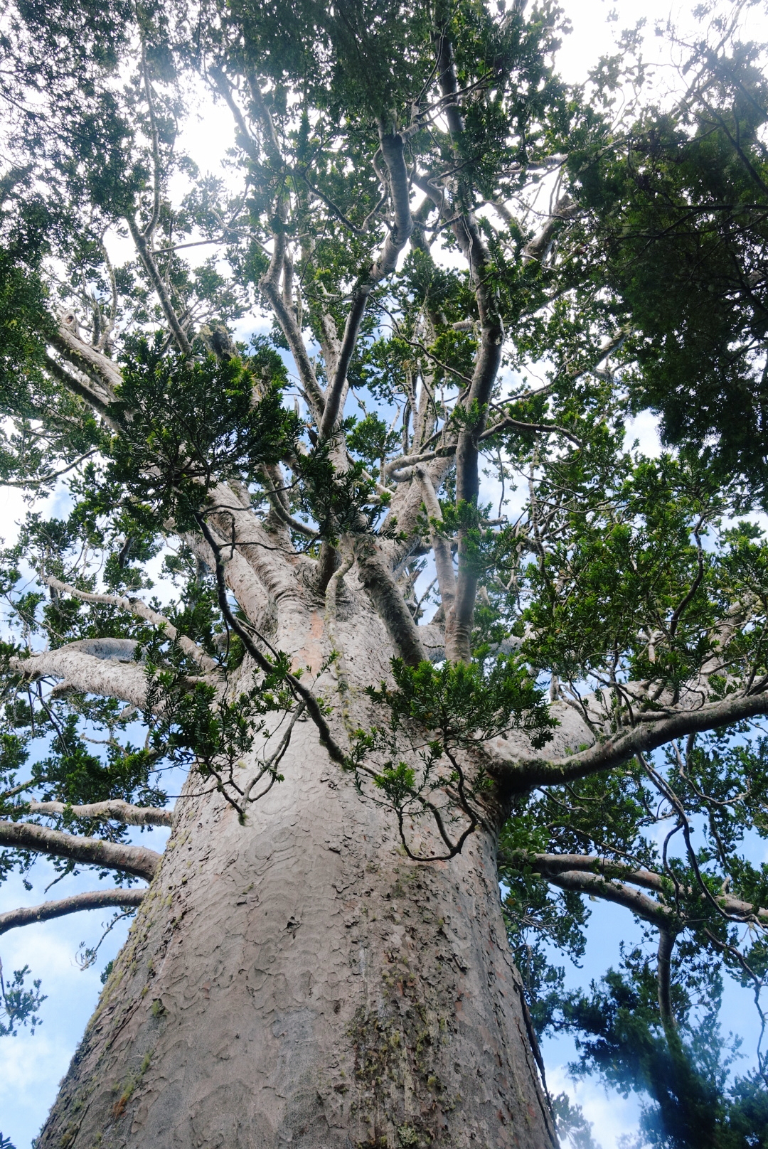
This massive Kauri, named Tane Moana, is believed to be over 1000 years old.
photo/ Jonathan
Kauri trees alter the soil chemistry around them and allow many other rare plants and animals (mainly birds) to thrive. This creates particularly unique forests in New Zealand because a massive number of the species found here are endemic, found nowhere else in the world. The kauri shed their lower branches as they grow, too, so the forests are brighter and airier than other bush.
Sadly, the kauri trees are dying. The usual trail through the Puketi Reserve was closed to hikers due to Kauri Dieback Disease, a fungus that is slowly killing off these forests and that is believed to be spread by humans and some invasive mammals like possums and wild pigs. Still, we've been able to walk through a several kauri forests, including a majestic grove near the edge of Puketi and it's easy to see why we'd want to protect these beautiful forests.
photo/ Jonathan
Impromptu Trail Magic
Some highlights come right in the wake of the lowlights. After a long day of hiking, the last thing you want to see is a sign that says "No Camping Allowed - Next 20 Km."
While we stood next to the sign, trying to decide where to go for the night, a man came out of the nearby house and approached us. He asked if we needed somewhere to stay -- this is the moment when you look around to determine how likely the person is to be a serial killer -- and said we were welcome to camp in the lawn.
When we approached the porch, where he and his wife were drinking their tea (yea, not particularly sketchy, in this case), he offered up the garage and introduced himself. Our lovely hosts, Keith and Raewyn, bought out cots for us and turned on the hot water so that we could take a shower. They showed us outlets where we could charge our phones and gave us the password for their WiFi. They even offered us a cold beer to drink before we turned in for the night.
These things may seem like basic comforts back home, but on the trail, the garage felt like a suite in a luxury hotel. Thank you so much to our hosts for your amazing hospitality and for giving us such a warm welcome to your beautiful country!
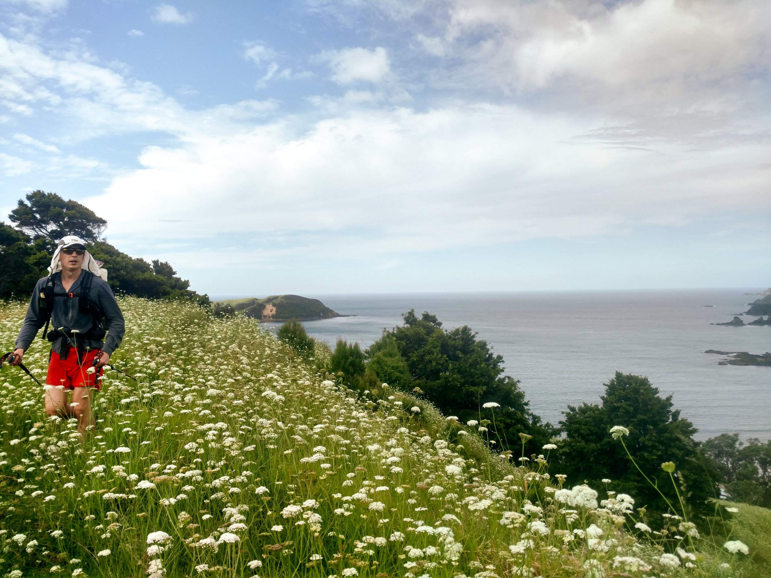
Jonathan tramping through a field of flowers north of Matapouri.
photo/ Molly
Taiharuru Estuary
One morning, joined by an Aussie hiker, we woke up at dawn to catch low tide for an estuary crossing. We donned our sand socks and walked 2 miles of so in the soft mud before reaching the river itself, which was waist deep, even at low tide. Just before reaching the river, we were treated to a picture perfect sunrise. Not a bad start to the day.

photo/ Molly

photo/ Jonathan
The Surprises
One of the perks of having the varied terrain through the Northland is that some of my favorite sections of trail have been total surprises. A short coastal walk between Paihia and Opua turned out to be a charming and well-maintained track right above the beach. And on another day, we practically turned a corner into a ridiculously stunning cliffwalk above the beaches near Mangawhai:

Once in a while, stunning views just pop up through the foliage, like this magical scene outside of Warkworth:

The Northland consists of all of the terrain north of Auckland, New Zealand's largest city at 1.2 million people. The city runs from coast to coast, so the trail runs right through the middle of it. So what's next? Hiker trash take to the city.

Our Next Adventure: The Colorado Trail
The Captains of Us are back in action! This August, Jonathan and Molly will undertake another crazy adventure: attempting to fastpack the 485-mile long Colorado Trail (CT) in just 14 days.
Remember that one time when Dan and Jonathan thru-hiked the PCT?
Well today, I'm happy to announce that the Captains of Us are back in action! This August, Jonathan and Molly will undertake another long-distance adventure: attempting to fastpack the 485-mile long Colorado Trail (CT) in just 14 days.
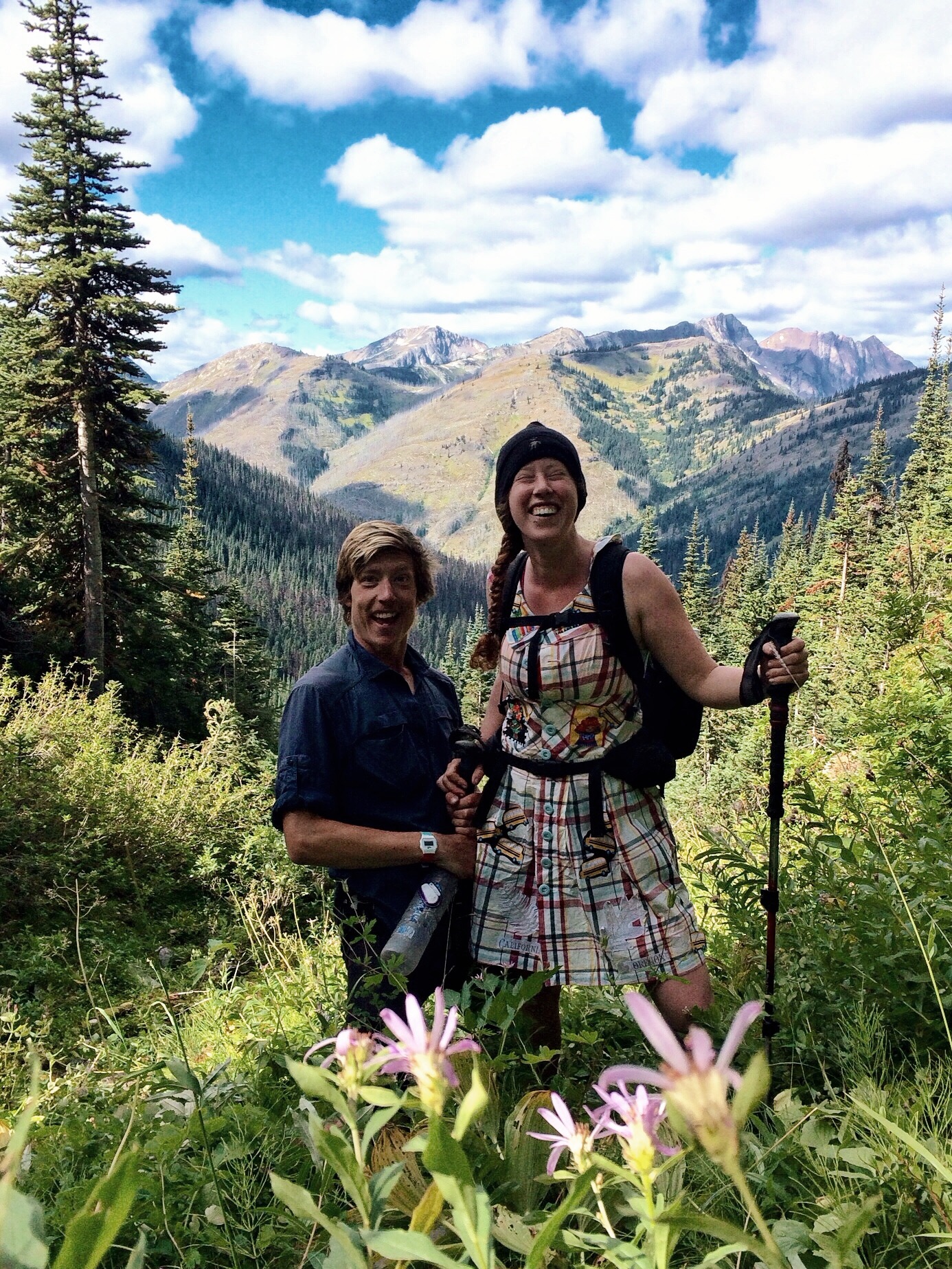
Jonathan and Molly living it up on the PCT in Washington
To give you all some perspective on why this might be a little bit crazy, let me explain a bit more about the CT. One of the countries "short long trails," the CT runs from Denver to Durango through eight major mountain ranges, seven national forests, and six wilderness areas. The majority of the trail is over 10,000ft in elevation and the high point sits at 13,334ft on Coney Summit in the San Juans. Most thru-hikers take between 4-6 weeks to complete the trail, according to The Colorado Trail Foundation, averaging about 15 miles per day. In order to complete our hike in 14 days, Jonathan and I will need to hike an average of 34.6 miles per day; that's more than a 50k per day, on average.
Here is a map of the trail to give you an idea of where we'll be, and an elevation profile to show you the dips and climbs that equal a grand total of approximately 75,000ft of elevation gain:
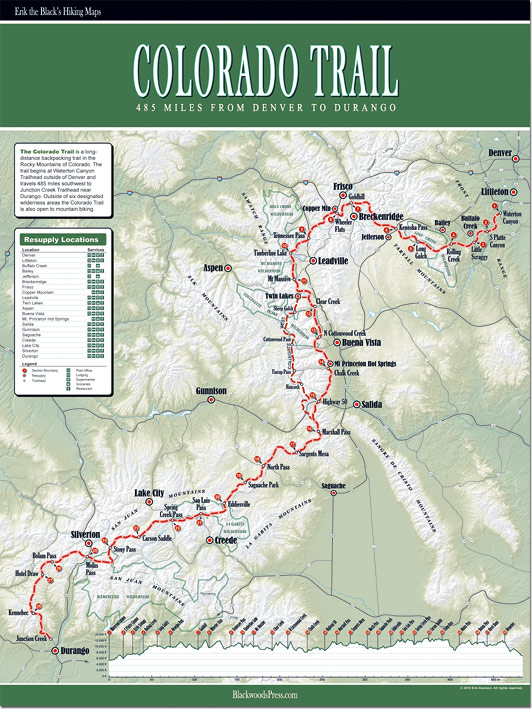
For a number of reasons, including travel logistics and differences in the terrain, Jonathan and I have decided to go against the usual flow of backpackers and hike from Durango to Denver, instead of the reverse. This means that we will encounter higher and more challenging terrain first, while our bodies are fresh, and move into the lower and (slightly) more easy-going terrain during the second week. While most hikers need time to get used to carrying a pack and hiking for days on end, we're going to have to be ready to put the miles in on day one.
As I mentioned above, we're going to be "fastpacking" the trail, rather than doing a traditional thru-hike. The line between these two forms of travel is a bit fuzzy, but you can think of fastpacking as a combination of backpacking and trail running, or, in our case, the lovechild of thru-hiking and ultra-running. Fastpackers, in general, travel lighter, faster, and farther than most backpackers. For this trip, we'll be carrying ultra-light packs with lots of front-access for food and water, to avoid long stops. Our pack base weights will probably fall around 8lbs each, and we'll be sharing gear to help keep our loads to a minimum. Don't worry mom, I promise we'll be carrying a tent.
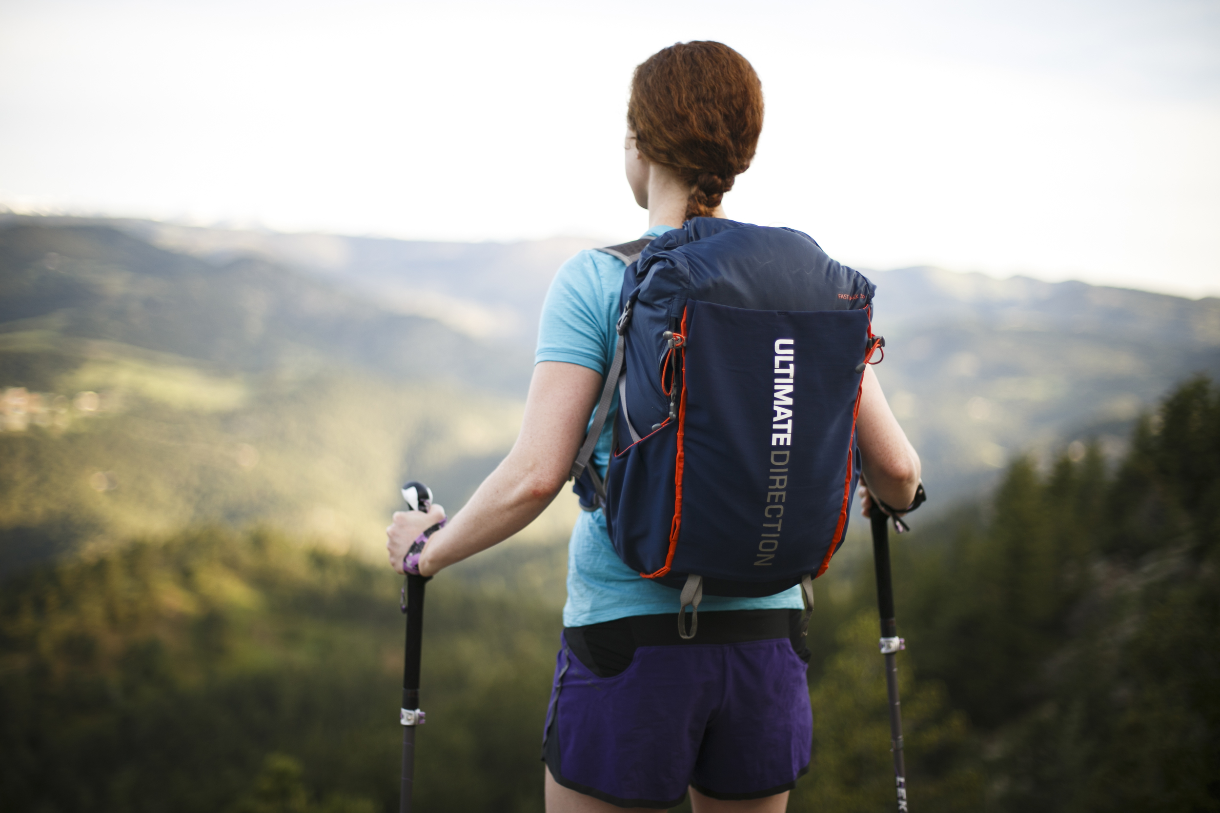
Our Fastpack 30L vests from Ultimate Direction will help us carry our gear in a small and compact space to ensure that it feels secure as we run along the trail.
Usually, when I explain this concept to people, I get one of two responses: either, "Is that even possible?!" or "Why on earth would you ever want to do that?!"
The answer to the first question is actually pretty easy: who knows?! We'll get back to you when we're done hiking. There are actually a few runners who have completed the trail in just 9 or 10 days, although most were supported. The current unsupported record is just under 11 days, set by Shawn Forry in 2012. Makes 14 days sound downright leisurely, right?
While this is certainly going to be a challenge for us, Jonathan and I have been planning this trip for a while, and we will be doing a lot of training to get our bodies ready. Check out this blog post I wrote about setting challenging, but realistic adventure goals. And seriously, where's the fun in going on an "adventure" that you already know is possible?
As for the second question, of why we want to do this, well I guess that's a little more personal. Jonathan and I like to push our physical limits, and we love to spend time in the mountains, sleeping out under the stars. This trail in particular will be a phenomenal opportunity to bask in the beauty of the Rocky Mountains and our new home state of Colorado. We can't afford to take four or five months off this year for a longer thru-hike, so we have decided to make the absolute most of our two-week vacation. Gotta pack it in when you can, right?
Catching the sunrise on Independence Pass. Sometimes, you have to wake up when the world is sleeping to see the things no one else sees.
Stay tuned for updates about our gear, food, resupply schedule, and training regimen!
Cheers and happy summer,
Molly